How to add a Satellite Overlay: Difference between revisions
Jump to navigation
Jump to search
No edit summary |
No edit summary |
||
| Line 10: | Line 10: | ||
{{article end | {{article end | ||
|notes=The resolution of the satellite image is dependent on the value of the [[Geo Option]] '''Satellite Resolution''' at the time the project was generated. | |notes=The resolution of the satellite image is dependent on the value of the [[Geo Option]] '''Satellite Resolution''' at the time the project was generated. | ||
|howtos=[[How to ]] | |howtos=*[[How to add an Inference Overlay]] | ||
|seealso=*[[Geo Option]] | |||
}} | }} | ||
Revision as of 15:26, 9 October 2024

How to add a satellite overlay:
- Select current situation in the ribbon bar.
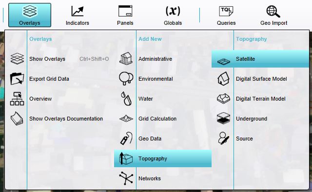
- Hover over Overlays to open the Overlay popup menu.
- In the overlay popup menu, hover over Topography and click on the option Satellite.
Notes
The resolution of the satellite image is dependent on the value of the Geo Option Satellite Resolution at the time the project was generated.