Terrain height: Difference between revisions
Jump to navigation
Jump to search
| Line 31: | Line 31: | ||
* The difference between the resampeled DTM and DSM is computed | * The difference between the resampeled DTM and DSM is computed | ||
* Depending on the topography-value and a threshold either the value of the DTM or DSM is used to compose a DTM on high resolution: | * Depending on the topography-value and a threshold either the value of the DTM or DSM is used to compose a DTM on high resolution: | ||
** for bare lands the default threshold is 100cm, all cells with a difference <100cm between the DTM and DSM, the value will be taken from the DSM | |||
** for roads the default threshold is 25cm, all cells with a difference <25cm between the DTM and DSM, the value will be taken from the DSM | ** for roads the default threshold is 25cm, all cells with a difference <25cm between the DTM and DSM, the value will be taken from the DSM | ||
** for crop-lands, scrup-land, etc the default threshold is 50cm, all cells with a difference <50cm between the DTM and DSM, the value will be taken from the DSM | ** for crop-lands, scrup-land, etc the default threshold is 50cm, all cells with a difference <50cm between the DTM and DSM, the value will be taken from the DSM | ||
It is possible to change the default thresholds, | It is possible to change the default thresholds. Therefore, change the corresponding value in the Advanced Settings. | ||
* Rooftops of buildings are getting an average height of the DSM of the polygon defining the buildings footprint. The footprint is split into sections using image recognition techniques; herewith the variability in rooftops can be taken into account in the elevation model | * Rooftops of buildings are getting an average height of the DSM of the polygon defining the buildings footprint. The footprint is split into sections using image recognition techniques; herewith the variability in rooftops can be taken into account in the elevation model | ||
Revision as of 14:35, 23 October 2018
Terrain height
- Terrain height is the whole of differences of terrain elevation in a given area, the quantitative measurement of vertical elevation change in a landscape. Terrain is used here as a general term in physical geography, referring to the lay of the land. This is usually expressed in terms of the elevation, slope, and orientation of terrain features. Terrain height - as element of a terrain - affects surface water flow and distribution. Over a large area, it can affect weather and climate patterns.
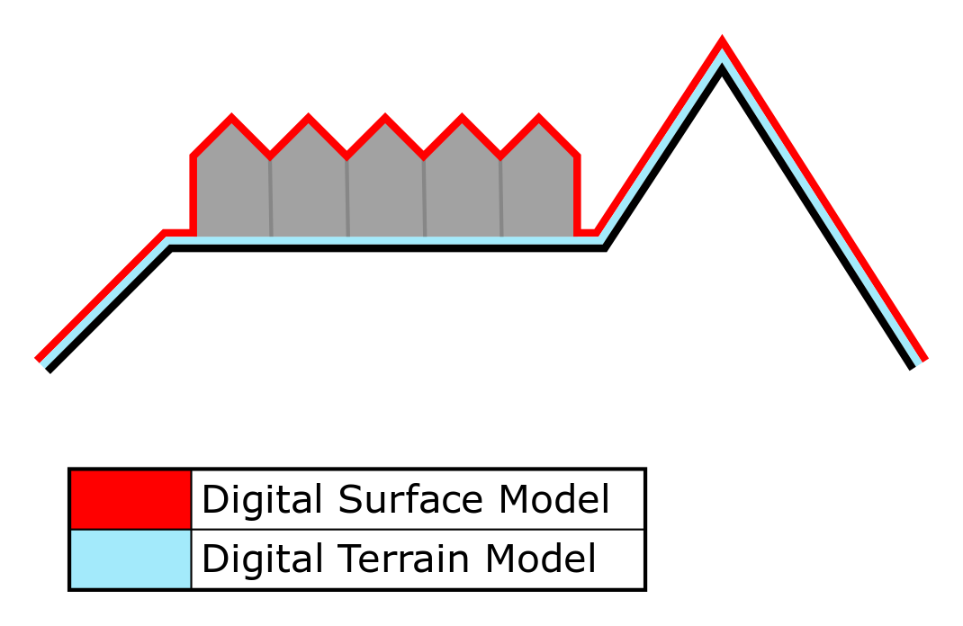
- In overlays, the user can select two types of elevation, the digital terrain model (DTM) and ditital surface model (DSM). A DTM represents the bare ground surface without any objects like plants and buildings. In contrast; a DSM represents the earth's surface including all objects (e.g. houses, trees, etc.) on it.
- View original file here:[1]
Terrain height in the Tygron Platform
DTM for projects in The Netherlands
Data sources
In the Netherlands a DTM is constructed using the following data sources:
- A DSM from the AHN Actuele Hoogte Bestand with a cell-size of 0.5x0.5m, 1x1m or 2.5x2.5m, and version AHN2 or AHN3.
- A DTM, with a cell size of 3mx3m, supplied by Rijkswaterstaat to ESRI, based on the AHN.
- Top10NL data.
When defining a new project, you can set the DSM resolution and version (AHN2 or AH3) under the advanced options at the wizard. These options influence the generation of the DTM:
- Use latest AHN3: if selected the more accurate AHN3 will be selected in stead of the older AHN2. However, since the AHN3 dataset is not yet complete for the whole of the Netherlands, a project in a location where there is no AHN3 data available, will show a project without buildings. In that case it is recommended to create a new project with the default AHN2 data.
- Hi-Resolution Heightmap: AHN will be available on 0.5m, 1m or 2.5m resolution in the project database for generating the elevation grid.
DTM generation
By the following steps a project DTM is composed:
- The ESRI DTM and AHN DSM are resampeled to the same resolution
- The difference between the resampeled DTM and DSM is computed
- Depending on the topography-value and a threshold either the value of the DTM or DSM is used to compose a DTM on high resolution:
- for bare lands the default threshold is 100cm, all cells with a difference <100cm between the DTM and DSM, the value will be taken from the DSM
- for roads the default threshold is 25cm, all cells with a difference <25cm between the DTM and DSM, the value will be taken from the DSM
- for crop-lands, scrup-land, etc the default threshold is 50cm, all cells with a difference <50cm between the DTM and DSM, the value will be taken from the DSM
It is possible to change the default thresholds. Therefore, change the corresponding value in the Advanced Settings.
- Rooftops of buildings are getting an average height of the DSM of the polygon defining the buildings footprint. The footprint is split into sections using image recognition techniques; herewith the variability in rooftops can be taken into account in the elevation model
Waterdepth
- Water bodies, found in terrain surface types, are lowered 3 meters relative to the elevation of the surrounding surface
DTM for projects abroad
Import your own DTM
If you have your own DTM, it can be used to (partially) replace the DEM generated by the Tygron Platform:
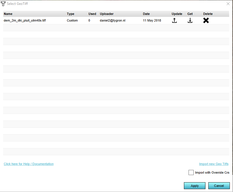
- Create a DTM in GeoTiff format
- Go to Geo Data -> Terrain -> Select Elevation GeoTiff
- In the Select GeoTiff wizard -> Select Import new Geo Tiffs
- Locate the GeoTiff on your harddrive and select Open
- After the GeoTiff is uploaded and shown in the GeoTiff list, select apply
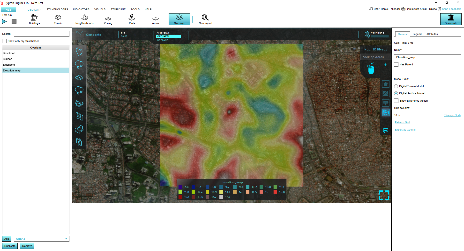
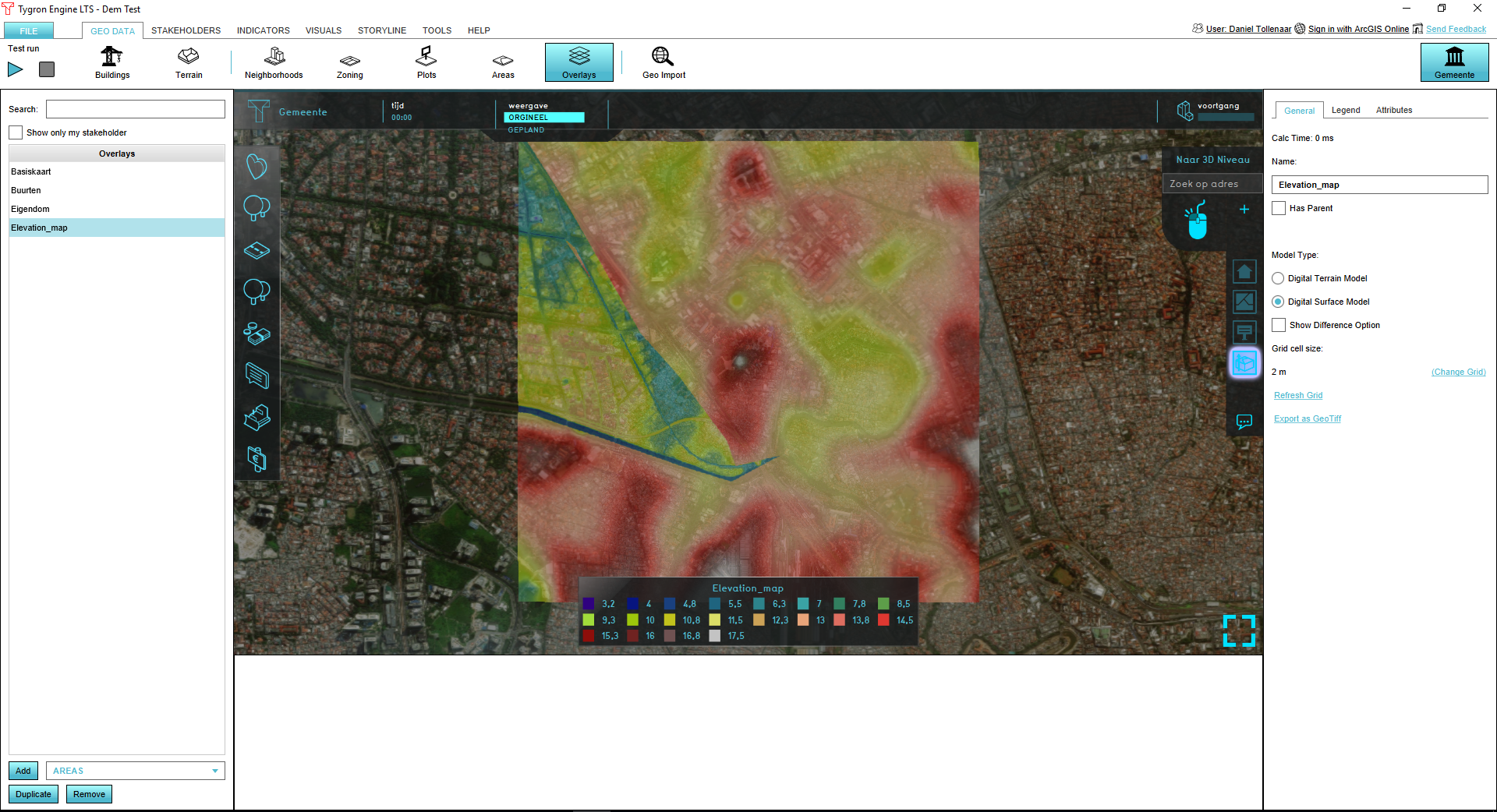
- Your original DTM is replaced by the GeoTiff for the area covered by the GeoTiff
Original DTM:
Partially replaced DTM:
Adding or removing terrain height
- When a project is created in the Tygron Platform, all terrain is flat. To add relief in the form of terrain height, a specific tool is available - the height tool brush.
The Terrain Height Brush panel
- Below is an image of the Terrain Height Brush Panel. This tool looks like the more common brush panel, but is adjusted to be able to draw in terrain height in the 3D world.
Start/ stop drawing
- The top button on the panel is called "Start Drawing" by default when loading the panel. This first button (de)activates the Terrain Height brush panel, by selecting the button named "Start Drawing" the rest of the options become available on the panel. With the brush panel activated, the user can start "painting". Selecting this button again - now named "Stop Drawing" - deactivates the panel, greying out the options.
-
Terrain height brush panel inactive
-
Terrain height brush panel active
Radius
- The first slider from the top is called "Radius". The radius slider refers to how big the area is that the cursor will affect when changing the terrain's height. The more to the right the slider is positioned, the larger the area of effect is.
-
Terrain height brush panel radius slider
Press
- The second slider from the top is called "Press" - for "Pressure". The press slider refers to how fast the area will be affected when changing the terrain's height. The more to the right the slider is positioned, the faster the area will adjust, making it possible to quickly alter terrain. If the slider is positioned more to the left side, the height effect can be finely adjusted.
-
Terrain height brush panel press slider
Brush Types
Flatten
- The brush type button on the right of the "Clear" button is called "Flatten". With the "Flatten" button, any area that the brush 'paints' will be flattened while maintaining most of its height. This is useful when placing constructions on elevated or lowered terrain, as constructions can only be placed on flat surfaces.
-
Terrain height brush panel flatten button
Raise
- The brush type button below the "Clear" button is called "Raise". With the "Raise" button any area that the brush 'paints' will be raised in elevation, in order to create terrain height, such as hills or other relief.
-
Terrain height brush panel raise button
Lower
- The brush type button below the "Flatten" button is called "Lower". With the "Lower" button any area that the brush 'paints' will be lowered in elevation, in order to create terrain effects such as valleys or even open (polder) water.
-
Terrain height brush panel lower button
Reset Changes
- The next button is called "Reset Changes". This button makes it possible to quickly undo any changes. With this button any changes that are not applied yet will be reverted.
-
Terrain height brush panel reset changes button
Apply Changes
- The last button, on the bottom of the panel, is called "Apply Changes". This button confirms changes made with the terrain height brush. After applying these changes it is not possible to revert them anymore.
-
Terrain height brush panel apply changes button
Adding terrain height
How to add terrain height:
- Open the Terrain Height Brush Panel
- Select "Start Drawing"
- Adjust the Radius and Press sliders as desired
- Select the brush type Raise, Flatten or Lower
- Adjust terrain height by pressing and holding the left mouse button while drawing in the 3D world
- Confirm the changes by selecting "Apply changes"
Removing terrain height
How to remove terrain height:
- Open the Terrain Height Brush Panel
- Select "Start Drawing"
- Adjust the Radius and Press sliders as desired
- Select the brush type Clear
- Adjust terrain height by pressing and holding the left mouse button while drawing in the 3D world
- Confirm the changes by selecting "Apply changes"


