Rasterization (Distance Overlay): Difference between revisions
Jump to navigation
Jump to search
No edit summary |
No edit summary |
||
| Line 10: | Line 10: | ||
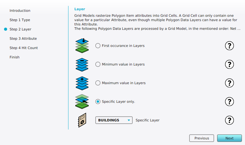
Possible values: | Possible values: | ||
# FIRST: Attribute: First layer | # '''FIRST''': Attribute: First layer | ||
# MIN: Attribute: Min value | # '''MIN''': Attribute: Min value | ||
# MAX: Attribute: Max value | # '''MAX''': Attribute: Max value | ||
# SINGLE LAYER: Attribute: [[Maplink (Distance Overlay)|Specific layer]] | # '''SINGLE LAYER''': Attribute: [[Maplink (Distance Overlay)|Specific layer]] | ||
# GRID: Grid: Input Overlay | # '''GRID''': Grid: Input Overlay | ||
{{article end | {{article end | ||
Revision as of 12:27, 31 January 2024

| Icon | Property | Description | Default value |
|---|---|---|---|
| |
Rasterization | The rasterization method of a Distance Overlay | n/a |
Possible values:
- FIRST: Attribute: First layer
- MIN: Attribute: Min value
- MAX: Attribute: Max value
- SINGLE LAYER: Attribute: Specific layer
- GRID: Grid: Input Overlay