Help
File list
Jump to navigation
Jump to search
This special page shows all uploaded files.
File list
Items per page:
20
50
100
250
500
Username:
Include old versions of files
Show file list
First page
Previous page
Next page
Last page
Date
Name
Thumbnail
Size
User
Description
Versions
12:11, 15 October 2025
QGIS wfs feature vertex button.png
(
file
)
1 KB
Frank@tygron.nl
(
talk
|
contribs
)
1
12:10, 15 October 2025
QGIS wfs classification form.png
(
file
)
9 KB
Frank@tygron.nl
(
talk
|
contribs
)
1
12:07, 15 October 2025
QGIS wfs attribute form.png
(
file
)
9 KB
Frank@tygron.nl
(
talk
|
contribs
)
1
12:04, 15 October 2025
QGIS wfs adding vertices.png
(
file
)
14 KB
Frank@tygron.nl
(
talk
|
contribs
)
1
12:01, 15 October 2025
QGIS wfs new feature button.png
(
file
)
1 KB
Frank@tygron.nl
(
talk
|
contribs
)
1
12:00, 15 October 2025
QGIS wfs edit button.png
(
file
)
1 KB
Frank@tygron.nl
(
talk
|
contribs
)
1
11:56, 15 October 2025
QGIS wfs new feature button.jpg
(
file
)
2 KB
Frank@tygron.nl
(
talk
|
contribs
)
1
11:56, 15 October 2025
QGIS wfs edit button.jpg
(
file
)
1,013 bytes
Frank@tygron.nl
(
talk
|
contribs
)
1
11:57, 14 October 2025
Export ai training data export config.png
(
file
)
39 KB
Frank@tygron.nl
(
talk
|
contribs
)
1
11:34, 14 October 2025
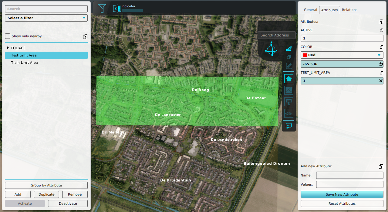
Demo train dataset test limit area.png
(
file
)
1.13 MB
Frank@tygron.nl
(
talk
|
contribs
)
1
11:34, 14 October 2025
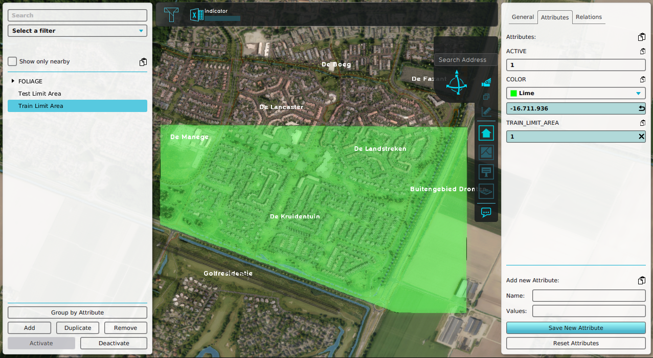
Demo train dataset train limit area.png
(
file
)
1.13 MB
Frank@tygron.nl
(
talk
|
contribs
)
1
14:28, 10 October 2025
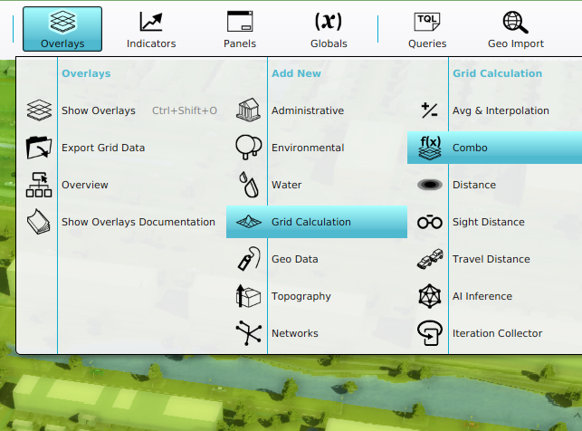
ComboOverlay addNew.png
(
file
)
221 KB
Frank@tygron.nl
(
talk
|
contribs
)
1
14:25, 10 October 2025
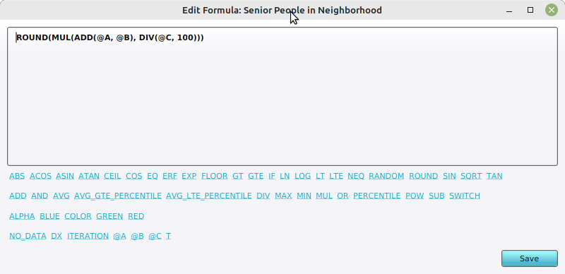
Neighborhood attributes formula.png
(
file
)
32 KB
Frank@tygron.nl
(
talk
|
contribs
)
1
14:23, 10 October 2025
Neigbhorhood attributes tooltip.png
(
file
)
179 KB
Frank@tygron.nl
(
talk
|
contribs
)
1
14:23, 10 October 2025
Neighborhood attributes input.png
(
file
)
89 KB
Frank@tygron.nl
(
talk
|
contribs
)
1
09:53, 10 October 2025
Plotly neighborhood pie chart.jpg
(
file
)
193 KB
Frank@tygron.nl
(
talk
|
contribs
)
1
08:15, 9 October 2025
Building floors.png
(
file
)
1.34 MB
Maxim@tygron.com
(
talk
|
contribs
)
1
08:06, 9 October 2025
Overlay icon scenario.png
(
file
)
5 KB
Maxim@tygron.com
(
talk
|
contribs
)
1
11:26, 8 October 2025
Export geopackage.png
(
file
)
41 KB
Maxim@tygron.com
(
talk
|
contribs
)
1
14:42, 3 October 2025
Ifc bridge example.png
(
file
)
1.04 MB
Frank@tygron.nl
(
talk
|
contribs
)
1
14:42, 3 October 2025
Ifc revit example.png
(
file
)
877 KB
Frank@tygron.nl
(
talk
|
contribs
)
1
10:32, 16 September 2025
Heat stress knmi data calculator.xlsx
(
file
)
8.86 MB
Rudolf@tygron.nl
(
talk
|
contribs
)
4
13:25, 16 July 2025
Evapotranspiration.jpg
(
file
)
315 KB
Bobby@tygron.nl
(
talk
|
contribs
)
Uploaded own work with UploadWizard
1
12:58, 30 May 2025
Measure area averages grid panel.png
(
file
)
55 KB
Frank@tygron.nl
(
talk
|
contribs
)
2
12:58, 30 May 2025
Measure area averages grid general.png
(
file
)
158 KB
Frank@tygron.nl
(
talk
|
contribs
)
2
12:44, 30 May 2025
Measure area averages grid template.png
(
file
)
128 KB
Frank@tygron.nl
(
talk
|
contribs
)
1
12:18, 30 May 2025
Text template panel example 1.png
(
file
)
686 KB
Frank@tygron.nl
(
talk
|
contribs
)
1
13:07, 28 May 2025
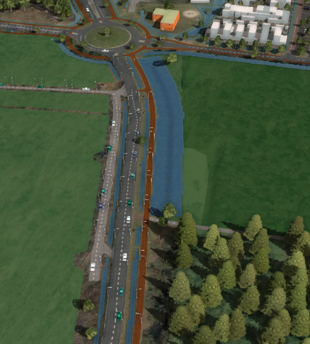
Vector data heightmap change result.png
(
file
)
630 KB
Frank@tygron.nl
(
talk
|
contribs
)
1
13:07, 28 May 2025
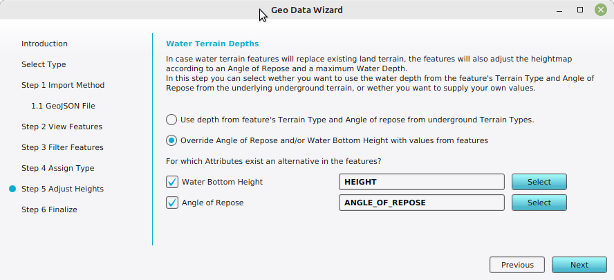
Vector data heightmap change adjust heights.png
(
file
)
78 KB
Frank@tygron.nl
(
talk
|
contribs
)
1
13:07, 28 May 2025
Vector data heightmap change assign types.png
(
file
)
59 KB
Frank@tygron.nl
(
talk
|
contribs
)
1
13:07, 28 May 2025
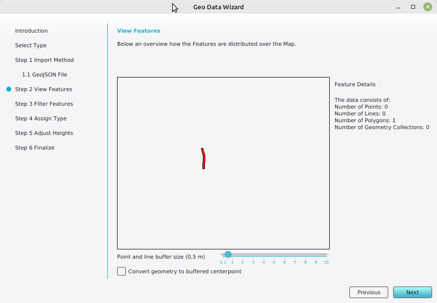
Vector data heightmap change view features.png
(
file
)
56 KB
Frank@tygron.nl
(
talk
|
contribs
)
1
13:07, 28 May 2025
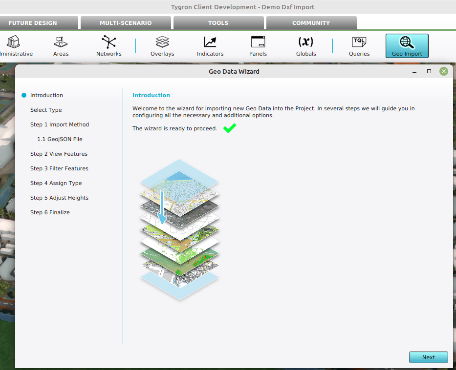
Vector data heightmap change geo import.png
(
file
)
192 KB
Frank@tygron.nl
(
talk
|
contribs
)
1
12:03, 28 May 2025
Remove waterway heightmap heightmap.png
(
file
)
735 KB
Frank@tygron.nl
(
talk
|
contribs
)
1
12:02, 28 May 2025
Remove waterway heightmap average.png
(
file
)
535 KB
Frank@tygron.nl
(
talk
|
contribs
)
1
12:02, 28 May 2025
Remove waterway heightmap combo.png
(
file
)
568 KB
Frank@tygron.nl
(
talk
|
contribs
)
1
12:02, 28 May 2025
Remove waterway heightmap interpolation.png
(
file
)
546 KB
Frank@tygron.nl
(
talk
|
contribs
)
1
12:02, 28 May 2025
Remove waterway heightmap measurement.png
(
file
)
370 KB
Frank@tygron.nl
(
talk
|
contribs
)
1
11:14, 28 May 2025
Terrain height overlay.png
(
file
)
725 KB
Frank@tygron.nl
(
talk
|
contribs
)
1
11:12, 28 May 2025
Tesselated terrain height.png
(
file
)
1.06 MB
Frank@tygron.nl
(
talk
|
contribs
)
1
10:11, 28 May 2025
Measure level terrain add grid spatial.png
(
file
)
108 KB
Frank@tygron.nl
(
talk
|
contribs
)
1
10:10, 28 May 2025
Measure level terrain select grid ovrelay.png
(
file
)
161 KB
Frank@tygron.nl
(
talk
|
contribs
)
1
10:07, 28 May 2025
Measure level terrain uncheck auto calculation.png
(
file
)
11 KB
Frank@tygron.nl
(
talk
|
contribs
)
1
09:59, 28 May 2025
Measure level terrain new situation.png
(
file
)
558 KB
Frank@tygron.nl
(
talk
|
contribs
)
1
09:58, 28 May 2025
Measure level terrain original situation.png
(
file
)
341 KB
Frank@tygron.nl
(
talk
|
contribs
)
1
09:56, 28 May 2025
Measure level terrain set terrain type.png
(
file
)
56 KB
Frank@tygron.nl
(
talk
|
contribs
)
1
09:54, 28 May 2025
Measure level terrain draw selection manually.png
(
file
)
179 KB
Frank@tygron.nl
(
talk
|
contribs
)
1
13:07, 27 May 2025
Editor ribbon bar testrun stop.jpg
(
file
)
2 KB
Frank@tygron.nl
(
talk
|
contribs
)
1
13:27, 7 May 2025
Grid overlay area measurement line chart.png
(
file
)
214 KB
Frank@tygron.nl
(
talk
|
contribs
)
1
07:38, 11 April 2025
Average overlay grid model.png
(
file
)
34 KB
Frank@tygron.nl
(
talk
|
contribs
)
1
07:29, 11 April 2025
AverageWizard icon surface only.png
(
file
)
5 KB
Frank@tygron.nl
(
talk
|
contribs
)
1
First page
Previous page
Next page
Last page
Navigation menu
Personal tools
Log in
Namespaces
Special page
English
Views
More
Search
Navigation
Main page
Recent changes
Random page
Upload files
Help
Tools
Special pages
Printable version


