UK Benchmark 6 (Water Module)
The Benchmark of the UK Environmental Agency (EA, 2013) is used to assess the functioning of the numerical scheme for several cases. The results are described below.
Benchmark 2
description
Tygron Platform version: 2019.0.0 DEV 66.0
Date executed: 2018-07-10
Characteristics: A test for the evaluation of an inundation pattern and depth at low momentum over a complex topography:
- Dimensions: 2000m X 200m
- Roughness: uniform manning = 0,03 m/s1/3
- Initial conditions: empty grid
- Resolution: 20m grid
- Boundary condition: Q(t) in North-East side of the model domain
note: the benchmark was executed on a 10m, instead of 20m
File:Inundation benchmark 01.PNG
results
Water levels every 300 secs on the centre of every depression are requested together with a map of the waterdepts at the end of simulation.
The waterdepth at the end of simulation is shown below
File:Inundation benchmark 02.PNG
And graphs of water levels at the centre of every depression:
File:Inundation benchmark 03.PNG
File:Inundation benchmark 04.PNG
Benchmark 3
description
Tygron Platform version: 2019.0.0 DEV 68.0
Date executed: 2018-07-11
Characteristics: Test for conservation of momentum over a small obstruction. By inertia (flow changing over time) some water flows over the obstruction.
- Dimensies: zie Figuur below
- Roughness: uniform manning = 0,01 m/s1/3
- Initial condition: 0m water depth
- Resolution: 5m grid
- Boundary condition: Q(t), see figure below
File:Inundation benchmark 05.PNG
results
Results every 2 seconds in the middle of every despression are requested and shown below
File:Inundation benchmark 06.PNG
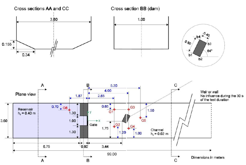
Benchmark 6
description
Tygron Platform version: 2019.0.0 DEV 61.0 Date executed: 2018-07-09
Characteristics:
- Dimensions: 20X the values below
- Roughness: uniform manning = 0,05 m/s1/3
- Initiële conditions: 8m in reservoir, 0,4m in floodplain
- Modelgrid resolution: 2m
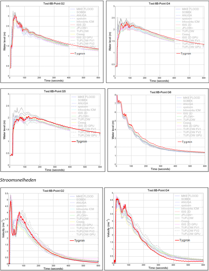
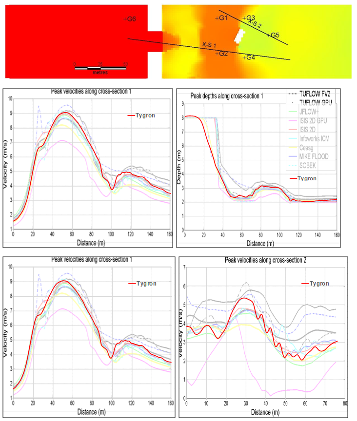
results
Waterlevels and profiles at the locations indicated in figure above
Velocity profiles
References
- Environmetal Agency (2013). Benchmarking the latest generation of 2D hydraulic modelling packages ∙ report Report – SC120002 ∙ found at: https://consult.environment-agency.gov.uk/engagement/bostonbarriertwao/results/appendix-6---neelz--s.---pender--g.--2013--benchmarking-the-latest-generation-of-2d-hydraulic-modelling-packages.-bristol_environment-agency.pdf (last visited 2018-08-03)


