Uncategorized files
Jump to navigation
Jump to search
Showing below up to 50 results in range #201 to #250.
-
 Aeriuswizard icon nh3 living.png 40 × 40; 4 KB
-
 Aeriuswizard icon nh3 recreation.png 40 × 40; 6 KB
-
 Aeriuswizard icon nh3 work.png 40 × 40; 3 KB
-
 Aeriuswizard icon nox.png 40 × 40; 3 KB
-
 Aeriuswizard icon nox living.png 40 × 40; 4 KB
-
 Aeriuswizard icon nox recreation.png 40 × 40; 6 KB
-
 Aeriuswizard icon nox work.png 40 × 40; 3 KB
-
 Aeriuswizard icon plan category amounts.png 40 × 40; 5 KB
-
 Aeriuswizard icon traffic sector.png 40 × 40; 5 KB
-
 Ahn.jpg 1,116 × 670; 214 KB
-
 Ahn file.JPG 931 × 619; 60 KB
-
 Ahn naming.JPG 934 × 468; 34 KB
-
 Ahn water level.JPG 930 × 405; 32 KB
-
 Align Evaluation.jpg 1,085 × 481; 111 KB
-
 Align Evaluation details.jpg 300 × 250; 18 KB
-
 Aligned to the left.png 369 × 166; 9 KB
-
 Analysis tools.jpg 594 × 450; 155 KB
-
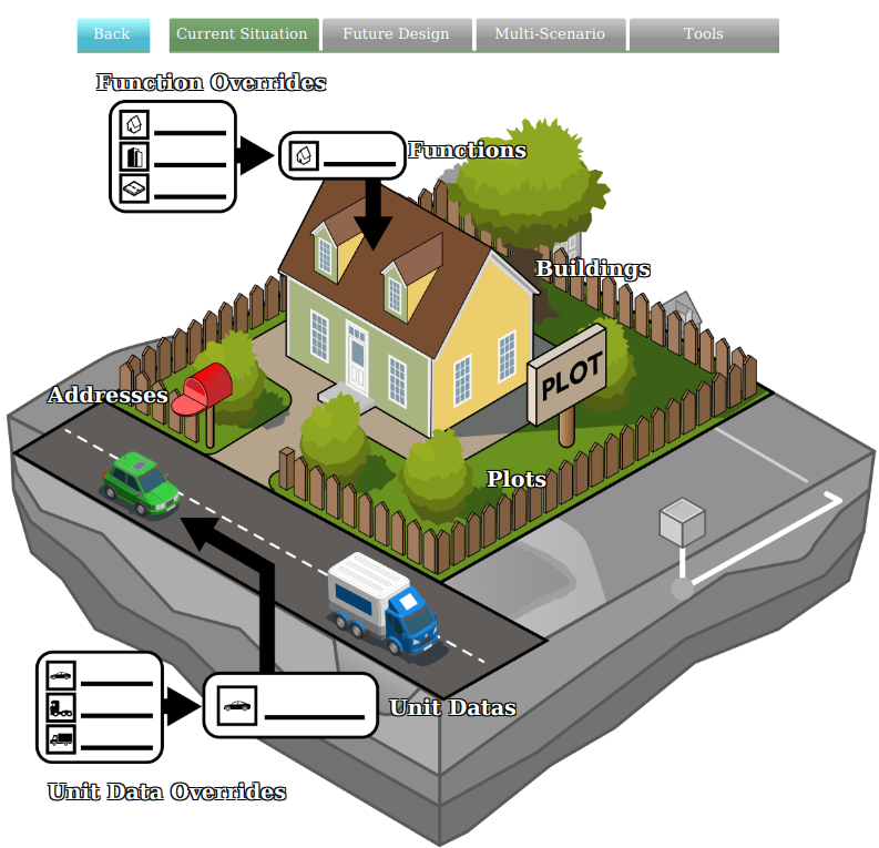 Api current situation building.png 793 × 765; 231 KB
-
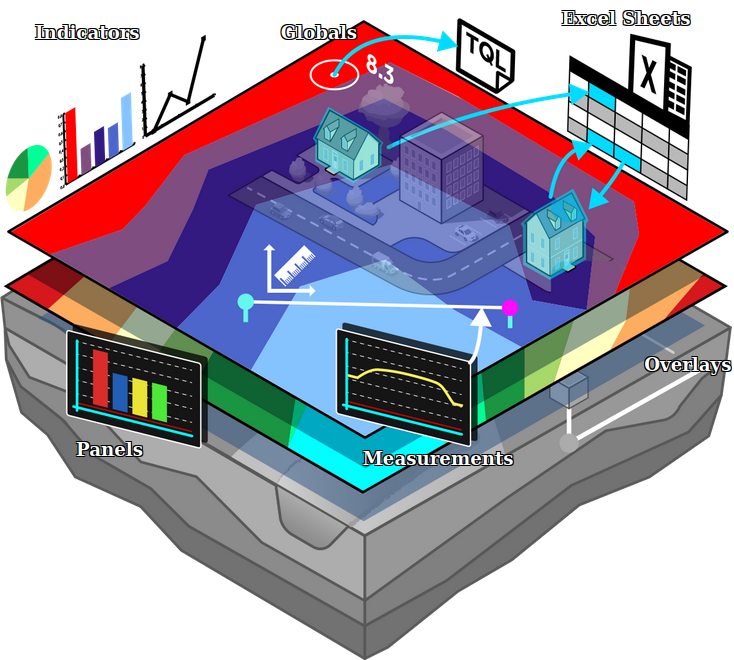 Api current situation calculation.png 734 × 660; 327 KB
-
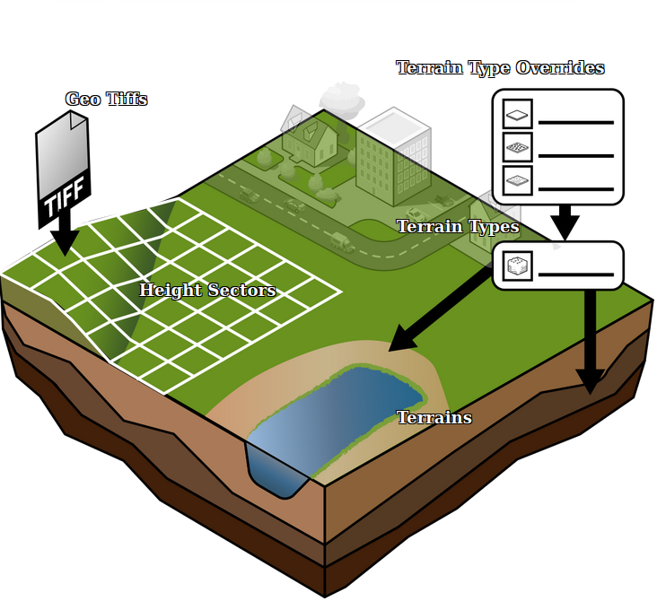 Api current situation geography.png 732 × 670; 258 KB
-
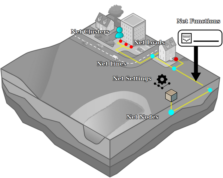 Api current situation network.png 742 × 593; 179 KB
-
 Api current situation urban subdiv.png 730 × 648; 190 KB
-
 Api figure13.PNG 1,924 × 1,042; 120 KB
-
 Api figure14.PNG 1,920 × 1,042; 160 KB
-
 Api future design.png 814 × 662; 374 KB
-
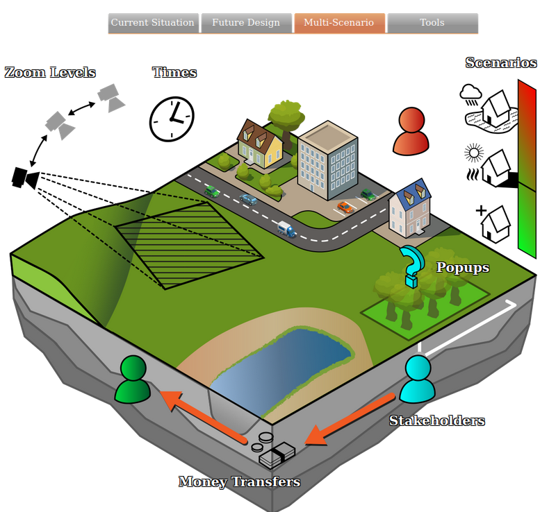 Api multi scenario.png 777 × 738; 324 KB
-
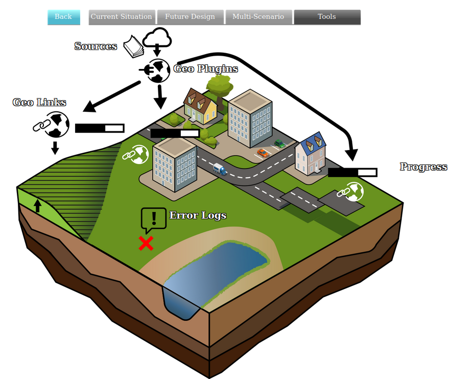 Api tools geo.png 879 × 742; 294 KB
-
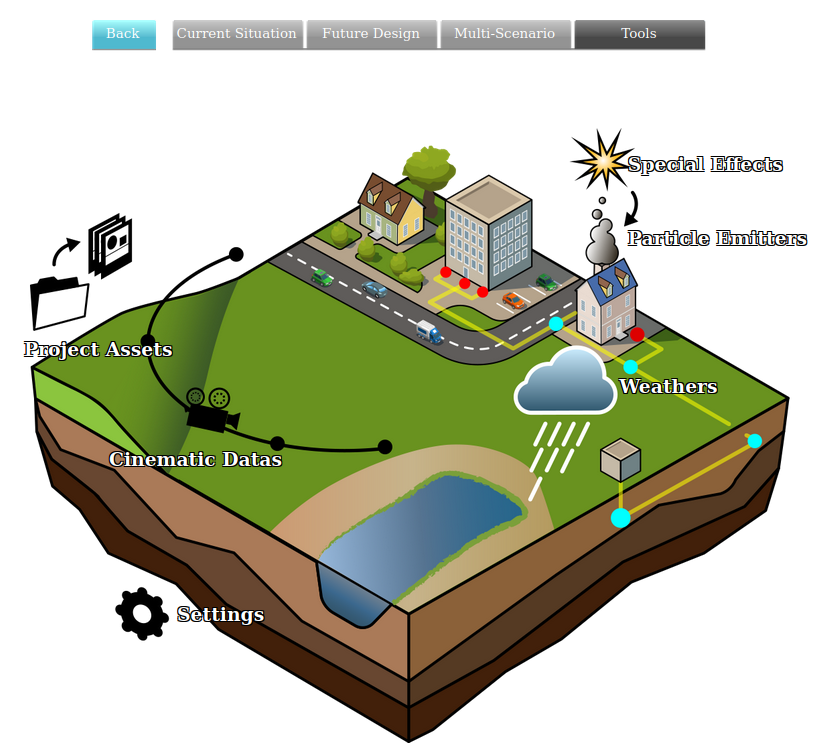 Api tools visual.png 814 × 749; 293 KB
-
 ApplyParaDesignBtn1.jpg 291 × 128; 11 KB
-
 Apply btn1.jpg 294 × 97; 8 KB
-
 Apply btn1a.jpg 294 × 97; 9 KB
-
 Apply file.JPG 878 × 724; 59 KB
-
 Apply foliage raster.JPG 812 × 674; 47 KB
-
 Apply measure.PNG 467 × 560; 231 KB
-
 Apply office.PNG 350 × 507; 167 KB
-
 Apply selection.png 582 × 582; 265 KB
-
 ArcGisAttrStyle.jpg 355 × 435; 42 KB
-
 ArcGisCopyNames.jpg 621 × 435; 69 KB
-
 ArcGisLogo1.jpg 354 × 120; 9 KB
-
 ArcGisOnlineLogo.png 421 × 198; 16 KB
-
 ArcGisSearchOwnership.jpg 800 × 465; 84 KB
-
 ArcMap WFS 01.jpg 972 × 541; 200 KB
-
 ArcMap WFS 02.jpg 486 × 465; 62 KB
-
 ArcMap WFS 03.jpg 392 × 456; 68 KB
-
 ArcMap WFS 04.jpg 379 × 441; 56 KB
-
 ArcMap WFS 05.jpg 1,112 × 704; 92 KB
-
 Archeological map.JPG 1,320 × 696; 201 KB
-
 Archeological map wms.JPG 1,326 × 693; 164 KB
-
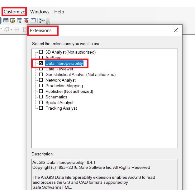 Arcmap data interop etension.JPG 626 × 610; 86 KB
-
 Area-right-active.jpg 230 × 20; 3 KB


