Basic Mode
>>>Please note: Basic Mode is still in beta and only available for Strategic Partners. This functionality is not fully developed and tested yet.
What is Basic Mode?
The Basic Mode can be useful for very large areas where very high detail in the calculations is less relevant.
- Basic Mode is selected during project creation, and enables large projects (max 180x180 km) with a medium (5m grid) map.
- Pending on the license agreement and hardware, maximum size can be smaller. If you can normally create 30x30 km projects, you can now create a 180x180km project in Basic Mode.
- Each domain can have 3 Basic Mode projects at the same time.
- Calculation grid size is set to 5x5m minimum, but larger grid sizes (10x10m, 20x20m, etc) can be selected.
- The Digital Elevation Model (DTM) is set to 10x10m in Basic Mode.
- To limit the high amount of polygons present in a Basic Mode project, BGT data and 3D models (buildings) will not be available.
How to use Basic Mode?
How to use Basic Mode:
- Log in to client.
- Select new project in the Main Menu.
- After naming your project, select Basic for Detail Level.
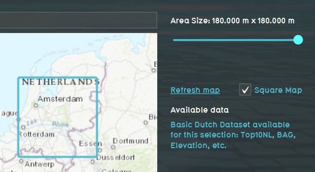
- Use the Map Wizard to select the Basic Mode map size and location of your project.
-
1. Log in to client.
-
2. Select new project in the Main Menu.
-
3. After naming your project, select Basic for Detail Level.
-
4. Use the Map Wizard to select the Basic Mode map size and location of your project.


