Basic Mode: Difference between revisions
Jump to navigation
Jump to search
| Line 2: | Line 2: | ||
==What is Basic Mode?== | ==What is Basic Mode?== | ||
The Basic Mode can be useful for very large areas | The Basic Mode can be useful for very large areas such as for regional analyses. | ||
*Basic Mode is selected during project creation, and enables very large projects with a medium (5m grid) map. | *Basic Mode is selected during project creation, and enables very large projects with a medium (5m grid) map. | ||
| Line 11: | Line 10: | ||
*The Digital Elevation Model (DTM) is set to 10x10m in Basic Mode. | *The Digital Elevation Model (DTM) is set to 10x10m in Basic Mode. | ||
*To limit the high amount of polygons present in a Basic Mode project, BGT data and custom 3D models (such as 3DBAG and CityGML/i3s) will not be available when creating a new project. | *To limit the high amount of polygons present in a Basic Mode project, BGT data and custom 3D models (such as 3DBAG and CityGML/i3s) will not be available when creating a new project. | ||
*All buildings starting from 10m2 are included in Basic Mode | |||
==How to use Basic Mode?== | ==How to use Basic Mode?== | ||
Revision as of 11:11, 29 September 2023
This functionality is currently in BETA and only available with a Strategic Partnership.
Read more about Beta features.
Read more about Beta features.
What is Basic Mode?
The Basic Mode can be useful for very large areas such as for regional analyses.
- Basic Mode is selected during project creation, and enables very large projects with a medium (5m grid) map.
- The maximum size of the basic mode is pending on your license agreement and hardware. If you can normally create 30x30 km projects, you can create a 180x180km project in Basic Mode.
- The size (km2) of a Basic Mode project counts for 1/25 in your license.
- Calculation grid size is set to 5x5m minimum, but larger grid sizes (10x10m, 20x20m, etc) can be selected.
- The Digital Elevation Model (DTM) is set to 10x10m in Basic Mode.
- To limit the high amount of polygons present in a Basic Mode project, BGT data and custom 3D models (such as 3DBAG and CityGML/i3s) will not be available when creating a new project.
- All buildings starting from 10m2 are included in Basic Mode
How to use Basic Mode?
How to use Basic Mode:
- Log in to client.
- Select new project in the Main Menu.
- After naming your project, select Basic for Detail Level.
- Use the Map Wizard to select the Basic Mode map size and location of your project.
1. Log in to client.
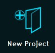
2. Select new project in the Main Menu.
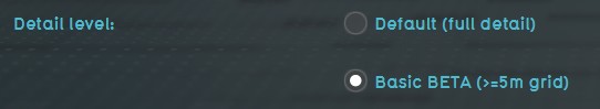
3. After naming your project, select Basic for Detail Level.
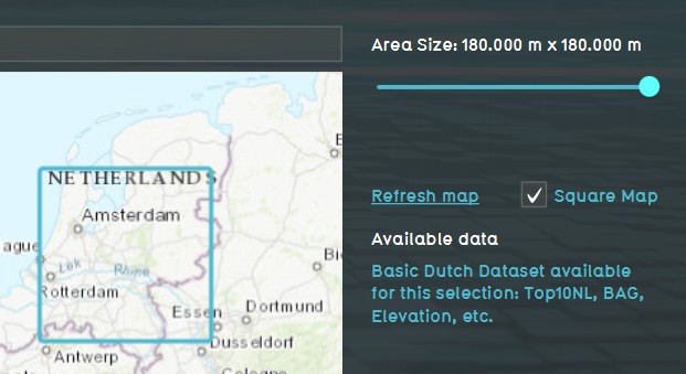
4. Use the Map Wizard to select the Basic Mode map size and location of your project.


