Satellite map: Difference between revisions
Jump to navigation
Jump to search
(Created page with "The satellite map is a visual component rendered on top of the heightmap in the 3D Visualization. Satellite images are obtained from WMS sources such as World Imagery and linked to Height Sectors.") |
No edit summary |
||
| (4 intermediate revisions by the same user not shown) | |||
| Line 1: | Line 1: | ||
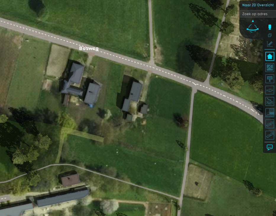
The satellite map is a visual component rendered on top of the [[ | [[File:Camera_top_down.png|thumb|right|400px|Buildings on top of a height map with satellite images rendered upon it. Notice that certain parts of the satellite image are overwritten by [[Building]]s and [[terrain]]s present on those locations]] | ||
The satellite map is a visual component rendered on top of the [[height map]] in the [[3D Visualization]]. | |||
Satellite images are obtained from WMS sources such as [[Project Sources#World Imagery|World Imagery]] and linked to [[Height Sector]]s. | Satellite images are obtained from WMS sources such as [[Project Sources#World Imagery|World Imagery]] and linked to [[Height Sector]]s. | ||
When making changes to [[terrain]]s in the [[project area]], the visibility of the satellite image can be partially overridden by the adjusted terrain part. | |||
Whether or not the satellite image is shown is determined by the ''showSatellite'' parameter in the [[Terrain]] item. | |||
{{article end | |||
|seealso= | |||
*[[3D Visualization]] | |||
*[[Height sector]] | |||
*[[Terrain]] | |||
}} | |||
Latest revision as of 14:01, 7 February 2023
The satellite map is a visual component rendered on top of the height map in the 3D Visualization.
Satellite images are obtained from WMS sources such as World Imagery and linked to Height Sectors.
When making changes to terrains in the project area, the visibility of the satellite image can be partially overridden by the adjusted terrain part.
Whether or not the satellite image is shown is determined by the showSatellite parameter in the Terrain item.
