Uncategorized files
Jump to navigation
Jump to search
Showing below up to 250 results in range #21 to #270.
View (previous 250 | next 250) (20 | 50 | 100 | 250 | 500)
 3D Web Viewer Activating.png 1,043 × 891; 505 KB
 3D Web Viewer Cinematic Activating.png 888 × 647; 589 KB
 3D Web Viewer Cinematic Inspect.png 497 × 453; 171 KB
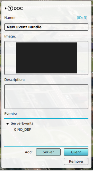
 3D Web Viewer Event Bundle Add.png 934 × 374; 351 KB
 3D Web Viewer Event Bundle Add Server Event.png 302 × 552; 123 KB
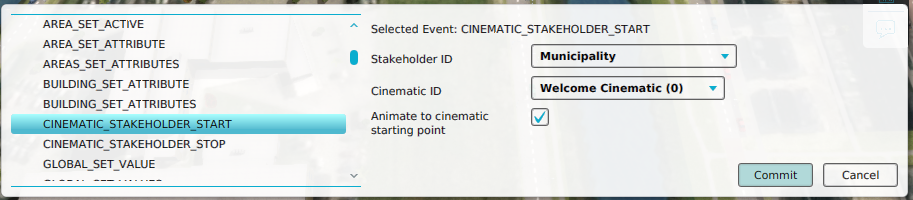 3D Web Viewer Event Configure Cinematic Stakeholder Start Event.png 913 × 200; 145 KB
 3D Web Viewer Measure Inspect.png 653 × 457; 257 KB
 3D Web Viewer Open.png 267 × 101; 8 KB
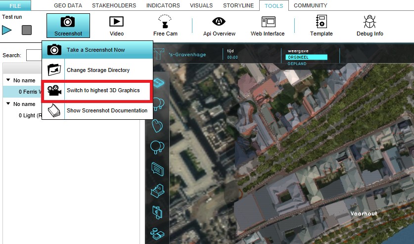 3d graphics.jpg 837 × 495; 114 KB
 5m 100m3 22kd.png 1,337 × 650; 101 KB
 5m 10m3 2 2k.png 1,338 × 650; 101 KB
 5m 25m3 22kd.png 1,337 × 651; 104 KB
 5m 25m3 2 2k.png 1,338 × 651; 102 KB
 5m 4m3 0 11k.png 1,337 × 651; 106 KB
 5m 4m3 0 44k.png 1,337 × 651; 102 KB
 5m 50m3 11kd.png 1,337 × 650; 103 KB
 5m 50m3 22kd.png 1,337 × 651; 98 KB
 5m 50m3 2 2k.png 1,339 × 652; 100 KB
 5m 50m3 44kd.png 1,337 × 650; 103 KB
 5m 50m3 4 4k.png 1,337 × 650; 102 KB
 5m 50m3 88kd.png 1,338 × 649; 102 KB
 64days 10m kd17 c20 ws10 h4 1.png 1,320 × 545; 170 KB
 64days 10m kd220 c20 ws10 h4 1.png 1,320 × 547; 176 KB
 64days 10m kd220 c20 ws25 h4 1.png 1,320 × 548; 182 KB
 64days 10m kd22 c10 ws33 h4 5.png 1,321 × 547; 174 KB
 64days 2m kd22 c20 ws10 h4 1.png 1,318 × 548; 170 KB
 64days 5m kd22 c20 ws10 h4 1.png 1,323 × 548; 178 KB
 A-Greener-Hoefkade.pdf ; 1.29 MB
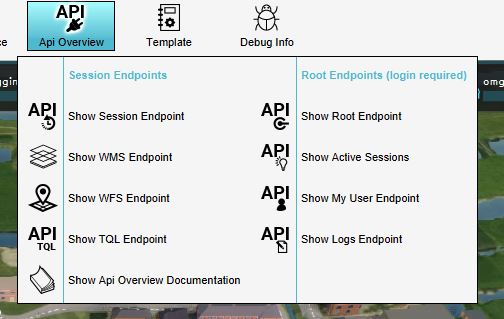 API endpoints.JPG 504 × 319; 35 KB
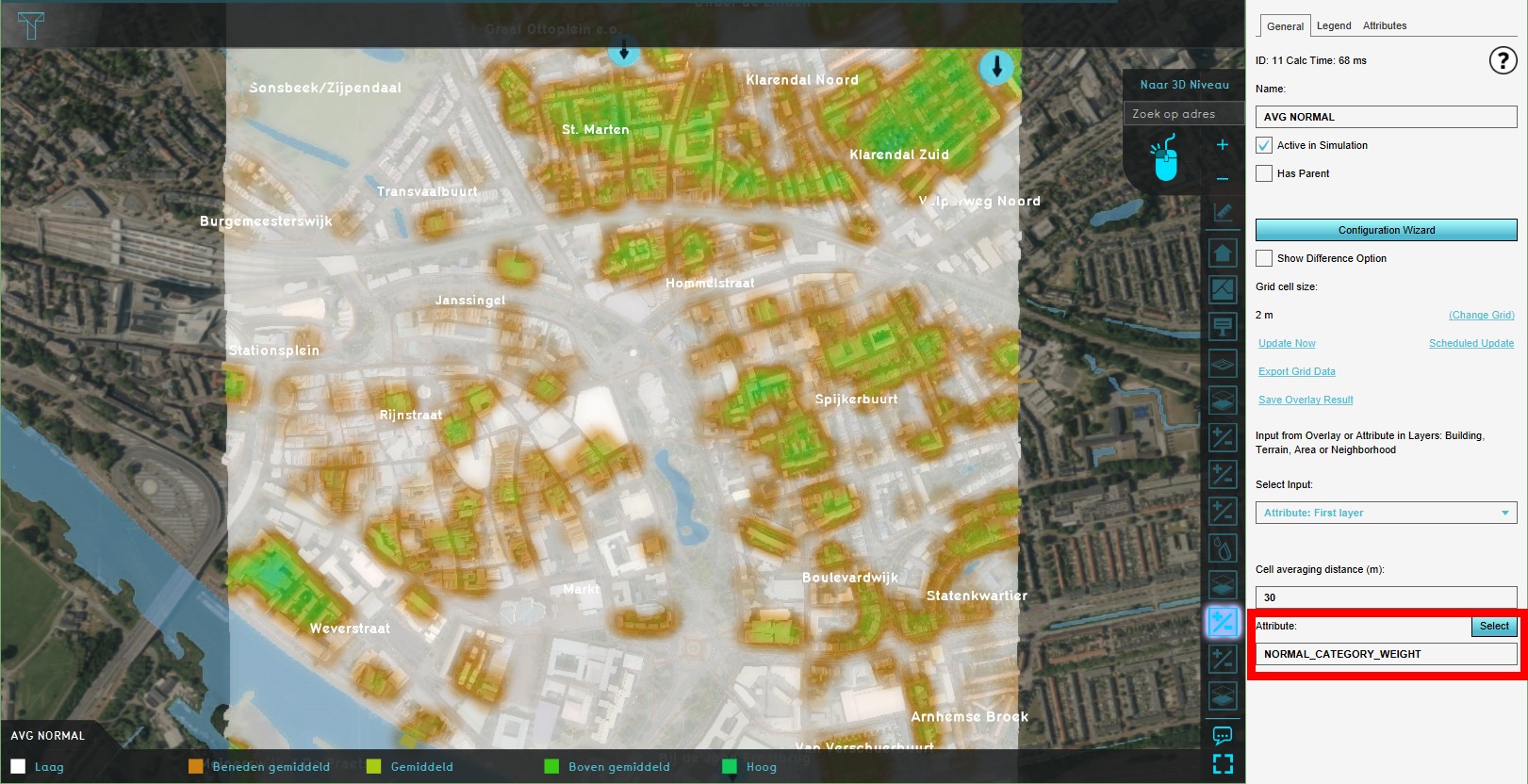 AVG Normal1.jpg 1,621 × 832; 328 KB
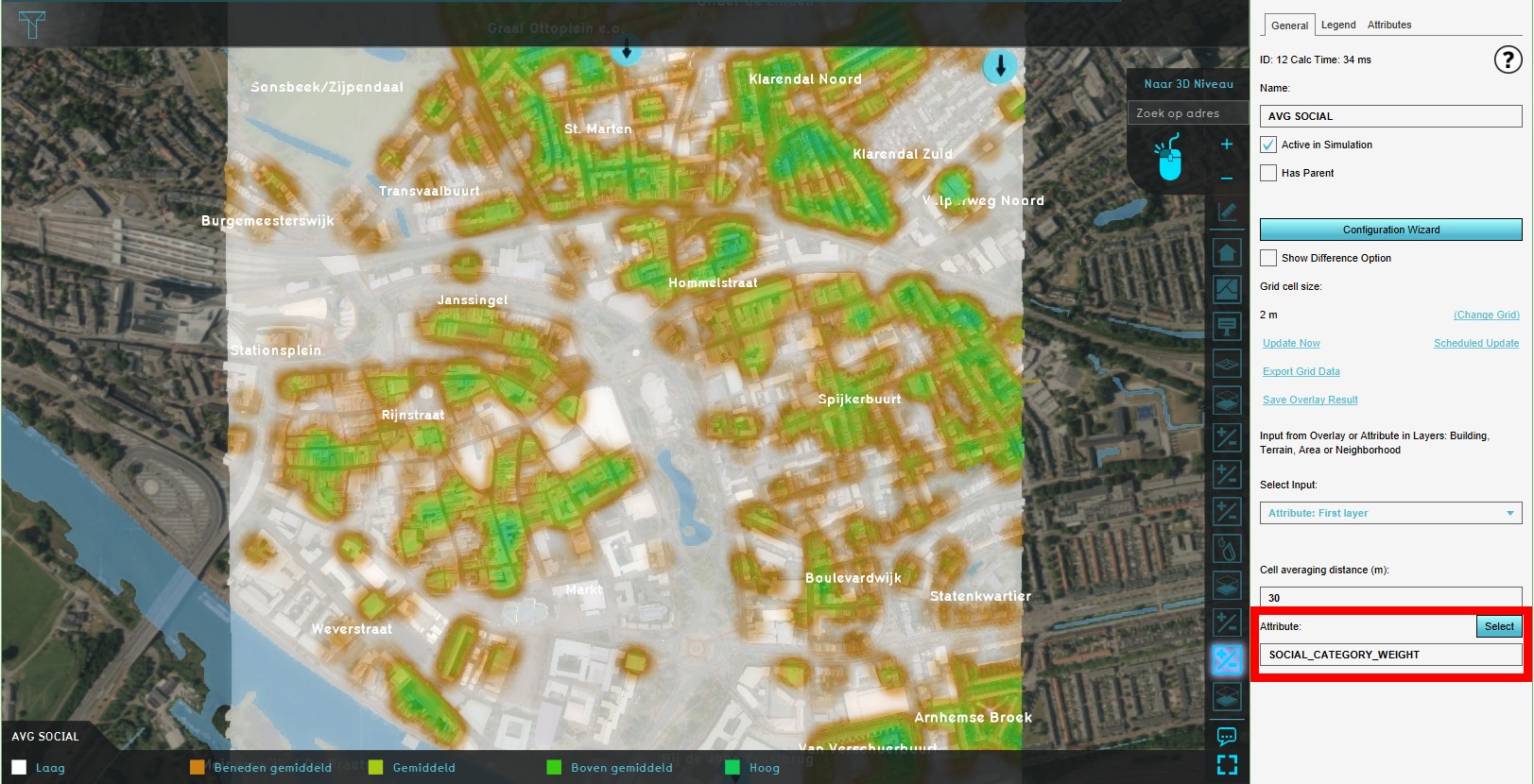 AVG Social1.jpg 1,623 × 830; 334 KB
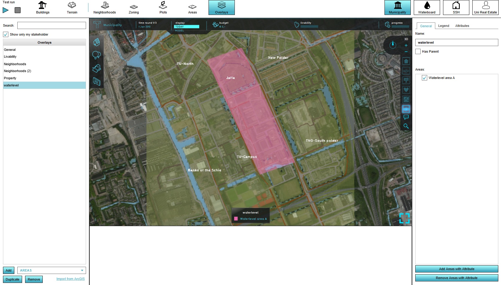
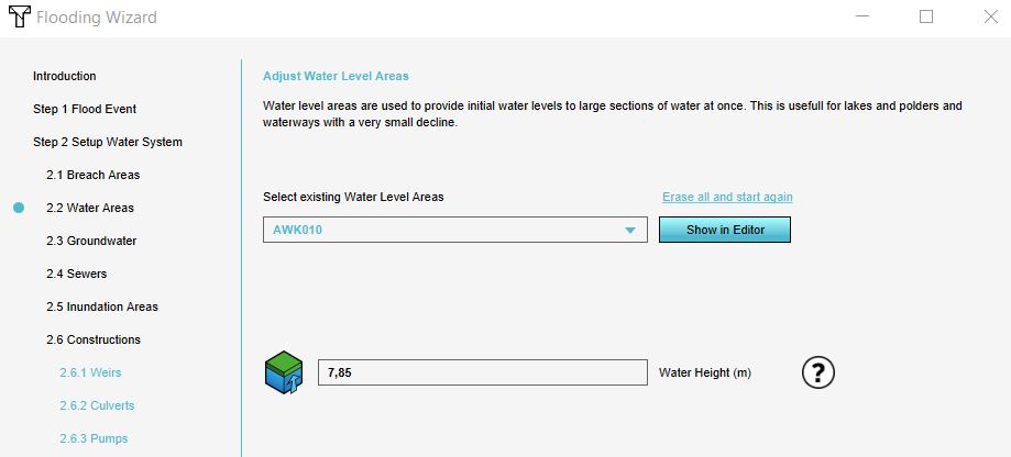 Aanpassen water level.JPG 919 × 416; 41 KB
 Absolute score.png 294 × 57; 2 KB
 Accept fix.PNG 923 × 576; 58 KB
 Actieve checkbox.png 298 × 43; 738 bytes
 Action .jpg 1,677 × 960; 351 KB
 Action bar project.png 395 × 348; 168 KB
 Action log.jpg 1,078 × 696; 204 KB
 Action log example.jpg 1,078 × 691; 214 KB
 Action log panel.png 274 × 519; 136 KB
 Action menu.jpg 449 × 594; 50 KB
 Action name.jpg 291 × 349; 16 KB
 Action panel closeup.jpg 468 × 468; 72 KB
 Action panel with selection.png 700 × 824; 579 KB
 Action selection.jpg 449 × 594; 50 KB
 Action testrun.png 629 × 344; 350 KB
 Actions-left.jpg 248 × 444; 29 KB
 Actions-right-actions.jpg 248 × 444; 26 KB
 Actions-right-active.jpg 230 × 20; 2 KB
 Actions-right-image.jpg 292 × 121; 10 KB
 Actions-right-move.jpg 277 × 31; 3 KB
 Actions-right-name.jpg 230 × 48; 3 KB
 Actions-right-stakeholders.jpg 286 × 243; 10 KB
 Actions-right.jpg 293 × 552; 43 KB
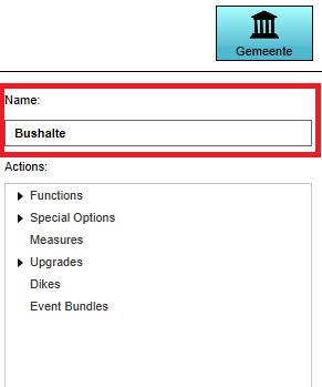
 Actions.png 305 × 131; 62 KB
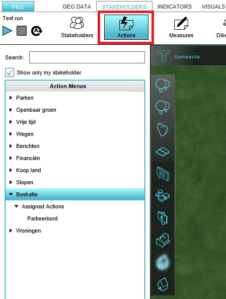
 Actions stakeholder.png 548 × 692; 316 KB
 ActivateExcelIndicator-Q3-2015.jpg 393 × 500; 42 KB
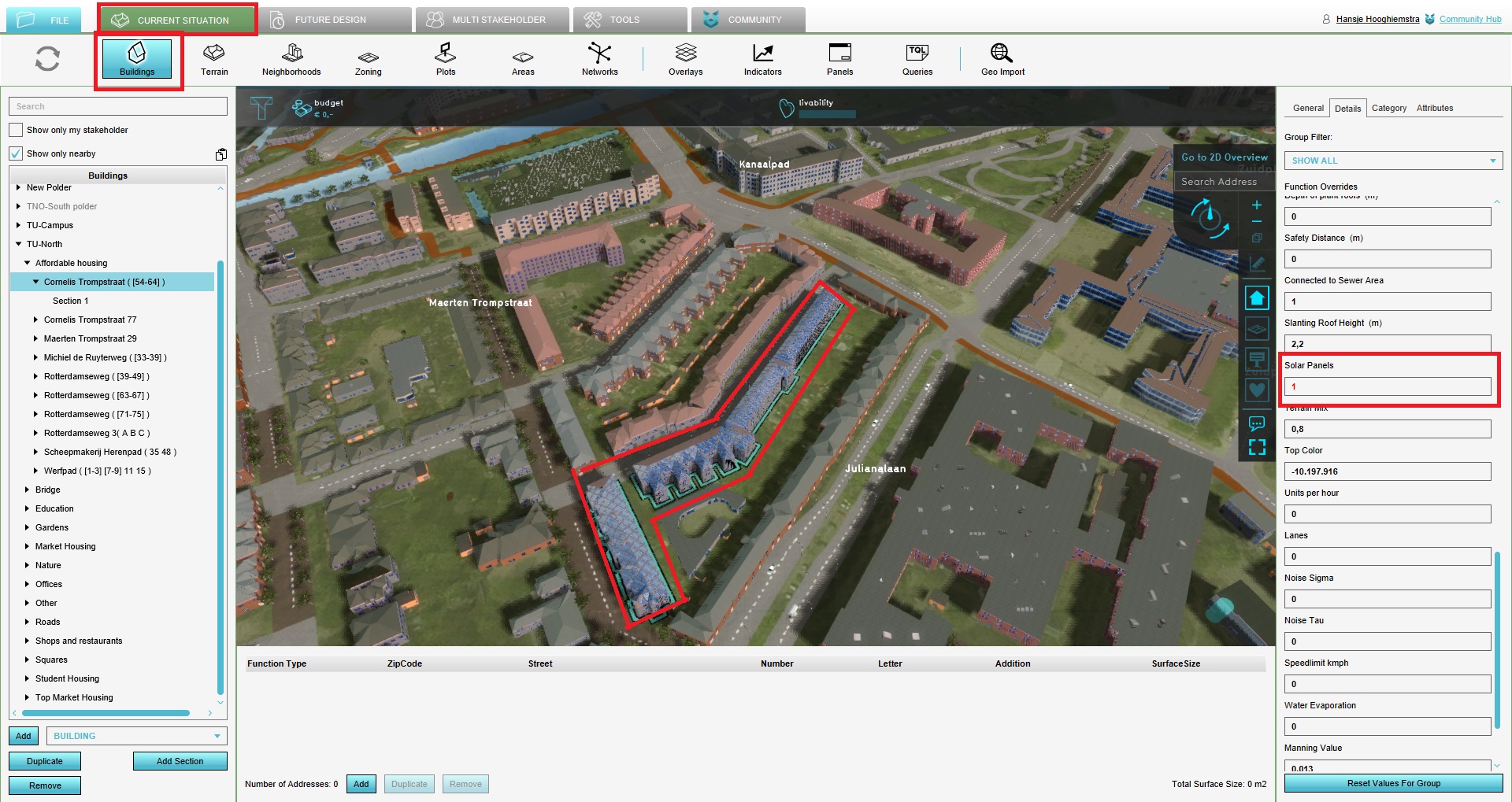 Activate solar panels attribute.jpg 1,920 × 1,019; 568 KB
 Active ccheckbox.png 291 × 315; 3 KB
 Active checkbox.png 292 × 38; 701 bytes
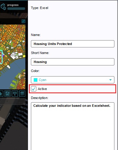
 Active indicator field.jpg 295 × 41; 2 KB
 Active select.jpg 1,545 × 939; 397 KB
 Add.jpg 591 × 982; 107 KB
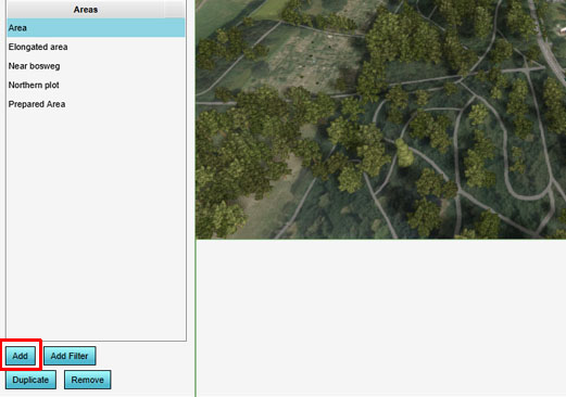
 AddArea.jpg 375 × 300; 35 KB
 AddAttribute1.jpg 646 × 439; 80 KB
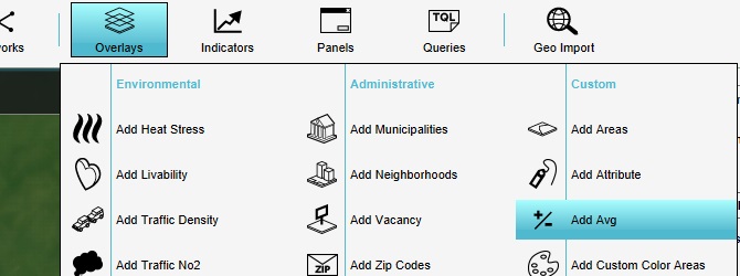 AddAverageOverlay.jpg 670 × 250; 45 KB
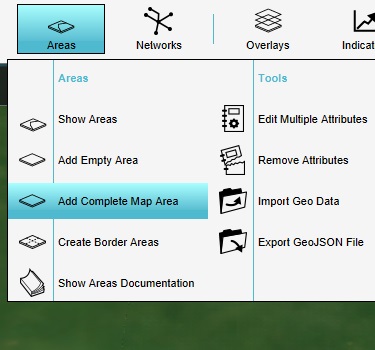 AddCompleteArea.jpg 375 × 350; 37 KB
 AddDescriptionExcelIndicator-Q3-2015.jpg 393 × 500; 43 KB
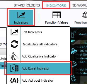 AddExcelIndicator-Q3-2015.jpg 297 × 285; 29 KB
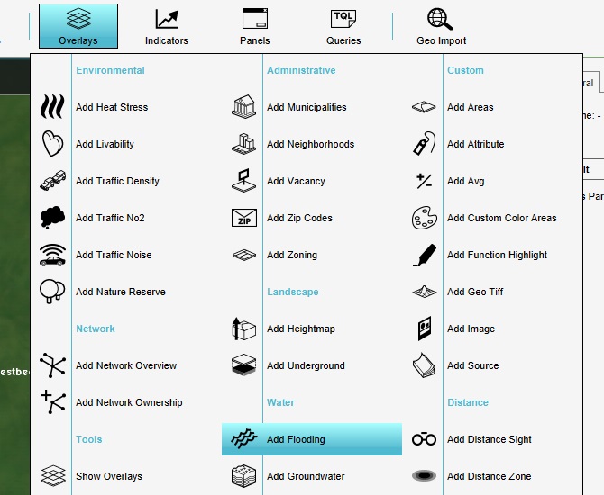 AddFloodingOverlay.jpg 670 × 550; 90 KB
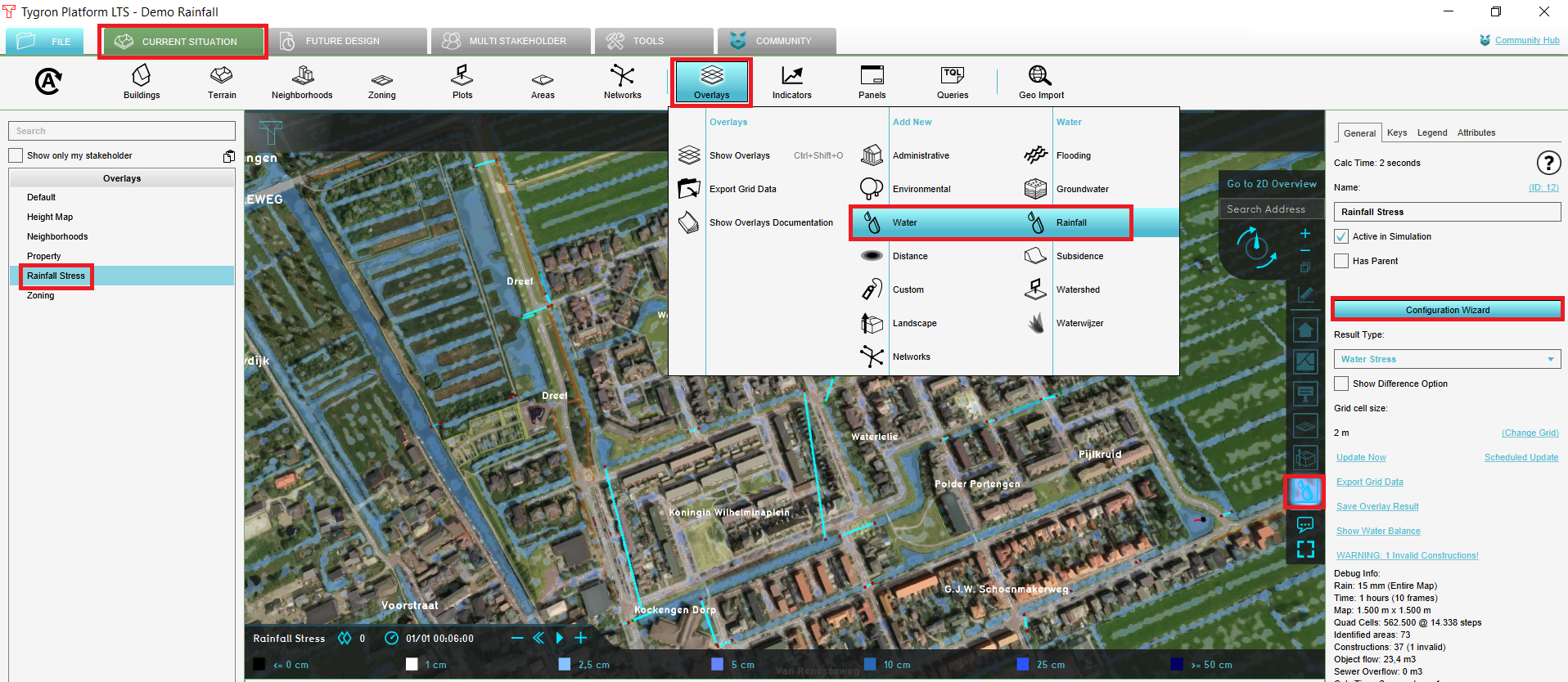
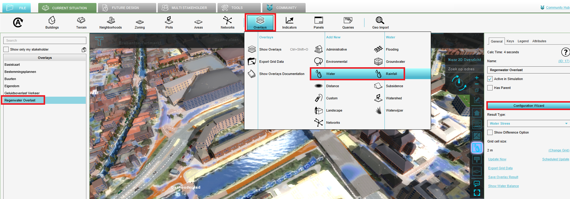
 AddRainfallOverlay1.jpg 747 × 508; 72 KB
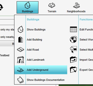 AddUndergroundConstruction.jpg 375 × 350; 40 KB
 AddWeather.jpg 300 × 529; 14 KB
 Add AVG Overlay1.jpg 635 × 429; 53 KB
 Add Attr-1.jpg 1,921 × 1,162; 461 KB
 Add Combo Overlay1.jpg 634 × 425; 54 KB
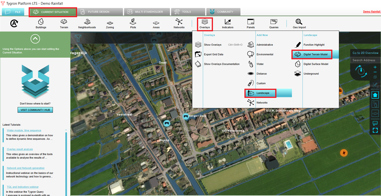
 Add DTM Overlay1.jpg 635 × 434; 54 KB
 Add Overlay As Terrain1.jpg 261 × 433; 32 KB
 Add Travel Distance Overlay1.jpg 707 × 460; 75 KB
 Add WFS server ArcGIS Pro.JPG 519 × 377; 44 KB
 Add aerius overlay.PNG 1,470 × 595; 849 KB
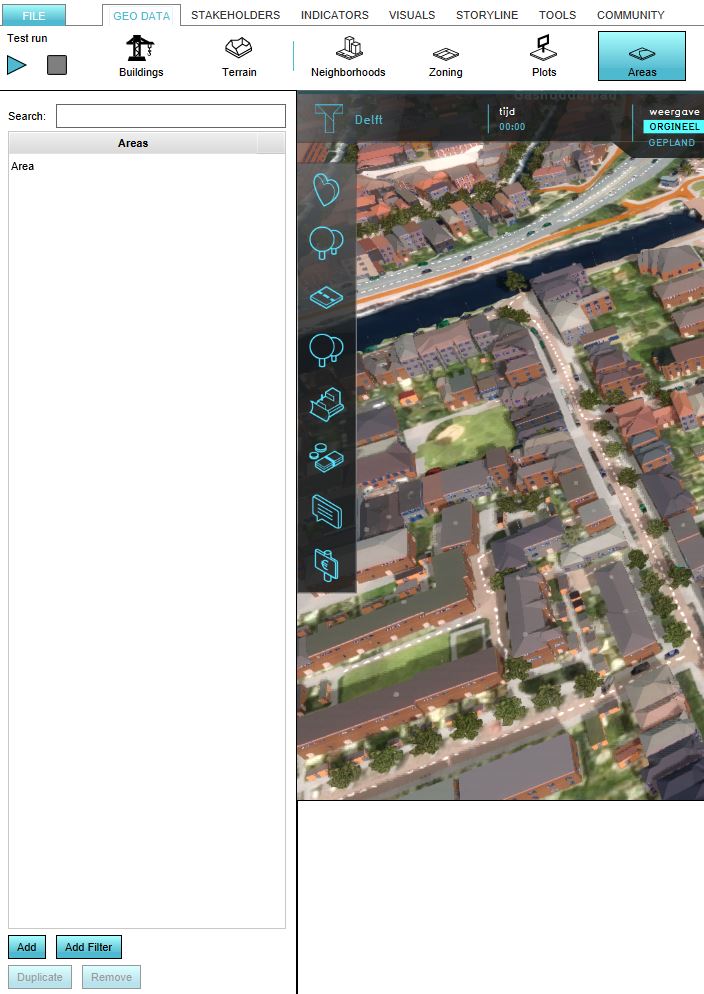 Add area.JPG 704 × 994; 105 KB
 Add area 001.jpg 521 × 366; 66 KB
 Add area 002.jpg 521 × 366; 47 KB
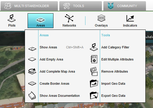
 Add areas.JPG 915 × 436; 41 KB
 Add areas1.JPG 501 × 209; 22 KB
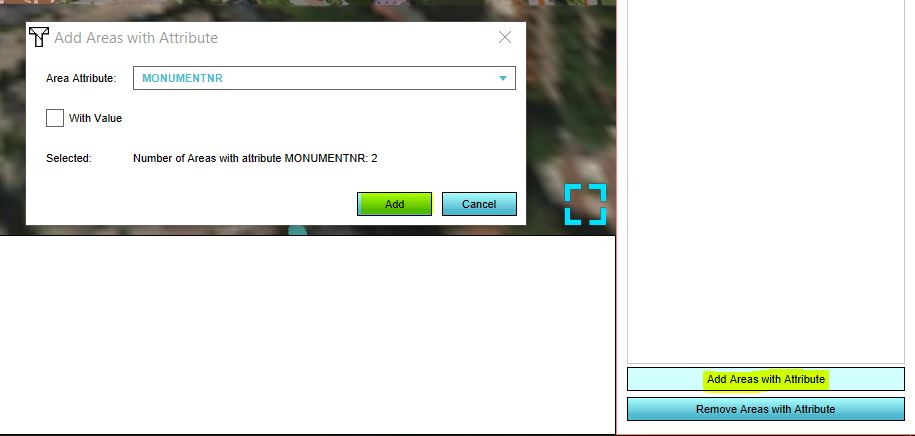
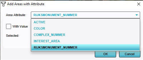
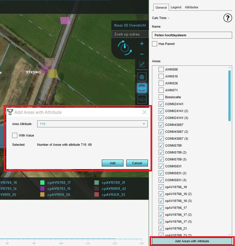 Add areas attribute.JPG 815 × 854; 148 KB
 Add areas new interface.JPG 725 × 113; 30 KB
 Add attribute.jpg 606 × 115; 26 KB
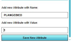 Add attribute plangebied.JPG 289 × 167; 17 KB
 Add attribute to area.JPG 291 × 480; 31 KB
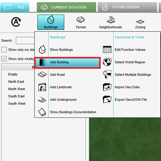 Add building.png 529 × 529; 71 KB
 Add data.jpg 783 × 688; 362 KB
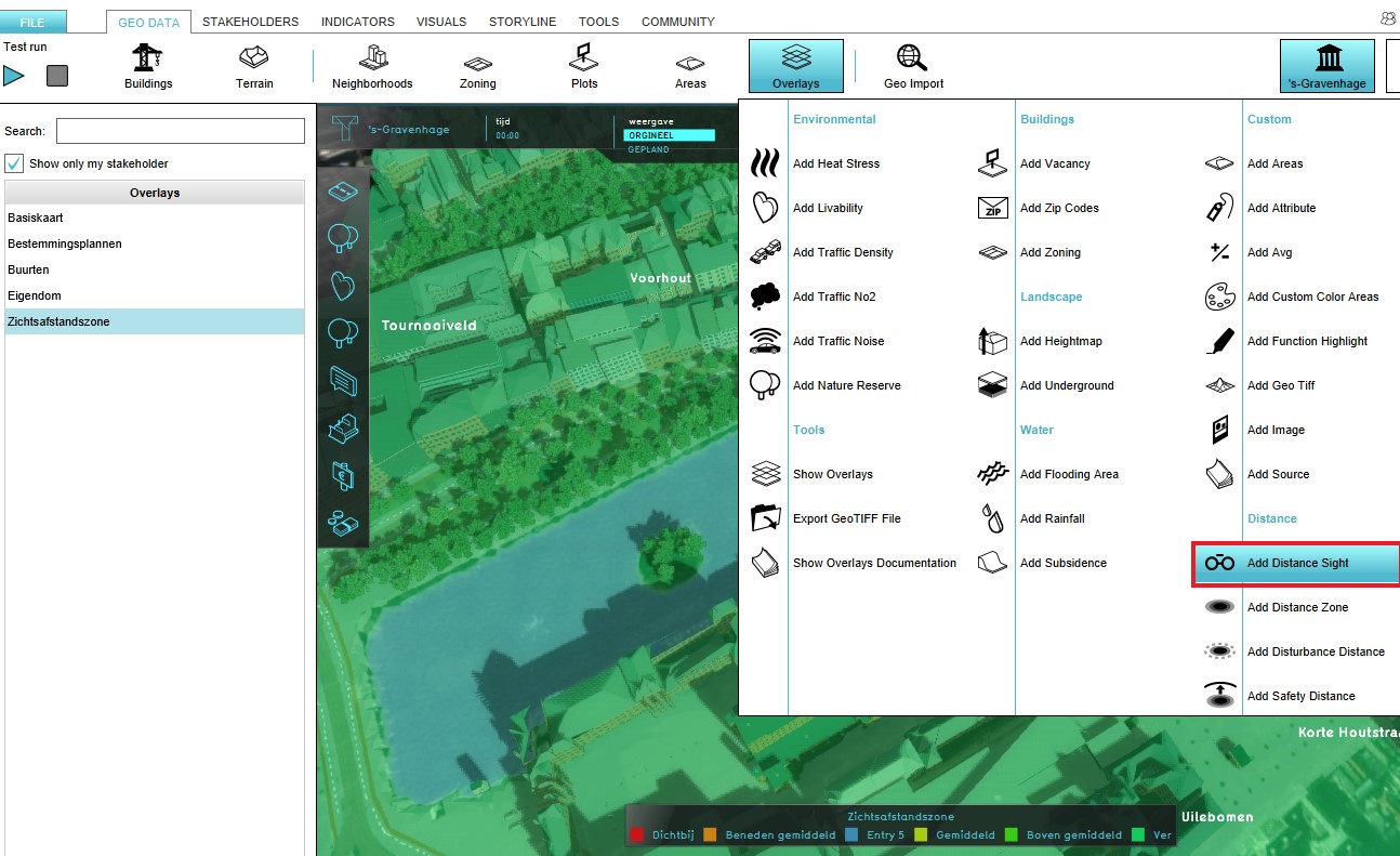
 Add distance.jpg 1,469 × 938; 142 KB
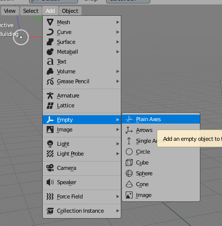 Add empty object.png 452 × 459; 65 KB
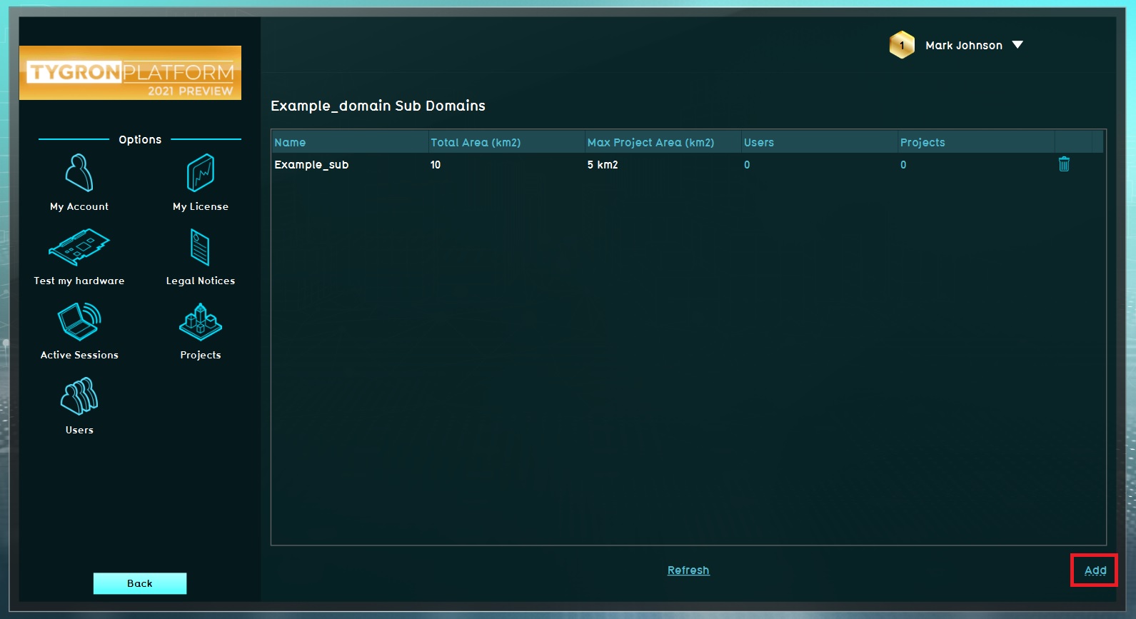 Add example subdomain.jpg 1,591 × 867; 137 KB
 Add field.PNG 621 × 299; 35 KB
 Add field extra attribute.PNG 612 × 293; 32 KB
 Add filter 001.jpg 521 × 366; 31 KB
 Add filter 002.jpg 521 × 366; 44 KB
 Add filter 003.jpg 521 × 366; 44 KB
 Add filter 004.jpg 521 × 366; 46 KB
 Add filter 005.jpg 521 × 366; 54 KB
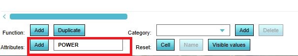
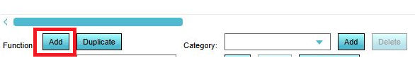
 Add function.JPG 606 × 115; 19 KB
 Add function higlight.JPG 300 × 888; 39 KB
 Add function table.png 586 × 89; 25 KB
 Add global.png 294 × 117; 3 KB
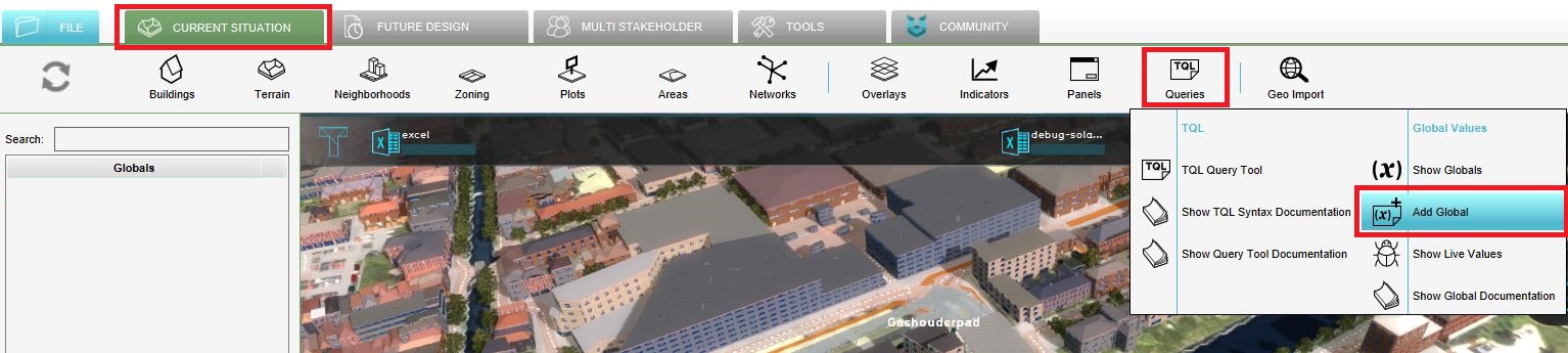 Add global new interface.JPG 1,534 × 345; 150 KB
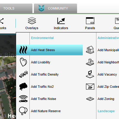 Add heat overlay.png 400 × 400; 55 KB
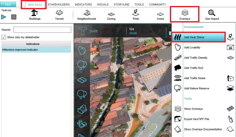 Add heat stress.JPG 942 × 549; 156 KB
 Add heightmap.PNG 1,621 × 833; 1.57 MB
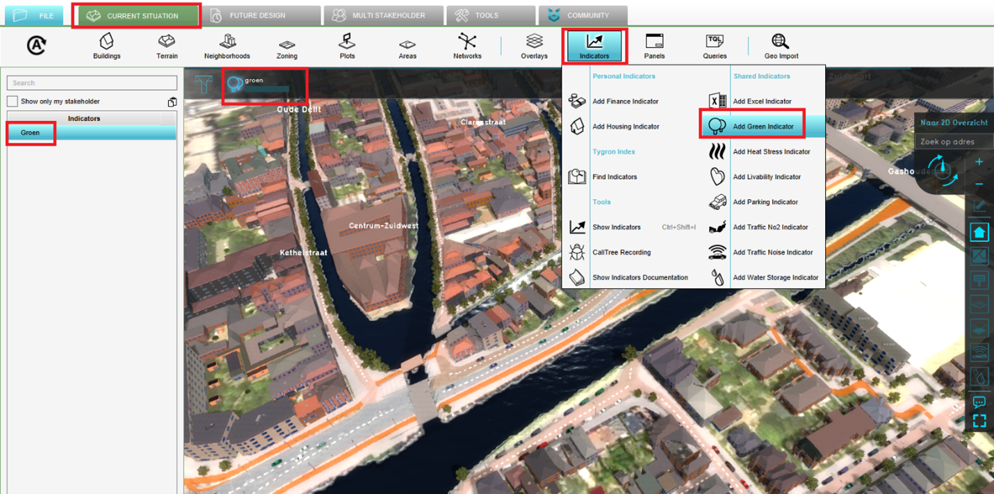 Add indicator.png 1,430 × 711; 1.58 MB
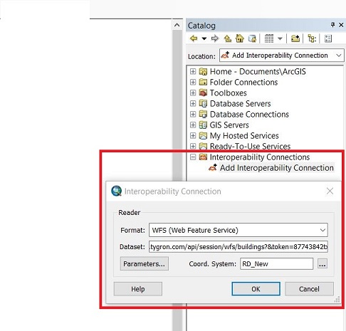
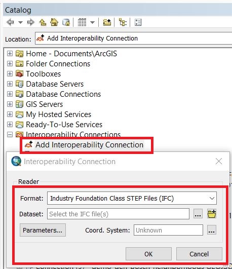 Add interop connection.JPG 458 × 531; 88 KB
 Add layer.jpg 568 × 426; 83 KB
 Add layer wms.JPG 1,103 × 621; 82 KB
 Add logo 1.JPG 294 × 984; 27 KB
 Add new entry.jpg 375 × 889; 56 KB
 Add overlay new.jpg 639 × 400; 61 KB
 Add overlays new interface.JPG 1,429 × 358; 132 KB
 Add parametric design.jpg 297 × 475; 57 KB
 Add parametric design btn1.jpg 300 × 72; 7 KB
 Add rainfall handout watermodule.PNG 1,916 × 834; 1.69 MB
 Add rainfall to project.PNG 1,908 × 669; 1.17 MB
 Add remove duplicate stakeholder.jpg 296 × 148; 7 KB
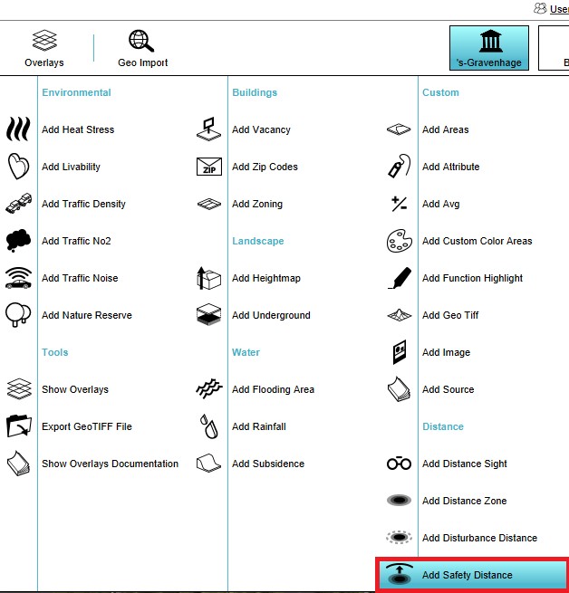
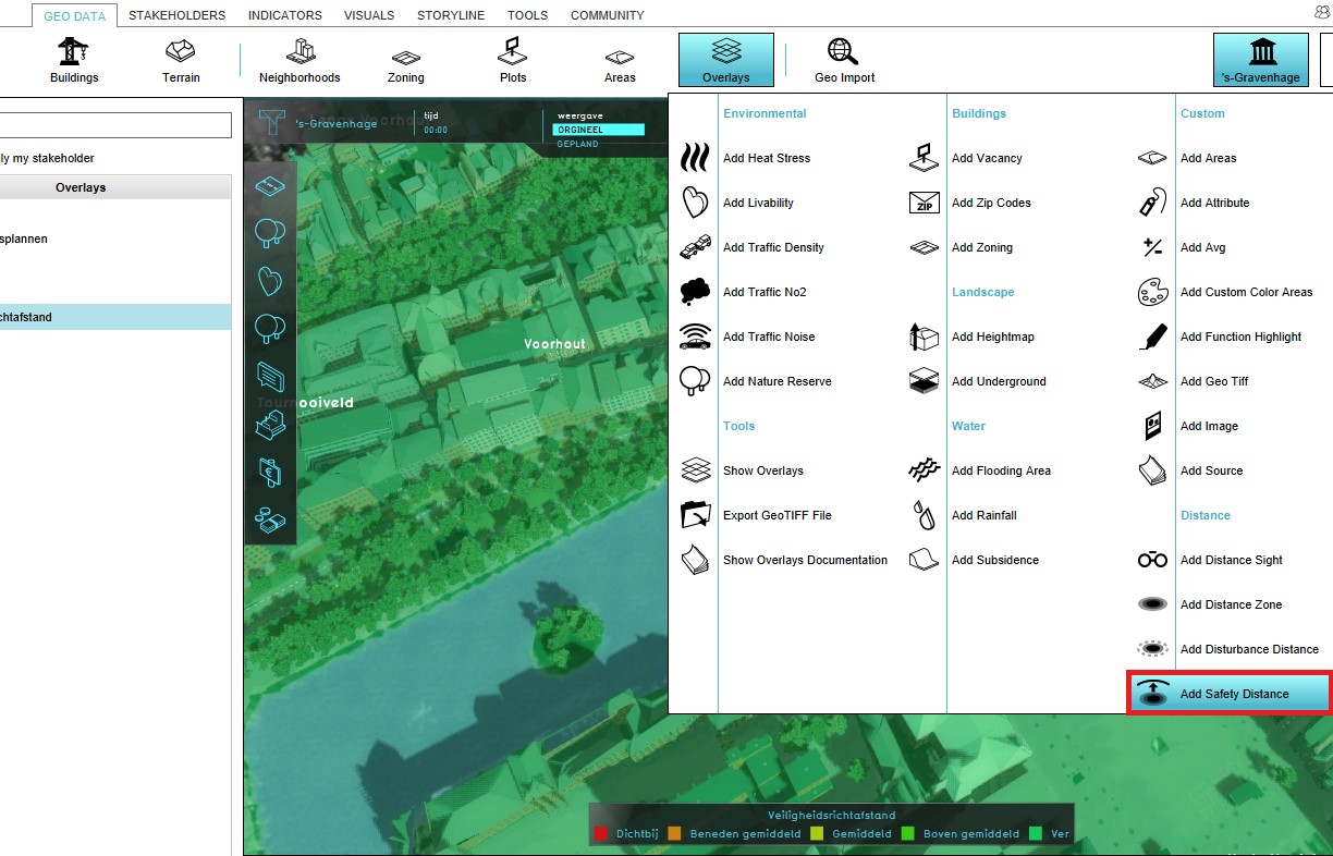 Add safety distance.jpg 1,224 × 786; 192 KB
 Add safety distance overlay.jpg 628 × 655; 74 KB
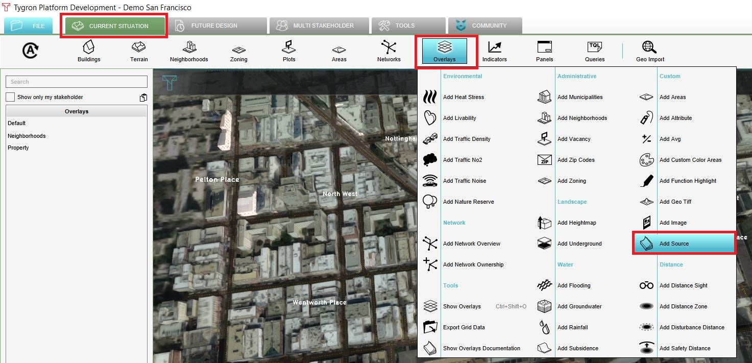 Add source.JPG 1,473 × 711; 266 KB
 Add the ds.jpg 1,294 × 791; 198 KB
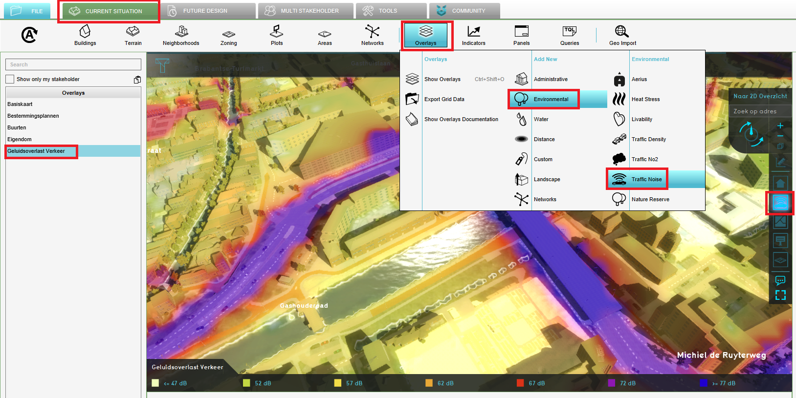 Add traffic noise overlay.PNG 1,628 × 815; 1.27 MB
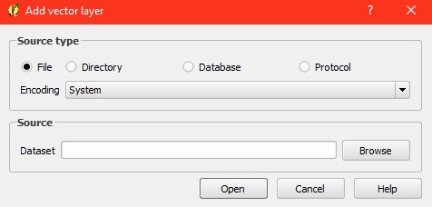 Add vector layer.jpg 476 × 228; 20 KB
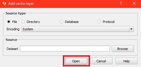 Add vector layer1.jpg 476 × 228; 21 KB
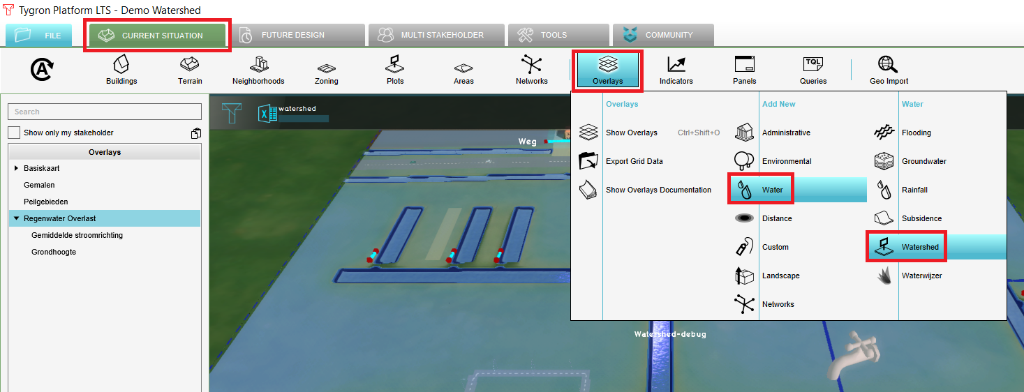 Add watershed.png 1,467 × 562; 358 KB
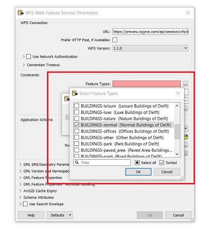
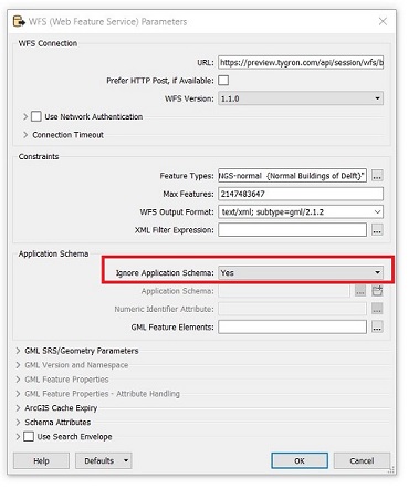
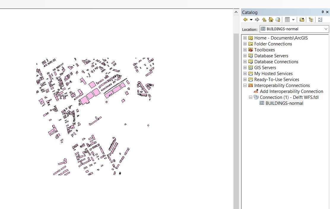
 Add wfs.JPG 873 × 684; 48 KB
 Add wfs connection.JPG 748 × 658; 97 KB
 Add wms.JPG 947 × 670; 87 KB
 AddingClientEvents-Q3-2015.jpg 300 × 238; 14 KB
 Additional info.jpg 463 × 427; 64 KB
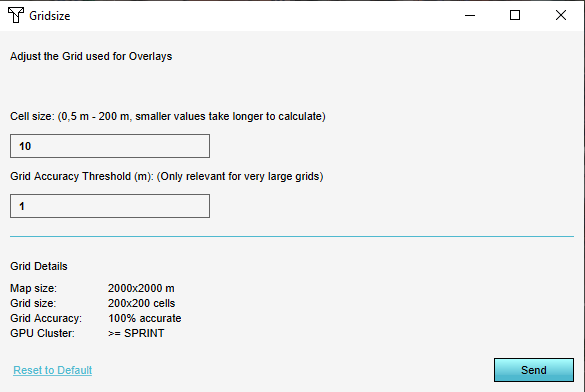 AdjustGridSizePanel1.png 585 × 392; 9 KB
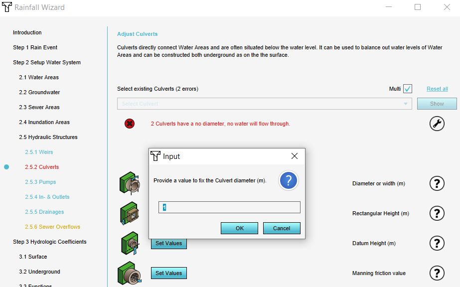
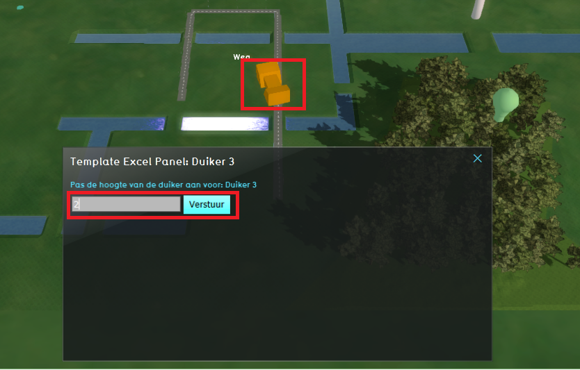 Adjust culvert.PNG 834 × 533; 458 KB
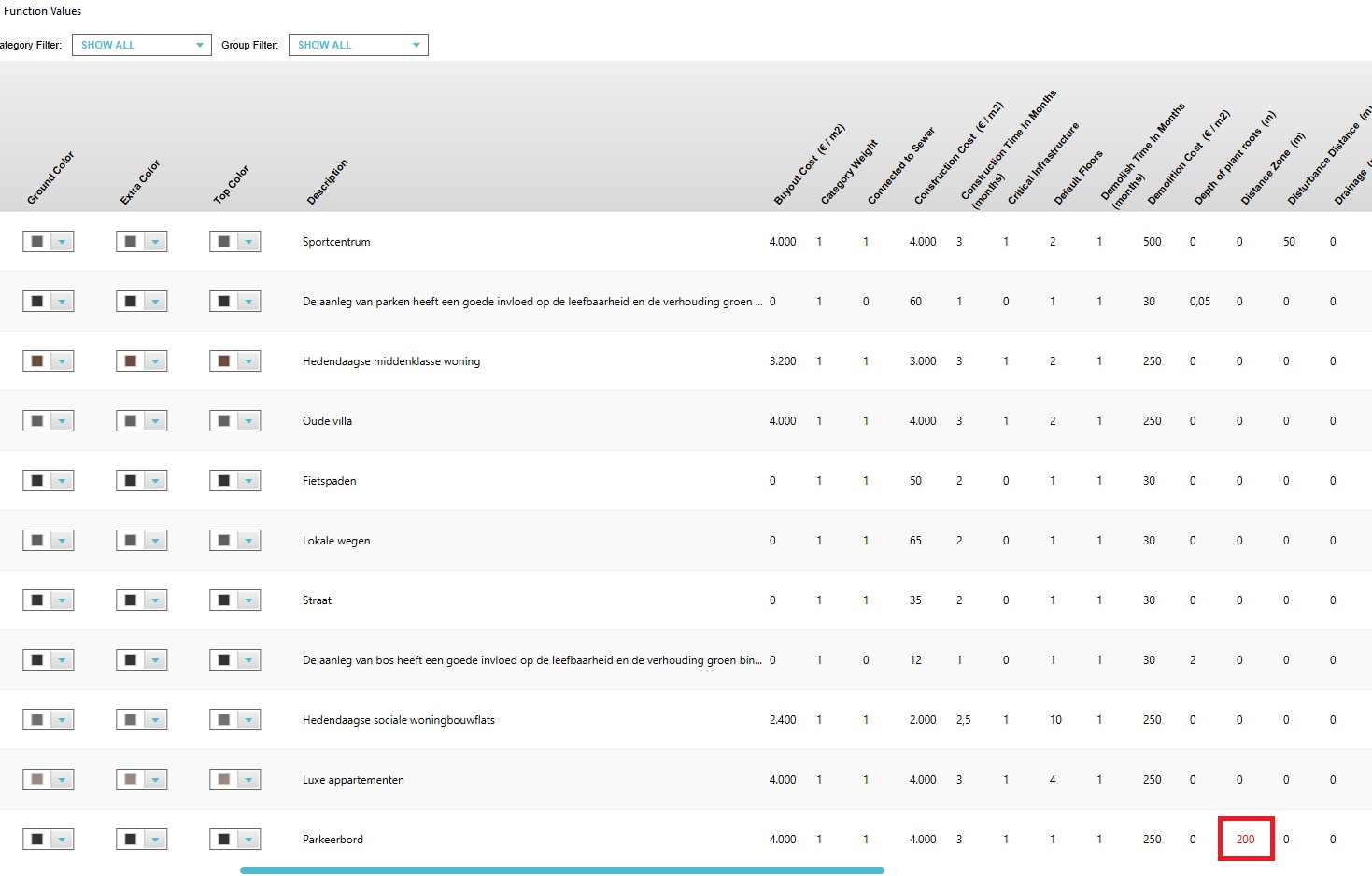
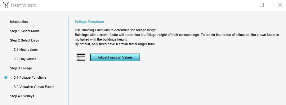 Adjust function values.JPG 922 × 339; 38 KB
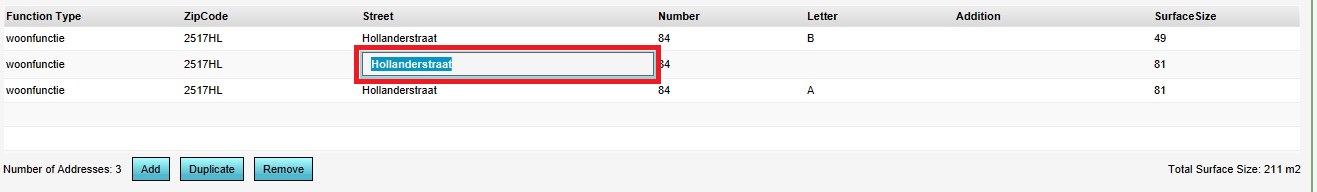 Adjusting addresses.jpg 1,317 × 192; 48 KB
 Adjusting addresses attribute.jpg 288 × 458; 28 KB
 Admin interface.jpg 702 × 391; 79 KB
 Admin interface video.jpg 1,275 × 717; 117 KB
 Advanced2020.jpg 289 × 127; 10 KB
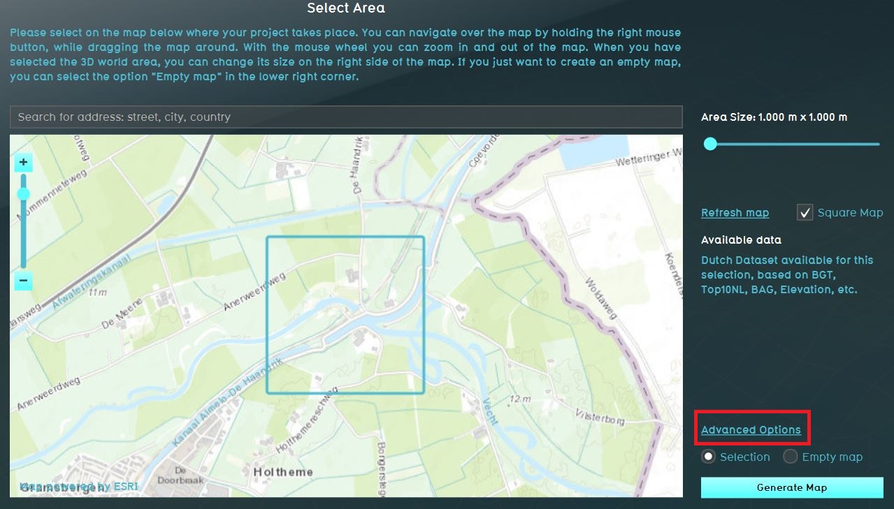
 Advanced options.jpg 291 × 394; 24 KB
 Advanced options panel.jpg 1,116 × 670; 206 KB
 Advanced options water.png 780 × 350; 381 KB
 Advanced settings.JPG 1,116 × 670; 210 KB
 Advanced settings rainfall.JPG 925 × 784; 106 KB
 Advanced settings template.JPG 1,279 × 729; 192 KB
 Aerius button.png 100 × 100; 3 KB
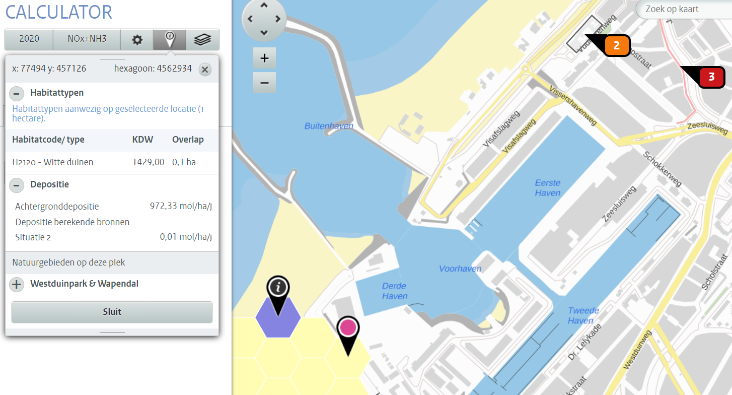 Aerius gebruiksfase ac.PNG 1,454 × 784; 495 KB
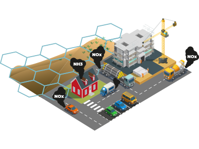 Aerius introduction.png 400 × 300; 75 KB
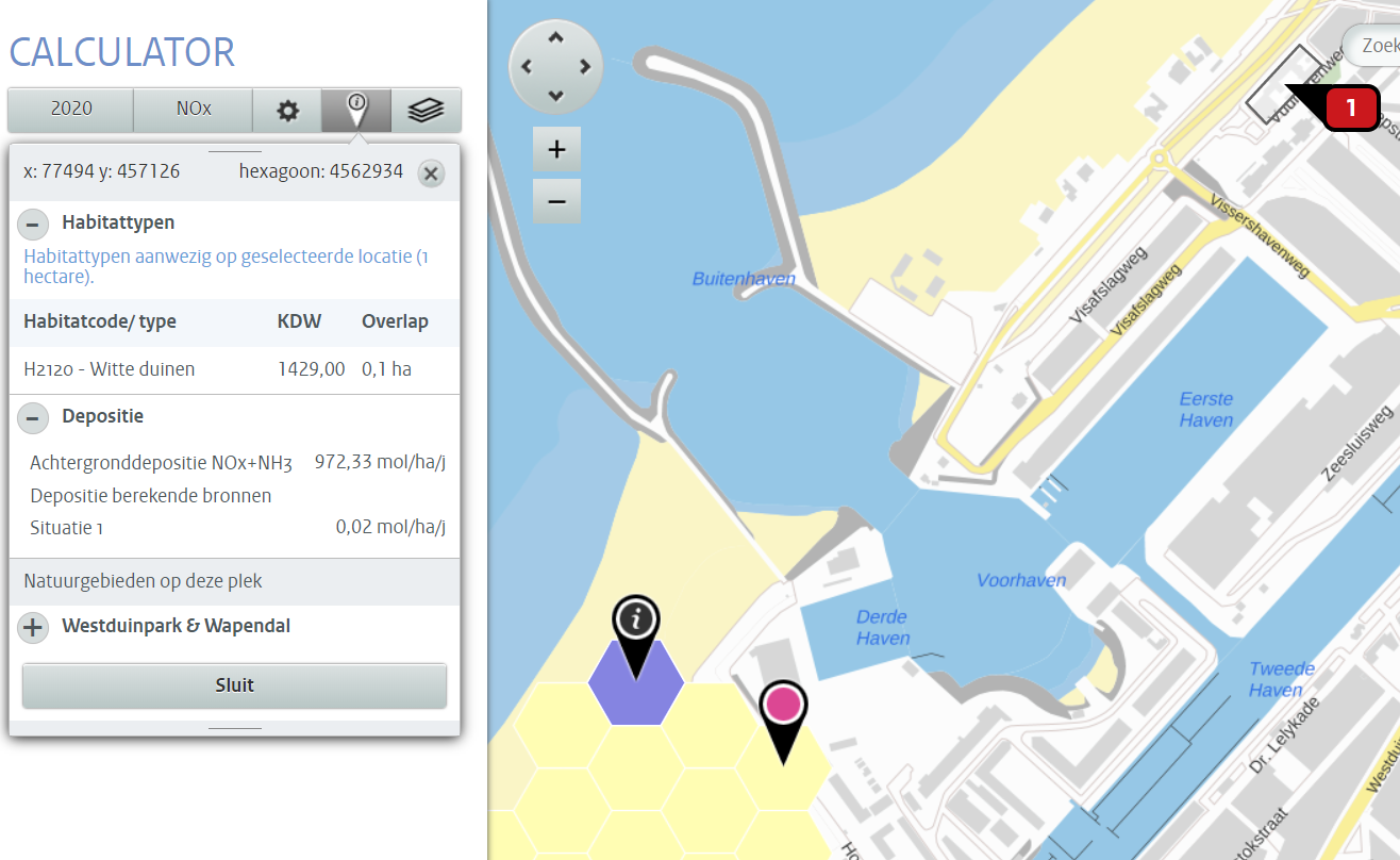 Aerius realisatiefase ac.PNG 1,316 × 808; 401 KB
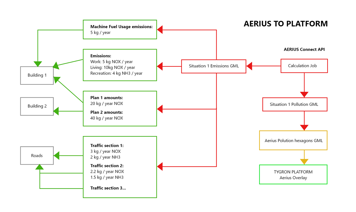 Aerius to platform.png 1,250 × 745; 111 KB
 Aeriuswizard icon bus traffic num.png 40 × 40; 4 KB
 Aeriuswizard icon bus traffic percentage.png 40 × 40; 5 KB
 Aeriuswizard icon calculation year.png 40 × 40; 4 KB
 Aeriuswizard icon heavy traffic num.png 40 × 40; 5 KB
 Aeriuswizard icon heavy traffic percentage.png 40 × 40; 5 KB
 Aeriuswizard icon light traffic num.png 40 × 40; 5 KB
 Aeriuswizard icon light traffic percentage.png 40 × 40; 5 KB
 Aeriuswizard icon machinery fuel usage.png 40 × 40; 4 KB
 Aeriuswizard icon medium traffic num.png 40 × 40; 5 KB
 Aeriuswizard icon medium traffic percentage.png 40 × 40; 5 KB
 Aeriuswizard icon nh3.png 40 × 40; 3 KB
 Aeriuswizard icon nh3 living.png 40 × 40; 4 KB
 Aeriuswizard icon nh3 recreation.png 40 × 40; 6 KB
 Aeriuswizard icon nh3 work.png 40 × 40; 3 KB
 Aeriuswizard icon nox.png 40 × 40; 3 KB
 Aeriuswizard icon nox living.png 40 × 40; 4 KB
 Aeriuswizard icon nox recreation.png 40 × 40; 6 KB
 Aeriuswizard icon nox work.png 40 × 40; 3 KB
 Aeriuswizard icon plan category amounts.png 40 × 40; 5 KB
 Aeriuswizard icon traffic sector.png 40 × 40; 5 KB
 Ahn.jpg 1,116 × 670; 214 KB
 Ahn file.JPG 931 × 619; 60 KB
 Ahn naming.JPG 934 × 468; 34 KB
 Ahn water level.JPG 930 × 405; 32 KB
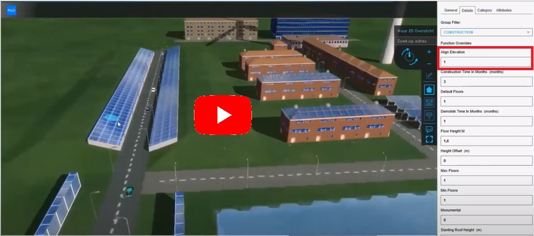 Align Evaluation.jpg 1,085 × 481; 111 KB
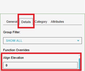 Align Evaluation details.jpg 300 × 250; 18 KB
 Aligned to the left.png 369 × 166; 9 KB
 Analysis tools.jpg 594 × 450; 155 KB
 Api current situation building.png 793 × 765; 231 KB
 Api current situation calculation.png 734 × 660; 327 KB
 Api current situation geography.png 732 × 670; 258 KB
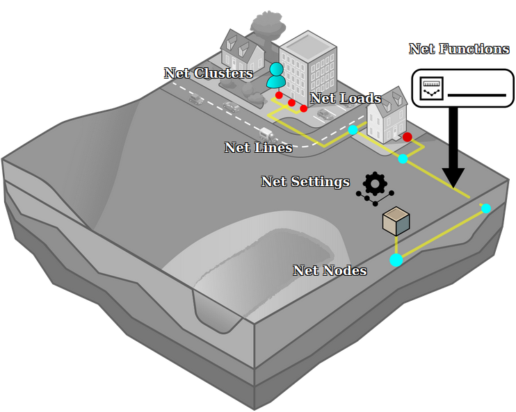 Api current situation network.png 742 × 593; 179 KB
 Api current situation urban subdiv.png 730 × 648; 190 KB
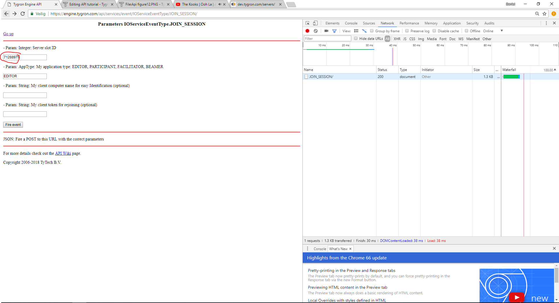 Api figure13.PNG 1,924 × 1,042; 120 KB
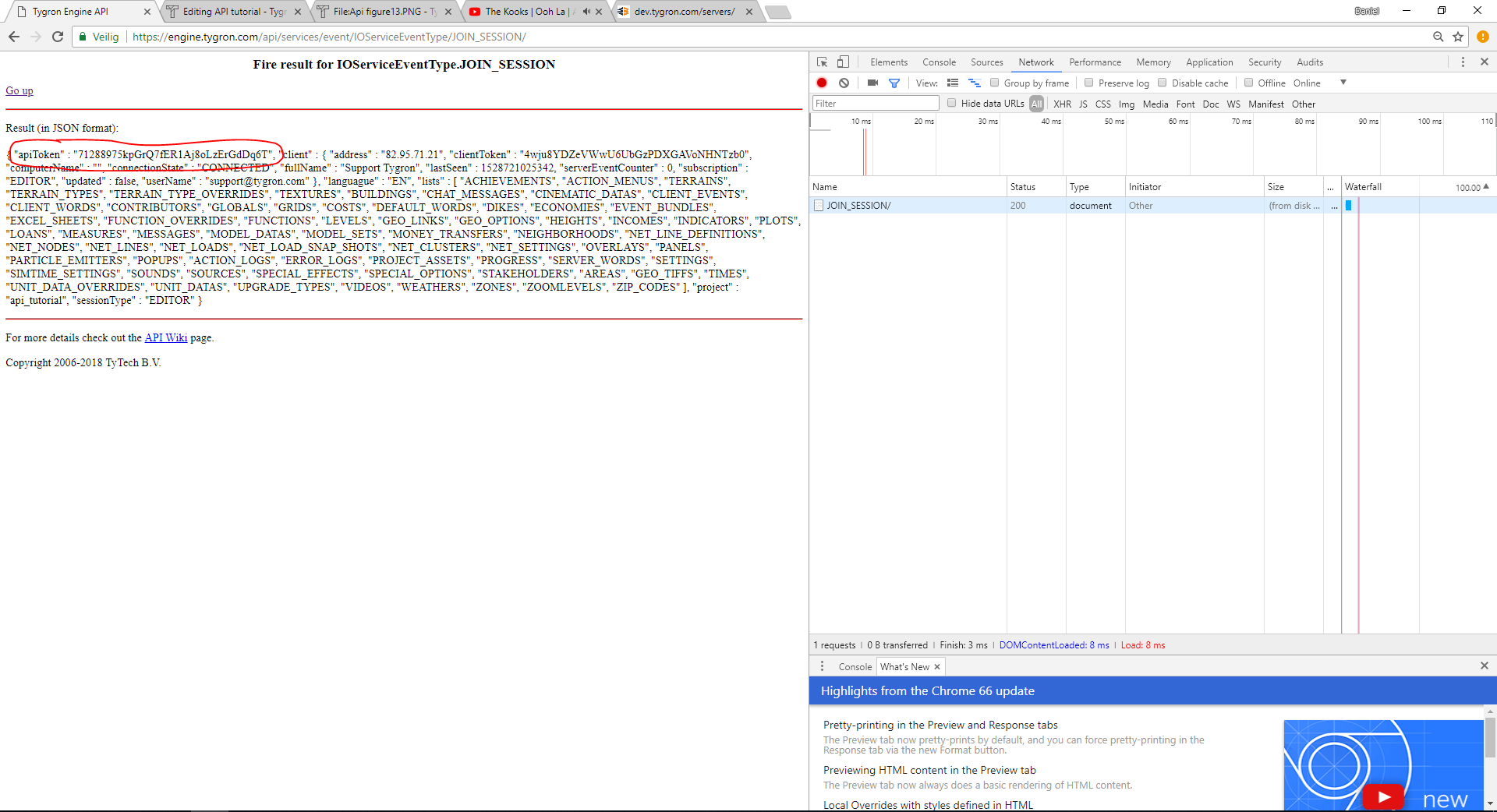 Api figure14.PNG 1,920 × 1,042; 160 KB
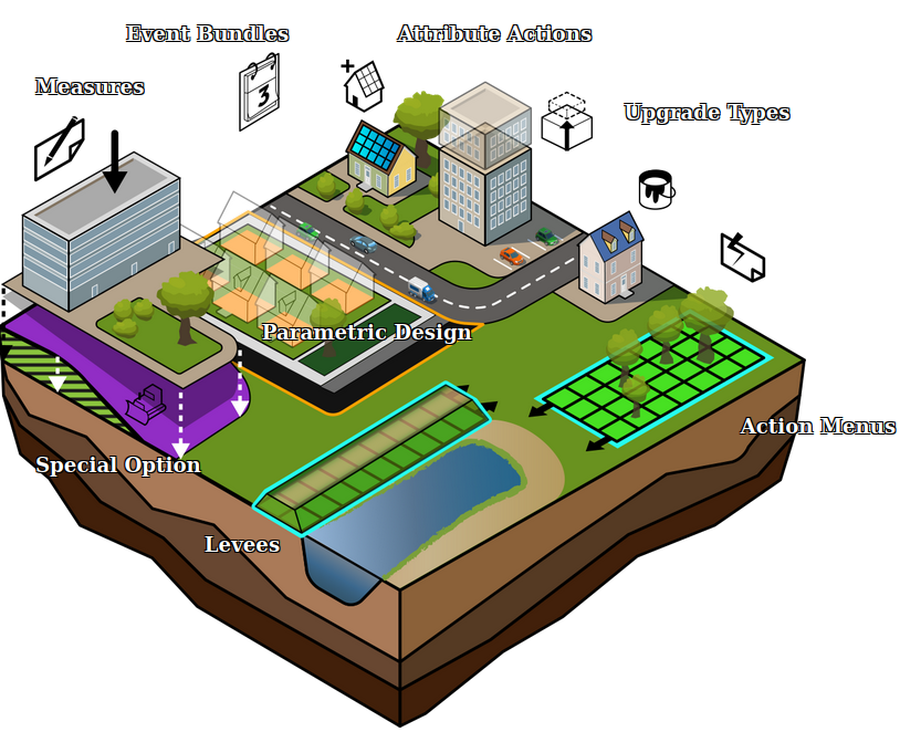 Api future design.png 814 × 662; 374 KB
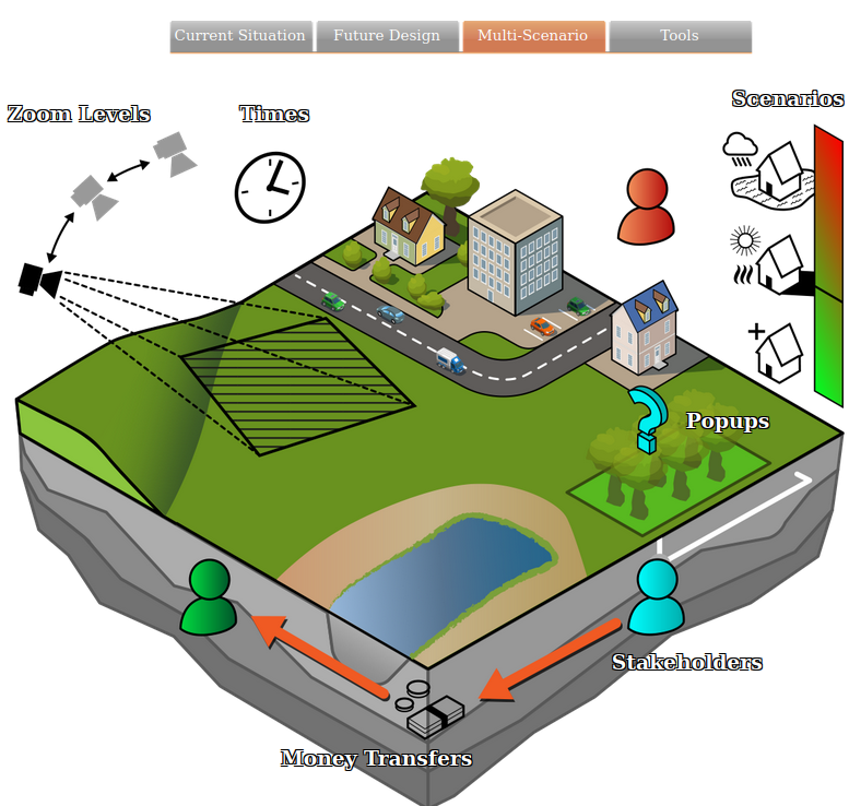 Api multi scenario.png 777 × 738; 324 KB
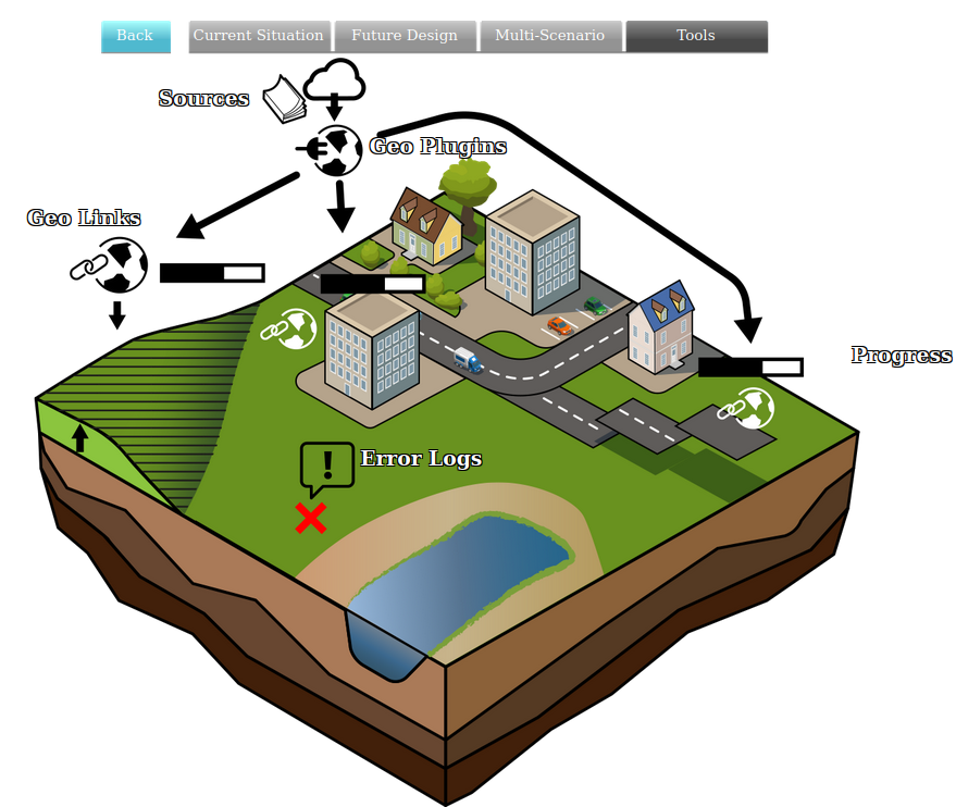 Api tools geo.png 879 × 742; 294 KB
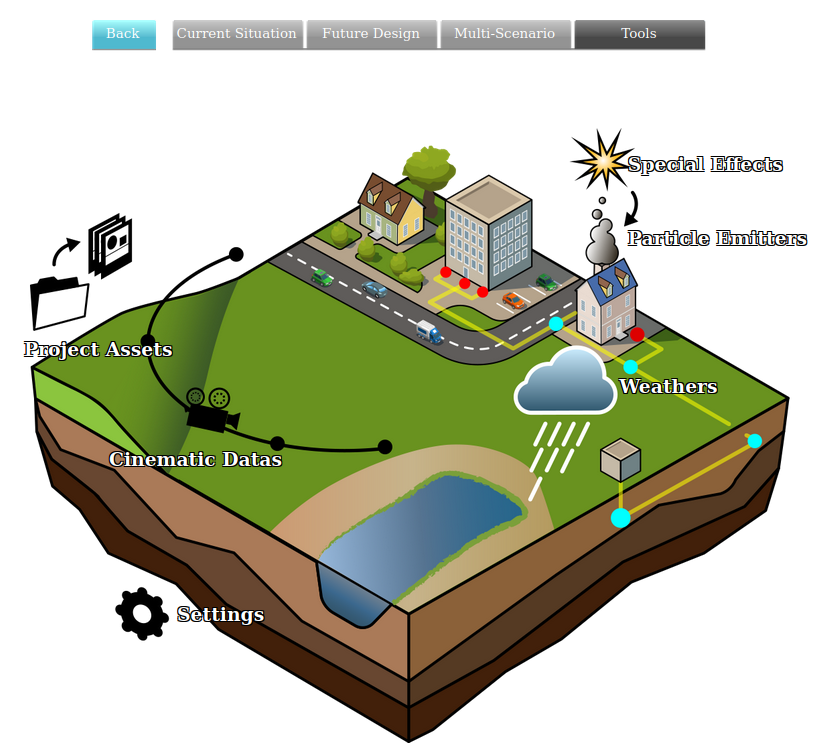 Api tools visual.png 814 × 749; 293 KB
 ApplyParaDesignBtn1.jpg 291 × 128; 11 KB
 Apply btn1.jpg 294 × 97; 8 KB
 Apply btn1a.jpg 294 × 97; 9 KB
 Apply file.JPG 878 × 724; 59 KB
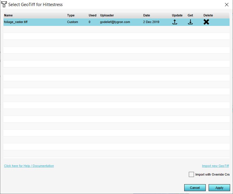 Apply foliage raster.JPG 812 × 674; 47 KB
 Apply measure.PNG 467 × 560; 231 KB
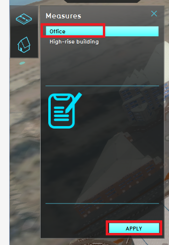 Apply office.PNG 350 × 507; 167 KB
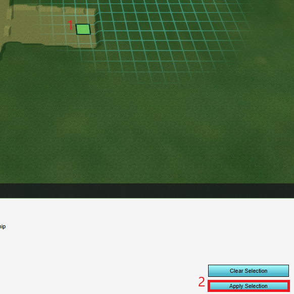 Apply selection.png 582 × 582; 265 KB
 ArcGisAttrStyle.jpg 355 × 435; 42 KB
 ArcGisCopyNames.jpg 621 × 435; 69 KB
 ArcGisLogo1.jpg 354 × 120; 9 KB
 ArcGisOnlineLogo.png 421 × 198; 16 KB
 ArcGisSearchOwnership.jpg 800 × 465; 84 KB
 ArcMap WFS 01.jpg 972 × 541; 200 KB
 ArcMap WFS 02.jpg 486 × 465; 62 KB
 ArcMap WFS 03.jpg 392 × 456; 68 KB
 ArcMap WFS 04.jpg 379 × 441; 56 KB
 ArcMap WFS 05.jpg 1,112 × 704; 92 KB
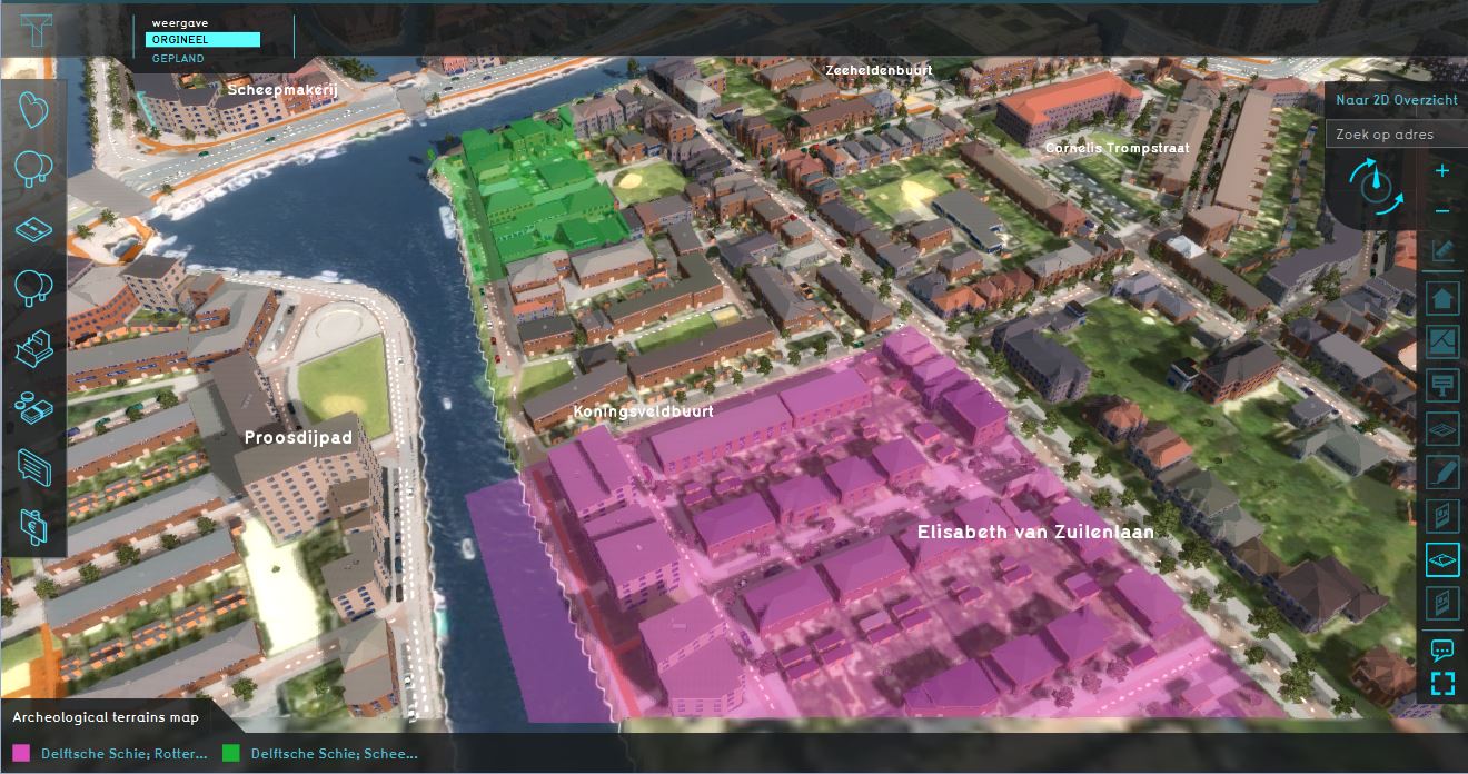 Archeological map.JPG 1,320 × 696; 201 KB
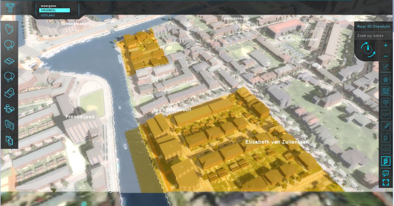 Archeological map wms.JPG 1,326 × 693; 164 KB
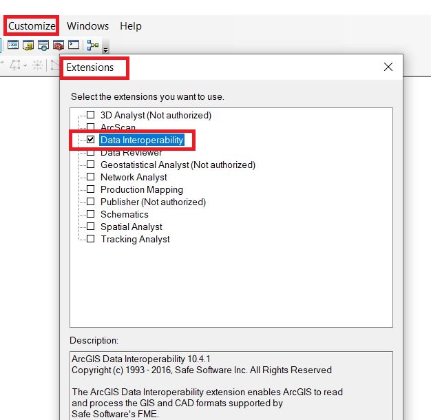 Arcmap data interop etension.JPG 626 × 610; 86 KB
 Area-right-active.jpg 230 × 20; 3 KB
 Area-right-adjust-area.jpg 230 × 26; 4 KB
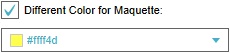 Area-right-color-maquette.jpg 230 × 53; 5 KB
 Area-right-color.jpg 230 × 48; 4 KB
 Area-right-name.jpg 230 × 48; 3 KB
 Area-right-tabs.jpg 230 × 24; 3 KB
 Area-right.jpg 248 × 473; 19 KB
 Area.JPG 1,920 × 1,040; 364 KB
 AreaOverlayGeneralTab1.jpg 297 × 349; 14 KB
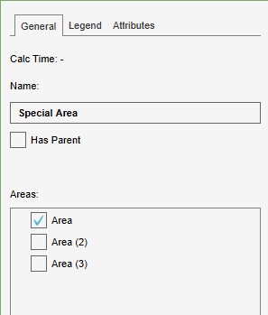
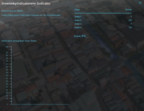 Area MKP green indicator.jpg 605 × 467; 59 KB
 Area attribute limit area.PNG 292 × 385; 8 KB
 Area attributes.JPG 519 × 629; 69 KB
 Area overlay.jpg 1,677 × 953; 343 KB
 Area size.jpg 1,115 × 667; 228 KB
 Area size .jpg 1,112 × 660; 140 KB
 Areas attributes.JPG 1,914 × 707; 354 KB
 Areas location.JPG 849 × 552; 157 KB
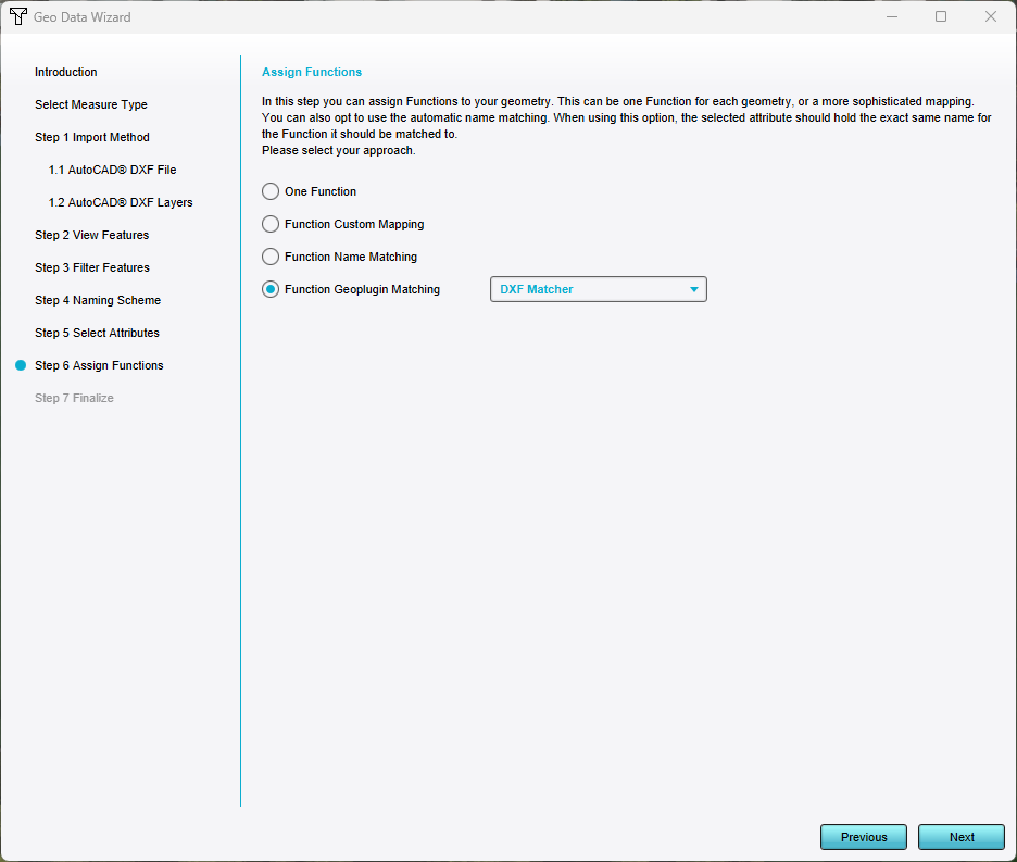 Assign geoplugin functions.png 936 × 793; 50 KB
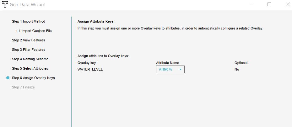
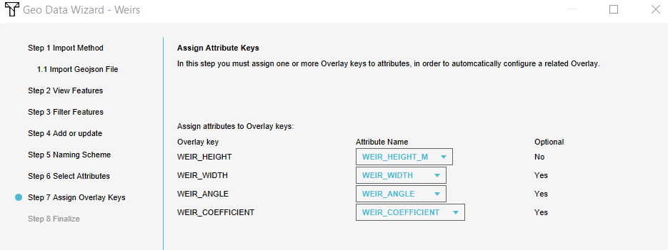 Assign keys.PNG 935 × 351; 20 KB
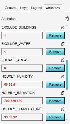 Attribute-array-example.jpg 236 × 417; 36 KB
 Attribute Action Now Available1.jpg 505 × 527; 52 KB
 Attribute Tab1.jpg 301 × 350; 23 KB
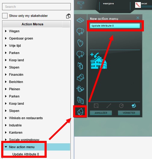
 Attribute action menu.png 669 × 491; 322 KB
 Attribute action panel.png 250 × 522; 112 KB
 Attribute action performed.png 388 × 278; 167 KB
 Attribute action plan.png 887 × 698; 650 KB
 Attribute action planned.png 518 × 225; 149 KB
 Attribute action solar panels1.png 293 × 316; 65 KB
 Attribute action solar panels2.png 296 × 176; 26 KB
 Attribute add.jpg 254 × 424; 29 KB
 Attribute attribute.jpg 234 × 48; 3 KB
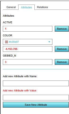
 Attribute editing panel.jpg 293 × 484; 24 KB
 Attribute multiple.jpg 636 × 313; 44 KB
 Attribute name.png 584 × 492; 16 KB


