Uncategorized files
Jump to navigation
Jump to search
Showing below up to 500 results in range #1,001 to #1,500.
View (previous 500 | next 500) (20 | 50 | 100 | 250 | 500)
 Events-bottom-type.jpg 354 × 182; 32 KB
 Events-right-button.jpg 213 × 55; 4 KB
 Events-right-list.jpg 230 × 183; 12 KB
 Events-right.jpg 248 × 332; 21 KB
 Example boomkronen.JPG 892 × 706; 83 KB
 Example custom overlay icon.png 45 × 45; 6 KB
 Example dsm.PNG 1,325 × 696; 1.91 MB
 Example dtm.PNG 1,326 × 646; 1.8 MB
 Example field calculator.JPG 754 × 393; 48 KB
 Example traffic model excel.jpg 1,434 × 840; 206 KB
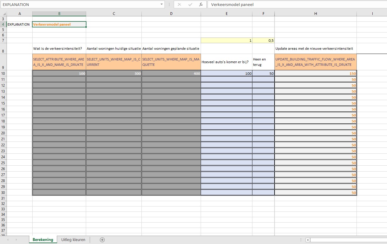
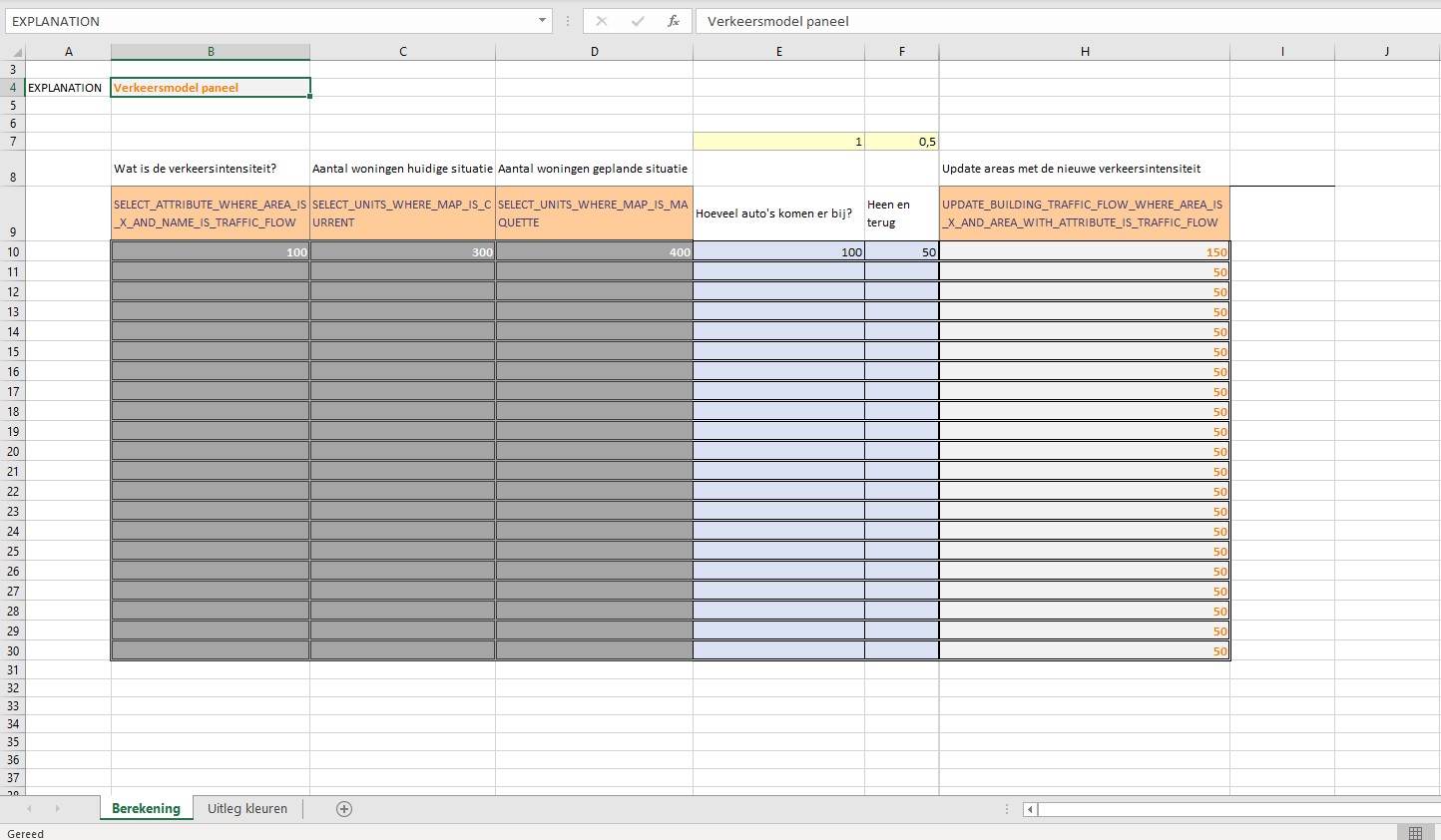
 Example traffic model excel panel.jpg 1,294 × 820; 206 KB
 Exce10a-Q3-2015.jpg 1,678 × 990; 268 KB
 Excel-func-cat-Q3-2015.jpg 1,678 × 990; 269 KB
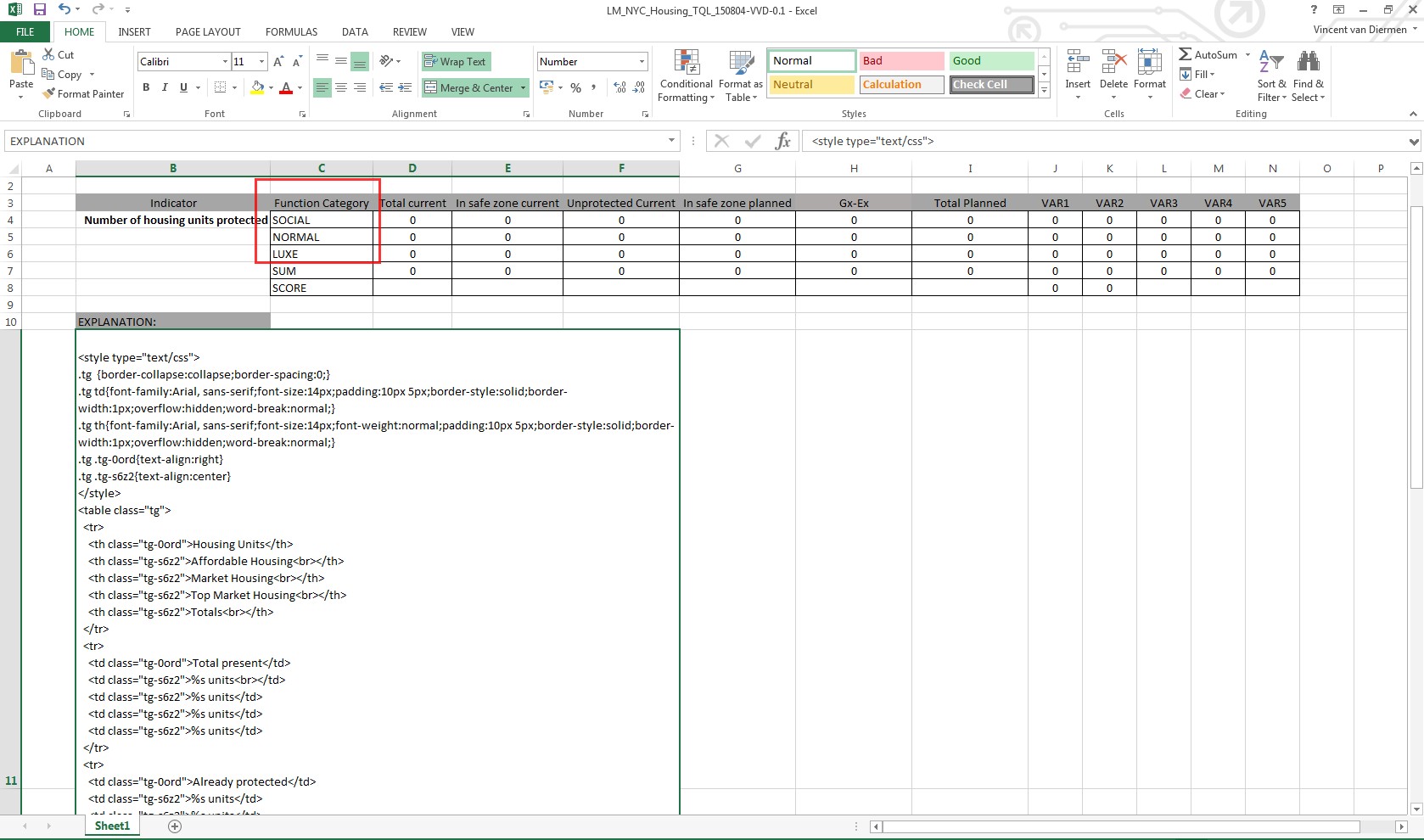
 Excel-lower-manhattan-Q3-2015.jpg 1,082 × 698; 148 KB
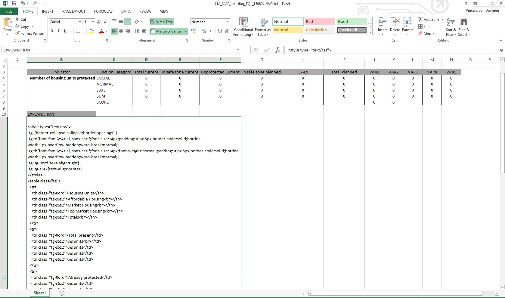
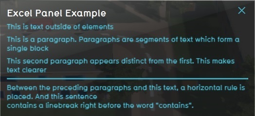
 ExcelExplanation-Q3-2015.jpg 412 × 280; 39 KB
 ExcelFilterFormula.jpg 450 × 140; 25 KB
 ExcelFlow2-Q3-2015.jpg 600 × 500; 55 KB
 ExcelFuncValue-Q3-2015.jpg 552 × 362; 38 KB
 ExcelIDs.jpg 450 × 140; 24 KB
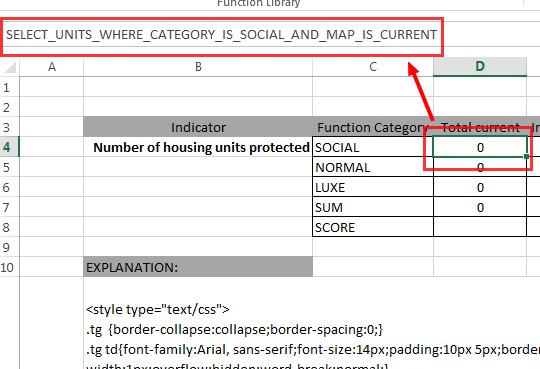
 ExcelIndicatorPanelExplanation2-Q3-2015.jpg 497 × 393; 27 KB
 ExcelIndicatorTextlExplanation-Q3-2015.jpg 655 × 578; 116 KB
 ExcelLogo1.jpg 609 × 272; 20 KB
 ExcelNameField.jpg 450 × 140; 22 KB
 ExcelNameManagerDelete-Q3-2015.jpg 567 × 438; 73 KB
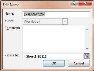 ExcelNameManagerEdit-Q3-2015.jpg 316 × 238; 19 KB
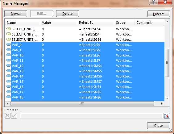 ExcelNameManagerMultiSelect-Q3-2015.jpg 564 × 434; 66 KB
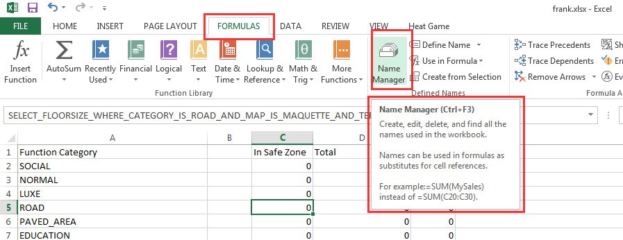 ExcelNameManagerRibbon-Q3-2015.jpg 897 × 346; 85 KB
 ExcelNameQuery-Q3-2015.jpg 540 × 369; 57 KB
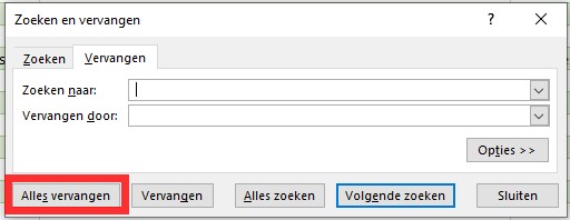 ExcelReplaceAllBtn1.jpg 512 × 198; 25 KB
 ExcelReplaceField1.jpg 512 × 198; 28 KB
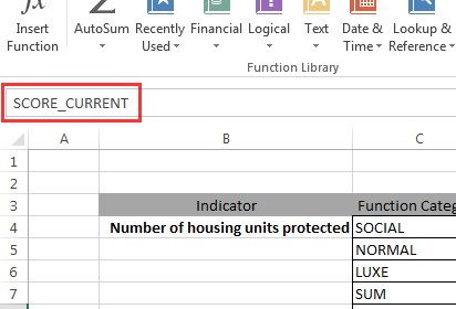 ExcelScoreCurrent-Q3-2015.jpg 412 × 280; 29 KB
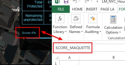
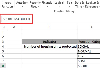 ExcelScoreMaquette-Q3-2015.jpg 412 × 280; 28 KB
 ExcelScorePlanned-Q3-2015.jpg 414 × 217; 29 KB
 ExcelSearchField1.jpg 512 × 198; 28 KB
 ExcelSelectEditReplace1.jpg 533 × 438; 50 KB
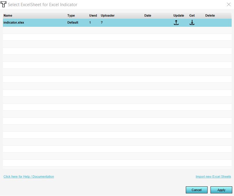
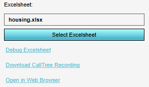
 ExcelSelectExcelsheet.jpg 298 × 147; 10 KB
 ExcelSelectStart1.jpg 569 × 547; 64 KB
 ExcelTableExplanation-Q3-2015.jpg 610 × 473; 60 KB
 ExcelTextStack.jpg 450 × 140; 21 KB
 ExcelTextValue-Q3-2015.jpg 412 × 248; 28 KB
 ExcelVar 0-Q3-2015.jpg 392 × 280; 28 KB
 ExcelVars2.jpg 450 × 140; 24 KB
 Excel file manager.JPG 806 × 673; 48 KB
 Excel panel.jpg 1,294 × 819; 204 KB
 Excel quick start 4.jpg 1,599 × 965; 462 KB
 Excel quick start 6a.jpg 1,213 × 246; 111 KB
 Excel s Variable-Q3-2015.jpg 412 × 280; 37 KB
 Excel traffic panel.jpg 1,444 × 842; 200 KB
 Excel voorbeeld.jpg 1,052 × 540; 430 KB
 Excelsheet.png 295 × 173; 4 KB
 Existing project settings.jpg 668 × 670; 77 KB
 Existing project template .jpg 668 × 665; 76 KB
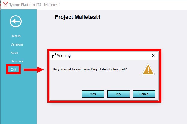 ExitProject1.jpg 622 × 414; 33 KB
 Explanation named cell.jpg 450 × 140; 21 KB
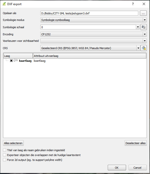 Export DXF2.jpg 614 × 716; 72 KB
 Export building.png 430 × 430; 46 KB
 Export csv.PNG 573 × 363; 20 KB
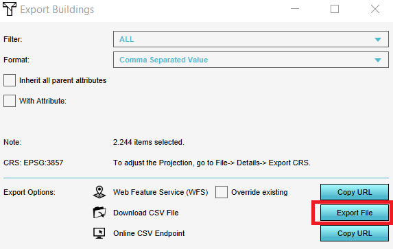
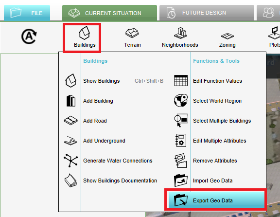 Export data.PNG 576 × 446; 64 KB
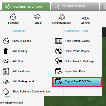
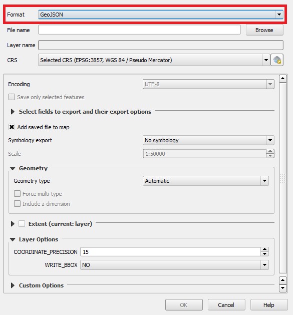
 Export geojson file.JPG 543 × 396; 44 KB
 Export geotiff.png 513 × 299; 51 KB
 Export grid data.png 1,430 × 522; 605 KB
 Export grid data geoshare all frames.jpg 600 × 380; 31 KB
 Export grid data geoshare last frame.jpg 600 × 380; 32 KB
 Export grid data overlays.jpg 684 × 427; 39 KB
 Export grid options.JPG 597 × 350; 41 KB
 Export legend polygons.png 495 × 283; 50 KB
 Export max speed.JPG 627 × 329; 33 KB
 Export max value.JPG 1,267 × 472; 153 KB
 Export measurement.PNG 1,582 × 454; 636 KB
 Export measurement panel.PNG 572 × 359; 19 KB
 Export options.JPG 583 × 288; 25 KB
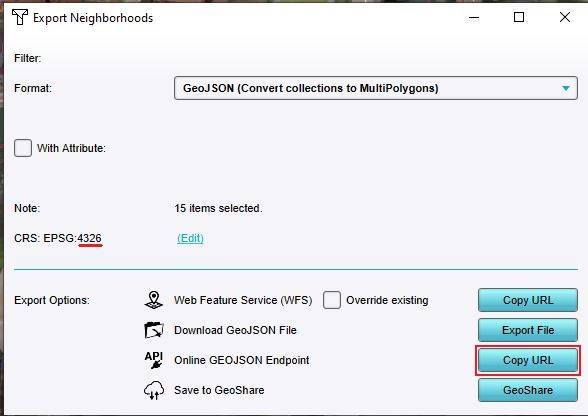 Export wgs 84 neighborhoods.JPG 588 × 416; 37 KB
 Extensions.png 324 × 205; 26 KB
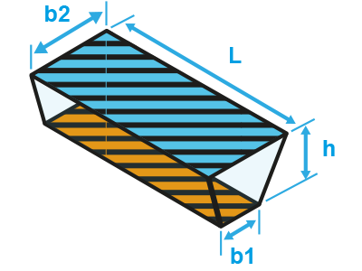 External water body trapezoid.png 400 × 300; 25 KB
 FOO-attr-avg-1.jpg 1,321 × 829; 284 KB
 Facilitator.jpg 1,278 × 676; 179 KB
 Facilitator tutorial.jpg 701 × 392; 79 KB
 Feature to feature class.jpg 570 × 537; 194 KB
 Feddes trapezium.jpg 960 × 630; 665 KB
 Feedback panel.png 306 × 59; 22 KB
 Field calc.PNG 682 × 363; 24 KB
 FileTab1.jpg 633 × 501; 81 KB
 File name.jpg 830 × 661; 74 KB
 File project.png 248 × 293; 73 KB
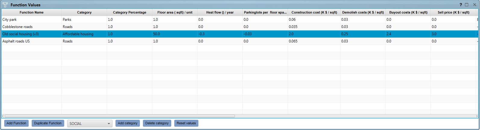 FinanceFunctionValuesPanel.jpg 1,592 × 432; 114 KB
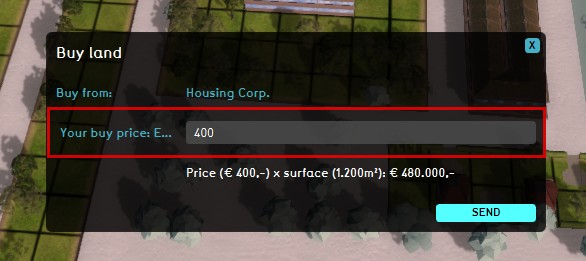 FinanceLandBuyPrice.jpg 586 × 261; 36 KB
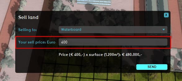 FinanceLandSellPrice.jpg 586 × 261; 39 KB
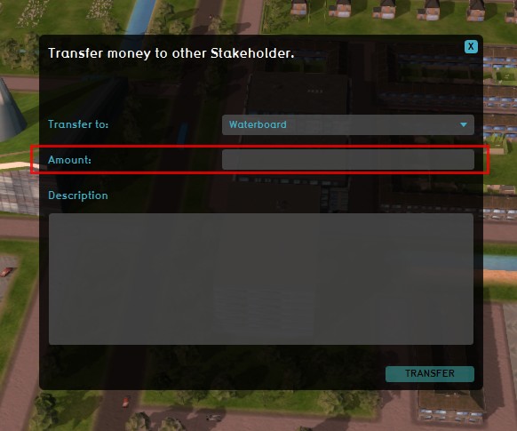 FinanceTransferMoneyPanel.jpg 582 × 485; 48 KB
 Finance Actions.png 430 × 511; 181 KB
 Finance overview.JPG 287 × 472; 33 KB
 Find construction.jpg 395 × 395; 43 KB
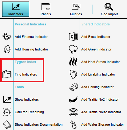
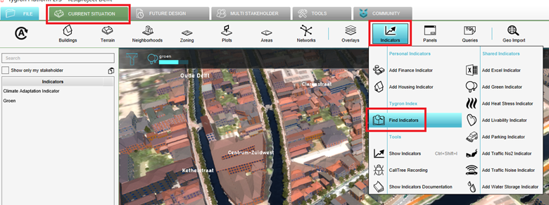 Find indicators.png 780 × 291; 317 KB
 Flood hydrograph case2 ukbm.png 453 × 248; 44 KB
 Flooding-inlet.gif 480 × 253; 1.21 MB
 FloodingOverlay2.png 485 × 402; 326 KB
 FloodingOverlayHydrologiCoefficients1.jpg 885 × 742; 52 KB
 FloodingOverlaySetUpWaterSystem1.jpg 886 × 741; 91 KB
 FloodingOverlayWizardBreach1.jpg 885 × 742; 54 KB
 FloodingOverlayWizardConstructions1.jpg 886 × 742; 59 KB
 FloodingOverlayWizardCulverts1.jpg 887 × 741; 58 KB
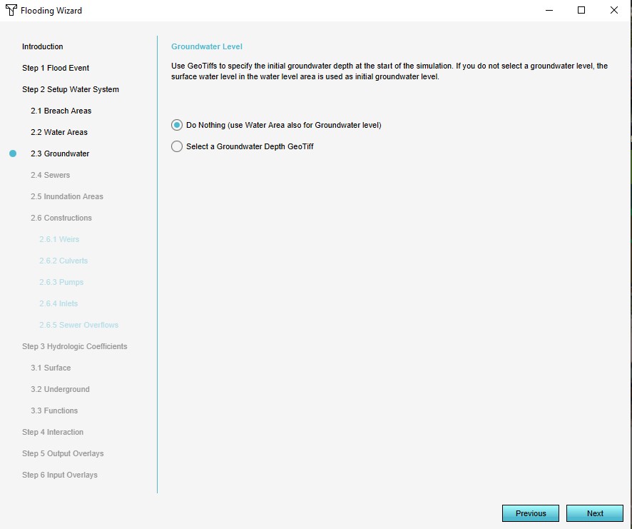 FloodingOverlayWizardGroundWater1.jpg 886 × 741; 53 KB
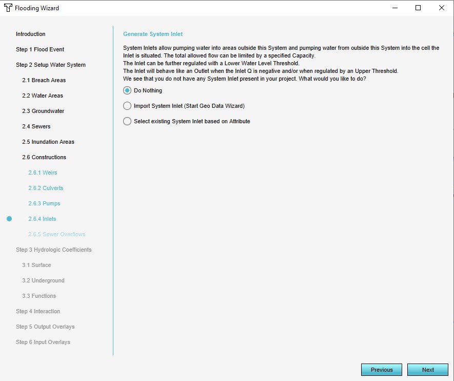 FloodingOverlayWizardInlets1.jpg 885 × 742; 72 KB
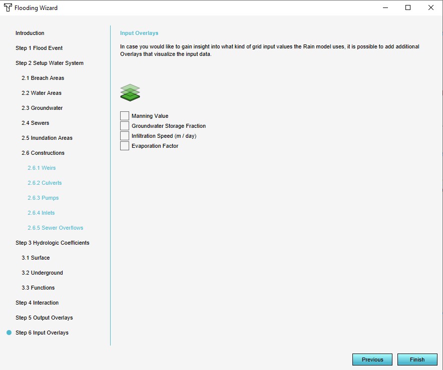 FloodingOverlayWizardInputOverlays1.jpg 885 × 741; 58 KB
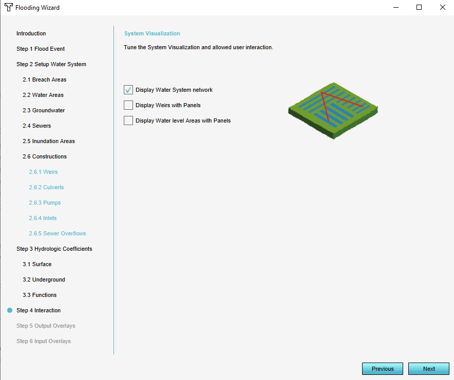 FloodingOverlayWizardInteraction1.jpg 884 × 741; 57 KB
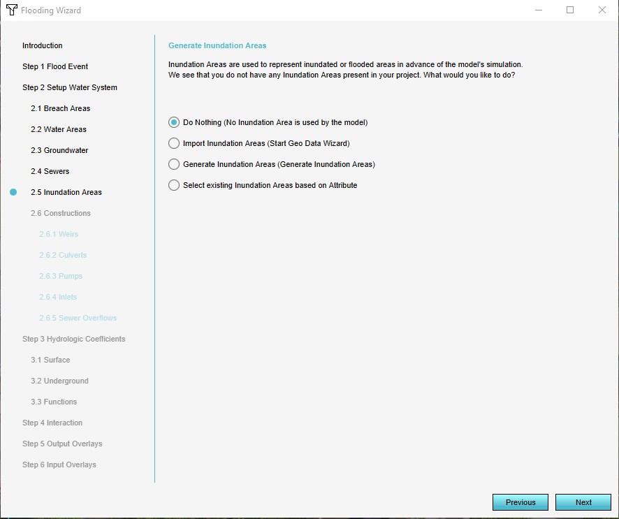 FloodingOverlayWizardInundationAreas1.jpg 886 × 743; 65 KB
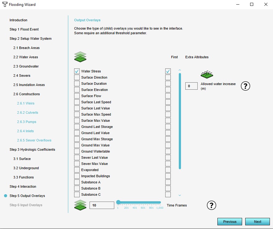 FloodingOverlayWizardOutputOverlays1.jpg 884 × 743; 90 KB
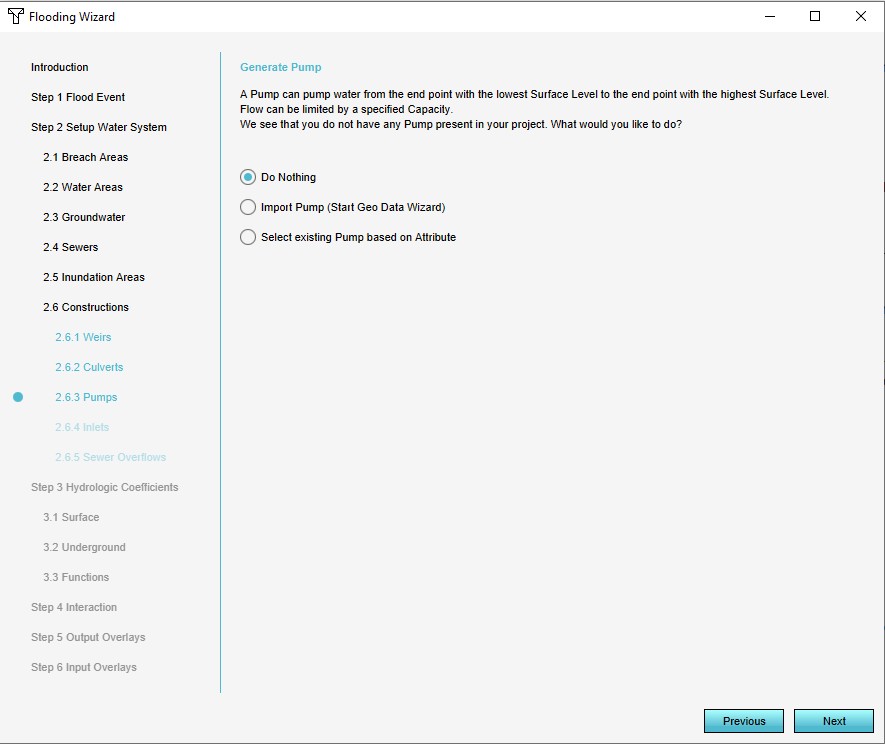 FloodingOverlayWizardPumps1.jpg 885 × 744; 62 KB
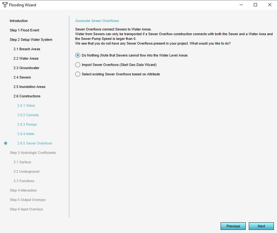 FloodingOverlayWizardSewerOverflows1.jpg 884 × 742; 64 KB
 FloodingOverlayWizardSewers1.jpg 886 × 741; 60 KB
 FloodingOverlayWizardSurfaceTerrain1.jpg 884 × 743; 75 KB
 FloodingOverlayWizardUndergroundTerrain1.jpg 885 × 742; 60 KB
 FloodingOverlayWizardWaterAreas1.jpg 886 × 742; 67 KB
 FloodingOverlayWizardWeirs1.jpg 886 × 742; 62 KB
 FloodingWizardFloodEvent1.jpg 886 × 743; 74 KB
 FloodingWizardIntroduction1.jpg 885 × 742; 67 KB
 Flooding overview.png 400 × 300; 44 KB
 Flooding testbed.JPG 1,322 × 699; 75 KB
 Floor height.jpg 1,677 × 771; 327 KB
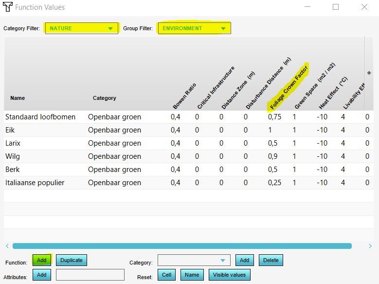
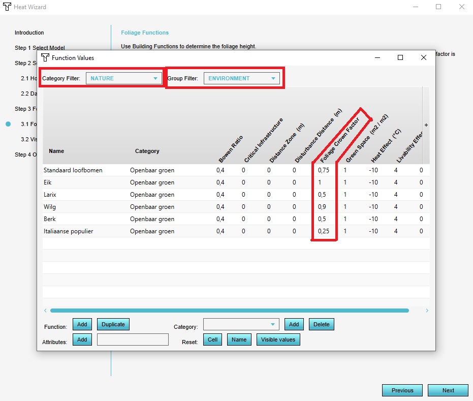 Foliage Crown Factor Function Values.jpg 931 × 789; 135 KB
 Foliage Overlay.jpg 1,078 × 684; 242 KB
 Foliage areas geo.JPG 924 × 383; 41 KB
 Foliage areas in platform.JPG 1,327 × 469; 110 KB
 Foliage areas in platform new.JPG 1,192 × 697; 142 KB
 Foliage areas key.JPG 934 × 366; 37 KB
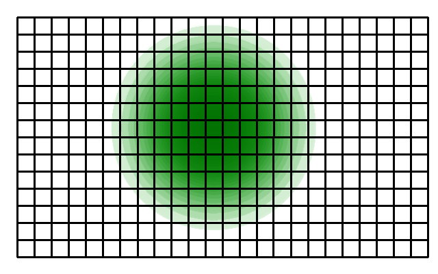
 Foliage crown factor.png 500 × 412; 30 KB
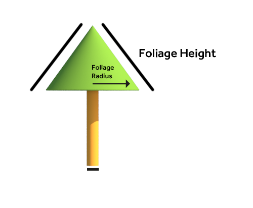
 Foliage diameter.png 640 × 480; 6 KB
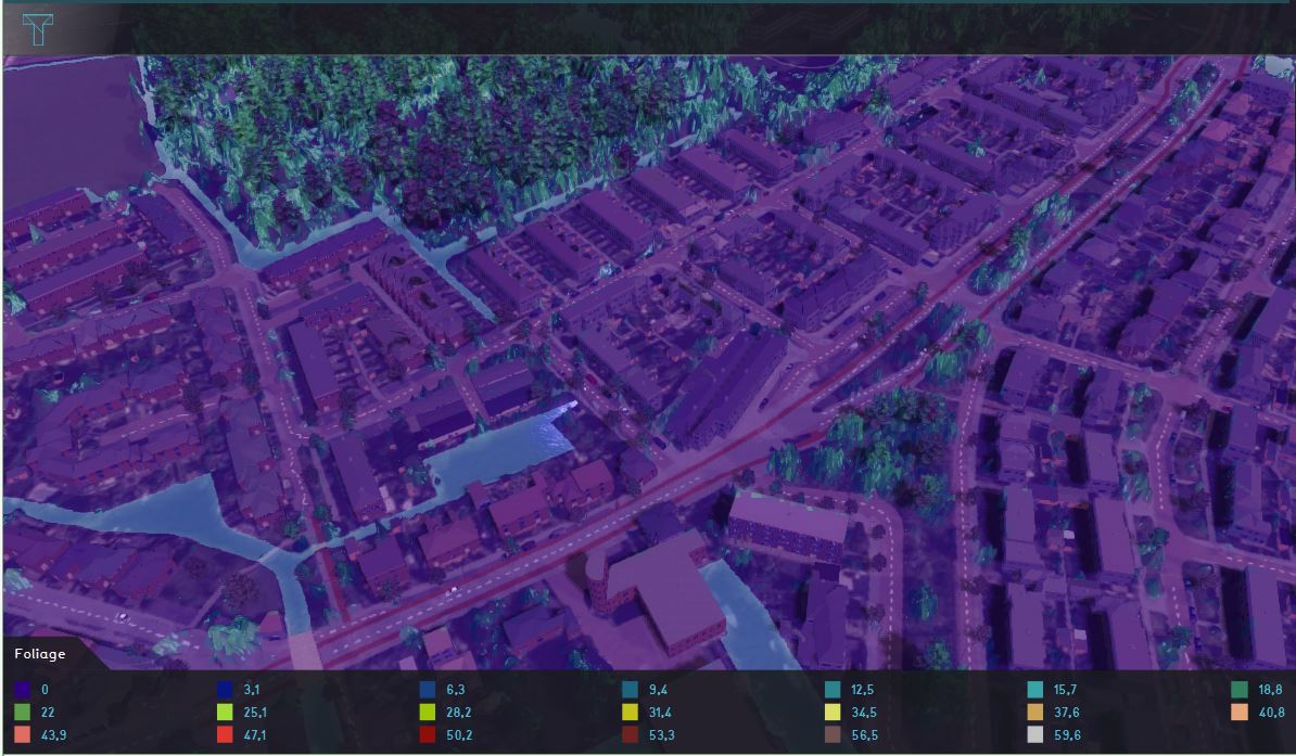
 Foliage heights wageningen.png 877 × 840; 401 KB
 Foliage heights wageningen zoomed.png 1,030 × 832; 417 KB
 Foliage legend.png 56 × 39; 821 bytes
 Foliage raster data.JPG 952 × 604; 179 KB
 Foliage raster data in platform.JPG 1,194 × 697; 147 KB
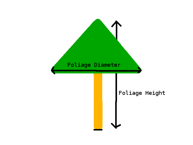
 Foliage top.png 640 × 400; 27 KB
 Foliage trunk.png 500 × 412; 18 KB
 Format.jpg 585 × 629; 70 KB
 Format location.png 501 × 242; 33 KB
 Formula window combo.JPG 785 × 594; 51 KB
 Freatic rain fall.gif 450 × 205; 4 KB
 Free cam active.jpg 133 × 179; 7 KB
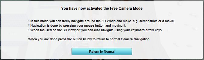
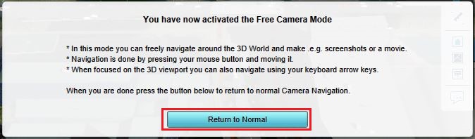 Free cam return.jpg 674 × 198; 33 KB
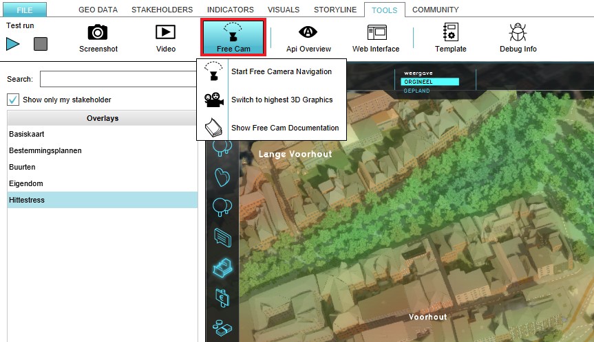 Free cam ribbon bar.jpg 863 × 498; 113 KB
 Freecam-bottom.jpg 673 × 198; 25 KB
 Fuel usage bouw.PNG 611 × 459; 309 KB
 Function-duplicated.jpg 967 × 61; 11 KB
 Function-selector.jpg 804 × 673; 62 KB
 Function-values-add-function.jpg 571 × 354; 50 KB
 Function-values-duplicate-function.jpg 560 × 369; 47 KB
 Function-values-location.jpg 438 × 393; 44 KB
 Function attribute add.jpg 302 × 140; 13 KB
 Function attribute custom.jpg 554 × 503; 36 KB
 Function attribute edit.jpg 551 × 469; 32 KB
 Function building.png 420 × 420; 85 KB
 Function color override in duplicate.jpg 606 × 133; 12 KB
 Function color reflected in duplicate.jpg 603 × 133; 12 KB
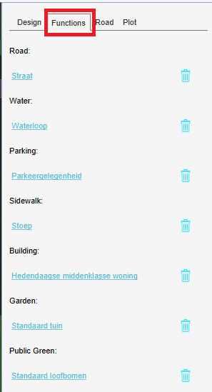
 Function group attributes.jpg 578 × 95; 13 KB
 Function group custom.jpg 544 × 74; 11 KB
 Function mapping.JPG 956 × 684; 67 KB
 Function override api html.jpg 800 × 422; 38 KB
 Function parameters.PNG 297 × 549; 16 KB
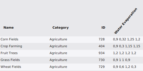 Function table evaporation factors.png 496 × 248; 22 KB
 Function type.JPG 1,306 × 102; 37 KB
 Function value table.png 1,000 × 700; 107 KB
 Function values screen.jpg 1,656 × 571; 242 KB
 Function values screen edit value.jpg 1,656 × 571; 252 KB
 Function values selection.jpg 648 × 329; 40 KB
 Function values tree.JPG 779 × 583; 68 KB
 Function values tree height.JPG 776 × 588; 63 KB
 Future design house.PNG 528 × 490; 111 KB
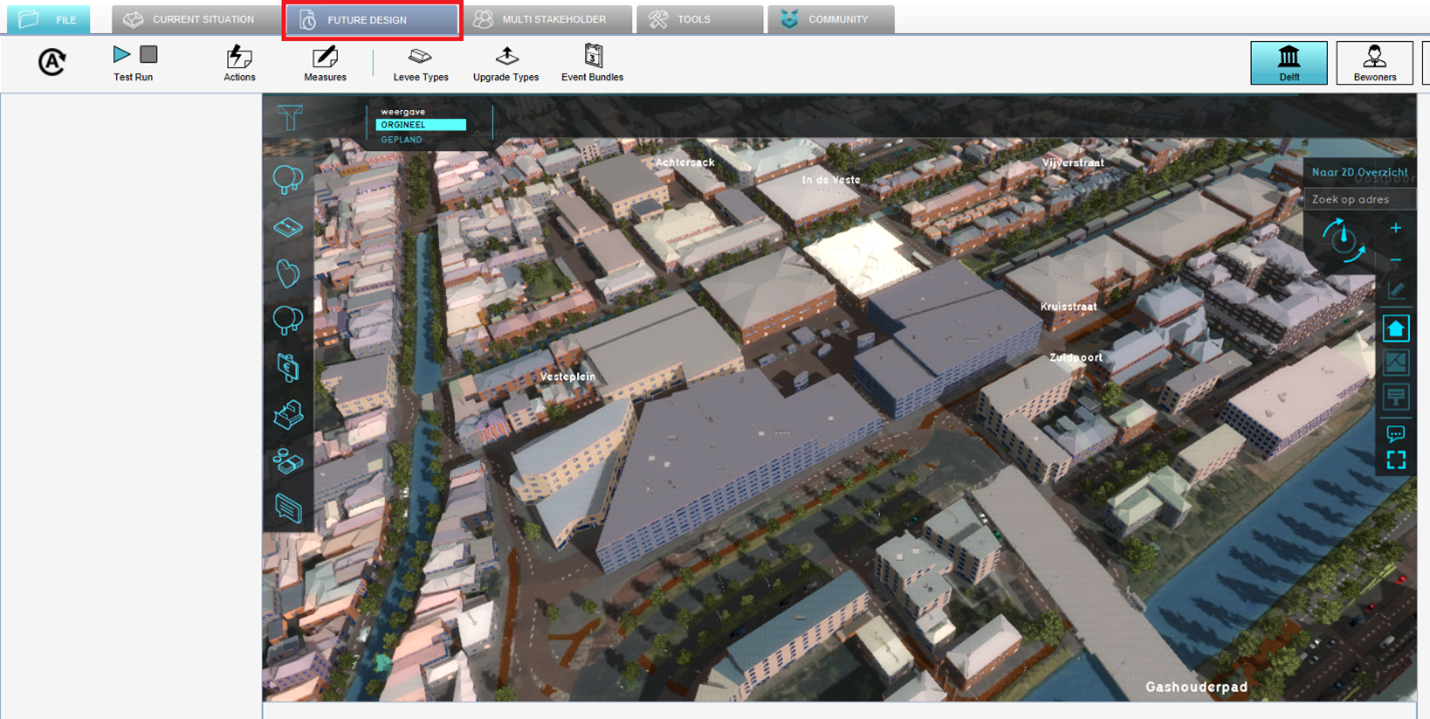 Future design tab.png 1,430 × 719; 1.74 MB
 Future desing tab.PNG 523 × 453; 113 KB
 GD tuto KD Overlay.PNG 1,920 × 1,040; 2.37 MB
 GD tuto KD as elevation.PNG 1,920 × 1,040; 2.39 MB
 GIF animation panel.png 1,091 × 705; 519 KB
 GISOverlayRightPanel.jpg 298 × 487; 20 KB
 GLG-legend.jpg 564 × 134; 27 KB
 Gebouw.png 293 × 885; 37 KB
 Gebouwgebonden emissies ac.PNG 805 × 517; 115 KB
 Gebouwgebonden emissies tp.PNG 611 × 256; 66 KB
 Geluidsoverlast.png 1,754 × 1,240; 83 KB
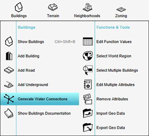 Gen water connections menu.png 300 × 273; 47 KB
 General tab.JPG 301 × 967; 71 KB
 General tab kockengen tut.JPG 288 × 644; 31 KB
 Generate 3D world databases.png 850 × 749; 618 KB
 Generate map.jpg 1,112 × 660; 138 KB
 Generate sewers handout watermodule.PNG 929 × 709; 76 KB
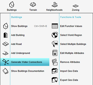 Generate water connections.png 300 × 272; 46 KB
 Generating map data.jpg 1,005 × 779; 92 KB
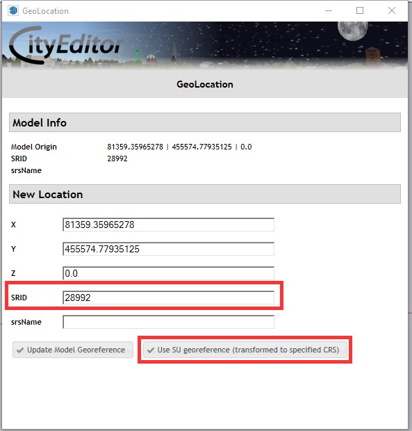 GeoLocation1.jpg 593 × 620; 62 KB
 GeoShareViewer.png 1,679 × 940; 1.71 MB
 GeoTIFF measure post.png 730 × 780; 812 KB
 GeoTIFF measure pre.png 801 × 791; 866 KB
 GeoTIFF measure with buildings.png 684 × 782; 799 KB
 Geo Data Buildings.jpg 304 × 110; 12 KB
 Geo Data Ribbon.jpg 304 × 110; 12 KB
 Geo Data Select.jpg 302 × 110; 12 KB
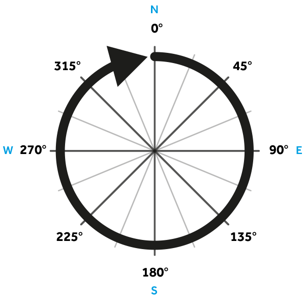 Geo angle.png 600 × 600; 36 KB
 Geo data 0.jpg 878 × 688; 46 KB
 Geo data 1.jpg 883 × 687; 43 KB
 Geo data 10.jpg 882 × 691; 46 KB
 Geo data 11.jpg 881 × 690; 35 KB
 Geo data 3.jpg 882 × 690; 40 KB
 Geo data 4.jpg 882 × 686; 146 KB
 Geo data 5.jpg 877 × 691; 39 KB
 Geo data 6.jpg 881 × 685; 46 KB
 Geo data 7.jpg 876 × 690; 50 KB
 Geo data 8.jpg 880 × 688; 134 KB
 Geo data 9.png 878 × 690; 22 KB
 Geo data areas.jpg 881 × 686; 46 KB
 Geo data areas 1.jpg 882 × 688; 55 KB
 Geo data safety distance overlay.jpg 1,224 × 786; 191 KB
 Geo data select.jpg 1,181 × 656; 126 KB
 Geo data static.jpg 735 × 685; 61 KB
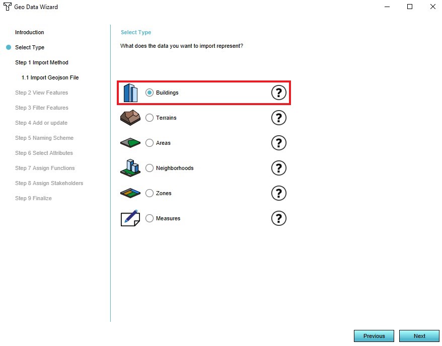
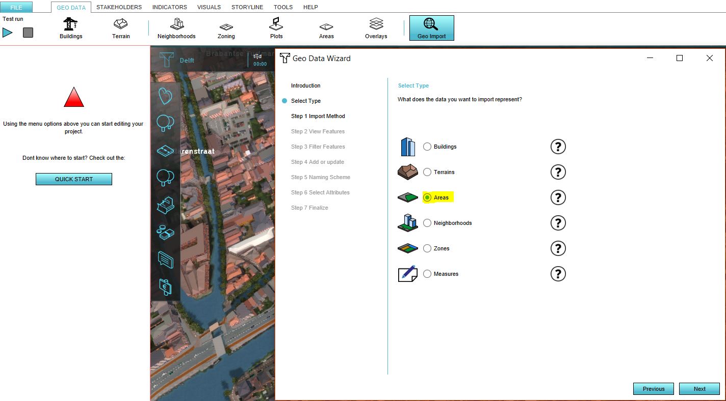
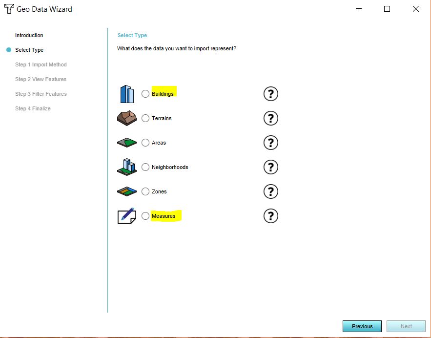
 Geo data wizard.JPG 1,381 × 624; 125 KB
 Geo import geoJSON.jpg 800 × 693; 87 KB
 Geo option road.png 1,008 × 586; 510 KB
 Geo plugin 01.PNG 1,000 × 413; 426 KB
 Geo plugin 02.PNG 801 × 605; 30 KB
 Geo plugin 02b.PNG 800 × 605; 34 KB
 Geo plugin 03.PNG 724 × 317; 168 KB
 Geo plugin 04.PNG 372 × 290; 20 KB
 Geo plugin 05.PNG 432 × 364; 57 KB
 Geo plugin 06.PNG 423 × 352; 54 KB
 Geo plugin 07.PNG 812 × 669; 20 KB
 Geo plugin 07b.PNG 478 × 311; 21 KB
 Geo plugin 08.PNG 377 × 352; 35 KB
 Geo plugin 09.PNG 366 × 358; 32 KB
 Geo plugin 10.PNG 296 × 462; 26 KB
 Geo plugin for new projects.png 294 × 229; 40 KB
 Geo plugin not for new projects.png 292 × 233; 42 KB
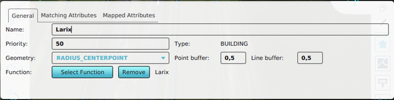
 Geolink mapping attribute roof color.png 670 × 195; 63 KB
 Geolink matching.png 670 × 189; 69 KB
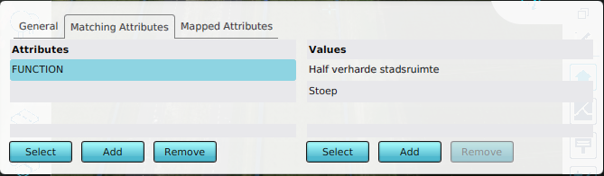 Geolink matching attribute.png 669 × 196; 55 KB
 Geolink radius centerpoint.png 770 × 197; 90 KB
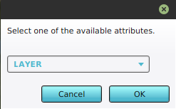 Geolink select attribute.png 247 × 153; 7 KB
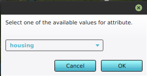 Geolink select values.png 300 × 156; 9 KB
 GeometryColorUpdated1.jpg 625 × 432; 82 KB
 Geoplugin inspect dxf file.png 948 × 827; 60 KB
 Geoplugin inspectable geometries.png 290 × 455; 60 KB
 Georeference model.jpg 1,252 × 753; 375 KB
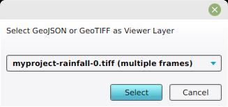 Geoshare add viewer geotiff multi.jpg 327 × 154; 8 KB
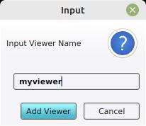 Geoshare add viewer name.jpg 206 × 178; 7 KB
 Geoshare grid overlay tiffs.jpg 800 × 600; 54 KB
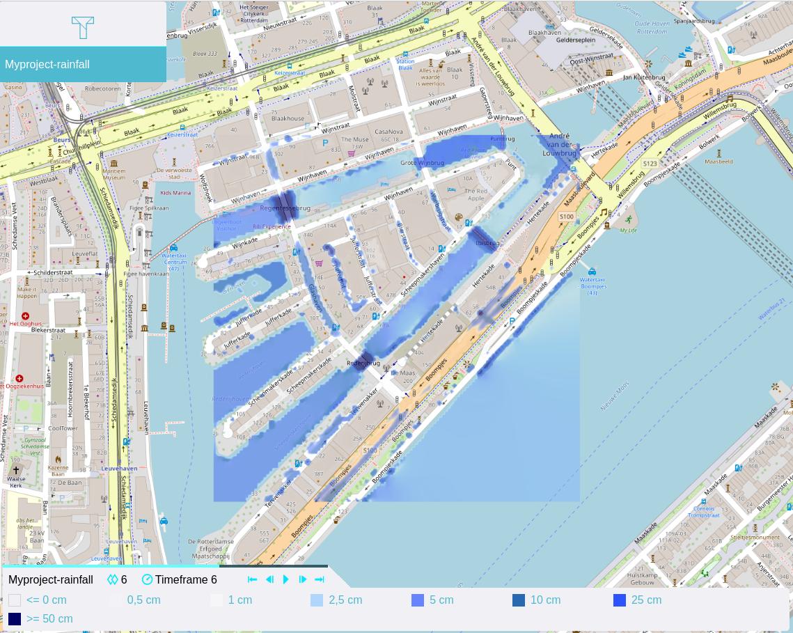 Geoshare viewer webbrowser play timeframes.jpg 1,139 × 909; 185 KB
 Geotiff export.jpg 452 × 513; 42 KB
 Geotiff overlay.jpg 1,080 × 639; 262 KB
 Geotiff overlay geotiff manager.jpg 1,140 × 700; 105 KB
 GettingStarted1.png 1,000 × 613; 343 KB
 Getting started button.png 100 × 100; 5 KB
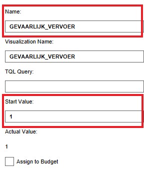 Gevaarlijk vervoer.jpg 288 × 376; 21 KB
 Gezondheid.jpg 328 × 178; 15 KB
 Gif animation example.gif 210 × 127; 135 KB
 Global detail panel.png 295 × 491; 72 KB
 Global green.JPG 300 × 358; 21 KB
 Global panel right.png 422 × 230; 39 KB
 Global panel with popup.png 617 × 480; 335 KB
 Global parking.JPG 298 × 402; 19 KB
 Global set point.png 1,375 × 365; 303 KB
 Global woningdoel.JPG 291 × 354; 20 KB
 Gondel.png 725 × 344; 424 KB
 Gondel2.png 735 × 339; 427 KB
 Graph-dbe.JPG 700 × 240; 26 KB
 Graph-dbs.JPG 700 × 240; 26 KB
 Graph-i.JPG 700 × 240; 29 KB
 Graph flooding.JPG 788 × 598; 96 KB
 Graph others p10 case2 ukbm.png 833 × 513; 138 KB
 Graph others p11 case2 ukbm.png 833 × 506; 141 KB
 Graph others p12 case2 ukbm.png 835 × 507; 133 KB
 Graph others p13 p16 case2 ukbm.png 820 × 353; 87 KB
 Graph others p1 case1 ukbm.png 651 × 512; 114 KB
 Graph others p1 case2 ukbm.png 847 × 512; 166 KB
 Graph others p2 case1 ukbm.png 624 × 521; 113 KB
 Graph others p2 case2 ukbm.png 834 × 517; 146 KB
 Graph others p3 case2 ukbm.png 834 × 516; 141 KB
 Graph others p4 case2 ukbm.png 837 × 517; 141 KB
 Graph others p5 case2 ukbm.png 835 × 512; 174 KB
 Graph others p6 case2 ukbm.png 836 × 518; 152 KB
 Graph others p7 case2 ukbm.png 836 × 525; 144 KB
 Graph others p8 case2 ukbm.png 838 × 523; 138 KB
 Graph others p9 case2 ukbm.png 839 × 518; 125 KB
 Graph p10 case2 ukbm.png 519 × 385; 15 KB
 Graph p11 case2 ukbm.png 520 × 382; 17 KB
 Graph p12 case2 ukbm.png 521 × 390; 16 KB
 Graph p13 case2 ukbm.png 521 × 388; 14 KB
 Graph p14 case2 ukbm.png 519 × 381; 14 KB
 Graph p15 case2 ukbm.png 526 × 386; 14 KB
 Graph p16 case2 ukbm.png 522 × 384; 15 KB
 Graph p1 case1 ukbm.png 656 × 474; 26 KB
 Graph p1 case2 ukbm.png 521 × 396; 19 KB
 Graph p2 case1 ukbm.png 657 × 458; 26 KB
 Graph p2 case2 ukbm.png 515 × 400; 18 KB
 Graph p3 case2 ukbm.png 518 × 387; 19 KB
 Graph p4 case2 ukbm.png 514 × 380; 19 KB
 Graph p5 case2 ukbm.png 519 × 395; 19 KB
 Graph p6 case2 ukbm.png 517 × 393; 18 KB
 Graph p7 case2 ukbm.png 519 × 381; 18 KB
 Graph p8 case2 ukbm.png 521 × 390; 18 KB
 Graph p9 case2 ukbm.png 520 × 395; 14 KB
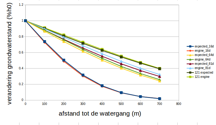
 Graph waterlevel change percentual over distance.png 600 × 400; 88 KB
 Graph xslice case1 ukbm.png 1,138 × 386; 35 KB
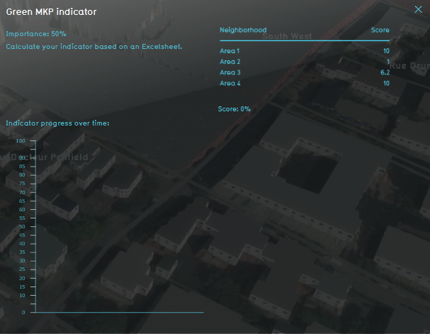 Green MKP indicator.png 607 × 471; 256 KB
 Green indicator.JPG 560 × 442; 84 KB
 Green indicator panel.png 780 × 461; 679 KB
 Green indicator panel parametric 2.jpg 914 × 679; 112 KB
 Green indicator panel parametric 3.jpg 1,170 × 944; 154 KB
 Green indicator parametric.jpg 848 × 657; 320 KB
 Green indicators bottom panel.jpg 1,304 × 151; 29 KB
 Green target after action.jpg 608 × 468; 92 KB
 Green target before action.jpg 679 × 531; 121 KB
 GridCellWarning1.png 237 × 29; 8 KB
 GridOverlayPlayerBtns1.jpg 510 × 133; 23 KB
 GridOverlayPlayerBtns2.jpg 800 × 500; 110 KB
 GridOverlayRightSidePanel1.png 300 × 807; 22 KB
 GridSize1.png 540 × 240; 3 KB
 Grid av.jpg 887 × 484; 126 KB
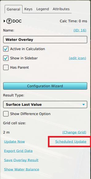 Grid overlay schedule update.jpg 295 × 579; 25 KB
 Grid overlay schedule update changed.jpg 177 × 26; 2 KB
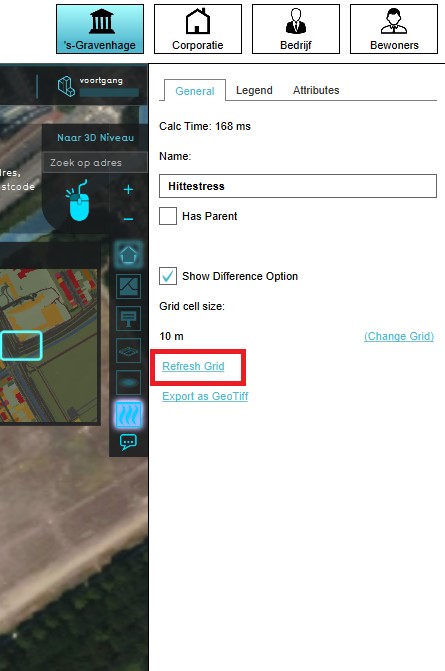 Grid refreshing.jpg 445 × 671; 49 KB
 Grid statement.jpg 1,046 × 624; 101 KB
 Grid value statement.jpg 1,046 × 624; 101 KB
 Ground-water-graph.jpg 481 × 289; 19 KB
 GroundPriceLowerLand.jpg 363 × 139; 22 KB
 GroundPricePanel.jpg 687 × 555; 67 KB
 GroundPriceRaiseLand2.jpg 363 × 139; 22 KB
 GroundWaterOverlayWeatherEvent1.jpg 887 × 740; 71 KB
 GroundWaterOverlayWizardAquiferAreas1.jpg 886 × 744; 61 KB
 Ground water spatial.jpg 274 × 305; 37 KB
 Groundprice-bottom.jpg 779 × 200; 28 KB
 Groundwater-Overlay.jpg 1,206 × 806; 274 KB
 Groundwater1.png 710 × 411; 54 KB
 Groundwater2.png 778 × 489; 16 KB
 GroundwaterOverlay2.png 677 × 584; 592 KB
 Groundwater explain.png 525 × 699; 130 KB
 Groundwater explain2.png 558 × 683; 162 KB
 Groundwater fluctuation Overlay.jpg 258 × 277; 32 KB
 Groundwater overview.png 400 × 300; 39 KB
 Groundwater spatial overlay.jpg 265 × 277; 32 KB
 Group by.PNG 510 × 460; 126 KB
 Groups 2 pm.png 1,552 × 932; 1.21 MB
 Groups 5 pm.png 606 × 605; 543 KB
 GroupworkingIHS.jpg 590 × 423; 33 KB
 GroupworkingIHS2.jpg 577 × 433; 37 KB
 GroupworkingIHS3.jpg 492 × 507; 1.35 MB
 HEAT-TopBar-PipeClusters-Q4-2015.jpg 250 × 175; 15 KB
 HEAT-TopBar-PipeEdit-Q4-2015.jpg 250 × 175; 16 KB
 HEAT-TopBar-Q4-2015.jpg 807 × 93; 28 KB
 HEAT-TopBar-Stakeholders-Q4-2015.jpg 390 × 64; 9 KB
 HTML example full.jpg 524 × 314; 47 KB
 HTML example headings.jpg 524 × 240; 30 KB
 HTML example table.jpg 524 × 240; 42 KB
 HTML example text.jpg 524 × 240; 44 KB
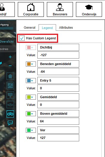 Has custom legend.jpg 354 × 531; 46 KB
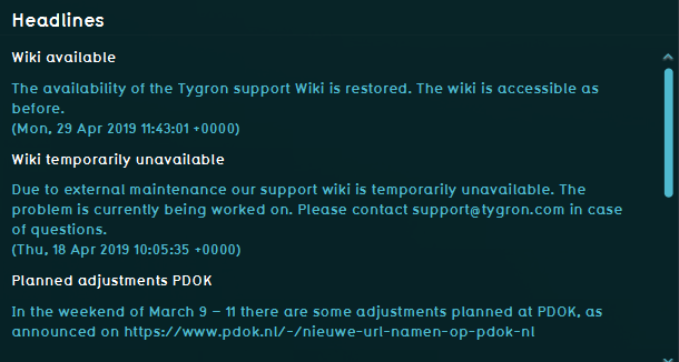 Headlines 2019.png 610 × 326; 25 KB
 Health.jpg 310 × 277; 31 KB
 Heat-step1.PNG 936 × 793; 22 KB
 Heat-step3.1.PNG 936 × 793; 22 KB
 Heat-step3.2.PNG 936 × 793; 20 KB
 Heat-step3.PNG 936 × 793; 25 KB
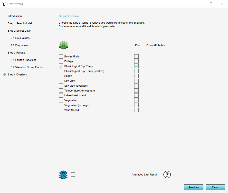 Heat-step4.PNG 936 × 793; 32 KB
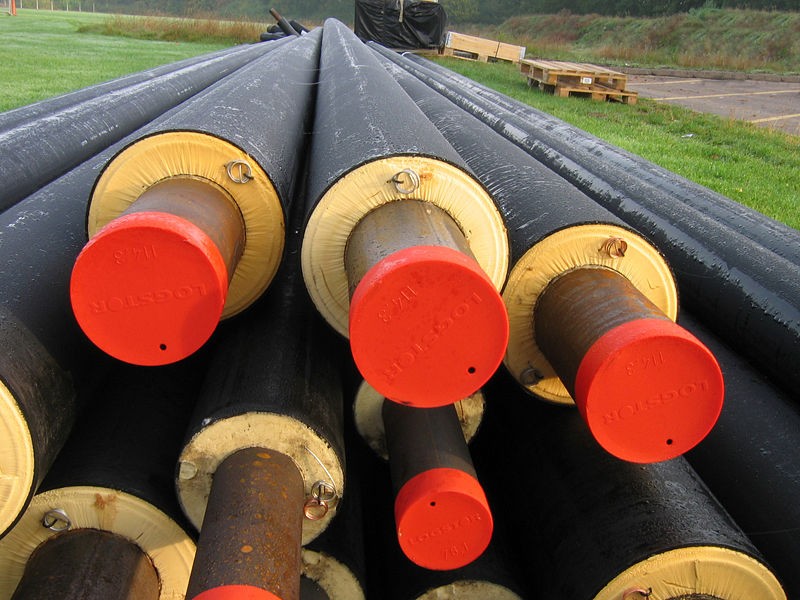 HeatNetworkPipes.jpg 800 × 600; 130 KB
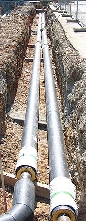 HeatNetworkPipesUndeground.jpg 170 × 435; 46 KB
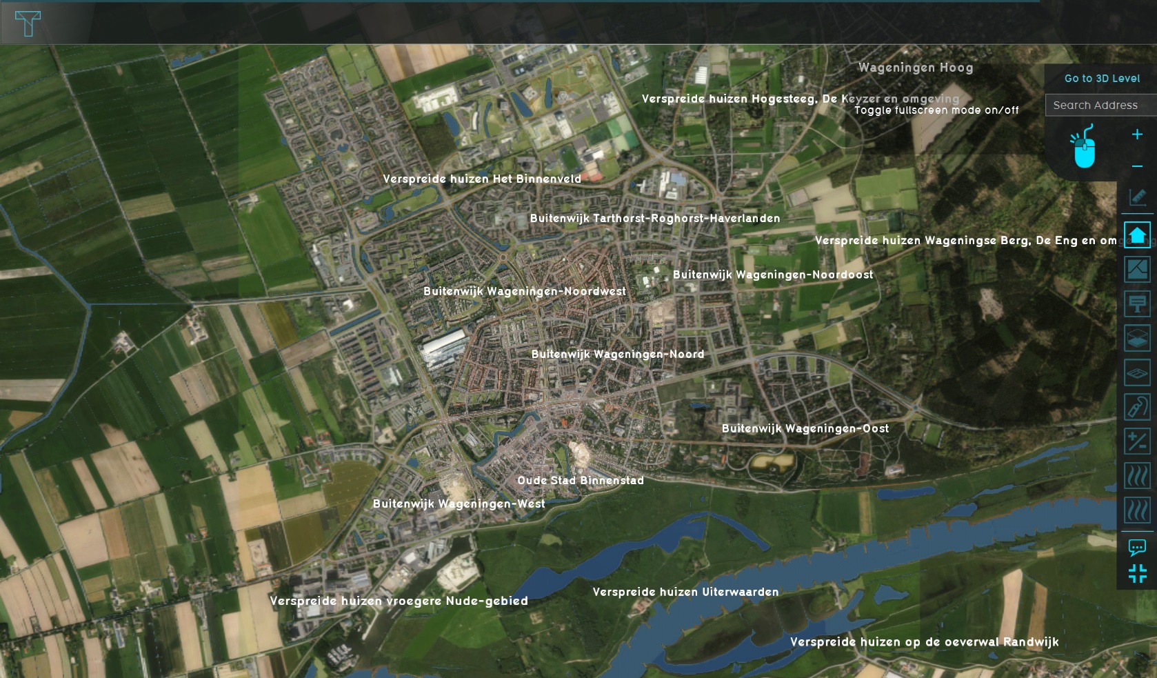 Heat Stress Wageningen project area.jpg 1,678 × 983; 560 KB
 Heat dpra report.png 607 × 858; 21 KB
 Heat effect.JPG 782 × 389; 70 KB
 Heat introduction button.png 100 × 100; 4 KB
 Heat overlay.JPG 1,047 × 299; 67 KB
 Heat overlaysth.PNG 679 × 367; 286 KB
 Heat risk panel.JPG 414 × 420; 62 KB
 Heat step2.1.PNG 936 × 793; 44 KB
 Heat step2.2.PNG 936 × 793; 34 KB
 Heat step2.PNG 936 × 793; 31 KB
 Heat stress knmi data calculator.xlsx ; 8.85 MB
 Heat wizard.JPG 289 × 257; 17 KB
 Heatstreeshoefkade0.png 866 × 400; 612 KB
 Heatstreeshoefkade1.png 866 × 400; 599 KB
 Heatstreeshoefkade2.png 629 × 396; 546 KB
 Heatstreeshoefkade3.png 629 × 396; 550 KB
 Heatstreeshoefkade4.png 629 × 396; 547 KB
 Heatstress hover panel.JPG 629 × 416; 45 KB
 Heatstress overlay.PNG 1,322 × 726; 2.23 MB
 Heightmap overlay.jpg 1,076 × 694; 193 KB
 Help.jpg 290 × 117; 12 KB
 Help mini.png 16 × 16; 226 bytes
 HighlightConstruction-Q3-2015.jpg 352 × 322; 22 KB
 HighlightExcelFileName-Q3-2015.jpg 408 × 436; 37 KB
 HighlightWeather.jpg 297 × 527; 17 KB
 Hmapcrop case2 ukbm.png 699 × 700; 12 KB
 Hmapori case2 ukbm.png 816 × 818; 109 KB
 Host session.png 280 × 231; 14 KB
 Hotel data.JPG 1,326 × 697; 286 KB
 Hotel map.JPG 1,319 × 695; 163 KB
 Hotel more information.JPG 411 × 255; 29 KB
 Housing goal.jpg 293 × 395; 20 KB
 Housing indicator parametric.jpg 500 × 434; 176 KB
 Housing score.jpg 318 × 272; 17 KB
 Housing target.jpg 316 × 236; 16 KB
 Housing target panel.JPG 432 × 405; 27 KB
 HoverPanelOwnership2.jpg 418 × 244; 29 KB
 Hover panel grid.PNG 352 × 196; 110 KB
 Hover panel heightmap overlay .jpg 1,080 × 694; 214 KB
 Hover panel network overview.jpg 1,093 × 407; 214 KB
 Hover panel network overview2.jpg 1,324 × 708; 361 KB
 Hover panel terrain.jpg 1,081 × 693; 211 KB
 How to custom foliage height.jpg 1,079 × 777; 79 KB
 How to dowload aerius results.PNG 1,911 × 849; 1.58 MB
 How to export object.PNG 1,323 × 699; 1.58 MB
 How to export object 2.PNG 1,588 × 438; 590 KB
 How to export object 3.PNG 614 × 409; 104 KB
 How to improved foliage height.jpg 1,077 × 801; 83 KB
 How to play.jpg 700 × 393; 75 KB
 How to rain areas 1.jpg 500 × 500; 42 KB
 How to rain areas 2.jpg 500 × 300; 25 KB
 How to rain areas 3.jpg 600 × 350; 52 KB
 How to rain areas 4.jpg 1,000 × 850; 109 KB
 Html-example-form-area-multiple.jpg 600 × 375; 44 KB
 Html-example-form-global-1.jpg 450 × 300; 26 KB
 Htriver-1-vlakken.jpg 1,320 × 842; 156 KB
 Htriver-2-inlets.jpg 935 × 695; 163 KB
 Htriver-3-waterstand.jpg 1,320 × 842; 169 KB
 Htriver-4-polder.jpg 1,320 × 842; 151 KB
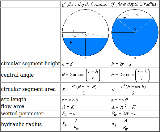 Hydraulic radius.png 518 × 427; 15 KB
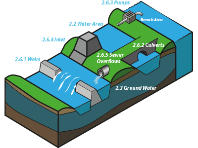 Hydraulic structures overview.png 400 × 300; 55 KB
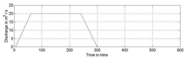 Hydrograph case4 ukbm.png 607 × 194; 44 KB
 I3s step.PNG 918 × 433; 33 KB
 ID adjustment.PNG 877 × 654; 38 KB
 IHSTygron.jpg 658 × 379; 75 KB
 IHS ScenarioAnalysis session1.pdf ; 1.82 MB
- IHS ScenarioAnalysis session2.pdf ; 647 KB
 IHSclassroom.jpg 577 × 433; 54 KB
 IOServicesEventsOverview.jpg 638 × 638; 172 KB
 Icon Map Format Visual GeoJSON.JPG 427 × 386; 23 KB
 Icon Map Format Visual WMS satellite.JPG 200 × 852; 29 KB
 Icon Map Format Visual WMS timeframe.JPG 204 × 836; 30 KB
 Icon Map GeoJSON gradient.jpg 1,880 × 858; 176 KB
 Icon Map Visualization.JPG 376 × 303; 26 KB
 Icon Map WMS satellite.JPG 675 × 440; 95 KB
 Icon Map WMS timeframe.JPG 675 × 437; 103 KB
 Icon Map app.JPG 499 × 400; 39 KB
 Icon Map config.JPG 301 × 853; 49 KB
 Icon Map config long lat.JPG 198 × 831; 40 KB
 Icon Map long lat.JPG 676 × 453; 71 KB
 Icon Map visual.JPG 201 × 588; 33 KB
 Icon building.PNG 665 × 540; 655 KB
 Id in editor.png 1,920 × 777; 1.84 MB
 Image.png 295 × 82; 1 KB
 ImageAMU.png 1,386 × 748; 1.11 MB
 ImageIndicator.jpg 1,383 × 750; 220 KB
 ImageRainfall.png 604 × 351; 296 KB
 ImageSelectorforOverlay.jpg 475 × 578; 32 KB
 Image indicator field.jpg 292 × 93; 4 KB
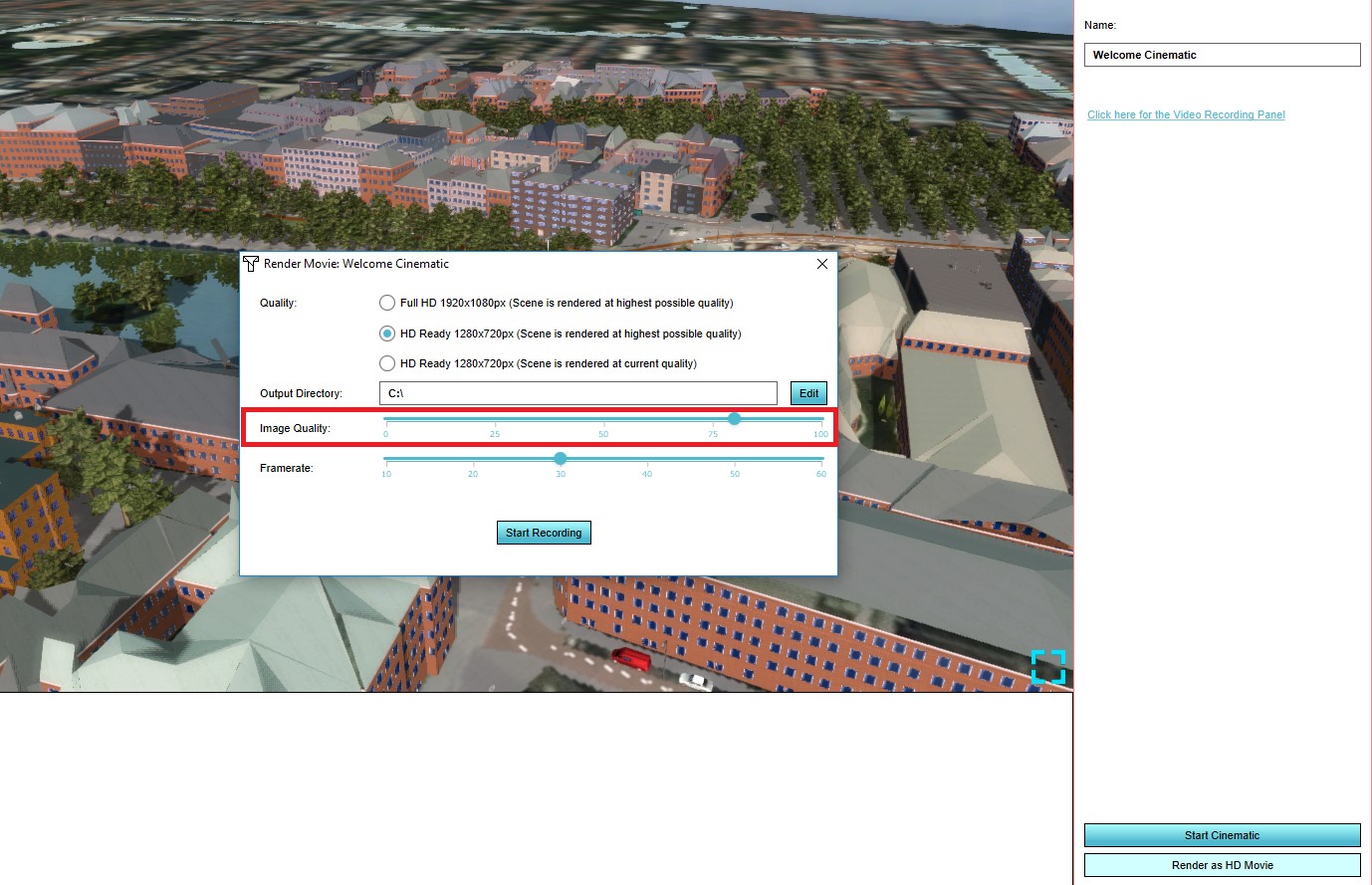 Image quality hd movie.jpg 1,378 × 889; 244 KB
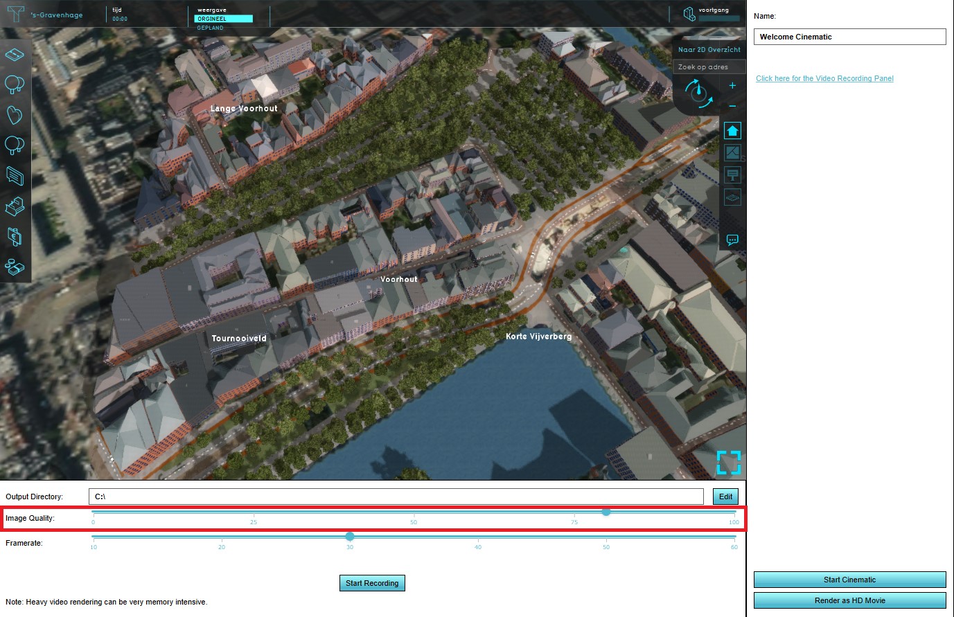 Image quality video.jpg 1,377 × 891; 277 KB
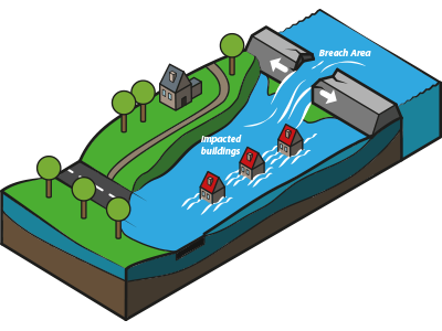
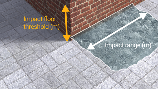 Impacted buildings.jpg 600 × 338; 241 KB
 Import-DXF file 001.JPG 936 × 793; 44 KB
 Import-DXF file 002.JPG 936 × 793; 56 KB
 Import-DXF file 003.JPG 936 × 793; 59 KB
 Import-DXF file 004.JPG 812 × 669; 62 KB
 Import-DXF file 005.JPG 1,920 × 1,040; 328 KB
 Import-DXF file 006.JPG 1,920 × 1,040; 312 KB
 Import-DXF file 007.JPG 936 × 793; 45 KB
 Import-DXF file 008.jpg 936 × 793; 67 KB
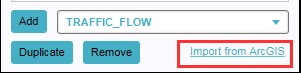 ImportFromArcGISButton.jpg 301 × 73; 8 KB
 ImportSuccess1.jpg 940 × 493; 186 KB
 ImportTextWizardStep1of3-1.jpg 718 × 460; 91 KB
 ImportTextWizardStep2of3-1.jpg 718 × 460; 72 KB
 ImportTextWizardStep3of3-1.jpg 718 × 460; 75 KB
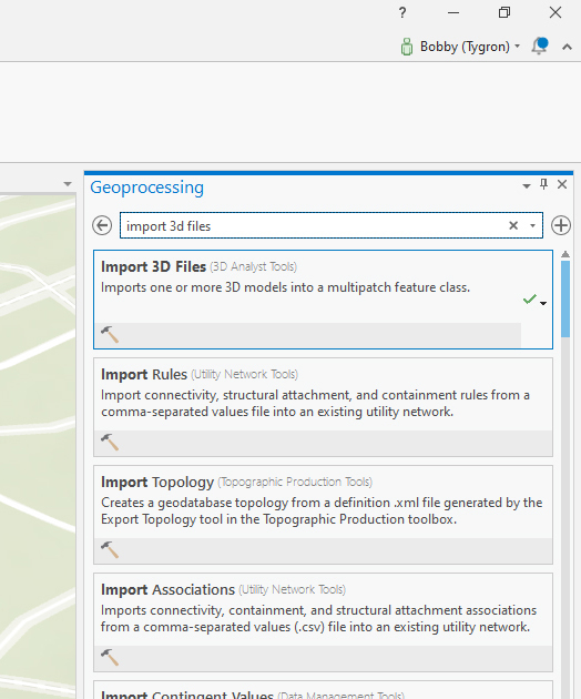 Import 3d files.jpg 524 × 630; 206 KB
 Import area.png 917 × 369; 246 KB
 Import areas.JPG 1,424 × 788; 115 KB
 Import as.JPG 883 × 692; 41 KB
 Import blocks 002.png 358 × 430; 186 KB
 Import blocks 005.png 966 × 235; 194 KB
 Import blocks 006.png 609 × 193; 59 KB
 Import blocks 007.png 531 × 193; 56 KB
 Import building.png 421 × 421; 41 KB
 Import csv.JPG 881 × 733; 37 KB
 Import csv timeframes.PNG 803 × 667; 19 KB
 Import culverts.JPG 935 × 734; 59 KB
 Import dialog.jpg 1,132 × 738; 236 KB
 Import discharge areas.PNG 748 × 357; 24 KB
 Import foliage raster.JPG 924 × 753; 41 KB
 Import geotiff.PNG 805 × 667; 19 KB
 Import infiltration csv.png 808 × 668; 26 KB
 Import new csv.PNG 805 × 666; 16 KB
 Import new csvs.PNG 809 × 667; 17 KB
 Import point measurements.PNG 660 × 538; 43 KB
 Import settings.PNG 808 × 669; 20 KB
 Import weirs.PNG 920 × 331; 27 KB
 Import weirs handout watermodule.png 567 × 205; 45 KB
 Import wizard geotiff.JPG 927 × 373; 42 KB
 Importance1.jpg 259 × 194; 6 KB
 Importance3.jpg 411 × 300; 16 KB
 Importance4.jpg 411 × 300; 35 KB
 Importance6.jpg 378 × 300; 14 KB
 Importance7.jpg 411 × 300; 36 KB
 ImportedData1.jpg 309 × 270; 16 KB
 Imported measurements.PNG 1,919 × 728; 1.79 MB
 Improving green indicator.jpg 1,451 × 921; 178 KB
 Index in indicatorpanel.png 413 × 425; 23 KB
 Indicator editor panel parking.jpg 200 × 686; 31 KB
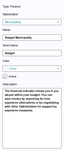 Indicator editor screen - budget.jpg 248 × 583; 37 KB
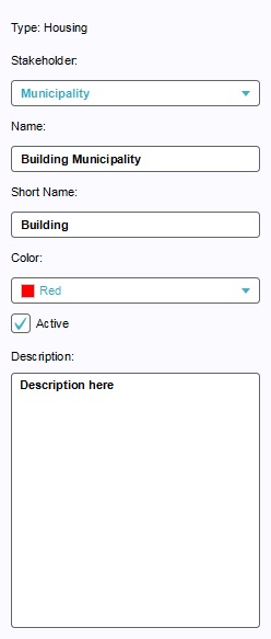 Indicator editor screen - building.jpg 248 × 583; 23 KB


