Unused files
Jump to navigation
Jump to search
The following files exist but are not embedded in any page. Please note that other web sites may link to a file with a direct URL, and so may still be listed here despite being in active use.
Showing below up to 500 results in range #21 to #520.
View (previous 500 | next 500) (20 | 50 | 100 | 250 | 500)
 WebApplicationEditorAndGroupAdmin.jpg 290 × 340; 24 KB
 Behavior2.jpg 349 × 190; 13 KB
 Behavior3.jpg 349 × 190; 26 KB
 Behavior4.jpg 349 × 190; 26 KB
 Editor land type dunes.jpg 349 × 190; 19 KB
 Behavior8.jpg 349 × 190; 13 KB
 ClientSideLogo-Q3-2015.jpg 225 × 225; 11 KB
 Editor overlay traffic flow hover.jpg 360 × 211; 66 KB
 Editor overlay underground.jpg 1,680 × 1,031; 175 KB
 Editor overlay heat stress hover.jpg 456 × 255; 54 KB
 Editor overlay quality of life.jpg 1,680 × 1,003; 262 KB
 MessagesRibbon-Q3-2015.jpg 575 × 189; 32 KB
 MessagesSubject-Q3-2015.jpg 299 × 61; 4 KB
 MessagesRightPanel-Q3-2015.jpg 299 × 898; 28 KB
 MessagesFrom-Q3-2015.jpg 299 × 61; 4 KB
 MessagesTo-Q3-2015.jpg 299 × 61; 3 KB
 MessagesSendToAll-Q3-2015.jpg 299 × 27; 3 KB
 MessagesAdminCanSend-Q3-2015.jpg 299 × 27; 4 KB
 MessagesAutoDate-Q3-2015.jpg 299 × 62; 6 KB
 MesssagesRemoveAnswer-Q3-2015.jpg 299 × 69; 6 KB
 MesssagesDuplicate-Q3-2015.jpg 299 × 69; 6 KB
 Custom function values screen edit value.jpg 527 × 491; 98 KB
 MessagesAnswerRightPanel-Q3-2015.jpg 250 × 390; 21 KB
 MessagesFreeForm-Q3-2015.jpg 455 × 380; 69 KB
 MessagesActionMenuIcon-Q3-2015.jpg 170 × 348; 24 KB
 Editor overlay terrains rightpanel.jpg 298 × 215; 44 KB
 Editor overlay terrains selected.jpg 298 × 137; 27 KB
 Editor screen.jpg 1,680 × 1,031; 510 KB
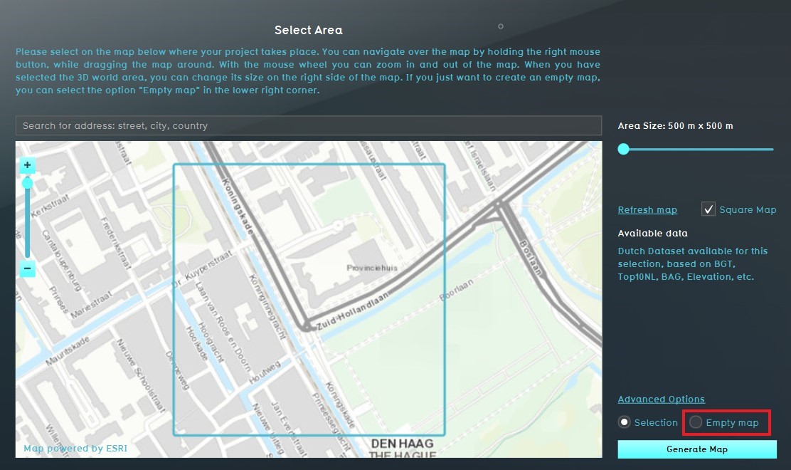
 Wizard select area.jpg 1,672 × 996; 363 KB
 Lowermanhattan-v1-sat1.jpg 331 × 288; 46 KB
 Terrain Flooding-Overlay.jpg 800 × 517; 100 KB
 Select3DWorld.jpg 513 × 382; 48 KB
 Overlays-right-custom-color-draw-area.jpg 298 × 258; 21 KB
 Overlays-right bottom-custom-overlay-add.jpg 299 × 43; 6 KB
 Overlays-right-custom-overlay2.jpg 299 × 374; 25 KB
 Vacancy Overlay-name.jpg 297 × 194; 4 KB
 Watermark-overlay.jpg 1,080 × 697; 256 KB
 CustomMarkings-overlay.jpg 1,080 × 697; 257 KB
 DrawnImage-overlay.jpg 1,080 × 697; 261 KB
 PhotoRealistic-overlay.jpg 1,080 × 697; 259 KB
 PropertiesImageOverlay.jpg 298 × 390; 10 KB
 ImageSelectorforOverlay.jpg 475 × 578; 32 KB
 OnlineGISDataLogInWindow.jpg 400 × 500; 39 KB
 OnlineGISDataSignInButton.jpg 339 × 135; 17 KB
 OnlineGISDataWindow.jpg 1,028 × 599; 57 KB
 OnlineGISDataLogOutWindow.jpg 299 × 400; 22 KB
 ImportFromArcGISButton.jpg 301 × 73; 8 KB
 GISOverlayRightPanel.jpg 298 × 487; 20 KB
 NewArcGISOwnership.jpg 600 × 566; 92 KB
 Weather Rain.jpg 800 × 517; 106 KB
 Weather Drought.jpg 303 × 231; 10 KB
 Weather SafeZoneFlooding.jpg 544 × 354; 40 KB
 WeatherAnualRainfall.jpg 299 × 57; 5 KB
 WeatherAmountOfRain.jpg 299 × 69; 6 KB
 WeatherDuration.jpg 299 × 59; 4 KB
 WeatherFloodingWaterlevel.jpg 299 × 59; 4 KB
 WeatherRainfallDuration.jpg 299 × 57; 4 KB
 WeatherVisualEffect.jpg 299 × 53; 4 KB
 HeatNetworkPipes.jpg 800 × 600; 130 KB
 HeatNetworkPipesUndeground.jpg 170 × 435; 46 KB
 Transfer of Development Rights Definition.jpeg 320 × 317; 45 KB
 TransOfDevRights9.jpeg 1,206 × 596; 171 KB
 ConstructionsRightSideDetail-Q4-2015.jpg 296 × 895; 37 KB
 Constructionspanel-Q4-2015.jpg 297 × 899; 61 KB
 HEAT-TopBar-Q4-2015.jpg 807 × 93; 28 KB
 HEAT-TopBar-PipeClusters-Q4-2015.jpg 250 × 175; 15 KB
 HEAT-TopBar-PipeEdit-Q4-2015.jpg 250 × 175; 16 KB
 HEAT-TopBar-Stakeholders-Q4-2015.jpg 390 × 64; 9 KB
 SHP-file-available.jpg 202 × 135; 5 KB
 QGIS-ImportedFile-Main.jpg 800 × 504; 85 KB
 QGIS-SAveAs.jpg 699 × 504; 75 KB
 QGIS-SaveVectorLayerAs.jpg 607 × 668; 72 KB
 QGIS-main.jpg 800 × 504; 53 KB
 QGIS-newGeoJSON.jpg 446 × 213; 32 KB
 QGIS Select vector Layers.jpg 600 × 273; 47 KB
 QGIS-rename.jpg 800 × 499; 91 KB
 QGIS-EnterValues.jpg 600 × 250; 34 KB
 QGIS-FeatureValues.jpg 377 × 242; 16 KB
 QGIS-Repeat.jpg 641 × 506; 75 KB
 Q1-2016-Permissions.jpg 649 × 153; 12 KB
 Attribute name.png 584 × 492; 16 KB
 Brush-single.jpg 575 × 470; 31 KB
 Attribute add.jpg 254 × 424; 29 KB
 Attribute tab.jpg 234 × 24; 3 KB
 Attribute attribute.jpg 234 × 48; 3 KB
 Attribute new name.jpg 234 × 48; 4 KB
 Attribute new value.jpg 234 × 48; 4 KB
 Attribute new save.jpg 234 × 26; 4 KB
 Attribute reset.jpg 234 × 26; 4 KB
 Api figure13.PNG 1,924 × 1,042; 120 KB
 Api figure14.PNG 1,920 × 1,042; 160 KB
 Noice overlay 01.PNG 1,920 × 1,041; 1.48 MB
 Noice overlay 02.PNG 1,920 × 1,040; 2.23 MB
 NO2 overlay 01.PNG 285 × 331; 8 KB
 NO2 overlay 03.PNG 1,920 × 1,040; 1.51 MB
 NO2 overlay 04.PNG 1,920 × 1,040; 1.94 MB
 Rainfall overlay 01.PNG 1,920 × 1,039; 1.48 MB
 Rainfall overlay 02.PNG 1,920 × 1,040; 2.12 MB
 Rainfall overlay 03.PNG 200 × 309; 11 KB
 Rainfall overlay 06.PNG 887 × 693; 34 KB
 Rainfall overlay 07.PNG 583 × 478; 25 KB
 Ng wfs.JPG 961 × 304; 55 KB
 Add wfs.JPG 873 × 684; 48 KB
 Naming.JPG 875 × 682; 44 KB
 Areas attributes.JPG 1,914 × 707; 354 KB
 Overlays areas.JPG 1,915 × 967; 372 KB
 Add areas.JPG 915 × 436; 41 KB
 Multiuser-main-select.jpg 350 × 350; 30 KB
 Multiuser-main-start.jpg 350 × 350; 19 KB
 Multiuser-main-projectname.jpg 350 × 50; 6 KB
 Multiuser-main-1session.jpg 350 × 350; 17 KB
 Multiuser-facilitator-overview-small.jpg 650 × 352; 30 KB
 Multiuser-main-joinbeamer.jpg 350 × 350; 20 KB
 Multiuser-main-projectname-running.jpg 350 × 200; 9 KB
 Multiuser-beamer-start-small.jpg 650 × 381; 58 KB
 Multiuser-facilitator-sendinvite.jpg 350 × 400; 26 KB
 Multiuser-client-invite.jpg 650 × 200; 33 KB
 Multiuser-client-invite2.jpg 650 × 200; 33 KB
 Multiuser-client-start-small.jpg 650 × 381; 58 KB
 Multiuser-facilitator-settings.jpg 650 × 400; 40 KB
 Multiuser-facilitator-settings-run.jpg 350 × 100; 10 KB
 Multiuser-client-start-continue.jpg 650 × 250; 19 KB
 Multiuser-client-time.jpg 350 × 150; 25 KB
 Multiuser-facilitator-settings-slow.jpg 650 × 100; 14 KB
 Multiuser-facilitator-team1.jpg 350 × 200; 12 KB
 Multiuser-facilitator-team1-screen-small.jpg 650 × 352; 33 KB
 Multiuser-facilitator-team1-beamer.jpg 650 × 100; 14 KB
 Multiuser-facilitator-team1-beamer-indicatorscreen-crop.jpg 650 × 600; 44 KB
 Multiuser-facilitator-settings-pause.jpg 650 × 100; 15 KB
 Multiuser-client-pause.jpg 350 × 100; 3 KB
 Multiuser-facilitator-settings-speed.jpg 650 × 100; 14 KB
 Multiuser-facilitator-team1-beamer-panel-small.jpg 650 × 352; 36 KB
 Multiuser-beamer-indicators-small.jpg 650 × 381; 41 KB
 Multiuser-client-message-send.jpg 650 × 522; 67 KB
 Multiuser-facilitator-message-indicator.jpg 350 × 150; 11 KB
 Multiuser-facilitator-inbox-panel.jpg 650 × 351; 28 KB
 Multiuser-facilitator-inbox-composemessage.jpg 650 × 610; 51 KB
 Multiuser-client-message-received.jpg 650 × 300; 86 KB
 Multiuser-facilitator-inbox-readmessage.jpg 650 × 351; 30 KB
 Multiuser-facilitator-settings-save.jpg 650 × 100; 13 KB
 Multiuser-facilitator-settings-saved.jpg 650 × 200; 13 KB
 Multiuser-facilitator-settings-close.jpg 650 × 100; 9 KB
 Banner home wiki.png 975 × 227; 413 KB
 Plaatje grid cells.jpg 1,280 × 720; 181 KB
 Panels-right.jpg 248 × 713; 39 KB
 Panels-right-open.jpg 230 × 48; 5 KB
 Planning vs timeline.png 250 × 295; 68 KB
 Panels-right-template.jpg 230 × 757; 51 KB
 Panels-right-template-template.jpg 230 × 105; 7 KB
 Panels-right-template-apply.jpg 230 × 26; 4 KB
 Ownership info.JPG 898 × 337; 56 KB
 Panels-right-answer-name.jpg 230 × 48; 4 KB
 Panels-right-answer-events.jpg 230 × 209; 14 KB
 Introduction screen.JPG 1,448 × 783; 167 KB
 Add logo 1.JPG 294 × 984; 27 KB
 Net-editing-bottom-netdef.jpg 202 × 26; 3 KB
 Ownership transfer.jpg 1,068 × 196; 23 KB
 Stakeholders left right panel.jpg 1,684 × 990; 301 KB
 Add remove duplicate stakeholder.jpg 296 × 148; 7 KB
 Select stakeholder.jpg 291 × 428; 23 KB
 Select level .jpg 290 × 381; 26 KB
 Stakeholder right panel.jpg 289 × 895; 72 KB
 Indicator weergave.jpg 1,078 × 107; 28 KB
 Left panel indicator menu.jpg 298 × 892; 25 KB
 Right panel indicators menu.jpg 294 × 894; 76 KB
 Stakeholder indicator field.jpg 292 × 111; 8 KB
 Indicator name field.jpg 297 × 70; 5 KB
 Short name indicator field.jpg 298 × 67; 4 KB
 Color indicator field.jpg 294 × 68; 3 KB
 Score graph indicator .jpg 292 × 41; 2 KB
 Target tabel indicator.jpg 944 × 197; 44 KB
 Description indicator field.jpg 295 × 169; 25 KB
 Active indicator field.jpg 295 × 41; 2 KB
 Image indicator field.jpg 292 × 93; 4 KB
 Score indicator field.jpg 295 × 65; 6 KB
 Traffic Density Overlay.jpg 1,376 × 700; 312 KB
 Traffic NO2 Overlay.jpg 1,379 × 692; 283 KB
 Traffic Noise Overlay.jpg 1,379 × 692; 256 KB
 Traffic data.jpg 292 × 524; 25 KB
 Geo Data Ribbon.jpg 304 × 110; 12 KB
 Traffic Noise Indicator.jpg 294 × 883; 45 KB
 Distance hits popup.jpg 1,346 × 690; 215 KB
 Distance zone popup.jpg 1,370 × 666; 208 KB
 Test lightning.jpg 967 × 752; 123 KB
 General tab.JPG 301 × 967; 71 KB
 Refresh grid.jpg 452 × 513; 42 KB
 Select add.jpg 473 × 956; 65 KB
 Select remove.jpg 473 × 956; 66 KB
 Select custom.jpg 397 × 537; 41 KB
 Grid refreshing.jpg 445 × 671; 49 KB
 Neighborhoods overlay general.jpg 1,078 × 687; 186 KB
 Add.jpg 591 × 982; 107 KB
 Confirm.jpg 881 × 687; 154 KB
 Neighborhoods list.jpg 591 × 982; 110 KB
 Overlays.jpg 1,177 × 781; 204 KB
 Remove .jpg 591 × 982; 108 KB
 Neighborhood option.jpg 591 × 982; 108 KB
 Project name.jpg 668 × 665; 76 KB
 Project specifications.jpg 668 × 665; 75 KB
 Existing project template .jpg 668 × 665; 76 KB
 Existing project settings.jpg 668 × 670; 77 KB
 Template.jpg 668 × 665; 73 KB
 Search area.jpg 1,112 × 660; 140 KB
 Map navigating .jpg 1,112 × 660; 141 KB
 Area size .jpg 1,112 × 660; 140 KB
 Refresh map.jpg 1,112 × 660; 139 KB
 Available data info.jpg 1,112 × 660; 139 KB
 Map selection option.jpg 1,112 × 660; 138 KB
 Empty map option.jpg 1,112 × 660; 138 KB
 Login screen.jpg 601 × 446; 28 KB
 Create new project.jpg 965 × 669; 102 KB
 Empty project settings .jpg 668 × 670; 77 KB
 Create empty project.jpg 668 × 670; 75 KB
 Generate map.jpg 1,112 × 660; 138 KB
 Generating map data.jpg 1,005 × 779; 92 KB
 Newly created project .jpg 1,375 × 759; 322 KB
 Use existing project.jpg 668 × 670; 75 KB
 Empty option.jpg 1,112 × 660; 136 KB
 No color.JPG 774 × 94; 23 KB
 Plain white.JPG 1,451 × 784; 260 KB
 Import as.JPG 883 × 692; 41 KB
 Csv example.JPG 351 × 374; 27 KB
 Save.JPG 907 × 621; 70 KB
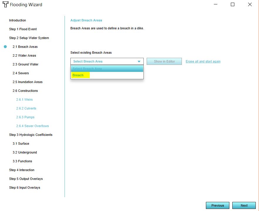 Select breach.JPG 883 × 719; 50 KB
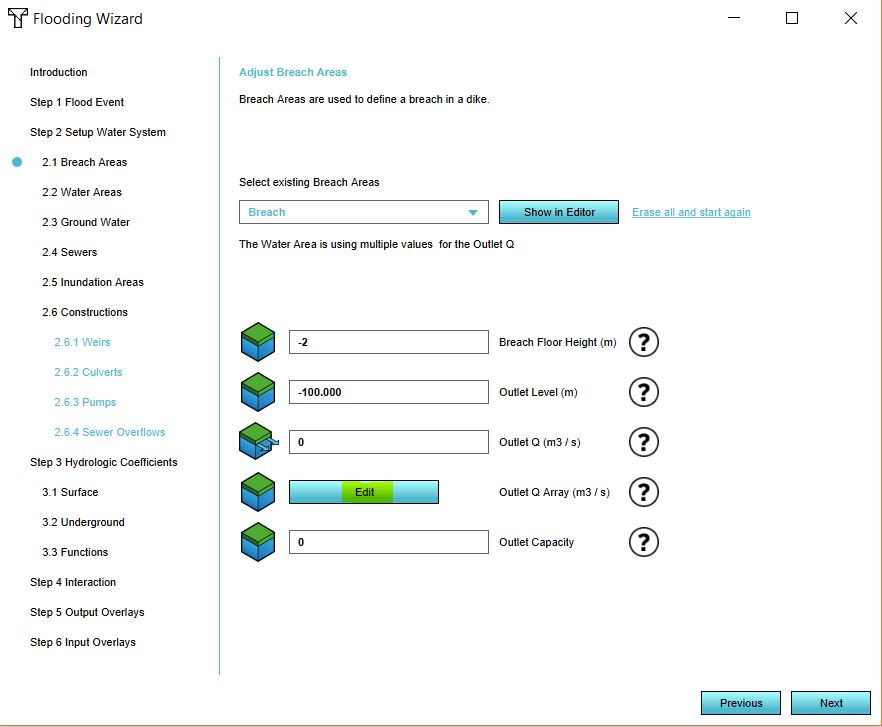 Edit breach.JPG 882 × 727; 65 KB
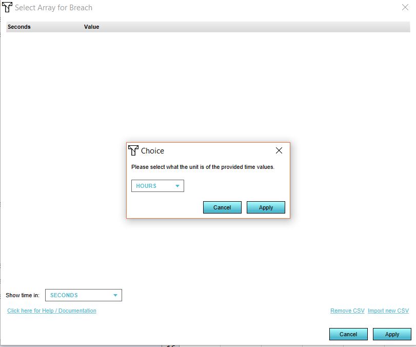 Time units.JPG 811 × 676; 36 KB
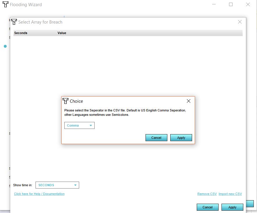 Seperator.JPG 883 × 732; 47 KB
 Apply file.JPG 878 × 724; 59 KB
 Config wizard.JPG 2,035 × 332; 176 KB
 Breach two.JPG 885 × 691; 67 KB
 Breach 2 csv.JPG 374 × 356; 26 KB
 Breach areas.JPG 1,451 × 456; 80 KB
 Create area.JPG 726 × 1,074; 114 KB
 Location area.JPG 1,213 × 976; 150 KB
 Draw area.JPG 1,442 × 780; 180 KB
 Area attributes.JPG 519 × 629; 69 KB
 Breach scenario 2.JPG 1,495 × 646; 115 KB
 Waterbalance scenario2.JPG 884 × 483; 39 KB
 Distance sight.jpg 1,076 × 691; 257 KB
 Distance sight hover.jpg 1,079 × 692; 239 KB
 Calculation time.JPG 876 × 265; 40 KB
 Image quality hd movie.jpg 1,378 × 889; 244 KB
 Output directory hd movie.jpg 1,378 × 889; 242 KB
 Quality hd movie.jpg 1,378 × 889; 242 KB
 Specify framerate hd movie.jpg 1,378 × 889; 246 KB
 Select visuals.jpg 769 × 530; 109 KB
 Image quality video.jpg 1,377 × 891; 277 KB
 Output directory video.jpg 1,377 × 891; 276 KB
 Specify framerate video.jpg 1,377 × 891; 280 KB
 Specify image quality video.jpg 1,376 × 897; 263 KB
 Start recording video.jpg 1,377 × 891; 273 KB
 Video recording panel button.jpg 1,377 × 891; 273 KB
 Video recording panel.jpg 1,377 × 891; 277 KB
 Legend colours.jpg 442 × 757; 68 KB
 Add the ds.jpg 1,294 × 791; 198 KB
 Overlays ribbon.jpg 1,294 × 791; 198 KB
 Select geodata.jpg 1,294 × 791; 199 KB
 Remove the ds overlay.jpg 451 × 982; 71 KB
 Confirm remove.jpg 1,072 × 692; 189 KB
 Graph flooding.JPG 788 × 598; 96 KB
 Visualization flooding.JPG 1,453 × 784; 180 KB
 Geo data 6.jpg 881 × 685; 46 KB
 Geo data 9.png 878 × 690; 22 KB
 Geo data 10.jpg 882 × 691; 46 KB
 Example traffic model excel.jpg 1,434 × 840; 206 KB
 Example traffic model excel panel.jpg 1,294 × 820; 206 KB
 Excel panel.jpg 1,294 × 819; 204 KB
 Change student password.png 1,565 × 850; 143 KB
 Tools bar.jpg 837 × 495; 112 KB
 Screenshot bar.jpg 837 × 495; 112 KB
 Take screenshot.jpg 837 × 495; 113 KB
 Change dir.jpg 837 × 495; 113 KB
 3d graphics.jpg 837 × 495; 114 KB
 Free cam ribbon bar.jpg 863 × 498; 113 KB
 Start free cam navigation.jpg 863 × 498; 113 KB
 Switch to high 3d graphics.jpg 863 × 498; 114 KB
 Tools video.jpg 847 × 475; 117 KB
 Video ribbon bar.jpg 847 × 475; 117 KB
 Start video recording.jpg 847 × 475; 118 KB
 Switch 3D graphics.jpg 847 × 475; 118 KB
 Change directory.jpg 847 × 475; 119 KB
 Left panel indicators.jpg 298 × 341; 24 KB
 Top bar indicators eng.jpg 1,072 × 90; 36 KB
 Add vector layer.jpg 476 × 228; 20 KB
 Coordinate reference system.jpg 984 × 587; 78 KB
 Format.jpg 585 × 629; 70 KB
 File name.jpg 830 × 661; 74 KB
 Select crs.jpg 752 × 626; 75 KB
 Select save as.jpg 647 × 536; 43 KB
 New file added.jpg 451 × 307; 14 KB
 New window.jpg 585 × 629; 66 KB
 Choose name.jpg 585 × 629; 70 KB
 Choose crs.jpg 585 × 629; 70 KB
 Select ok.jpg 588 × 627; 69 KB
 Select layer.jpg 454 × 436; 45 KB
 Add layer.jpg 568 × 426; 83 KB
 Select vector layer.jpg 571 × 431; 83 KB
 Add vector layer1.jpg 476 × 228; 21 KB
 Layer panel.jpg 327 × 256; 13 KB
 Terrain.JPG 503 × 380; 30 KB
 Add heat stress.JPG 942 × 549; 156 KB
 Reset.JPG 528 × 454; 76 KB
 Housing target panel.JPG 432 × 405; 27 KB
 Add attribute plangebied.JPG 289 × 167; 17 KB
 Global woningdoel.JPG 291 × 354; 20 KB
 Safety indicator .png 252 × 205; 57 KB
 Add safety distance overlay.jpg 628 × 655; 74 KB
 Overkluizing.jpg 297 × 361; 21 KB
 Gevaarlijk vervoer.jpg 288 × 376; 21 KB
 Protest indicator panel.jpg 514 × 293; 29 KB
 Groundwater1.png 710 × 411; 54 KB
 Groundwater2.png 778 × 489; 16 KB
 Groundwater explain.png 525 × 699; 130 KB
 Groundwater explain2.png 558 × 683; 162 KB
 Green MKP indicator.png 607 × 471; 256 KB
 Geo data safety distance overlay.jpg 1,224 × 786; 191 KB
 Overlays bar safety distance.jpg 1,224 × 786; 192 KB
 Add safety distance.jpg 1,224 × 786; 192 KB
 Safety distance overlay list.jpg 898 × 538; 121 KB
 Safety distance overlay selected.jpg 488 × 780; 69 KB
 Remove safety distance overlay.jpg 361 × 980; 51 KB
 Confirm removal safety distance overlay.jpg 1,078 × 691; 193 KB
 Safety distance overlay 3d world.jpg 1,076 × 692; 222 KB
 Safety distance overlay hover.jpg 1,078 × 696; 229 KB
 Student housing indicator.PNG 371 × 294; 111 KB
 Housing target.jpg 316 × 236; 16 KB
 Housing score.jpg 318 × 272; 17 KB
 Satefy distance.JPG 765 × 310; 32 KB
 Import area.png 917 × 369; 246 KB
 Boxshadow.png 230 × 3; 3 KB
 Overlay icon custom color areas.png 55 × 55; 1,013 bytes
 Overlay icon difference.png 38 × 38; 347 bytes
 Overlay icon disturbance distance.png 55 × 55; 1 KB
 Overlay icon safety distance.png 55 × 55; 1,006 bytes
 Overlay icon flooding area.png 55 × 55; 1,018 bytes
 Overlay icon ground water.png 55 × 55; 2 KB
 Overlay icon water debug walls.png 55 × 55; 1 KB
 SelectOverlayPopUp2.jpg 643 × 656; 92 KB
 OverlayParameters2.jpg 683 × 917; 173 KB
 Waterwizard icon avg water areas.png 40 × 40; 1 KB
 Waterwizard icon dry large.png 85 × 85; 3 KB
 Waterwizard icon evaporation.png 40 × 40; 2 KB
 Waterwizard icon horizontal infiltration.png 40 × 40; 2 KB
 Waterwizard icon introduction.png 394 × 300; 40 KB
 Waterwizard icon map layer.png 175 × 112; 8 KB
 Waterwizard icon rain.png 40 × 40; 888 bytes
 Waterwizard icon rain large.png 85 × 85; 2 KB
 Waterwizard icon result type.png 40 × 40; 2 KB
 Waterwizard icon timeframes.png 40 × 40; 2 KB
 Waterwizard icon upper threshold.png 40 × 40; 2 KB
 Waterwizard icon urbanization.png 40 × 40; 2 KB
 Waterwizard icon water area layer.png 175 × 112; 2 KB
 Waterwizard icon water areas schematic.png 400 × 300; 37 KB
 Waterwizard icon water height.png 40 × 40; 2 KB
 Waterwizard icon water level layer.png 175 × 112; 3 KB
 Waterwizard icon weir layer.png 175 × 112; 2 KB
 Waterwizard icon weir speed attribute.png 40 × 40; 2 KB
 Waterwizard icon weir type.png 40 × 40; 1 KB
 Overlay icon water evaporated.png 55 × 55; 1 KB
 Help mini.png 16 × 16; 226 bytes
 DamBreachMovieThumb1.png 1,174 × 664; 1.26 MB
 LogIn1.png 754 × 567; 177 KB
 CreateOrLoadProject1.png 328 × 147; 8 KB
 GettingStarted1.png 1,000 × 613; 343 KB
 ProjectInEditor1.png 1,920 × 1,161; 2.1 MB
 GridCellWarning1.png 237 × 29; 8 KB
 GridOverlayRightSidePanel1.png 300 × 807; 22 KB
 AdjustGridSizePanel1.png 585 × 392; 9 KB
 GridSize1.png 540 × 240; 3 KB
 SelectWaterOverlayPopUp1.jpg 643 × 656; 92 KB
 2D-Saint-Venant system.png 853 × 193; 18 KB
 ResultTypeDropDownMenu1.jpg 297 × 348; 22 KB
 SetCalculationPrefs1.jpg 197 × 59; 4 KB
 PlaceholderImg1.png 240 × 240; 3 KB
 RainfallOverlay3.jpg 1,319 × 825; 369 KB
 RainfallOverlayminiMap1.jpg 386 × 464; 62 KB
 GridOverlayPlayerBtns1.jpg 510 × 133; 23 KB
 GridOverlayPlayerBtns2.jpg 800 × 500; 110 KB
 RainfallHoverpanel1.jpg 379 × 298; 40 KB
 LineMeasurementRainfall1.jpg 694 × 586; 126 KB
 PointMeasurementRainfall1.jpg 720 × 589; 126 KB
 StoredMeasurementsRainfall1.jpg 768 × 795; 138 KB
 Sewer overflow model2.png 683 × 487; 19 KB
 Sewer overflow model.png 712 × 580; 42 KB
 FloodingWizardFloodEvent1.jpg 886 × 743; 74 KB
 Underground model.png 871 × 434; 47 KB
 Undergroundflow.png 649 × 435; 34 KB
 Configure button.png 100 × 100; 5 KB
 Tips button.png 100 × 100; 4 KB
 Use cases button.png 100 × 100; 4 KB
 Gezondheid.jpg 328 × 178; 15 KB
 Verkoeling.jpg 308 × 261; 27 KB
 Neighborhood attribute.JPG 824 × 545; 81 KB
 Add area.JPG 704 × 994; 105 KB
 User management tutorial.png 384 × 304; 113 KB
 Auto update on.JPG 246 × 198; 16 KB
 Auto update off.JPG 250 × 190; 15 KB
 Manual update.JPG 234 × 187; 15 KB
 Community hub.png 586 × 162; 59 KB
 Topbar indicators.png 1,081 × 84; 142 KB
 Topbar Indicators.png 1,081 × 84; 143 KB
 Index in indicatorpanel.png 413 × 425; 23 KB
 Export geojson file.JPG 543 × 396; 44 KB
 Export options.JPG 583 × 288; 25 KB
 Editor ribbon header futuredesign.jpg 1,556 × 103; 34 KB
 Editor ribbon header multistakeholder.jpg 1,552 × 102; 35 KB
 Testbed ConstructionAttribute5.jpg 375 × 350; 40 KB
 Sewer model.png 887 × 536; 120 KB
 Add function.JPG 606 × 115; 19 KB
 Kockengen figure05.PNG 884 × 744; 36 KB
 Kockengen figure09.PNG 918 × 786; 30 KB
 Kockengen figure12.PNG 885 × 744; 42 KB
 Kockengen figure16.PNG 856 × 744; 52 KB
 Main menu options.jpg 290 × 359; 27 KB
 Invite 2019.jpg 458 × 170; 19 KB
 Actions.png 305 × 131; 62 KB
 LTS Release 2019 header.png 800 × 333; 94 KB
 Editor game interface maximize.jpg 263 × 191; 72 KB
 Interface game 3D Visualization.jpg 1,511 × 920; 258 KB
 Kockengen tutorial rain event.JPG 933 × 741; 62 KB
 Kockengen tutorial sewer areas.JPG 951 × 791; 50 KB
 StakeholderTab.jpg 912 × 104; 25 KB
 Stakeholder types.png 292 × 407; 7 KB
 Update tql.JPG 1,140 × 689; 110 KB
 Building import.PNG 936 × 743; 36 KB
 Import building.png 421 × 421; 41 KB
 Waterlevel p6 case4 ukbm.png 472 × 391; 18 KB
 Overlay icon heat bowen ratio.png 55 × 55; 2 KB
 Overlay icon heat.png 55 × 55; 1 KB
 Constructionspanel-2019.jpg 303 × 1,032; 64 KB
 Constructionspanel small-2019.jpeg 200 × 681; 35 KB
 Indicator editor panel parking.jpg 200 × 686; 31 KB
 Indicator target panel parking.jpg 800 × 117; 15 KB
 WizardRealDataSelectSize.jpg 1,306 × 783; 187 KB
 WizardRealDataFull.jpg 1,306 × 783; 187 KB
 WizardSelectArea.jpg 1,306 × 783; 190 KB
 WizardGenerateButton.jpg 1,306 × 783; 187 KB
 WizardSelectTemplate.jpg 782 × 782; 98 KB
 WizardGenerated3DWorldTemplate.jpg 1,920 × 1,160; 436 KB
 Interface game minimap.jpg 370 × 399; 50 KB
 Stakeholder dropdown menu.jpg 685 × 641; 121 KB
 Transfer ownership.png 1,075 × 197; 6 KB
 Calculation panel peak hours.png 925 × 386; 44 KB
 Sun motion angles (Heat Overlay).png 545 × 692; 79 KB
 Foliage diameter.png 640 × 480; 6 KB
 OculusDK2-1.jpg 550 × 394; 25 KB
 SelectDK2-1a.jpg 500 × 301; 27 KB
 Wss 1.JPG 678 × 657; 79 KB
 Wss impacted.JPG 929 × 740; 70 KB
 Wss reset x.JPG 949 × 456; 62 KB
 Wss select id.JPG 780 × 488; 30 KB
 Wss excel new.JPG 1,100 × 635; 143 KB
 Wss install.JPG 823 × 657; 78 KB
 Wss done install.JPG 793 × 658; 79 KB
 Wss indicator panel.JPG 400 × 444; 40 KB
 Wss function values.JPG 919 × 481; 77 KB
 Change grid.JPG 300 × 499; 30 KB
 Example boomkronen.JPG 892 × 706; 83 KB
 Foliage areas in platform.JPG 1,327 × 469; 110 KB
 Heat-step3.PNG 936 × 793; 25 KB
 Heat-step3.1.PNG 936 × 793; 22 KB
 Heat-step3.2.PNG 936 × 793; 20 KB
 Heat-step4.PNG 936 × 793; 32 KB
 Weirs angel.jpg 930 × 790; 86 KB
 Wageningen project area.PNG 666 × 375; 336 KB
 Wageningen project area th.PNG 666 × 375; 336 KB
 Difference overlay.png 110 × 110; 6 KB
 Difference overlay icoon.jpg 110 × 110; 6 KB
 Step 3.1 Foliage Functions.jpg 933 × 535; 54 KB
 Step 3.2 Visualize Crown Factor.jpg 931 × 535; 48 KB
 General tab kockengen tut.JPG 288 × 644; 31 KB
 Simulation period.JPG 929 × 736; 99 KB
 Naming peilgebied.JPG 929 × 451; 35 KB
 Water level peilgebieden.JPG 924 × 333; 32 KB
 Ahn naming.JPG 934 × 468; 34 KB
 Ahn water level.JPG 930 × 405; 32 KB
 PE Temperature.jpg 1,082 × 684; 378 KB
 PE Temperature Relative.jpg 1,079 × 681; 324 KB
 Other child overlays.jpg 1,079 × 681; 281 KB
 Demolish.jpg 1,080 × 682; 228 KB
 Build trees.jpg 1,078 × 684; 211 KB
 Help.jpg 290 × 117; 12 KB
 New project sources.jpg 1,115 × 667; 212 KB
 Empty project or template.jpg 669 × 666; 95 KB
 Area size.jpg 1,115 × 667; 228 KB
 Selection or empty map.jpg 1,117 × 669; 223 KB
 Sky view data.JPG 1,319 × 695; 344 KB
 Shade.jpg 1,321 × 711; 281 KB
 Terrain height brush bottom.jpg 560 × 198; 37 KB
 Editor ribbon header community.jpg 1,334 × 105; 28 KB
 Editor ribbon header tools.jpg 1,167 × 105; 20 KB
 Editor ribbon icon community.png 30 × 30; 1 KB
 Paste wfs.JPG 916 × 782; 48 KB
 View area.JPG 1,915 × 734; 354 KB
 Advanced settings.JPG 1,116 × 670; 210 KB
 NSL attributes.JPG 297 × 716; 50 KB
 QA wanner terrain building wiki.jpg 384 × 200; 102 KB
 QA parametrisch ontwerpen wiki.jpg 384 × 200; 96 KB
 QA testrun wiki.jpg 384 × 200; 95 KB
 QA wanner terrain building wiki3.jpg 384 × 200; 102 KB


.png)


