Unused files
Jump to navigation
Jump to search
The following files exist but are not embedded in any page. Please note that other web sites may link to a file with a direct URL, and so may still be listed here despite being in active use.
Showing below up to 239 results in range #501 to #739.
View (previous 500 | next 500) (20 | 50 | 100 | 250 | 500)
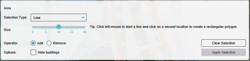
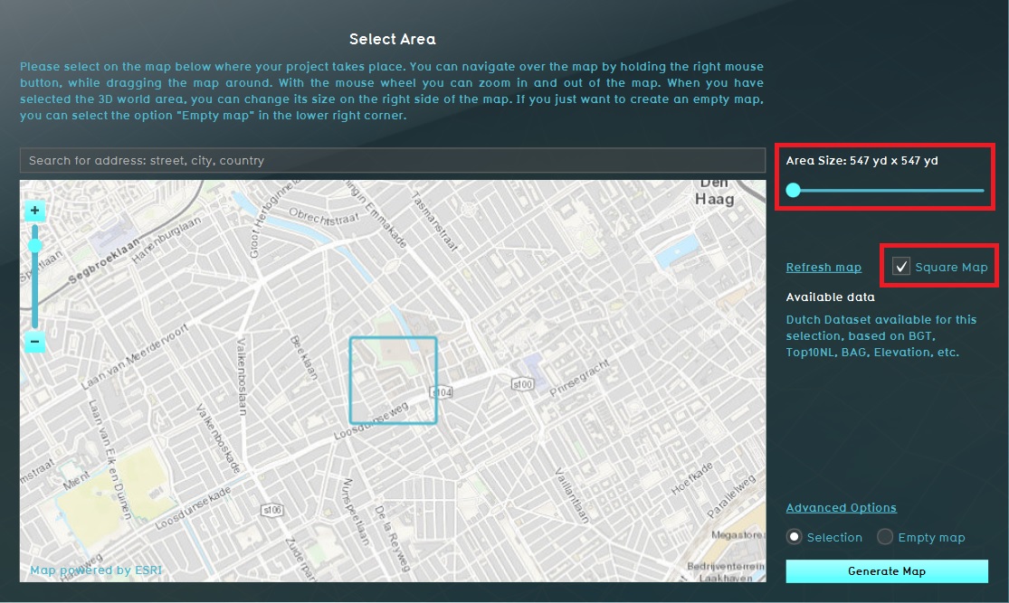 Area size.jpg 1,115 × 667; 228 KB
 Selection or empty map.jpg 1,117 × 669; 223 KB
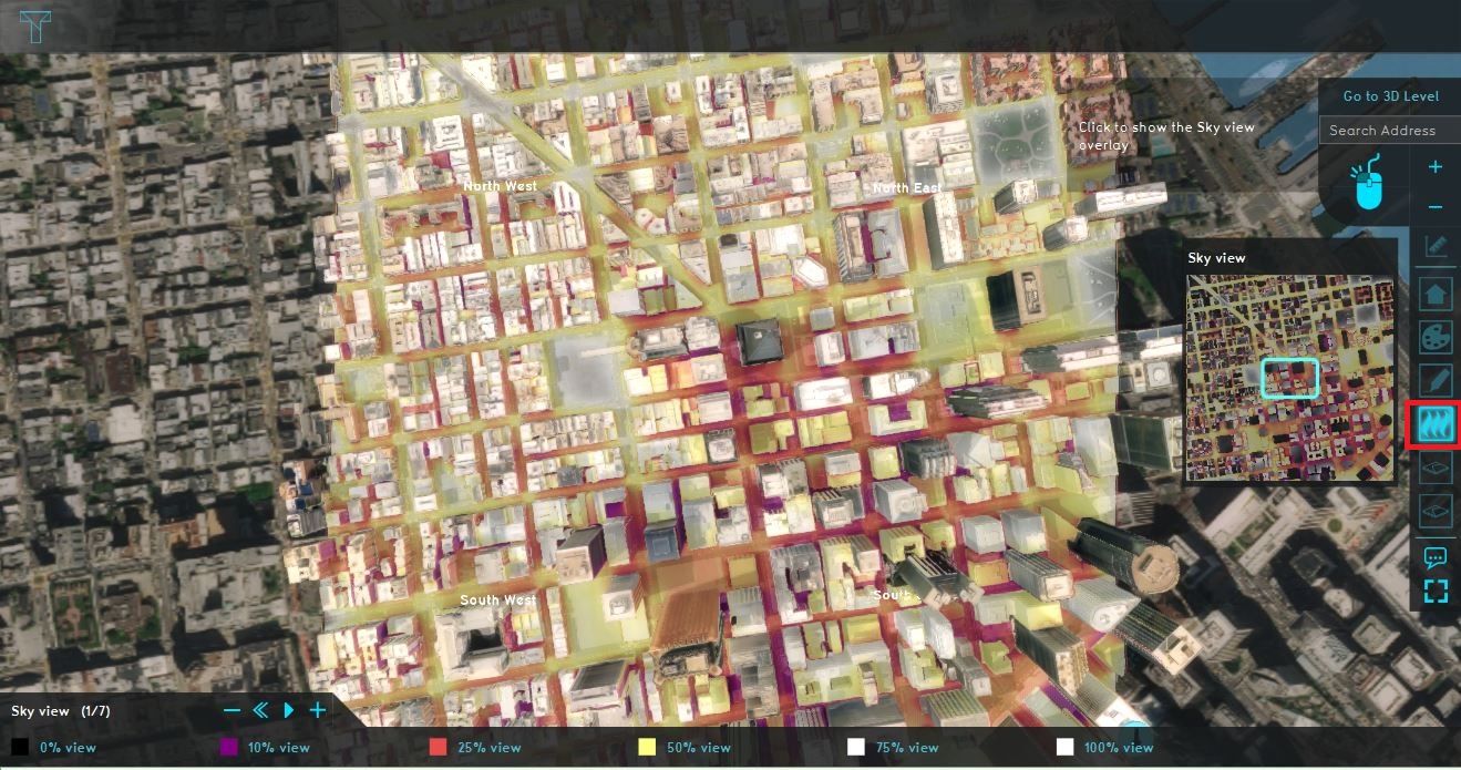 Sky view data.JPG 1,319 × 695; 344 KB
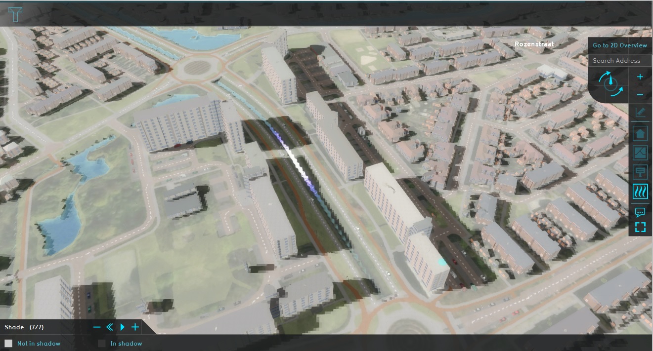 Shade.jpg 1,321 × 711; 281 KB
 Terrain height brush bottom.jpg 560 × 198; 37 KB
 Editor ribbon header community.jpg 1,334 × 105; 28 KB
 Editor ribbon header tools.jpg 1,167 × 105; 20 KB
 Editor ribbon icon community.png 30 × 30; 1 KB
 Paste wfs.JPG 916 × 782; 48 KB
 View area.JPG 1,915 × 734; 354 KB
 Advanced settings.JPG 1,116 × 670; 210 KB
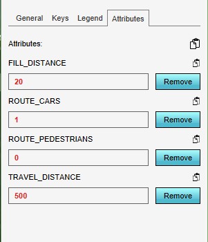
 NSL attributes.JPG 297 × 716; 50 KB
 QA wanner terrain building wiki.jpg 384 × 200; 102 KB
 QA parametrisch ontwerpen wiki.jpg 384 × 200; 96 KB
 QA testrun wiki.jpg 384 × 200; 95 KB
 QA wanner terrain building wiki3.jpg 384 × 200; 102 KB
 QA verschil terrains buildings measures wiki.jpg 384 × 200; 109 KB
 QA verschil terrains buildings measures wiki2.jpg 384 × 200; 109 KB
 QA verkeersbronnen wiki.jpg 384 × 200; 94 KB
 QA NWBID wiki.jpg 384 × 200; 101 KB
 Polygons exporteren wiki.png 384 × 200; 121 KB
 Watershed discharge areas initial.png 1,676 × 963; 1.52 MB
 Watershed discharge areas culverts.png 1,679 × 959; 1.52 MB
 Watershed direction.png 1,677 × 956; 1.79 MB
 Watershed water level.png 1,678 × 957; 1.44 MB
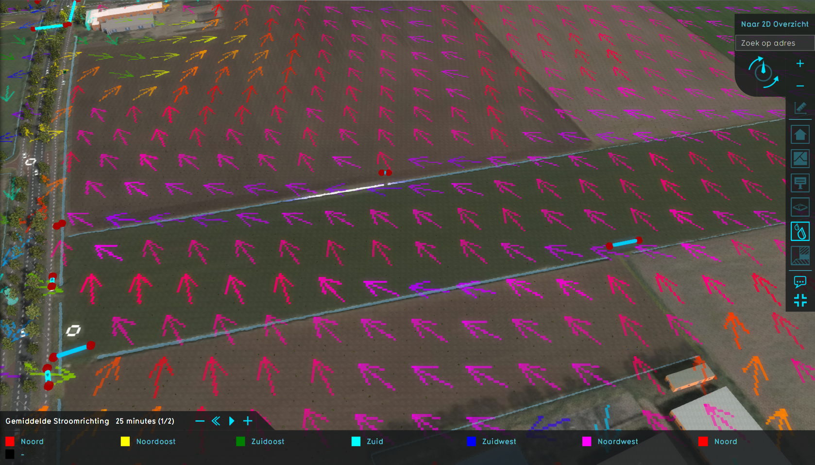 Watershed water direction.png 1,678 × 957; 1.76 MB
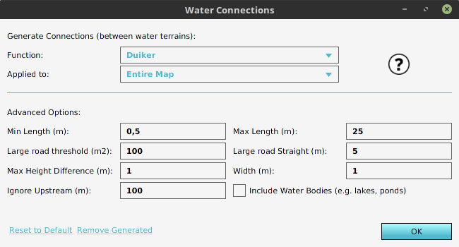 WaterConnectionGenerator.png 650 × 350; 25 KB
 Small straight.jpeg 1,078 × 676; 42 KB
 Large straight.jpeg 1,077 × 673; 40 KB
 Aeriuswizard icon plan category amounts.png 40 × 40; 5 KB
 Placeholder100x100.jpg 100 × 100; 4 KB
 Parametric design selection.jpg 1,078 × 659; 65 KB
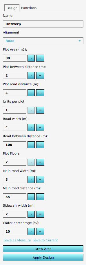 Parametric design panel.jpg 297 × 917; 37 KB
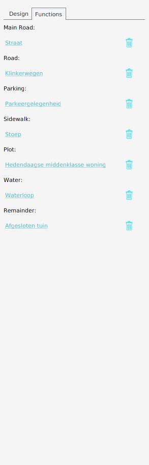 Parametric design functions.jpg 293 × 915; 13 KB
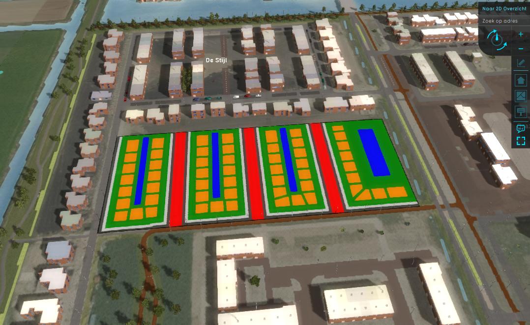 Parametric design layout.jpeg 1,078 × 661; 109 KB
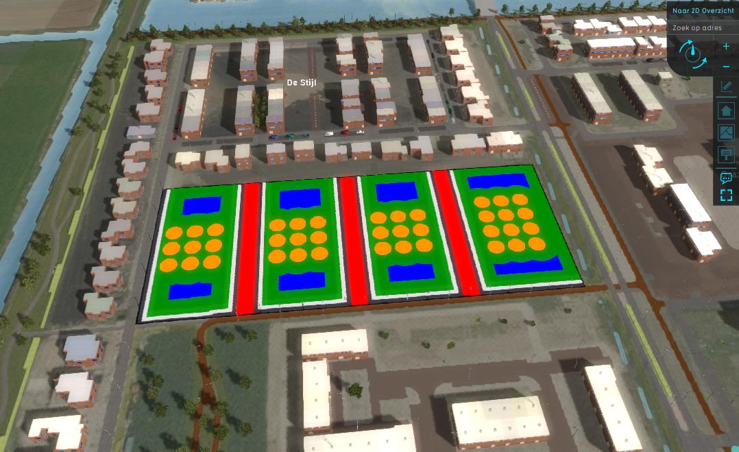
 Parametric design application.jpeg 1,077 × 661; 104 KB
 Parametric design spaced.jpeg 1,078 × 659; 109 KB
 Parametric design demo example tweaked 1.jpg 239 × 48; 5 KB
 Parametric design demo example tweaked 2.jpg 239 × 48; 5 KB
 Parametric design demo example tweaked 3.jpg 239 × 48; 4 KB
 Demo project parametric design.jpg 1,918 × 1,015; 774 KB
 Parametric design demo example predefined 1.jpg 1,918 × 1,015; 705 KB
 Parametric design demo example predefined 2.jpg 1,918 × 1,015; 636 KB
 Parametric design demo example tweaked 4.jpg 1,918 × 1,015; 644 KB
 Parametric design demo example created 1.jpg 1,918 × 1,015; 554 KB
 Parametric design demo example created 2.jpg 1,918 × 1,015; 617 KB
 Parametric design demo example mixed 1.jpg 1,918 × 1,015; 658 KB
 Waterwijzer button.png 30 × 30; 1 KB
 Demo project ww agriculture.jpg 1,920 × 1,017; 502 KB
 Demo ww agricultiure indexation panel.jpg 650 × 400; 64 KB
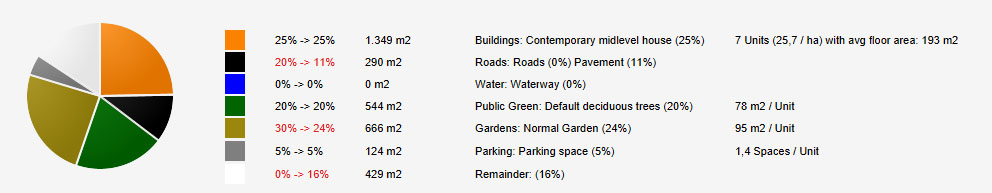
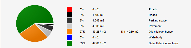 Pie chart parametric.jpg 746 × 190; 65 KB
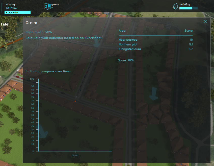 Green indicator parametric.jpg 848 × 657; 320 KB
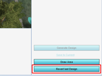
 Revert last design.jpg 434 × 380; 89 KB
 Parametric design right panel.jpg 297 × 782; 93 KB
 Add parametric design.jpg 297 × 475; 57 KB
 Parametric functions.jpg 297 × 470; 38 KB
 Road value.jpg 800 × 491; 150 KB
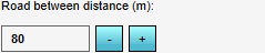
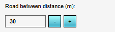 Road between distance.jpg 226 × 63; 18 KB
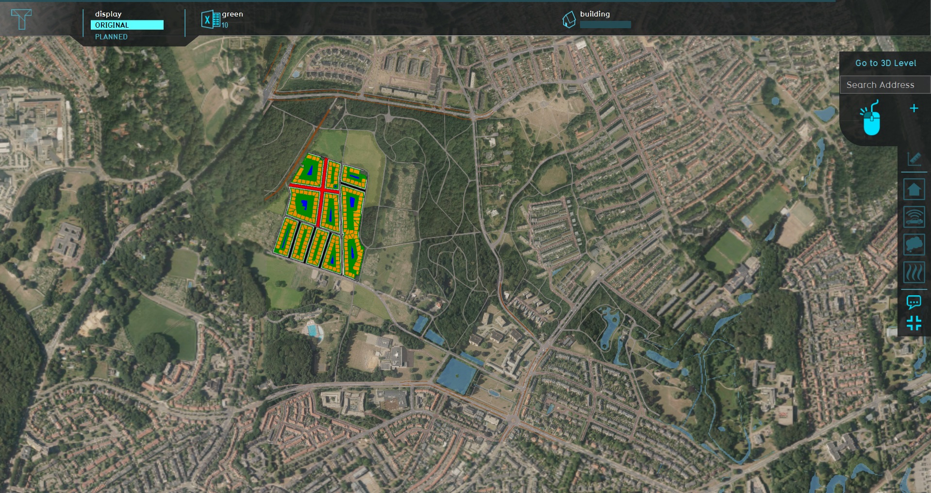
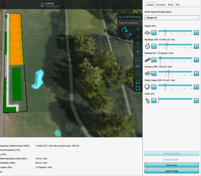
 Parametric designs urban.jpg 1,200 × 634; 515 KB
 ParamConcept1.jpg 300 × 476; 17 KB
 ParamParameters1.jpg 301 × 841; 44 KB
 Example dtm.PNG 1,326 × 646; 1.8 MB
 Large road straight setting.png 697 × 399; 36 KB
 CSV-logo1.jpg 256 × 256; 14 KB
 CSV-logo1.png 256 × 256; 18 KB
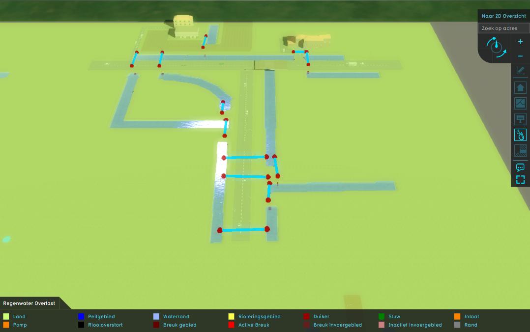
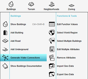 Generate water connections.png 300 × 272; 46 KB
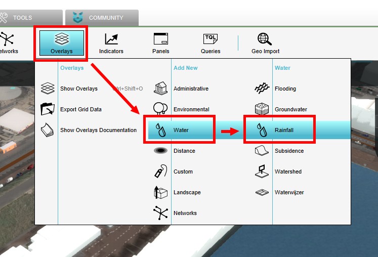 AddRainfallOverlay1.jpg 747 × 508; 72 KB
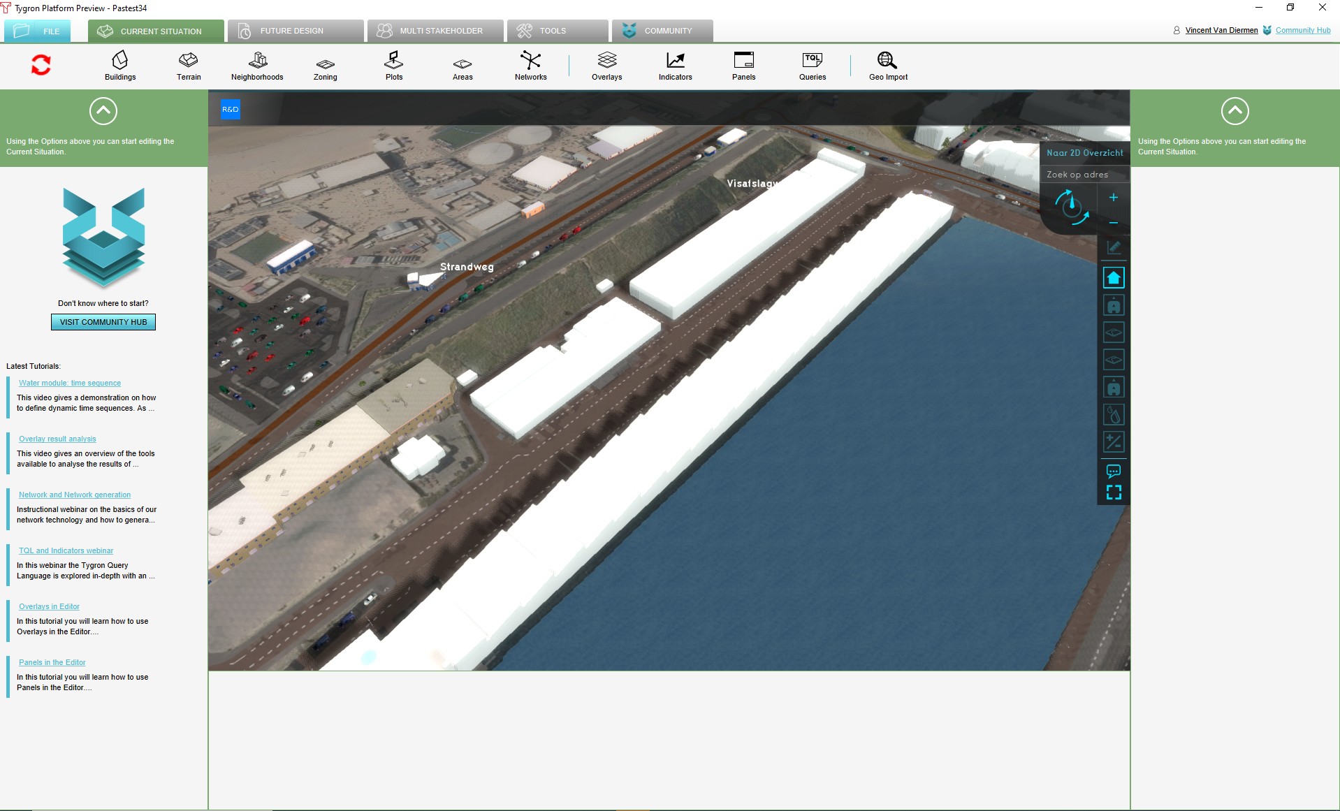 ProjectInEditor1.jpg 1,918 × 1,161; 322 KB
 DTM 2.jpg 1,070 × 364; 491 KB
 Hover panel network overview.jpg 1,093 × 407; 214 KB
 Green indicator panel parametric 2.jpg 914 × 679; 112 KB
 Parametric design demo example executed 2.jpg 1,916 × 1,129; 561 KB
 Parametric design demo example predefined2.jpg 1,920 × 1,132; 492 KB
 Pie chart parametric2.jpg 658 × 170; 21 KB
 Parametric design demo example executed 3.jpg 1,919 × 1,134; 534 KB
 Parametric design demo example predefined 3.jpg 1,920 × 1,129; 590 KB
 Pie chart parametric 3.jpg 661 × 180; 23 KB
 Parametric design right panel 2.jpg 249 × 856; 47 KB
 Parametric design right panel 2a.jpg 249 × 749; 39 KB
 Apply btn1.jpg 294 × 97; 8 KB
 Apply btn1a.jpg 294 × 97; 9 KB
 Streetview.JPG 1,319 × 710; 151 KB
 Cost Budget.JPG 1,322 × 713; 198 KB
 Network Ownership Hover.jpg 1,321 × 698; 198 KB
 Parametric design demo example predefined 4.jpg 1,321 × 832; 310 KB
 Parametric design demo example applied 4.jpg 1,322 × 830; 299 KB
 Parametric design right panel 4a.jpg 273 × 612; 41 KB
 Parametric design demo example tweaked 4a.jpg 272 × 79; 5 KB
 Querries.JPG 1,348 × 514; 137 KB
 Default parametric design values1.jpg 301 × 728; 45 KB
 Parametric functions-2.jpg 300 × 751; 29 KB
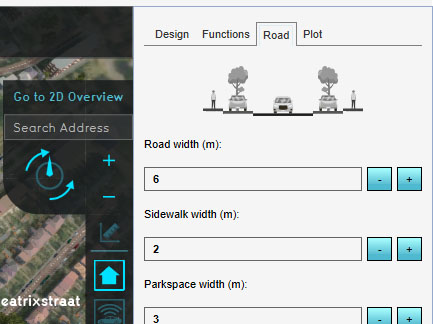
 Road Tab-1.jpg 250 × 563; 31 KB
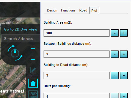
 Plot Tab-1.jpg 250 × 563; 33 KB
 Plot Tab-2.jpg 250 × 604; 33 KB
 Plot Tab-3.jpg 249 × 154; 11 KB
 List Of ParamDesigns-1.jpg 250 × 671; 32 KB
 Combo Overlay with masking1.jpg 1,325 × 834; 301 KB
 Drainage aquifer benchmark.gif 390 × 289; 12 KB
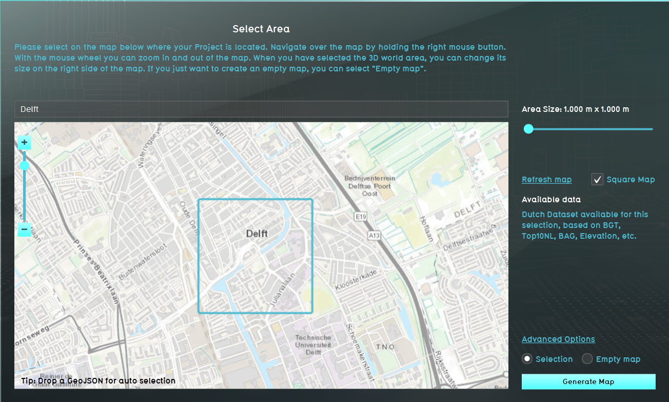 Location Delft tutorial.PNG 1,304 × 783; 1.39 MB
 Grid av.jpg 887 × 484; 126 KB
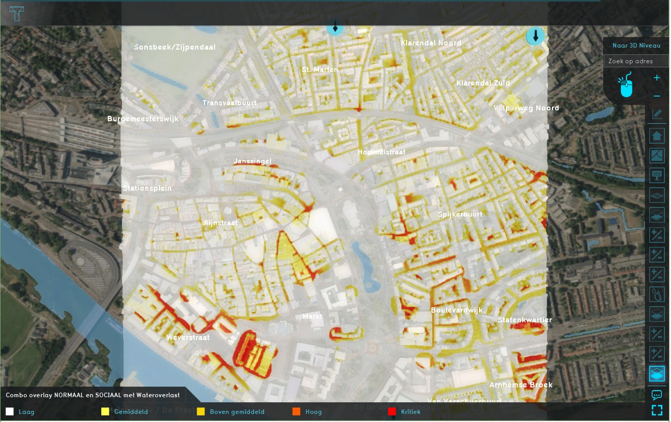
 Combo Overlay.jpg 1,177 × 718; 183 KB
 Drainage.jpg 1,281 × 719; 183 KB
 Parametric 001.jpg 433 × 324; 54 KB
 Parametric 002.jpg 433 × 324; 40 KB
 Parametric 003.jpg 433 × 324; 47 KB
 Parametric 004.jpg 433 × 324; 51 KB
 Parametric 005.jpg 433 × 324; 29 KB
 Parametric 006.jpg 700 × 616; 108 KB
 Parametric 007.jpg 992 × 193; 55 KB
 Parametric 008.jpg 433 × 324; 30 KB
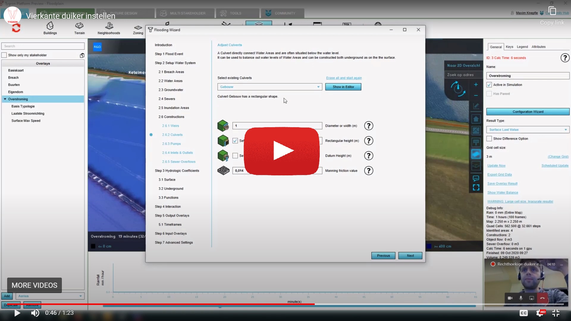 Rectangular culvert.jpg 1,920 × 1,080; 330 KB
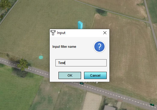 Add filter 002.jpg 521 × 366; 44 KB
 Culvert width.png 100 × 100; 9 KB
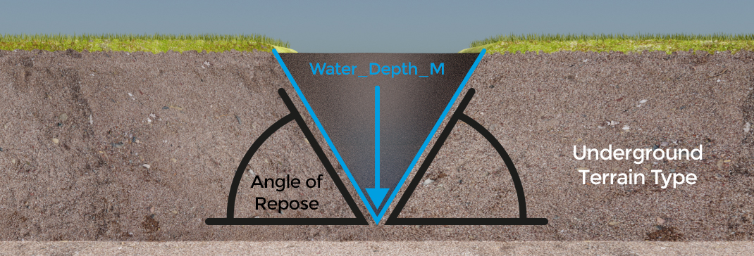
 Max water depth.png 100 × 100; 11 KB
 Max water bottom.png 100 × 100; 10 KB
 Attribute Tab1.jpg 301 × 350; 23 KB
 Video tutorial Domain management.jpg 1,279 × 719; 119 KB
 Recalculate panel2.jpg 940 × 472; 71 KB
 SEssion setup.jpg 693 × 389; 59 KB
 Facilitator tutorial.jpg 701 × 392; 79 KB
 Admin interface.jpg 702 × 391; 79 KB
 How to play.jpg 700 × 393; 75 KB
 Indicators.jpg 701 × 394; 50 KB
 Overlays VT.jpg 700 × 394; 49 KB
 Overlays results.jpg 701 × 393; 67 KB
 Templates.jpg 700 × 394; 54 KB
 Duiker.jpg 1,274 × 716; 118 KB
 Bresgroei modelleren.jpg 1,281 × 719; 106 KB
 Lang rekenen.jpg 1,277 × 717; 111 KB
 Neerslag Radar.jpg 1,277 × 723; 113 KB
 Override buildings.PNG 1,323 × 202; 18 KB
 Basemaphoefkade3.png 629 × 396; 581 KB
 Basemaphoefkade4.png 629 × 396; 580 KB
 Heatstreeshoefkade4.png 629 × 396; 547 KB
 Basemaphoefkade1.png 866 × 400; 718 KB
 Waterstreeshoefkade0.png 1,320 × 832; 1.95 MB
 Summary poster - virtual river game.pdf ; 1.24 MB
 VirtualGame2.png 540 × 462; 37 KB
 Object properties.png 365 × 444; 29 KB
 Environment CRS.png 362 × 327; 23 KB
 Nieuwe kaartlaag.png 459 × 624; 50 KB
 Qgis pseudo mercator.png 857 × 862; 79 KB
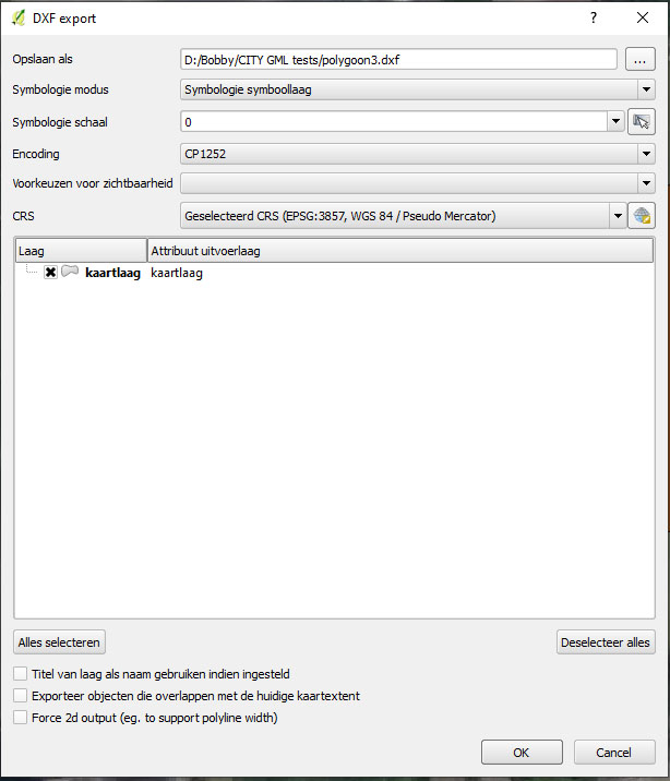 Export DXF2.jpg 614 × 716; 72 KB
 Bridges.jpg 1,274 × 716; 126 KB
 Inlet capacity.jpg 1,276 × 718; 115 KB
 Inlet-outlet.jpg 1,279 × 715; 113 KB
 Sessies movie.jpg 1,274 × 720; 120 KB
 Admin interface video.jpg 1,275 × 717; 117 KB
 Facilitator.jpg 1,278 × 676; 179 KB
 Edu manual feature 2.jpg 845 × 321; 58 KB
 Demo projects.jpg 1,247 × 965; 338 KB
 Demo waardassacker.jpg 1,320 × 712; 371 KB
 Learning1.jpg 840 × 791; 130 KB
 Learning1.png 840 × 791; 299 KB
 Water1.jpg 860 × 1,040; 62 KB
 Lecturer1.jpg 3,872 × 2,592; 1.03 MB
 PowerpointLogo1.jpg 187 × 173; 6 KB
 UrbanPlanning1.jpg 800 × 618; 140 KB
 Trafficwizard icon base no2.png 100 × 100; 3 KB
 Trafficwizard icon background db.png 100 × 100; 3 KB
 Htriver-1-vlakken.jpg 1,320 × 842; 156 KB
 Htriver-3-waterstand.jpg 1,320 × 842; 169 KB
 Htriver-4-polder.jpg 1,320 × 842; 151 KB
 Average overlay.JPG 297 × 390; 28 KB
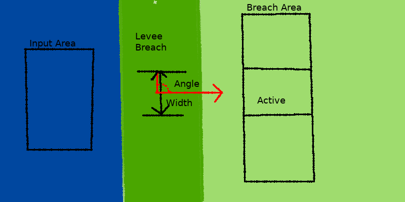
 Breach input area.png 627 × 242; 150 KB
 Breach-top.png 800 × 400; 20 KB
 Breach-side.png 800 × 339; 28 KB
 Breach-side2.png 800 × 339; 28 KB
 Breach-top2.png 800 × 400; 23 KB
 Breach-side3.png 800 × 339; 28 KB
 Breach-top3.png 800 × 400; 21 KB
 Breach-top4.png 800 × 400; 27 KB
 Breach-side4.png 800 × 339; 32 KB
 Breach-side5.png 800 × 339; 32 KB
 Weir drop time.png 100 × 100; 6 KB
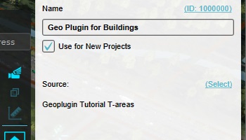 GeoPluginTutorial-geoplugin-source-configured.jpg 350 × 200; 21 KB
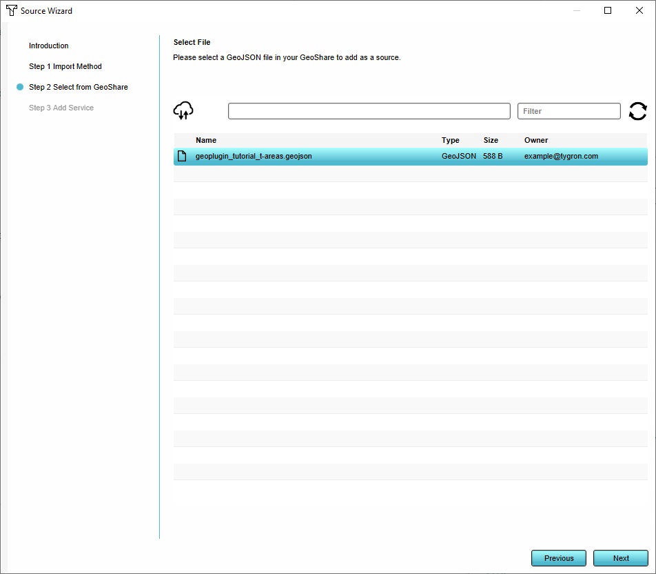 GeoPluginTutorial-source-wizard-geojson.jpg 952 × 832; 68 KB
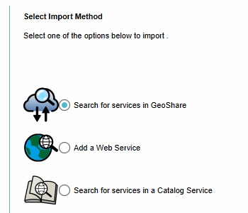 GeoPluginTutorial-source-wizard-geoshare.jpg 350 × 300; 20 KB
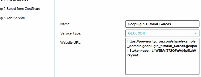 GeoPluginTutorial-source-wizard-url.jpg 650 × 250; 28 KB
 Basics-editor-gsanu-eula.jpg 850 × 650; 209 KB
 Basics-editor-gsanu-mainmenu.jpg 1,280 × 800; 151 KB
 Basics-editor-gsanu-myaccount.jpg 974 × 625; 75 KB
 Basics-editor-gsanu-download.jpg 650 × 450; 73 KB
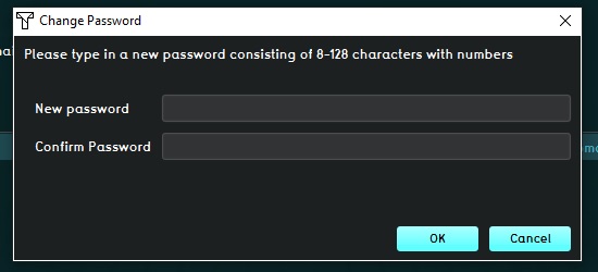 Basics-editor-gsanu-passwordprompt.jpg 550 × 250; 26 KB
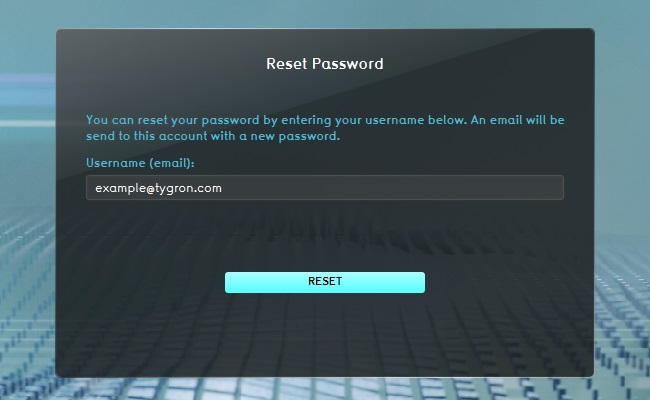 Basics-editor-gsanu-reset.jpg 650 × 400; 46 KB
 Basics-editor-gsanu-settings.jpg 520 × 270; 33 KB
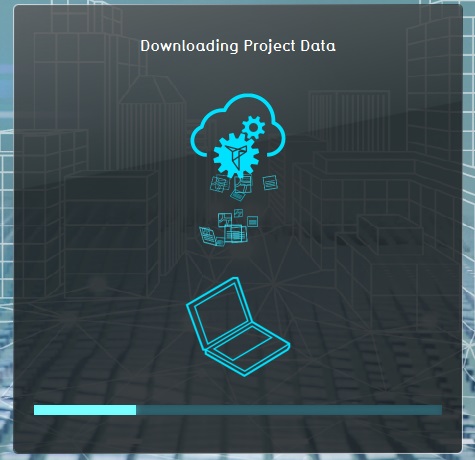 Basics-editor-project-newproject-3dloader.jpg 475 × 460; 52 KB
 Basics-editor-project-newproject-loader.jpg 1,020 × 800; 169 KB
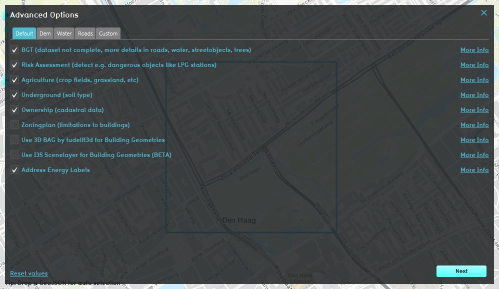 Basics-editor-project-newproject-advanced.jpg 998 × 578; 141 KB
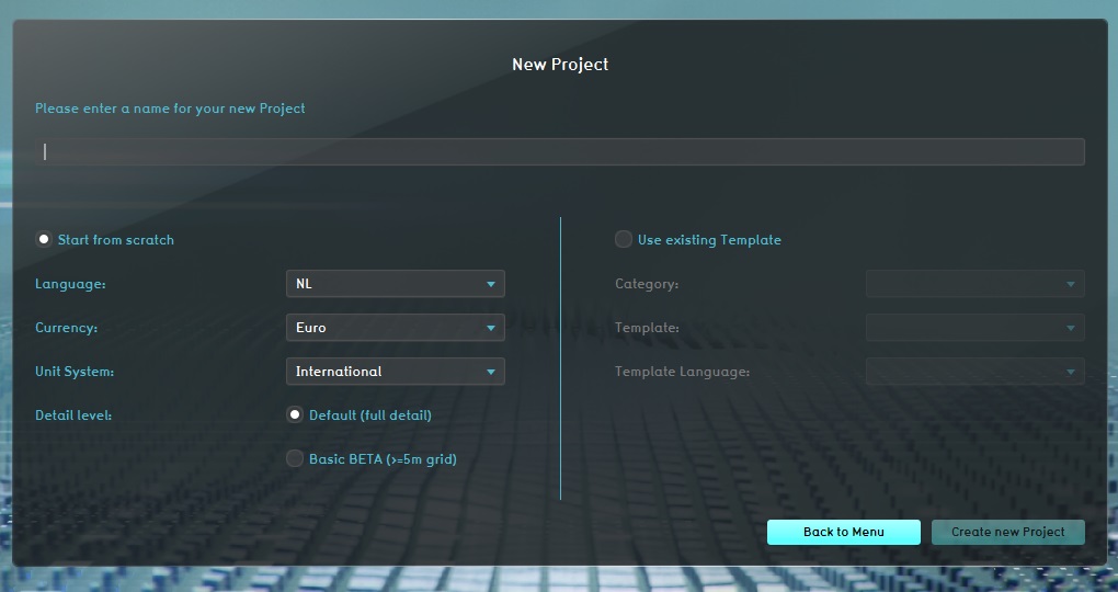 Basics-editor-project-newproject.jpg 1,020 × 540; 80 KB
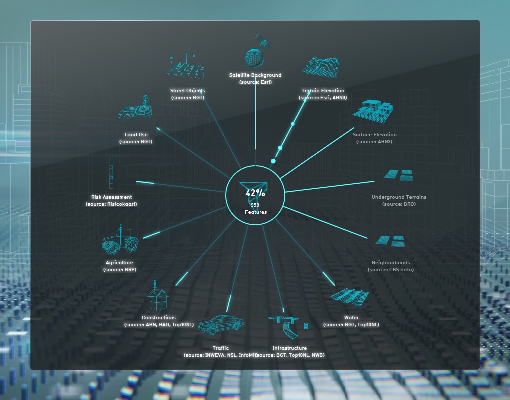
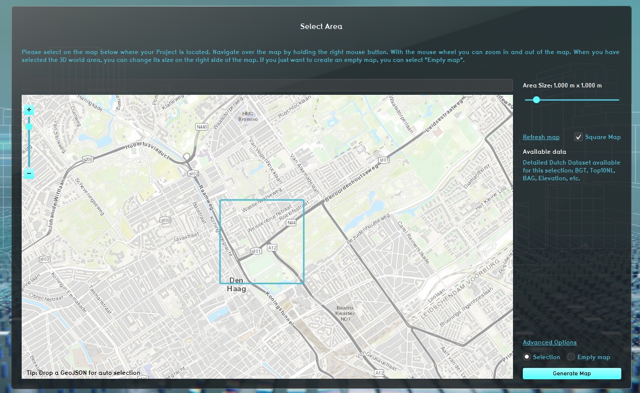 Basics-editor-project-newproject-location.jpg 1,300 × 800; 359 KB
 Basics-editor-project-newproject-new.jpg 450 × 270; 19 KB
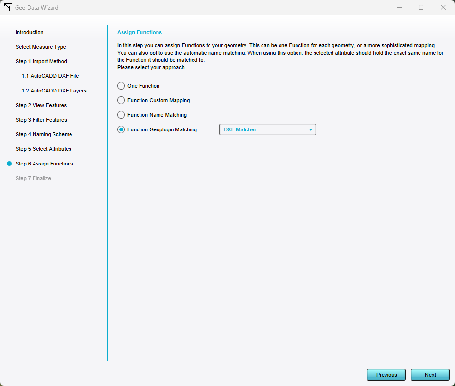 Assign geoplugin functions.png 936 × 793; 50 KB
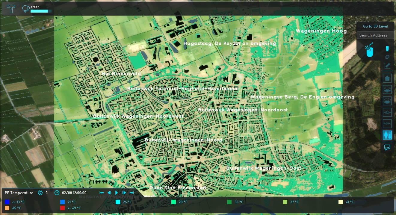 Tutorial trees pe temperature overlay result 3.jpg 1,322 × 718; 501 KB
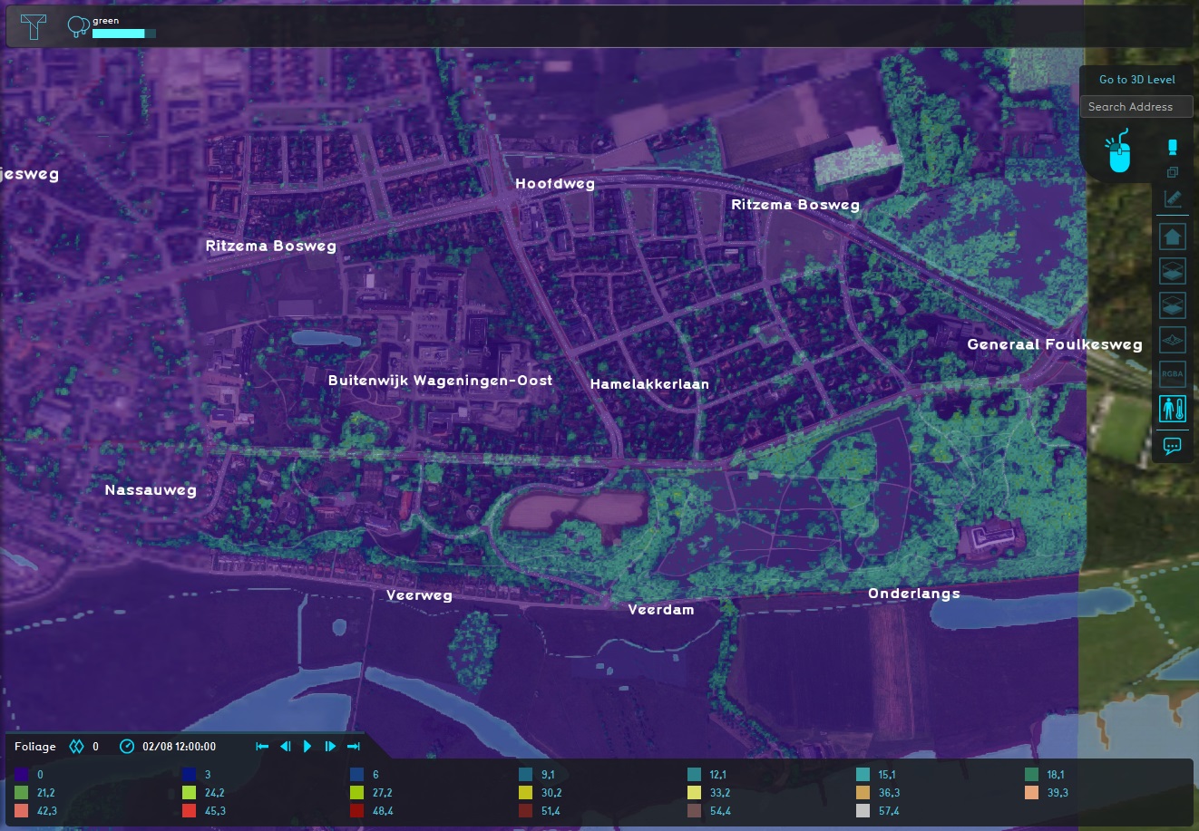 Tutorial trees pe temperature overlay result foliage2.jpg 1,322 × 917; 402 KB
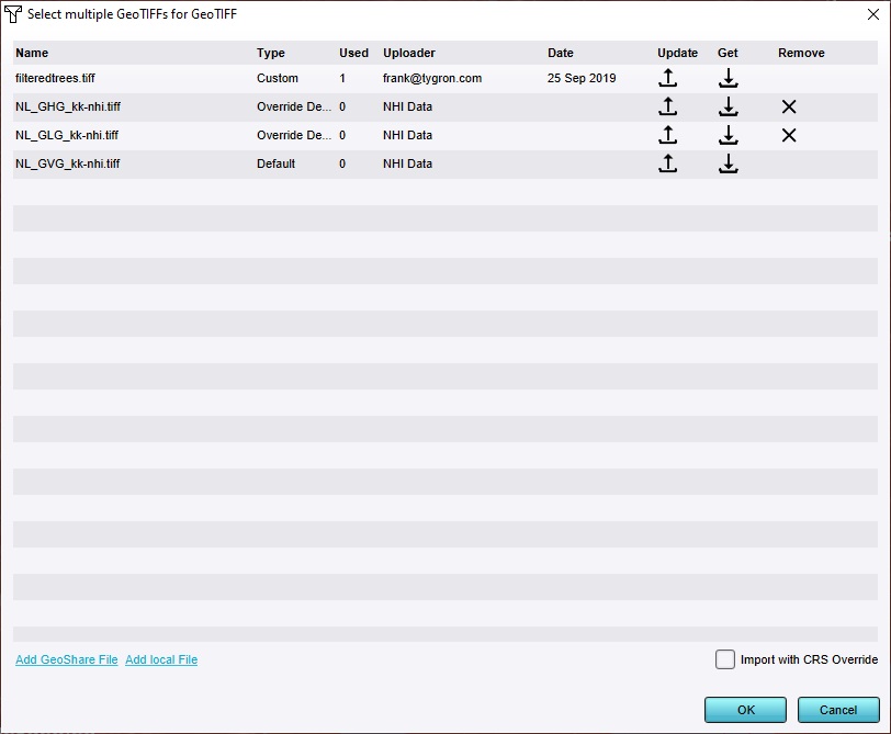 Tutorial trees tiff manager.jpg 812 × 669; 81 KB
 Tutorial trees tiff manager2.jpg 812 × 669; 89 KB
 Tutorial trees geo import6.jpg 936 × 793; 93 KB
 Tutorial trees geo import6 highlight.jpg 936 × 793; 96 KB
 Tutorial trees geo import7.jpg 936 × 793; 80 KB
 Tutorial trees geo import8.jpg 936 × 793; 83 KB
 Tutorial trees pe temperature overlay result 2.jpg 1,322 × 718; 466 KB
 Tutorial trees pe temperature overlay result foliage1.jpg 1,245 × 565; 180 KB
 Tutorial trees geo import1.jpg 939 × 796; 79 KB
 Tutorial trees geo import2.jpg 936 × 793; 100 KB
 Tutorial trees geo import3.jpg 936 × 793; 110 KB
 Tutorial trees geo import4.jpg 936 × 793; 61 KB
 Tutorial trees geo import5.jpg 936 × 793; 70 KB
 Tutorial trees pe temperature overlay result 1.jpg 1,322 × 718; 510 KB
 Tutorial trees function select trees.jpg 814 × 671; 112 KB
 Tutorial trees pe temperature overlay result 0.jpg 1,322 × 718; 516 KB
 Tutorial trees foliage height export option.jpg 350 × 200; 23 KB
 Tutorial trees foliage height export panel.jpg 650 × 390; 62 KB
 Tutorial trees pe temperature overlay.jpg 750 × 330; 108 KB
 Tutorial trees export geo data.jpg 650 × 440; 101 KB
 Tutorial trees export geo data export panel.jpg 650 × 440; 80 KB
 Tutorial trees foliage height.jpg 720 × 300; 77 KB
 Tutorial trees pe temperature overlay result 3-small.jpg 650 × 353; 152 KB
 Tutorial trees pe temperature overlay result foliage2-small.jpg 650 × 450; 131 KB
 Tutorial trees geo import6-small.jpg 650 × 550; 53 KB
 Tutorial trees foliage height-small.jpg 650 × 270; 64 KB
 Combo-overlay-tutorial-avg-add.jpg 687 × 422; 83 KB
 Combo-overlay-tutorial-avg-overlay.jpg 1,680 × 879; 508 KB
 Combo-overlay-tutorial-combo-1.jpg 1,680 × 879; 405 KB
 Combo-overlay-tutorial-combo-2.jpg 1,680 × 879; 467 KB
 Combo-overlay-tutorial-combo-3.jpg 1,680 × 879; 476 KB
 Combo-overlay-tutorial-combo-4.jpg 1,680 × 879; 541 KB
 Combo-overlay-tutorial-combo-5.jpg 1,680 × 879; 520 KB
 Combo-overlay-tutorial-combo-6.jpg 1,680 × 879; 540 KB
 Combo-overlay-tutorial-combo-add.jpg 686 × 423; 86 KB
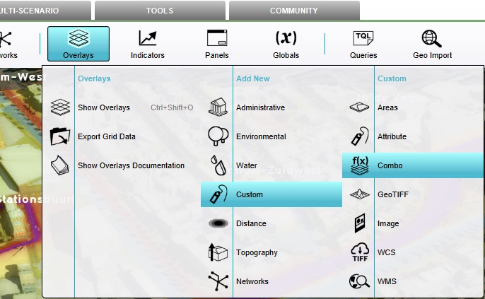
 Combo-overlay-tutorial-traffic-noise-add.jpg 685 × 423; 87 KB
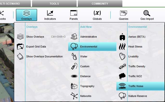
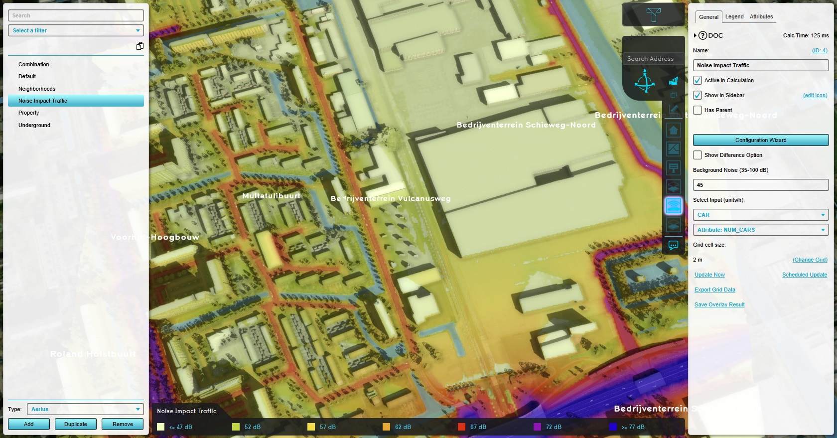 Combo-overlay-tutorial-traffic-noise-overlay.jpg 1,680 × 879; 468 KB
 View area1.JPG 1,200 × 648; 177 KB
 Nodata tool command.PNG 1,059 × 34; 3 KB
 Brush-bottom.jpg 801 × 197; 23 KB
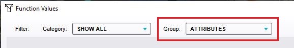 Function group attributes.jpg 578 × 95; 13 KB
 Waterwizard icon microrelief storage.png 100 × 100; 6 KB
 Tutorial GeoData.zip ; 17 KB
- Indicator template.xlsx ; 23 KB


