Watershed Module
The watershed module calculates the result for the following question:
I want to know into which waterway a set of rain drops will end up based on the terrain elevation and the starting location of the drops.
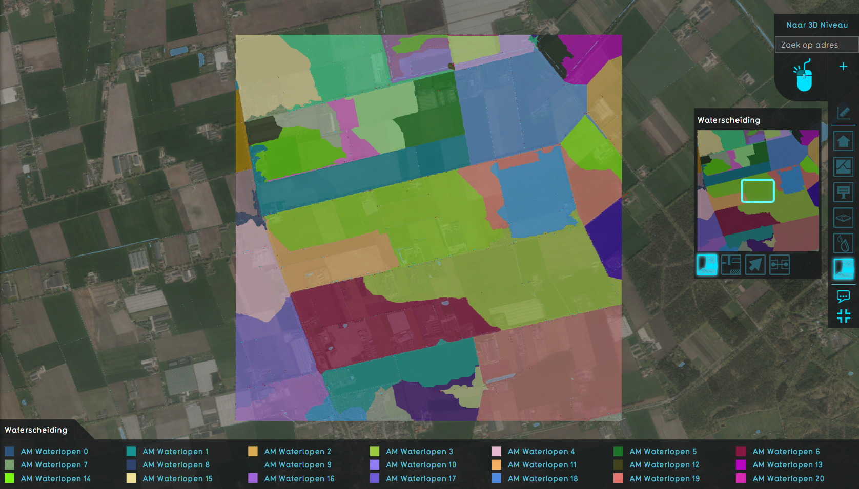
The locations of the drops that all end up in the same waterway can be grouped together to form a region called the watershed.
Watersheds applications
Watersheds can be used for the following:
- A client wants to know which waterways are the largest and therefore most important in his water system. This way, the client can manage maintenance and adjustments more appropriately.
- A client wants to validate its water system and find out if all major rainfall catchment areas are connected to the water system. For example, a client finds out that a human constructed water body plays a major roll in storing rain fall water but has no connection to the water system to discharge any excess.
- A client can use the watershed, in combination with the waterways this watershed belongs to, in our calculation models outside the Tygron Platform. For example, by using the watershed as a way to quantify how much rainfall a waterway will receive in grand scale, low detail water system calculations.
- A client has to solve disputes with landowners complaining about (the lack of) rainfall discharge on their land.
Concept
- Rainfall simulation is done and generates a directional result.
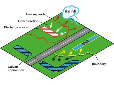
- Discharge areas indicate the locations where rainfall will conceptually be discharged out of the system. Each discharge area will result in a watershed.
- Discharge areas are expanded along the waterways and culvert connections.
- Based on the direction the rainfall has moved in, the watersheds are gradually backtracked starting from the discharge areas. This is done for each watershed in parallel.
- On locations where the watersheds meet, the backtracking stops.
- The end result will be an overlay with unique id numbers corresponding to a watershed based on the initial discharge area.
This is the general concept, but there are variations on this concept:
- Terrain height can be used instead of a rainfall simulation. However, this approach suffers more from local mini and oversegmentation.
- Discharge areas are advised but not required. Optionally, each waterway and waterbody can be identified as a unique discharge area, in turn resulting into unique watersheds.
Calculation
Historically, the calculation of watersheds for rainfall was done based on the gradient of the terrain. Issues occur when the terrain is near flat; it is not known where the rain water will flow and the direction will be assigned arbitrarily based on the used algorithm. Secondly, the terrain often contains a lot of local minimas, which results in the creation of too many unique watersheds (oversegmentation). To solve this, one would often apply filters to the terrain to remove these local minimas, but this required a lot of user judgement.
Fortunately, instead of using only the gradient of the terrain directly, we can also simulate rainfall using our Rainfall (Overlay) and use the Average Direction result to have a better idea of where the rain drops will end up based on momentum. Given that the rainfall is sufficiently large, this will remove local minima and solve most issues of unknown flow direction on flat surfaces.
Discharge Areas
In a water system model, the waterways generally catch the rainfall and transport it elsewhere, often out of the system. These waterways can be considered the end point of a rain drops travel overland and we could call them discharge waterways.
Expert users often have grouped multiple waterways together to make it easier for analysis and discussion. The Tygron Platform allows to import these groups as areas, which we conceptually call Discharge areas. Each discharge area will then result into a unique watershed.
In practice, the provided Discharge areas do not fully cover the waterways geometrically. We therefore added an initialization step in which water cells that are not yet assigned to any discharge area be automatically assigned to one when they are connected as a neighbour or by a culvert.
In absence of, or in addition to, discharge areas, users can also choose to automatically add discharge areas for each individual waterway and waterbody. However, when these waterways or bodies are still connected to a provided Discharge area, they can still be overwritten by this prioritized discharge area.
Culverts
Since the propagation of discharge areas to neighboring waterways heavily relies on the connectivity of water system, culverts are important. Optionally, we could even restrict this propagation based on the direction of the flow through this culvert, allowing only the propagation from A to B when B flows to A.
Unfortunately, the available Geo data on the locations of culverts is often incomplete, containing mostly the most important culverts but missing the minor ones. We have therefore added a Water Connection Generator tool to automatically add culverts based on configured parameters. In general it deals with concepts such as:
- culvert generally do not cross major roads, but can cross driveways on private plots;
- culverts generally connect waterways, and not large water bodies;
- culverts generally do not connect waterways of distinctly different heights or waterlevels;


