Parametric Design: Difference between revisions
No edit summary |
No edit summary |
||
| Line 1: | Line 1: | ||
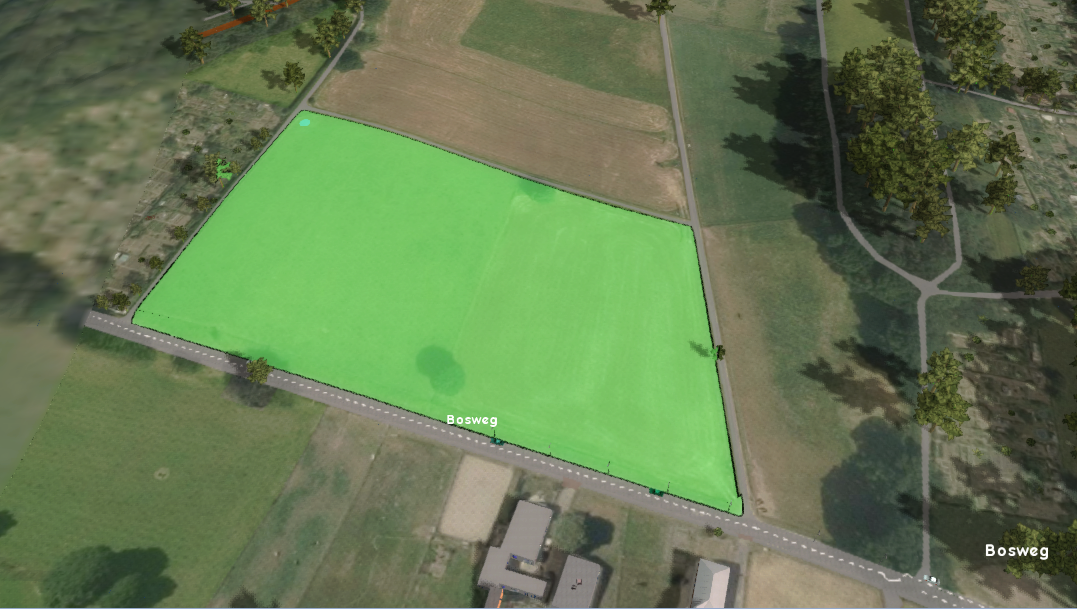
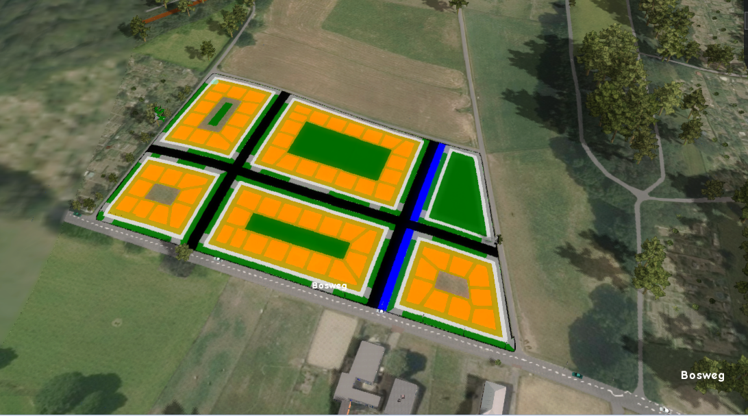
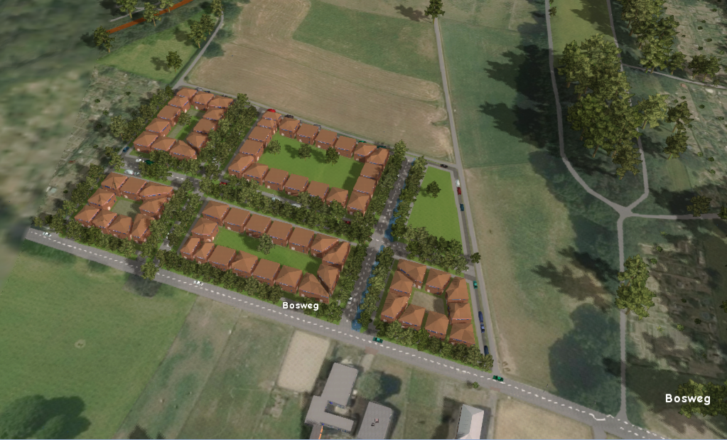
A parametric design in the {{software}} can be used to automatically place elements of a [[spatial plan]], such as [[Construction|building]]s, [[Construction|roads]]s, [[Construction|green]]s and [[waterways]] in a certain layout for a given area. Requirements for the design can be configured using a set of parameters. These describe the rules and boundaries, as well as attributes for the created [[Construction]]s and [[Terrain Type]]s. The algorithm behind the parametric design tries to comply to the provided requirements as much as possible when generating a design. | |||
<ul> | |||
<li style = "display:inline-block">[[File:Design_area.PNG|200xpx]]</li> | |||
<li style = "display:inline-block">[[File:Design.PNG|200xpx]]</li> | |||
<li style = "display:inline-block">[[File:Design_gebouwd.PNG|200xpx]]</li> | |||
</ul> | |||
==Configuration== | |||
[[File:Design_pie_chart.PNG|right|thumb|300px| A generated parametric design]] | [[File:Design_pie_chart.PNG|right|thumb|300px| A generated parametric design]] | ||
A parametric design consist of the following seven elements which make up the spatial plan: | A parametric design consist of the following seven elements which make up the spatial plan: | ||
| Line 19: | Line 27: | ||
[[File:YoutubeLogo1.jpg | link=https://www.youtube.com/watch?v=ZB2DaDV7jFI&t=177s|thumb|left|200px|Webinar Parametric City Design 2.0 in het {{software}} - 30 november 2021(Dutch only)]]{{clear}} | [[File:YoutubeLogo1.jpg | link=https://www.youtube.com/watch?v=ZB2DaDV7jFI&t=177s|thumb|left|200px|Webinar Parametric City Design 2.0 in het {{software}} - 30 november 2021(Dutch only)]]{{clear}} | ||
{{article end | |||
* Save to current: a [[ | |notes= | ||
* Especially for road | * Save to current: a [[Test Run]] is not started. Instead it is applied to the [[Current Situation]]. This method is not easily reversed. | ||
* Especially for road aligned designs it can sometimes be needed to add a road to the area manually in advance, in order to get proper road alignment. The {{software}} only adds roads within an area, never on the edge, to avoid adjacent road placement. | |||
|seealso= | |||
* [[ | * [[Chart (Parametric Design)]] | ||
* [[ | * [[Design types (Parametric Design)]] | ||
* [[Parameters (Parametric Design)]] | |||
* [[Parametric Design]] | |howtos= | ||
* [[How to configure and use a parametric design]] | * [[How to configure and use a parametric design]] | ||
* [[How to save a parametric design as a measure]] | * [[How to save a parametric design as a measure]] | ||
<!--* [[How to create an urban area using parametric design]] | <!--* [[How to create an urban area using parametric design]] | ||
* [[How to create an area of trees using parametric design]]--> | * [[How to create an area of trees using parametric design]]--> | ||
}} | |||
[[Category:Items]] | [[Category:Items]] | ||
Revision as of 09:59, 11 February 2022
A parametric design in the Tygron Platform can be used to automatically place elements of a spatial plan, such as buildings, roadss, greens and waterways in a certain layout for a given area. Requirements for the design can be configured using a set of parameters. These describe the rules and boundaries, as well as attributes for the created Constructions and Terrain Types. The algorithm behind the parametric design tries to comply to the provided requirements as much as possible when generating a design.
Configuration

A parametric design consist of the following seven elements which make up the spatial plan:
- Roads
- Water
- Parking
- Side walk
- Building, up to 6 different plot designs
- Garden
- Public Green
For each of the elements a function or terrain type can be chosen. Other parameters such as the width of the roads and the number of floors for the building can be adjusted. To generate the design, the amount in percentages of each function (with the exception of the side walk function) can be adjusted with a slider. Additionally, when the design has multiple building plot designs, the percentual distribution between these plot designs has to be specified.
The general strategy is to provide a selection area and a design type. Then use the sliders to set the percentage per function you would like to see in the design. After the design is generated, notice in the pie chart in the bottom panel the actual percentage of each function that is determined by the parametric design algorithm. When you are happy with the generated design, the plan can either be saved to the Current Situation, added as a Measure or constructed in Future Design.

Notes
- Save to current: a Test Run is not started. Instead it is applied to the Current Situation. This method is not easily reversed.
- Especially for road aligned designs it can sometimes be needed to add a road to the area manually in advance, in order to get proper road alignment. The Tygron Platform only adds roads within an area, never on the edge, to avoid adjacent road placement.


