How to open the Project Sources table: Difference between revisions
Jump to navigation
Jump to search
No edit summary |
No edit summary |
||
| Line 12: | Line 12: | ||
====Note==== | ====Note==== | ||
If the count is 0, this means the data is not used for generating the 3D model. If the data is a raster dataset, which technically does not contain features, but cells with a value, the value will be 1. | If the count is 0, this means the data is not used for generating the 3D model. If the data is a raster dataset, which technically does not contain features, but cells with a value, the value will be 1. | ||
[[Category:Source]][[Category:How-to's]] | |||
Revision as of 12:06, 20 October 2022
How to show the project sources table:
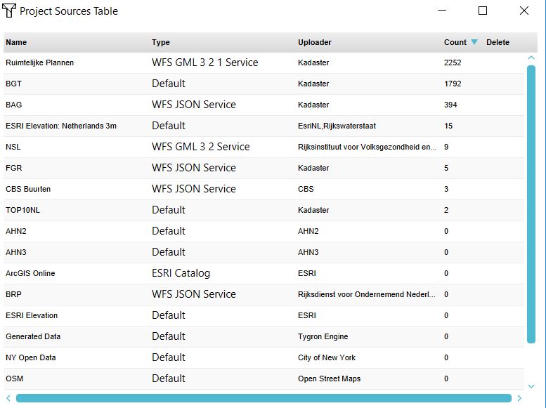
The project sources table shows the used Geo data sets in the 3D model and the by a user imported data. The table shows:
- the name of the dataset
- the type
- the publisher of the dataset
- the number of features in the 3D model (count).
Note
If the count is 0, this means the data is not used for generating the 3D model. If the data is a raster dataset, which technically does not contain features, but cells with a value, the value will be 1.

