Levee Type: Difference between revisions
No edit summary |
|||
| Line 21: | Line 21: | ||
Water management is an important factor of spatial planning. Dikes (or levees) are some of the most basic water management measures that can be implemented; just build a wall and keep the water out! | Water management is an important factor of spatial planning. Dikes (or levees) are some of the most basic water management measures that can be implemented; just build a wall and keep the water out! | ||
In the Tygron Engine these Dikes play a special part. As dedicated [[constructions]] they can affect [[Terrains#Safe Zone Terrain|safe zone terrains]] and [[Terrains#Flooding Terrain|floods]]. By constructing a Dike as [[Actions|action]] or [[Predefined Measures|measure]], the safe zone terrain will be expanded, protecting more houses and industry when a flood occurs. This can all be visualized in the Tygron Engine and a dedicated [[Indicators|indicator]] can be set up to have the implementation of levees score on the [[stakeholder]] progression. | In the Tygron Engine these Dikes play a special part. As dedicated [[constructions]] they can affect [[Terrains#Safe Zone Terrain|safe zone terrains]] and [[Terrains#Flooding Terrain|floods]]. By constructing a Dike as an independent [[Actions|action]] or as part of a [[Predefined Measures|measure]], the safe zone terrain will be expanded, protecting more houses and industry when a flood occurs. This can all be visualized in the Tygron Engine and a dedicated [[Indicators|indicator]] can be set up to have the implementation of levees score on the [[stakeholder]] progression. | ||
<gallery> | <gallery> | ||
File:DikesLMBefore-Q3-2015.jpg|High water in Lower Manhattan, before flood protection | File:DikesLMBefore-Q3-2015.jpg|High water in Lower Manhattan, before flood protection | ||
Revision as of 09:40, 18 August 2015
What are Dikes?
Dyke or dike refers to a natural or artificial slope or wall to regulate water levels, called levee in US English.
For more descriptions and information, see also: https://en.wikipedia.org/wiki/Dyke & https://en.wikipedia.org/wiki/Levee
There are three distinct uses for Dikes:
River Flood Protection
- Along some of the larger rivers in the world (Rhine, Mississippi) elaborate levee structures have been constructed to prevent the river and it's delta from flooding the banks.
Coastal Flood Protection
- Many coastal flatlands are protected by complex flood defenses, for example the sea wall at Vancouver BC (Canada). An extreme example is the Netherlands, where huge levee structures protect against coastal inundations. Besides protecting the landmass, dikes are also used in the Netherlands to claim more land that is originally below mean sea level.
Spur dykes or groynes
- These man made constructions are implemented as erosion prevention. These dikes are usually constructed at an angle to the bank or coast, and can be found in inland rivers and canals, and at the sea coast. They are for instance deployed in the 'Room for the Rivers' project in the Netherlands to counter bank erosion.
How do Dikes relate to the Tygron Engine?
Water management is an important factor of spatial planning. Dikes (or levees) are some of the most basic water management measures that can be implemented; just build a wall and keep the water out!
In the Tygron Engine these Dikes play a special part. As dedicated constructions they can affect safe zone terrains and floods. By constructing a Dike as an independent action or as part of a measure, the safe zone terrain will be expanded, protecting more houses and industry when a flood occurs. This can all be visualized in the Tygron Engine and a dedicated indicator can be set up to have the implementation of levees score on the stakeholder progression.
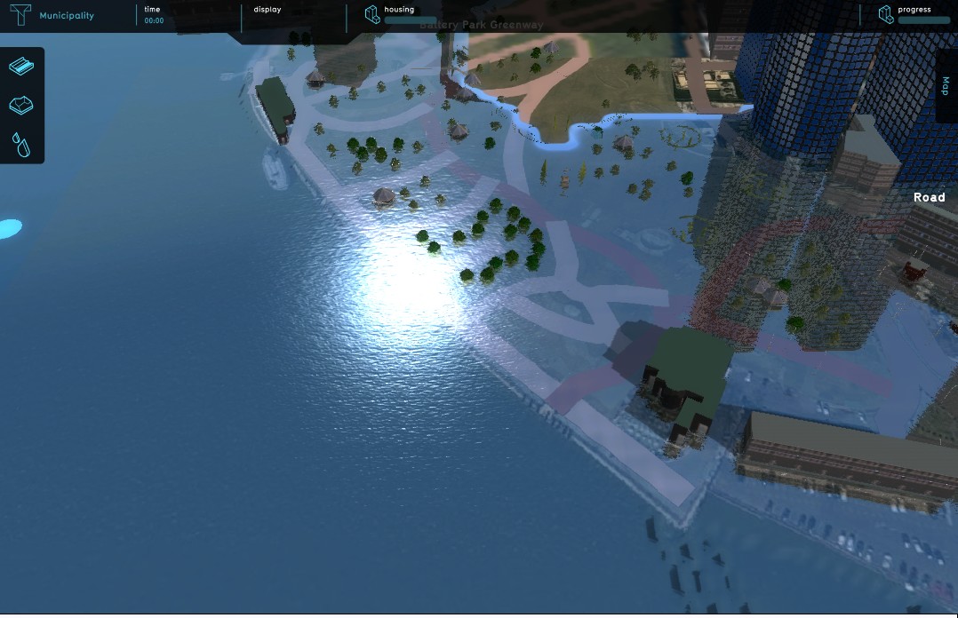
High water in Lower Manhattan, before flood protection
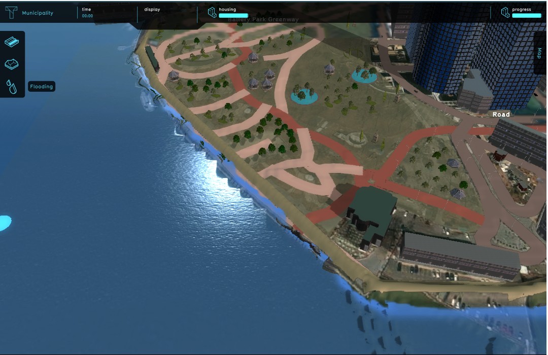
High water in Lower Manhattan, after flood protection

