Breach measurement distance m (Water Overlay): Difference between revisions
Jump to navigation
Jump to search
No edit summary |
No edit summary |
||
| (11 intermediate revisions by the same user not shown) | |||
| Line 1: | Line 1: | ||
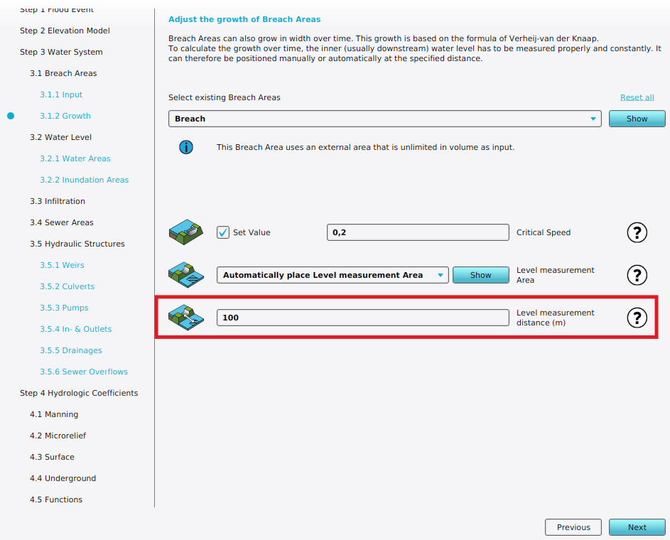
{{Overlay | [[File:Wateroverlay_wizard_breach_measurement_distance_m.png|thumb|right|Breach measurement distance m width can be configured in ''Breach Growth'' step of a [[Flooding Overlay]] wizard.]] | ||
{{Overlay | {{Overlay attributes|<onlyinclude> | ||
| | {{Overlay attributes|type=row|overlay=Water | ||
|attribute=BREACH_MEASUREMENT_DISTANCE_M | |||
|unit=m | |unit=m | ||
|description=Distance | |description=Distance from the breach area to the automatically placed measurement point for the downstream water level of the breach, in the direction of the breach. | ||
|defaultvalue=100 | |defaultvalue=100 | ||
|icon= | |range=0 to {{max surface}} | ||
|icon=waterwizard_icon_breach_measurement_distance_m.png | |||
}}</onlyinclude>}} | }}</onlyinclude>}} | ||
{{article end | {{article end | ||
|notes= | |notes= | ||
* | * This distance is only taken into account when not using a manual defined [[Breach level area (Water Overlay)|Breach level area]]. | ||
* In order to place the measurement the breach area must have a [[Breach_angle_(Water_Overlay)|BREACH_ANGLE]]. | * In order to place the measurement the breach area must also have a [[Breach_angle_(Water_Overlay)|BREACH_ANGLE]]. Together they determine the location at which the point of measurement is placed. | ||
* Only when the area behind the breach is lower then the breach level itself the measurement point can be placed. This prevents invalid | * The downstream water level of the breach is used in the [[Breach_growth_formula_(Water_Overlay)|Verheij–van der Knaap growth formula]]. | ||
* Only when the area behind the breach is lower then the breach level itself the measurement point can be placed. This prevents invalid measurement points, for example when it is placed on top of a [[building]]. | |||
|seealso= | |seealso= | ||
* [[Breach flow formula (Water Overlay)]] | * [[Breach flow formula (Water Overlay)]] | ||
* [[Breach model (Water Overlay)]] | |||
* [[Weir formula (Water Overlay)]] | * [[Weir formula (Water Overlay)]] | ||
|howtos= | |howtos= | ||
Latest revision as of 13:07, 20 January 2026

| Icon | Attribute | Unit | Range | Description | Default value |
|---|---|---|---|---|---|
| |
BREACH_MEASUREMENT_DISTANCE_M | m | 0 to 10000 | Distance from the breach area to the automatically placed measurement point for the downstream water level of the breach, in the direction of the breach. | 100 |
Notes
- This distance is only taken into account when not using a manual defined Breach level area.
- In order to place the measurement the breach area must also have a BREACH_ANGLE. Together they determine the location at which the point of measurement is placed.
- The downstream water level of the breach is used in the Verheij–van der Knaap growth formula.
- Only when the area behind the breach is lower then the breach level itself the measurement point can be placed. This prevents invalid measurement points, for example when it is placed on top of a building.


