Tygron EDU Manual: Difference between revisions
| Line 138: | Line 138: | ||
! style="width: 180pt;" |[[Tygron_for_Decision-Making|Decision-Making]] | ! style="width: 180pt;" |[[Tygron_for_Decision-Making|Decision-Making]] | ||
|- | |- | ||
| Name of the course | | Name of the course/research | ||
| | | Urban Water | ||
| | | Geo-information Science BSc research project | ||
| | | Virtual River Game | ||
| | | Area Study Sustainability Netherlands | ||
| | | Scenario Building for Sustainable Cities | ||
|- | |- | ||
| Educational institute | | Educational institute | ||
| | | Van Hall Larenstein University of Applied Sciences | ||
| | | Wageningen University & Research | ||
| | | University of Twente | ||
| | | Leiden University | ||
| | | IHS/ Erasmus University Rotterdam | ||
|- | |- | ||
| Background of users | | Background of users | ||
| | | | ||
| | * HBO students | ||
| | * Prior knowledge of GIS, CAD, Hydrodynamic Modeling, and SOBEK 2 & 3 | ||
| | * No experience with the Tygron platform | ||
| | | | ||
* Third year Bachelor level | |||
* Experience of GIS | |||
* No experience with the Tygron platform | |||
| | |||
* PhD level | |||
* Experience in design methods | |||
* No coding or GIS experience | |||
* No experience with the Tygron platform | |||
| | |||
* Various backgrounds (chemistry, chemical engineering, international relations and studies) | |||
* Some experience with ArcGIS | |||
* No experience with the Tygron platform | |||
| | |||
* Masters level | |||
* Various backgrounds | |||
* Some knowledge of decision-making | |||
* No experience with the Tygron platform | |||
|- | |- | ||
| Main objective | | Main objective | ||
| | | to design a sustainability plan for an urban area using vulnerability assessment, modeling and solution recommendation. | ||
| | | to apply GIS and remote sensing knowledge to real life projects. | ||
| | | to create a virtual game that allows players to interact with an imaginary river section. | ||
| | | to act as sustainability experts to provide advise to the City Councils based on their sustainability goals. | ||
| | | to learn planning and decision making for sustainable cities in a multi-stakeholder environment. | ||
|- | |- | ||
| Dedicated time | | Dedicated time | ||
Revision as of 13:33, 29 March 2021
Introducing the EDU Manual
In the past years, many educational institutes managed to integrate the Tygron Geodesign Platform into their curriculum. They did that by delivering different courses to students from various backgrounds. The implementation of these courses resulted in varying levels of outcomes; some were more successful than others.
In some cases, lecturers ran into problems with their courses. Most of the time the problems were technical or logistical. For instance, the outcome of a course was compromised because the course-assignment has not been properly set up, or because students ran into hardware problems.
During last year’s Tygron EDU Event (2020), participants expressed their need for an educational manual. The main goal of this manual is to provide educational institutes with successful use-cases, of different learning objectives, in order to help them implement the use of the Tygron Platform effectively in their course.
This manual is a practical manual designed to help the lecturers get a grip of what is needed to set up a successful course that could be delivered repetitively for multiple years.
How was the manual compiled?
- Our team got in contact with lecturers and individuals who have recently used Tygron in their courses or research.
- With different objectives in mind, one use-case was chosen as an example of each learning objective.
- The lecturers then filled out a detailed feedback template focusing on the content and the logistics of the courses in which the Tygron platform was used.
- After that, we had one-on-one interviews with the lecturers and researchers to further discuss their use-cases and to get further recommendations.
- Most importantly, they answered the question "what would you have done differently?".
By using this manual, you will be able to:
- Learn how other institutes have been using Tygron in their educational curricula;
- Understand the content and the design of the courses, including time-distribution, target students, logistics, challenges, outcome and assessment, and other important details;
- Take into consideration others’ recommendations and feedback based on their experience.
This manual consists of the following:
- Resources and a guiding template to help you design a course using the Tygron platform.
- Existing educational use-cases of Tygron, with 5 different learning objectives.
- The outcomes of each use-case presented in the form of reports, pictures, StoryMaps and videos.
How do I integrate the Tygron platform in my curriculum?
Do you want to integrate the Tygron Geodesign Platform in your curriculum? If yes, then this is the right place to start!
Below is a checklist to help you get started. This section, along with the use-cases, will most likely steer you in the right direction.
1. Answer the following questions:
1.  What are the learning objectives of the course?
2.  What is the expected outcome?
3.  What will the students be using Tygron for?
4.  Who are my target students? What prior knowledge do they have? What technical skills do they have?
5.  How many students will be taking this course?
6.  Will the course be online or offline? Will students use their own laptops or the institute's computers?
7.  Do you have a real client or third parties involved? What will be their roles?
8.  Are there an guest lecturers?
9.  Who will guide the students on the use of Tygron? Will you prepare your own guiding materials?
10. Are you familiar with Tygron? Will you need any support from the Tygron team?
11. Will the course be based on a real location or will you be using a Tygron template?
12. Did you try loading the location into Tygron and testing it? Is the data available in my selected location?
13. Is there a budget for this course?
14. How long is the course? How long is dedicated to learn Tygron? What other activities are included?
15. What will be the assignment and will students work individually or in groups?
16. Will students work on the same theme? Will they be working on different themes with the same location?
17. How will the course product/outcome be presented? How will students be assessed?
It is recommended to download and fill in this detailed template that we designed to help you kick-start your course with Tygron: File:Tygron Course Design template.docx
2. Go over the EDU use-cases which best fit your learning objectives for inspiration. Learn from their feedback and take their recommendations into account.
3. Request an EDU-license from Tygron.
- The free EDU License includes:
- Parallel backup of 30 projects. This allows groups of students (3 or 4 per project) to work on projects together.
- The maximum dimensions per project are 1 kilometer x 1 kilometer.
- Loading 200 new projects without saving.
- Climate game and several demo projects are supplied as a standard.
- Can be used on an international level.
Are you interested and would you like to obtain an EDU license'? Please contact us at info@tygron.com.
Here you can find more information about our other paid licenses and potential partnerships: Licences & Partnerships
4. Start designing your course:
- Go over the basic video tutorials
- Go over our elaborate wiki
- Ask questions on the community forum
- Reach us for further support at info@tygron.com.
Overview of the Learning Objectives and Use-Cases
Tygron has been used for courses related to different objectives such as:
- Urban Analysis
- Geographic Information System (GIS)
- Spatial Planning
- Scientific Research
- Decision-Making
For each of the mentioned learning objectives, we have selected one successful use-case of the Tygron platform. Below are the use-cases for each learning objective:
1. Tygron for Urban Analysis: “Urban Water Course”
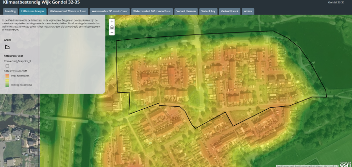
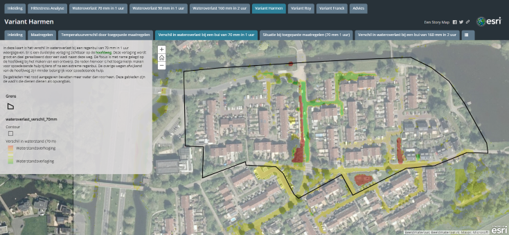
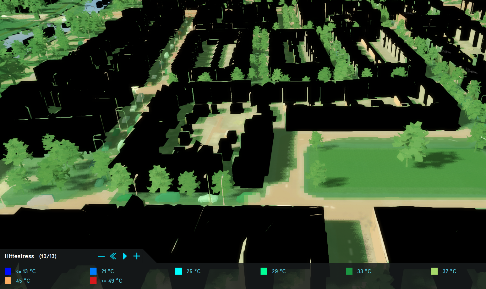
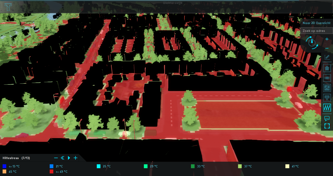
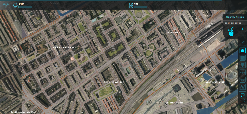
A 9-week course delivered by Van Hall Larenstein to water management students at the HBO level. During this course, the students are divided into groups, and each group is assigned to work on a different neighborhood within the Lelystad area. Students have to use the Tygron platforn to develop a sustainability plan for their chosen areas while focusing on flooding, heat and livability. Read more about this use-case.
2. Tygron with GIS data: “Planting Trees to Reduce Heat Stress”
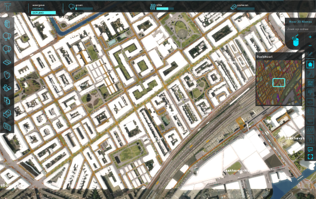
This use-case describes how a student from the “International Land and Water Management” at the Wageningnen University and Research has used Tygron platform in his 4-week GIS course to prepare for his Bachelor research. Contrary to his course-mates who used other software, the student had chosen the Tygron platform to explore the most effective way of planting trees to reduce heat stress in Rivierenwijk in Utrecht. Read more about this use-case.
3. Tygron for Spatial Planning: “Proposals for a Greener Hoefkade”
In this use-case, a group of students of very different backgrounds used the Tygron platform to develop an eco-consultancy plan for the municipality of the Hague, as an assignment for an area study course within their Sustainable Development interdisciplinary minor at the University of Leiden. In 4 weeks only, the team learned to use the Tygron platform and created a complete plan for a greener Hoefkade neighborhood. Read more about this use-case.
4. Tygron for Scientific Research: “the Virtual River Game”
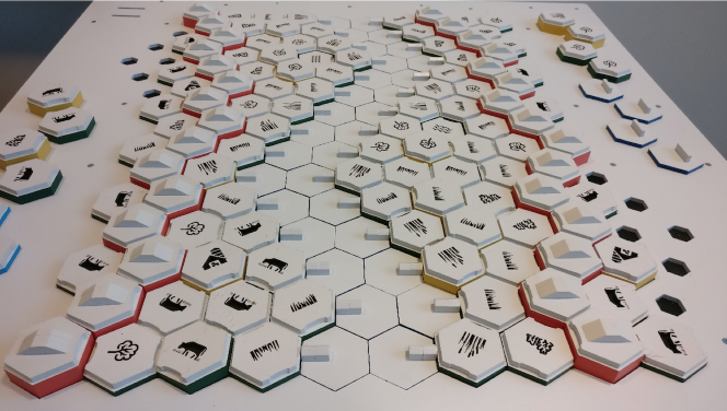
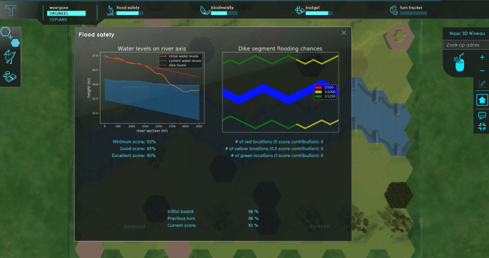
A PhD candidate at the University of Twente was assigned to create a serious game that would facilitate stakeholder engagement in river management as part of the RiverCare research program. Five years later, the result was the virtual River Game, a unique board-game that is digitally connected to the Tygron platform. By manipulating the pieces on the board, stakeholders can immediately see the calculations and graphs on the Tygron platform.Read more about this use-case.
5. Tygron for Decision-making: “Scenario Building for Sustainable Cities”
IHS has developed a Scenario Building course for its Master students of the “Urban Environment Sustainability and Climate Change” specialization. In less than 5 days, and with no prior experience in the Tygron platform, groups of students are asked to make up their own "development story" such as defining potential stakeholders and targets, then to play a simulation game that would resemble stakeholder interaction in real life.Read more about this use-case.
Comparison of the Use-cases
| Details | Urban Analysis | GIS Data | Scientific Research | Spatial Planning | Decision-Making |
|---|---|---|---|---|---|
| Name of the course/research | Urban Water | Geo-information Science BSc research project | Virtual River Game | Area Study Sustainability Netherlands | Scenario Building for Sustainable Cities |
| Educational institute | Van Hall Larenstein University of Applied Sciences | Wageningen University & Research | University of Twente | Leiden University | IHS/ Erasmus University Rotterdam |
| Background of users |
|
|
|
|
|
| Main objective | to design a sustainability plan for an urban area using vulnerability assessment, modeling and solution recommendation. | to apply GIS and remote sensing knowledge to real life projects. | to create a virtual game that allows players to interact with an imaginary river section. | to act as sustainability experts to provide advise to the City Councils based on their sustainability goals. | to learn planning and decision making for sustainable cities in a multi-stakeholder environment. |
| Dedicated time | 1 | 2 | 3 | 4 | 5 |
| Guidance | 1 | 2 | 3 | 4 | 5 |
| Outcome | 1 | 2 | 3 | 4 | 5 |
Continuous Development of the EDU Manual
It is important to mention that each use-case in this manual is different, and that the lecturers themselves are constantly fine-tuning their courses based on the circumstances.
That is why, the manual is designed to highlight the practical side of the courses, and not only their content.
This manual will be constantly updated and we will be adding more use-cases to each learning objective with time.
- Are you a lecturer who has already integrated the Tygron platform in one of your courses?
Then we ask you to contribute to the continuous development of our EDU Manual. Here's how it goes:
- you can download the following "feedback template", fill it in and send it to us via email at info@Tygron.com.
- we will follow up by conducting a short online interview with you!
- overall, the entire process will take you no more than 1 hour, but will save others from our EDU network hours of work!
- Do you want to contribute but find that this "feedback template" not applicable?
Then let us know, and we will get back to you with a customized template!
| Next page>> |
