3D Visualization: Difference between revisions
Jump to navigation
Jump to search
mNo edit summary |
No edit summary |
||
| Line 45: | Line 45: | ||
==How to create a 3D World in the {{software}}== | ==How to create a 3D World in the {{software}}== | ||
: ''Main article: [[Wizard]].'' | : ''Main article: [[New Project Wizard]].'' | ||
: The 3D world can be created through the [[Wizard | : The 3D world can be created through the [[New Project Wizard]]. In this part of the [[editor]], the user can select the project area, decide to base the project on real data, use custom shape files or start with an empty 3D world after selecting the size of the project area. | ||
==How to adjust an already existing 3D World in the Editor== | ==How to adjust an already existing 3D World in the Editor== | ||
Revision as of 07:43, 3 March 2022
What is a 3D World?
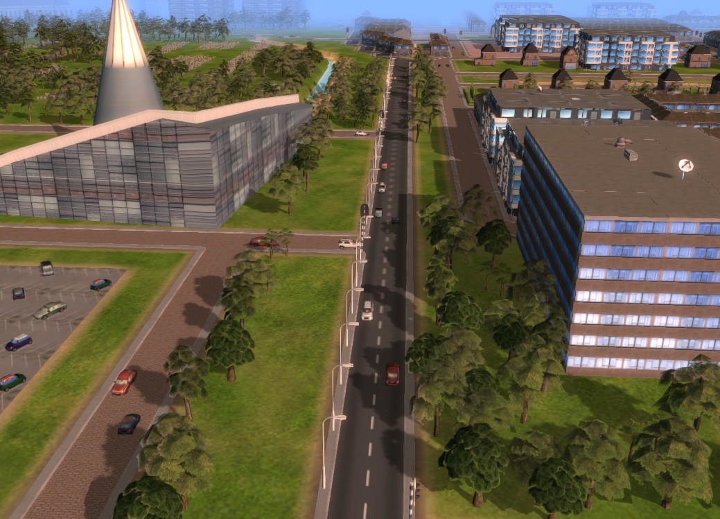
- The 3D World is a visual representation in three dimensions of (a part of) the real world or a virtual area.
What is the function of the 3D World in the Tygron Platform?
- When using the Tygron Platform, a three dimensional (3D) visualization of the selected area is rendered. In this 3D world the users can together navigate and perform their stakeholders actions. The effects of their actions are also instantly visualized, delivering direct visual feedback. When for example a stakeholder action negatively affects water storage in the project area, floods will occur and will be displayed during heavy rain fall.

Elements of the 3D world
- The 3D world consists of certain elements. These elements will be shortly explained below, however, for more details, please follow the links for the specific pages of these elements.
Constructions
- Main article: Constructions.
- Constructions are all the objects that can be built/ placed in the 3D world. They are split in three main groups:
- Standard buildings:
- These constructions are divided in sub groups, such as offices, housing, industry, agriculture, etc.
- Landmarks:
- To improve user immersion and recognition, some objects are modeled from real life landmarks. Examples are renowned constructions such as huge Dutch Delta works, university faculty buildings in Delft, the freedom towers in New York and other large spatial objects.
- Roads:
- This group contains all different types of road surfaces, from African dirt roads to high tech Vietnamese Rapid Transit train tracks.
- This group contains all different types of road surfaces, from African dirt roads to high tech Vietnamese Rapid Transit train tracks.
Land
- Main article: terrain.
Zoning
- Main article: Zoning.
- The 3D world can be divided in different zones. Each zone can have it's dedicated zoning plan, describing which types of constructions are allowed. The municipality usually has the task to approve building permits according to what is allowed in these zoning plans.
Areas
- Main article: Areas.
Overlays
- Main article: Overlay.
Levee Types
- Main article: Levee Types.
Upgrade Types
- Main article: Upgrade Types.
How to create a 3D World in the Tygron Platform
- Main article: New Project Wizard.
- The 3D world can be created through the New Project Wizard. In this part of the editor, the user can select the project area, decide to base the project on real data, use custom shape files or start with an empty 3D world after selecting the size of the project area.
How to adjust an already existing 3D World in the Editor
- Main article: Editor.
- Upon creation of a project, it is possible to adjust the 3D world afterwards too: by reloading the project in the editor. It is for example possible to replace a construction by any other construction in the Tygron Platform, or to address other elements of the 3D world; zoning, ownership, terrain and ground price.