Ground watertable with surface (Water Overlay): Difference between revisions
Jump to navigation
Jump to search
No edit summary |
No edit summary |
||
| Line 10: | Line 10: | ||
<gallery mode=nolines> | <gallery mode=nolines> | ||
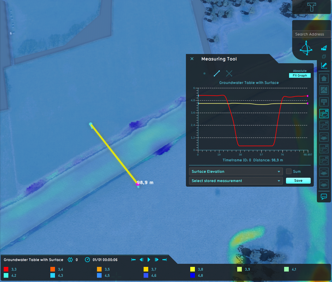
File:Wateroverlay_groundwatertable_with_surface.png|Water Overlay set to include the surface for the ground watertable. | File:Wateroverlay_groundwatertable_with_surface.png|Measurement of a waterway for a [[Ground_watertable_result_type_(Water_Overlay)|water table result]] of a Water Overlay set to include the surface for the ground watertable. | ||
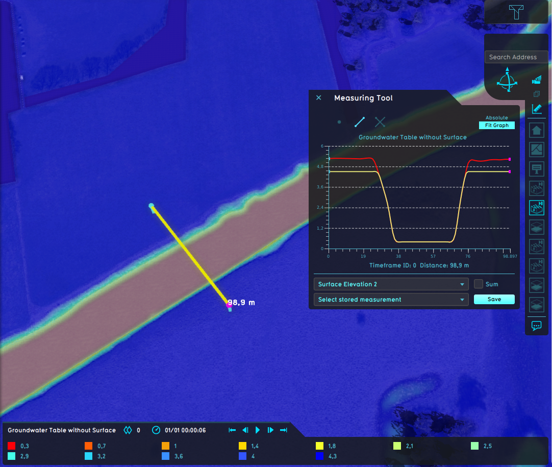
File:Wateroverlay_groundwatertable_without_surface.png|Water Overlay set to exclude the surface for the ground watertable. | File:Wateroverlay_groundwatertable_without_surface.png|Measurement of a waterway for a [[Ground_watertable_result_type_(Water_Overlay)|water table result]] of Water Overlay set to exclude the surface for the ground watertable. | ||
</gallery> | </gallery> | ||
Revision as of 15:16, 29 January 2024

| Icon | Attribute | Unit | Range | Description | Default value |
|---|---|---|---|---|---|
| |
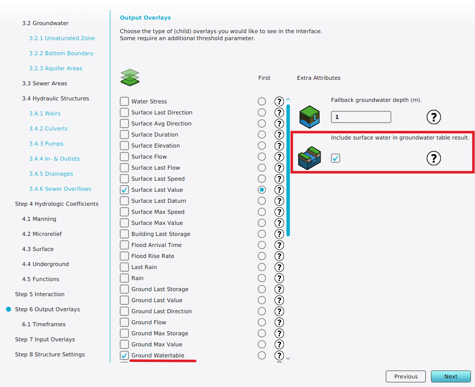
GROUND_WATERTABLE_WITH_SURFACE | boolean | Whether the ground watertable result type should also include the surface water level, when the groundwater levels are close to the surface. | True |
-
Measurement of a waterway for a water table result of a Water Overlay set to include the surface for the ground watertable.
-
Measurement of a waterway for a water table result of Water Overlay set to exclude the surface for the ground watertable.


