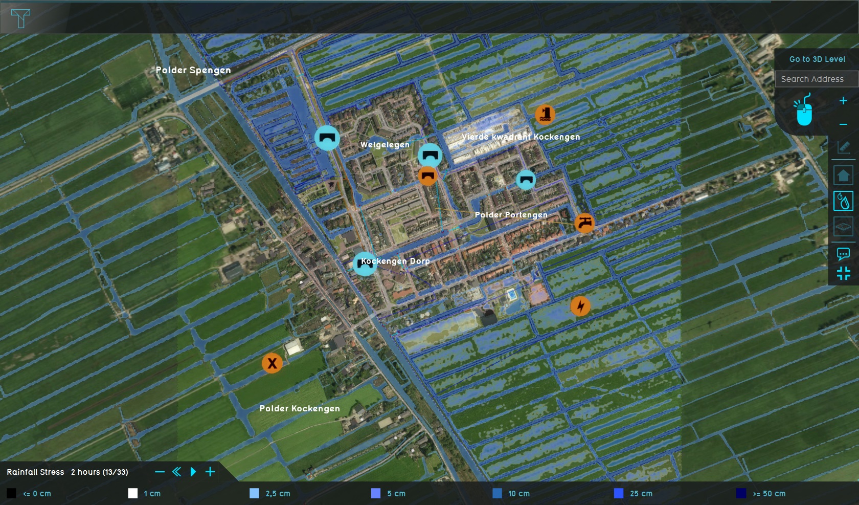
Demo Iteration Project

The Demo Iteration project is available for all users and can be found in the main menu under Edit projects. This project does not count towards your license.
This project is intended for hydrologists and other water experts.
This project showcases the rainfall overlay in a iteration mode.
The demo show the iteration functionality that can be used to adjust the ground infiltration speed using a combo formula.
Calculations using the Iteration option
The demo project simulates a Dutch polder to demonstrate how rainfall infiltration can be modeled using the iteration option. A hypothetical formula is applied to calculate the infiltration rate per time step, based on the saturation level of the unsaturated zone. This iterative process determines the soil's saturation step by step, which in turn influences the potential infiltration.
The purpose of this demo project is to illustrate the capabilities of this iterative calculation method.
Setup of the Demo Project
The demo project consists of a number of components that are essential for this calculation. These components are discussed and the reason for this is explained.
Components:
- Combo Overlay
- Rainfall Overlay
- Iteration Collector
- Indicator
- Number of Iterations
Combo Overlays
Before we create the Rainfall event, a number of overlays are created that serve as input for the various iteration steps. At the end of each iteration the combo overlay is updated an serves as the input for the next iteration step. We'll go through the different combo overlays.
Combo Surface U and Combo Surface V
When water flows, the velocity (both U and V) at the end of an iteration is used as the initial velocity for the next iteration. If there is no previous iteration step, the value should be 0. Make sure to check the box "previous" to make sure the Combo overlay uses the U and V of the previous itertationstep.
The formula in the combo overlay should in this case read: IF(EQ(ITERATION, 0), 0, A)
Combo Fraction and Combo Groundwater Depth
The percentage of the saturated fratcion of the unsaturated zone as well as the groundwaterdepth are both inputs for the next iteration step. If there is no previous iterationi step, the global values are used. Make sure to check the box "previous" to make sure the Combo overlay uses the values of the previous itertationstep.
For the saturation percentage the global GLOBAL_DEFAULT_FRACTION should be used.
For the groundwater level the global GLOBAL_DEFAULT_TABLE shoulld be used.
The formula in the combo overlay Combo Fraction should in this case read:
IF(EQ(ITERATION, 0), GLOBAL_DEFAULT_FRACTION, IF(EQ(A, NO_DATA), GLOBAL_DEFAULT_FRACTION, A))
The formula in the combo overlay Combo Groundwater Depth should in this case read:
IF(EQ(ITERATION, 0), GLOBAL_DEFAULT_TABLE, A)
Combo Surface
The waterlevel on the surface is input for the next iteration step. If there is no previous iteration step, the value should be 0. Make sure to check the box "previous" to make sure the Combo overlay uses the values of the previous itertationstep.
The formula in the combo overlay Combo Fraction should in this case read:
IF(EQ(ITERATION, 0), 0, A)
Combo Infiltration Speed
The combo overlay Combo Infiltration calculates the infiltration speed based on soil saturation. For this demo a hypothetical formula is used. It uses the Ground BOFEK ID overlay to identify the soil type.
The formula in the combo overlay
MAX(0, SUB(GLOBAL_DEFAULT_INFIL, SWITCH(B, 0, 1004, MUL(10, SUB(A, GLOBAL_DEFAULT_FRACTION)), 1006, MUL(5, SUB(A, GLOBAL_DEFAULT_FRACTION)))))
Rainfall Overlay
Default settings are used for the rainfall overlay, with some exceptions:
Rain Event Duration: Here the the total duration of the calculation is specified. Later this is divided into different iterationsteps.
Water System – Water Level: Here the initial water level and the U and V flow are set. Use the option "Advanced: Select Ggrid Overaly to set initial water level and also flow UV".
The water level is set based on a specific overlay, which is the combo overaly Surface. Similarly, the y and x speed from the combo overlay is used as initial input.
Groundwater: Initialize the groundwater level using the Groundwater Depth combo overlay.
Unsaturated Zone: Initialize saturation and storage percentages per grid cell using the Fraction combo overlay.
Generated Output Overlays:
- Surface Last Value
- Rain
- Ground Last Value
- Ground Watertable
- Ground Last Unsaturated Storage
- Ground Last Unsaturated Fraction
- Surface Last U
- Surface Last V
- The number of timeframes is set to 1.
Iteration Collector
Displays results of each iteration step. The input overlay is the Rain Event.
Modulus: Set to 1 by default, meaning one output is saved per iteration as a timeframe in the collector.
Indicator
Handles partial updates for specific timeframes. Example formulas:
UPDATE_OVERLAY_PARTIAL_END_SEC_WHERE_OVERLAY_IS_10 Queries like SELECT_ITERATIONS_WHERE and SELECT_ITERATION_WHERE retrieve the number of iterations and the current iteration.
Number of Iterations
Set through the interface (default is 1).
Notes and Limitations
Debugging cannot be downloaded per iteration but can be saved for each iteration. Specific updates (e.g., updating attributes for certain building types in iteration 5) can be executed using the API and indicator but not through TQL for non-initial iterations.
Exploring the project
To begin exploring the project, see the outlet located on the left side.