How to select specific input data for AI Inference
[Work In Progress]
It is possible to mask the image layer of a satellite input in a Combo Overlay. This way you can specifically in- or exclude certain areas from the Inference Overlay. Below you will find two examples, which require that you already have a regular inference overlay set up.
Exclude open water areas from an Inference Overlay
Sometimes foliage inference will also place foliage incorrectly on open water. In case you would like to exclude areas such as open water, or already existing BGT trees, you can use the following steps.
How to exclude open water from an Inference Overlay:
- Add an Average Overlay, we will use this to assign water areas.
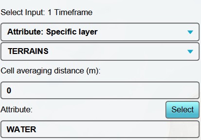
- With this overlay selected, set the input options to "Attribute: Specific Layer" and "Terrains".
- Because we want a sharp distinction between water and land, we set the cell averaging distance to 0 meters.
- As attribute to look for, we select "WATER".
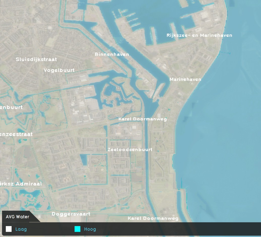
- Select finally "Update Now", and you have created an overlay that displays all open water areas.
- Now add a Combo Overlay.
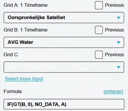
- Select the Original Satellite overlay as input for Grid A.
- Select the Avg Water Terrains overlay as input for Grid B.
- Enter the following formula: "IF(GT(B, 0), NO_DATA, A)". This formula checks wether a point is in a water area. If so, return no data, else return the satelite image.
- Select again "Update Now".
- Now use this new combo overlay with a fitered satelite image as input for your inference overlay, and update. You have now excluded open water areas from your inference overlay.
-
AVG Water Areas overlay settings
-
AVG Water Areas overlay
-
Combination layer settings, for filtering out open water from satellite layer.
Notes
- The detected foliage overlay can be used to import as trees or foliage areas into your project.


