How to access your project's WFS in ArcMap: Difference between revisions
Jump to navigation
Jump to search
(Created page with "The {{software}} allows you to access geographical features through a WFS endpoint, making the data available to view and edit via other GIS application. {{editor steps|t...") |
No edit summary |
||
| (3 intermediate revisions by 2 users not shown) | |||
| Line 1: | Line 1: | ||
The {{software}} allows you to access geographical features through a [[WFS]] endpoint, making the data available to view and edit via other GIS application. | The {{software}} allows you to access geographical features through a [[WFS]] endpoint, making the data available to view and edit via other GIS application. | ||
{{editor steps|title= | {{editor steps|title=access the WFS of your project in ArcMap | ||
|Select the export option of the geo data source you wish to access. | |Select the export option of the geo data source you wish to access. | ||
|For the export option "Web Feature Service", select "Copy URL". This will store the URL on your clipboard. | |For the export option "Web Feature Service", select "Copy URL". This will store the URL on your clipboard. | ||
| Line 13: | Line 13: | ||
|Drag the layer to your map, and the features will be displayed. | |Drag the layer to your map, and the features will be displayed. | ||
}} | }} | ||
<gallery mode=nolines> | |||
File:ArcMap WFS 01.jpg|Obtain the WFS url. | |||
File:ArcMap WFS 02.jpg|Add an Interoperability Connection. | |||
File:ArcMap WFS 03.jpg|Select the desired feature types. | |||
File:ArcMap WFS 04.jpg|Ingore the application schema. | |||
File:ArcMap WFS 05.jpg|The features are available in ArcMap. | |||
</gallery> | |||
==Notes== | ==Notes== | ||
* The WFS is currently only available when a project is active in the [[editor]]. | * The WFS is currently only available when a project is active in the [[editor]]. | ||
* The WFS url includes an [[authentication token]] which ties the validity of the url to a specific session. If the editing session is closed and reopen at a later time, the url will need to be renewed. | * The WFS url includes an [[Web_Interface#Authentication|authentication token]] which ties the validity of the url to a specific session. If the editing session is closed and reopen at a later time, the url will need to be renewed. | ||
[[Category:How-to's]][[Category:WFS]] | |||
Latest revision as of 10:50, 13 December 2022
The Tygron Platform allows you to access geographical features through a WFS endpoint, making the data available to view and edit via other GIS application.
How to access the WFS of your project in ArcMap:
- Select the export option of the geo data source you wish to access.
- For the export option "Web Feature Service", select "Copy URL". This will store the URL on your clipboard.
- Open ArcMap.
- Add a new WFS Interoperability Connection.
- Select 'WFS' as the format
- As URL for the dataset, paste the URL copied to the clipboard earlier.
- Select the Coordinate Reference System (CRS)
- In the parameters panel, select the appropriate layer in the WFS by clicking on the Feature types button and selecting the desired layer.
- In the parameters panel, for Ignore Application Schema select "Yes", and click on OK at the bottom of the panel.
- Drag the layer to your map, and the features will be displayed.
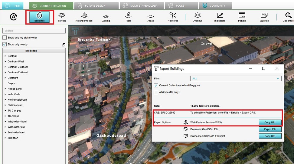
Obtain the WFS url.
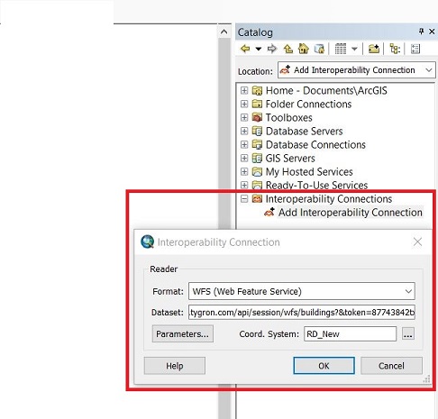
Add an Interoperability Connection.
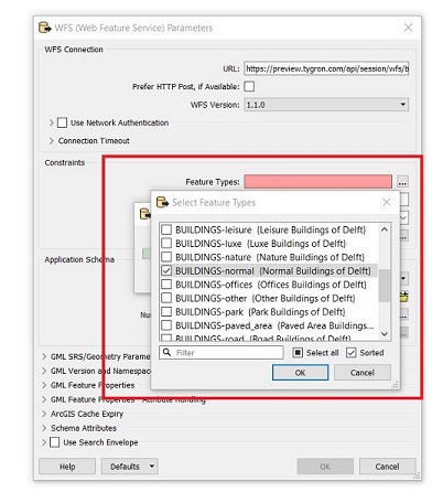
Select the desired feature types.
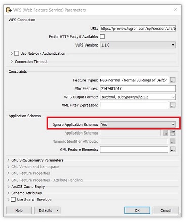
Ingore the application schema.
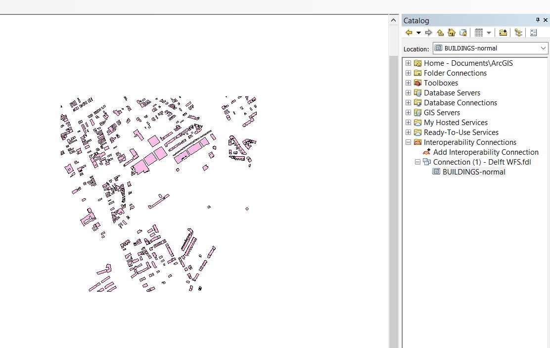
The features are available in ArcMap.


Notes
- The WFS is currently only available when a project is active in the editor.
- The WFS url includes an authentication token which ties the validity of the url to a specific session. If the editing session is closed and reopen at a later time, the url will need to be renewed.