How to access your project's WFS in ArcMap
Jump to navigation
Jump to search
The Tygron Platform allows you to access geographical features through a WFS endpoint, making the data available to view and edit via other GIS application.
How to access the WFS of your project in ArcMap:
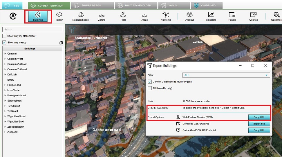
- Select the export option of the geo data source you wish to access.
- For the export option "Web Feature Service", select "Copy URL". This will store the URL on your clipboard.
- Open ArcMap.
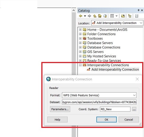
- Add a new WFS Interoperability Connection.
- Select 'WFS' as the format
- As URL for the dataset, paste the URL copied to the clipboard earlier.
- Select the Coordinate Reference System (CRS)
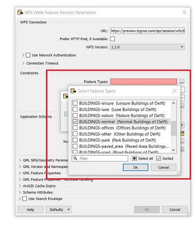
- In the parameters panel, select the appropriate layer in the WFS by clicking on the Feature types button and selecting the desired layer.
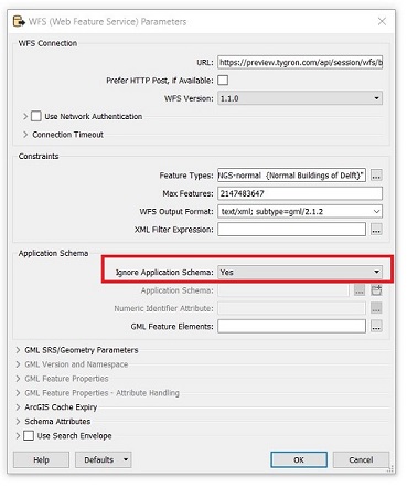
- In the parameters panel, for Ignore Application Schema select "Yes", and click on OK at the bottom of the panel.
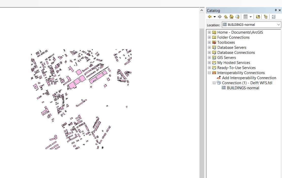
- Drag the layer to your map, and the features will be displayed.
-
Obtain the WFS url.
-
Add an Interoperability Connection.
-
Select the desired feature types.
-
Ingore the application schema.
-
The features are available in ArcMap.
Notes
- The WFS is currently only available when a project is active in the editor.
- The WFS url includes an authentication token which ties the validity of the url to a specific session. If the editing session is closed and reopen at a later time, the url will need to be renewed.
