How to create an Average Overlay based on another Grid Overlay: Difference between revisions
Jump to navigation
Jump to search
(Created page with "{{Editor location|Overlays}} {{Editor steps|title=create an Average Overlay based on another Grid Overlay |Select Current Situation in the ribbon bar of the editor. |Hover over Overlays, and under ''Grid Calculation'', select ''Avg & Interpolation''. |With the Overlay selected, open the ''Configuration Wizard'' by clicking on the button in the detail panel. |Once the wizard is ready, select next. |In the operator step, select the option na...") |
No edit summary |
||
| (5 intermediate revisions by the same user not shown) | |||
| Line 8: | Line 8: | ||
|In the type step, select the option named ''The overlay's input is based on an other grid overlay''. | |In the type step, select the option named ''The overlay's input is based on an other grid overlay''. | ||
|In the overlay step, select the [[Grid Overlay]] that you want to average. | |In the overlay step, select the [[Grid Overlay]] that you want to average. | ||
|Close the wizard by clicking on the finish button. | |||
|Adjust the averaging distance by selecting the ''Cell averaging distance (m)'' field. | |||
}} | }} | ||
<br> | <br> | ||
<gallery> | <gallery> | ||
File: | File:editor_overlay_grid_calculation_avg_overlay.png |2. Add a new [[Average Overlay]]. | ||
File: | File:avg_overlay_avg_operator.png |5. Select the ''AVG'' option. | ||
File: | File:avg_overlay_grid_overlay_type.png |6. Select the ''overlay input based on other grid overlay'' option. | ||
File:avg_overlay_overlay_selection.png |7. Select a specific [[Grid Overlay]] | |||
File:avg_overlay_cell_averaging_distance.png |8. Specify the averaging distance. | |||
File: | |||
File: | |||
</gallery> | </gallery> | ||
{{article end | |||
|seealso= | |||
*[[Average Overlay]] | |||
|howtos= | |||
*[[How to fill NO_DATA values in a grid overlay by interpolation using and Average Overlay]] | |||
*[[How to create an Average Overlay based on feature attributes]] | |||
*[[How to configure an Average Overlay to gain insight into grid cell values]] | |||
}} | |||
[[Category:How-to's]] | |||
Latest revision as of 13:58, 30 January 2024
How to create an Average Overlay based on another Grid Overlay:
- Select Current Situation in the ribbon bar of the editor.
- Hover over Overlays, and under Grid Calculation, select Avg & Interpolation.
- With the Overlay selected, open the Configuration Wizard by clicking on the button in the detail panel.
- Once the wizard is ready, select next.
- In the operator step, select the option named AVG.
- In the type step, select the option named The overlay's input is based on an other grid overlay.
- In the overlay step, select the Grid Overlay that you want to average.
- Close the wizard by clicking on the finish button.
- Adjust the averaging distance by selecting the Cell averaging distance (m) field.
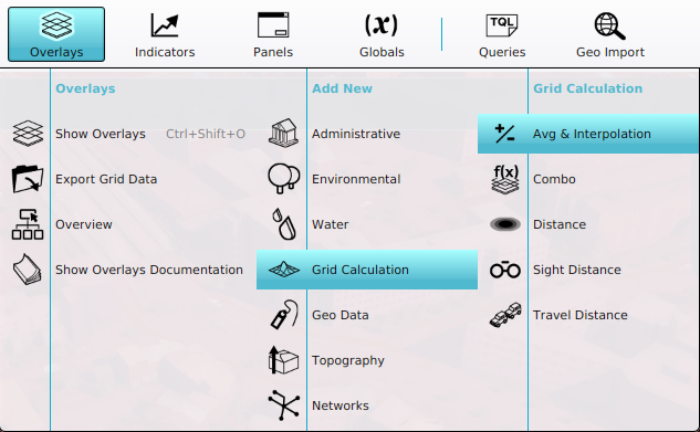
2. Add a new Average Overlay.
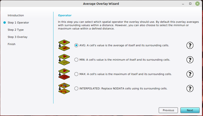
5. Select the AVG option.
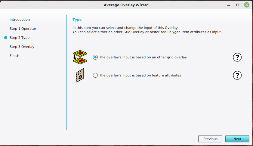
6. Select the overlay input based on other grid overlay option.
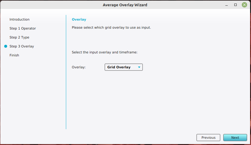
7. Select a specific Grid Overlay
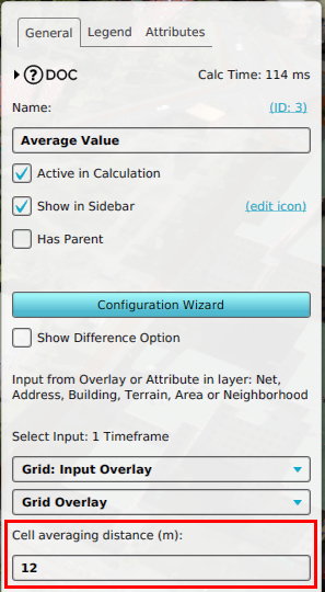
8. Specify the averaging distance.


