I3S: Difference between revisions
No edit summary |
No edit summary |
||
| Line 1: | Line 1: | ||
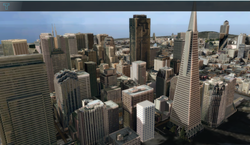
[[File:San_francisco.png|thumb|300px|right|Custom geometries of San Francisco from an I3S Service, visualized in the {{software}}]] | [[File:San_francisco.png|thumb|300px|right|Custom geometries of San Francisco from an I3S Service, visualized in the {{software}}]] | ||
Indexed 3D Scene Layer Specification (I3S) is a format for large 3D Geo datasets. The specification was mainly designed for streaming large 3D visualization data over the web. The specification originates from Esri and was adopted as a Community Standard by the OGC (Open Geospatial Consortium) in 2017. In ArcGIS software, an I3S dataset can be visualized using a Scene Layer. | |||
In the {{software}} it is possible to add your own 3D models as [[Custom Geometries]]. A format for these models which the {{software}} supports is I3S, along with the other format [[CityGML]]. <br> | In the {{software}} it is possible to add your own 3D models as [[Custom Geometries]]. A format for these models which the {{software}} supports is I3S, along with the other format [[CityGML]]. <br> | ||
Revision as of 12:18, 3 October 2023
Indexed 3D Scene Layer Specification (I3S) is a format for large 3D Geo datasets. The specification was mainly designed for streaming large 3D visualization data over the web. The specification originates from Esri and was adopted as a Community Standard by the OGC (Open Geospatial Consortium) in 2017. In ArcGIS software, an I3S dataset can be visualized using a Scene Layer.
In the Tygron Platform it is possible to add your own 3D models as Custom Geometries. A format for these models which the Tygron Platform supports is I3S, along with the other format CityGML.
Different other formats, such as BIM data or a SketchUp model, can be converted to the I3S format with a SLPK file. Read on to learn more about this.
What is an SLPK?
A Scene Layer Package (SLPK) is a file format for the storage/exchange of one or more I3S layers.
How-to's
See also
