How to edit spatial components of a measure
A measure can contain spatial components. These include the placement of buildings, the manipulation of land and the execution of upgrades. To add a spatial component to a measure, select the measure you wish to add the effect to, and select one of the following options:
- "Add Building" to add the placement of a building.
- "Add Section" to add a section to the selected building.
- "Add Levee" to add the placement of a levee
- "Add Upgrade" to add the execution of an upgrade
- "Add Spatial" to add a manipulation of height and type of terrain.
Of each type, multiple effects can be added, e.g. a measure can place multiple buildings, and/or perform multiple upgrades.
To remove a spatial component from a measure, select the spatial sub-item you wish to remove, and select "Remove". Make sure to select the sub-item, and not the measure itself.
Buildings

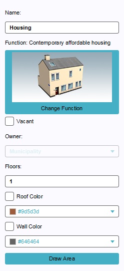
Editing a building to be placed by a measure is done in the same way as regular building. The only difference is that an owner cannot be set, because the owner of the building will be the owner of the measure. For more information, see the article on Buildings.
Upgrades

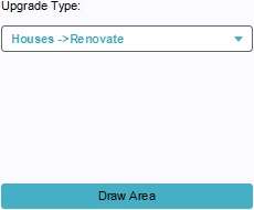
To change the type of upgrade the measure is meant to execute, select the appropriate upgrade type from the drop down menu. To select where the upgrade is to be performed, select "Draw Area", and use the brush to select an area.
Spatials

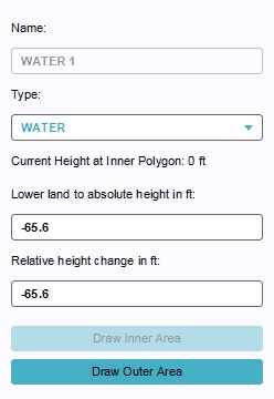
There are 3 possible land manipulations that can be added to a measure: Flatten, Water, and Levee.
To change the type of terrain feature the measure is meant to create, select the appropriate land type from the drop down menu. To change the height the land must have after the measure is executed, change the values in the "Lower land to absolute height" or "Relative height change". To change the location where the land is to be changed, select "Draw Outer Area", and use the brush to select an area. If applicable, select "Draw Inner Area" and select the are within the first selection which must be at the specified height.