Bridge elevation (Water Overlay): Difference between revisions
Jump to navigation
Jump to search

No edit summary |
No edit summary |
||
| Line 10: | Line 10: | ||
{{nominal list|zeroindex=true | {{nominal list|zeroindex=true | ||
||'''Lowest''': Lowest elevation point from Terrain below bridge is used. | ||'''Lowest''': Lowest elevation point from Terrain below bridge is used, when the terrain is '''[[Water (Terrain Attribute)|water]]'''. | ||
||'''Terrain''': Use standard elevation from Terrain. Bridges are excluded from the DEM, allowed water to flow as if they didn't exist. | ||'''Terrain''': Use standard elevation from Terrain. Bridges are excluded from the DEM, allowed water to flow as if they didn't exist. | ||
||'''Bridge''' : Use bridge deck as elevation. Bridges and [[Align elevation (Function Value)|floating]] Constructions are included in the DEM, blocking water flow. | ||'''Bridge''' : Use bridge deck as elevation. Bridges and [[Align elevation (Function Value)|floating]] Constructions are included in the DEM, blocking water flow. | ||
Revision as of 09:57, 28 February 2024

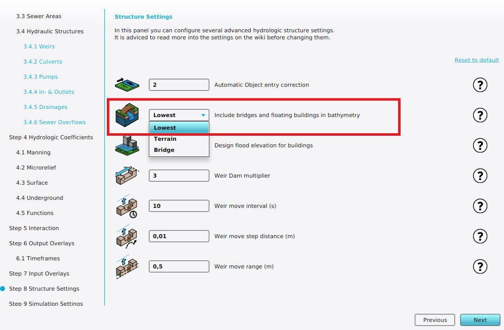
Bridge elevation can be configured in Structure Settings step of a Water Overlay wizard.
| Icon | Attribute | Unit | Range | Description | Default value |
|---|---|---|---|---|---|
| |
BRIDGE_ELEVATION | nominal | Specifies the mode by which bridges are include in the elevation model, used for the water calculations. | Lowest |
| 0. | Lowest: Lowest elevation point from Terrain below bridge is used, when the terrain is water. |
| 1. | Terrain: Use standard elevation from Terrain. Bridges are excluded from the DEM, allowed water to flow as if they didn't exist. |
| 2. | Bridge : Use bridge deck as elevation. Bridges and floating Constructions are included in the DEM, blocking water flow. |
Notes
- When using Bridge mode, it is still possible to model the flow from one side of a bridge to the other by using a Culvert.


