How to select specific input data for A.I. Inference
It is possible to mask the image layer of a satellite input in a Combo Overlay. This way you can specifically in- or exclude certain areas from the Inference Overlay. Below you will find two examples, which require that you already have a regular inference overlay set up.
Exclude open water areas from an Inference Overlay
Sometimes foliage inference will also place foliage incorrectly on open water. In case you would like to exclude areas such as open water, or already existing BGT trees, you can use the following steps.
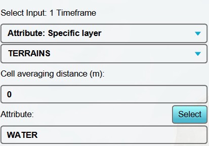
- Add an Average Overlay, we will use this to assign water areas.
- With this overlay selected, set the input options to "Attribute: Specific Layer" and "Terrains".
- Because we want a sharp distinction between water and land, we set the cell averaging distance to 0 meters.
- As attribute to look for, we select "WATER".
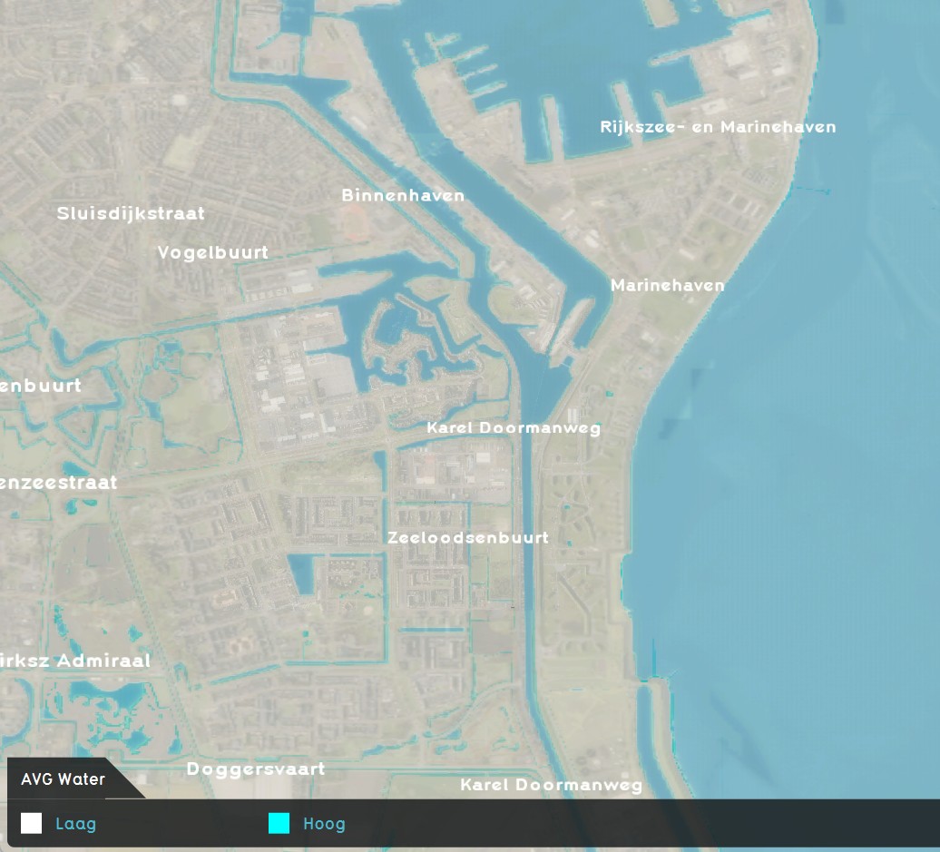
- Select finally "Update Now", and you have created an overlay that displays all open water areas.
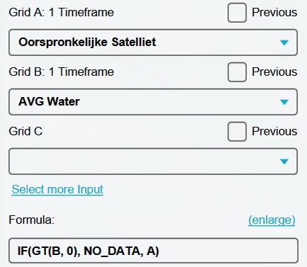
- Now add a Combo Overlay.
- Select the Original Satellite overlay as input for Grid A.
- Select the Avg Water Terrains overlay as input for Grid B.
- Enter the following formula: "IF(GT(B, 0), NO_DATA, A)". This formula checks wether a point is in a water area. If so, it returns no data, else it returns the satelite image.
- Select again "Update Now".
- Now use this new combo overlay with a fitered satelite image as input for your inference overlay, and update. You have now excluded open water areas from your inference overlay.
-
 AVG Water Areas overlay settings
 -
 AVG Water Areas overlay
 -
 Combination layer settings, for filtering out open water from satellite layer.
 -
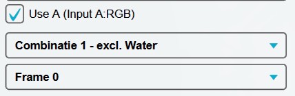 Using Combination layer as input for Inference Overlay


Only include private yards, and exclude the rest from an Inference Overlay
To improve a heat stress calculation, using inference to gain data of foliage in private gardens can be very helpful. For this you can mask all data except private yards from the satelite image.
- Add an Average Overlay, we will use this to assign private yards.
- With this overlay selected, set the input options to "Attribute: Specific Layer" and "Buildings".
- Because we want a margin all around to look for foliage at the edges of the private Yards, we set the cell averaging distance to 3,5 meters.
- As attribute to look for, we select "PRIVATE_YARD".
- Select finally "Update Now", and you have created an overlay that displays all private yard areas/ gardens.
- Now add a Combo Overlay.
- Select the Original Satellite overlay as input for Grid A.
- Select the Avg Private Yards overlay as input for Grid B.
- Enter the following formula: "IF(GT(B, 0), A, NO_DATA)". This formula checks wether a point is in a private yard. If so, it returns the satellite image, else it returns no data.
- Select again "Update Now".
- Now use this new combo overlay with a filtered satelite image as input for your inference overlay, and update. You have now excluded everything but private yards from your inference overlay.
-
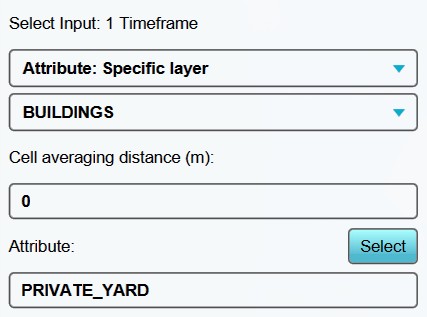 AVG Private Yards overlay settings.
 -
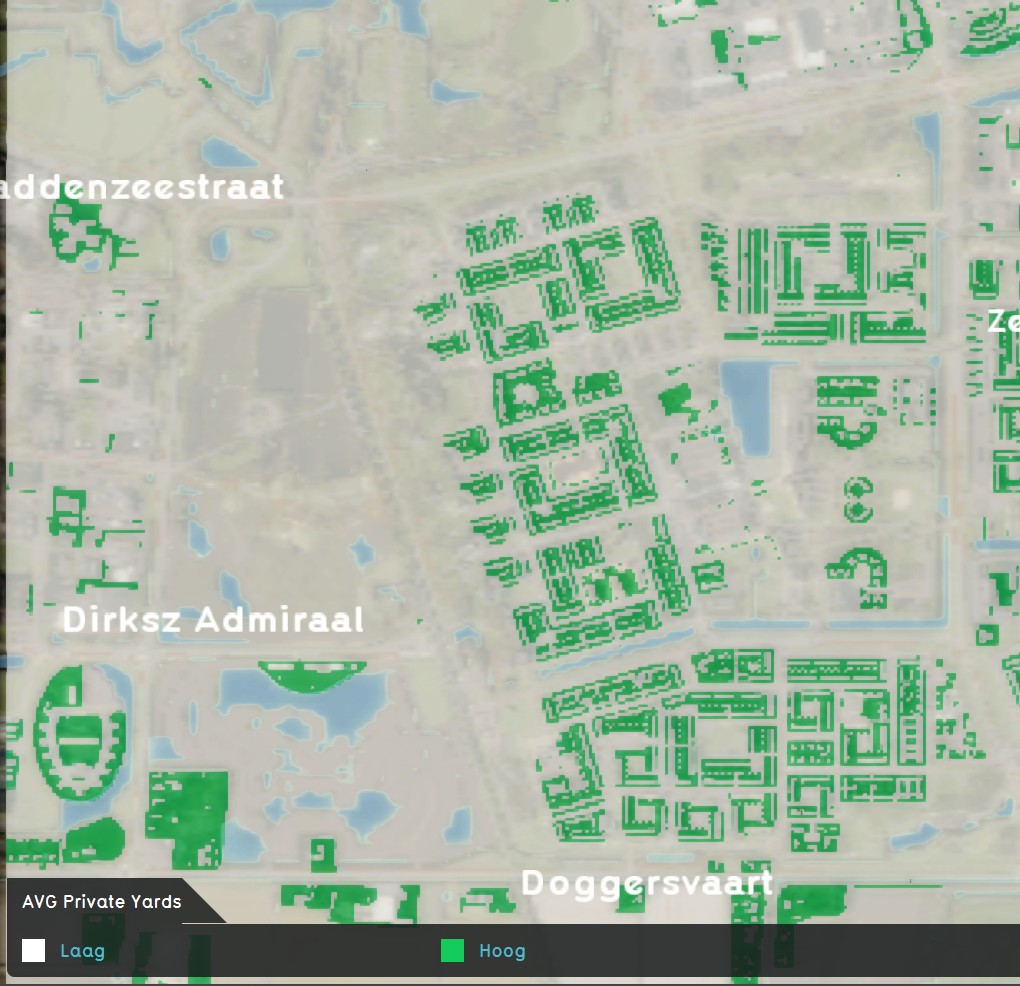 AVG Private Yards overlay.
 -
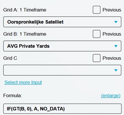 Combination layer settings, for excluding everything except private yards.
 -
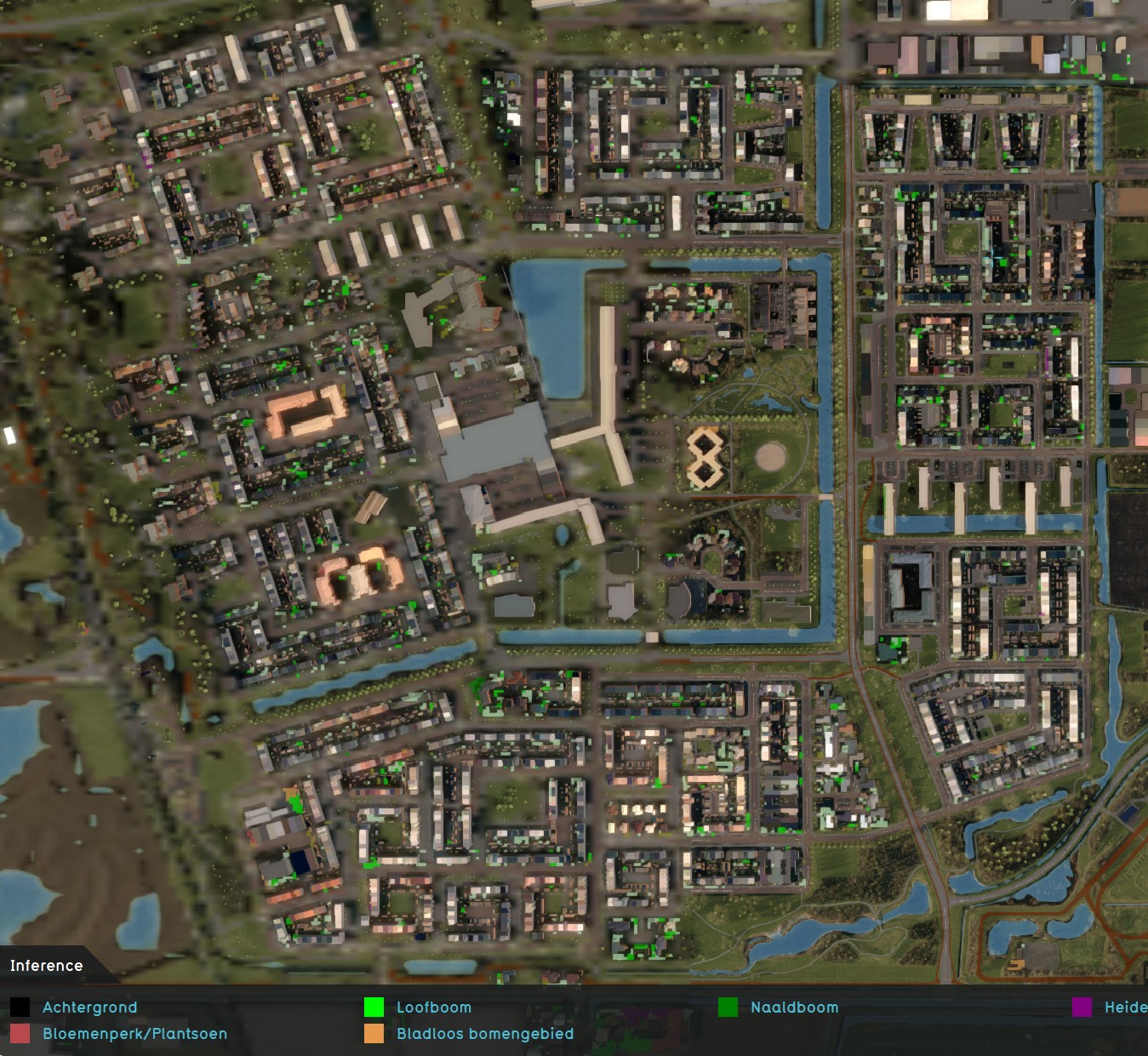 Inference overlay excluding everything but private yards.


Rasterize only private yards, based on an Attribute, and exclude the rest from an Inference Overlay
To make life easier, you can also rasterize input for a combo overlay, based on a single attribute. Using only an attribute as input, is much faster, as it avoids having to set up areas in an average overlay based on that attribute first. You will, however, lack the option to set up an averaging distance.
- Add a Combo Overlay.
- Select the Original Satellite overlay as input for Grid A.
- Click on 'Select more Input or Attfribute'.
- Ensure that for input 'Attribute: Specific Layer' and 'Buildings' is selected.
- Select or enter 'PRIVATE_YARD' as attribute.
- Enter the following formula: "IF(GT(ATTRIBUTE, 0), A, NO_DATA)". This formula checks wether a point is has a value for the attribute PRIVATE_YARD. If so, it returns the satellite image, else it returns no data.
- Select again "Update Now".
- Now use this new combo overlay with a filtered satelite image as input for your inference overlay, and update. You have now excluded everything but private yards from your inference overlay, based on the attribute PRUIVATE_YARD.
-
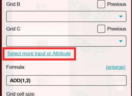 Click on 'Select more Input or Attfribute'.
 -
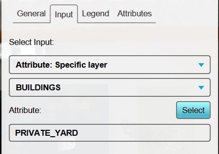 Ensure that for input 'Attribute: Specific Layer' and 'Buildings' is selected, and select or enter 'PRIVATE_YARD' as attribute.
 -
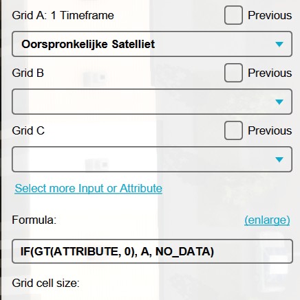 Combination layer settings, for excluding everything except private yards, based on an Attribute.


Notes
- The detected foliage overlay can be used to import as trees or foliage areas into your project.
- The Combo Overlay only accepts a satellite image as input in Grid A.
- You can combine multiple masking overlays; for example you can look for only private yards, but exclude already existing BGT trees.
- When using only an attribute for input, in stead of an average overlay based on that attribute, it is not possible to implement a so called averaging distance.