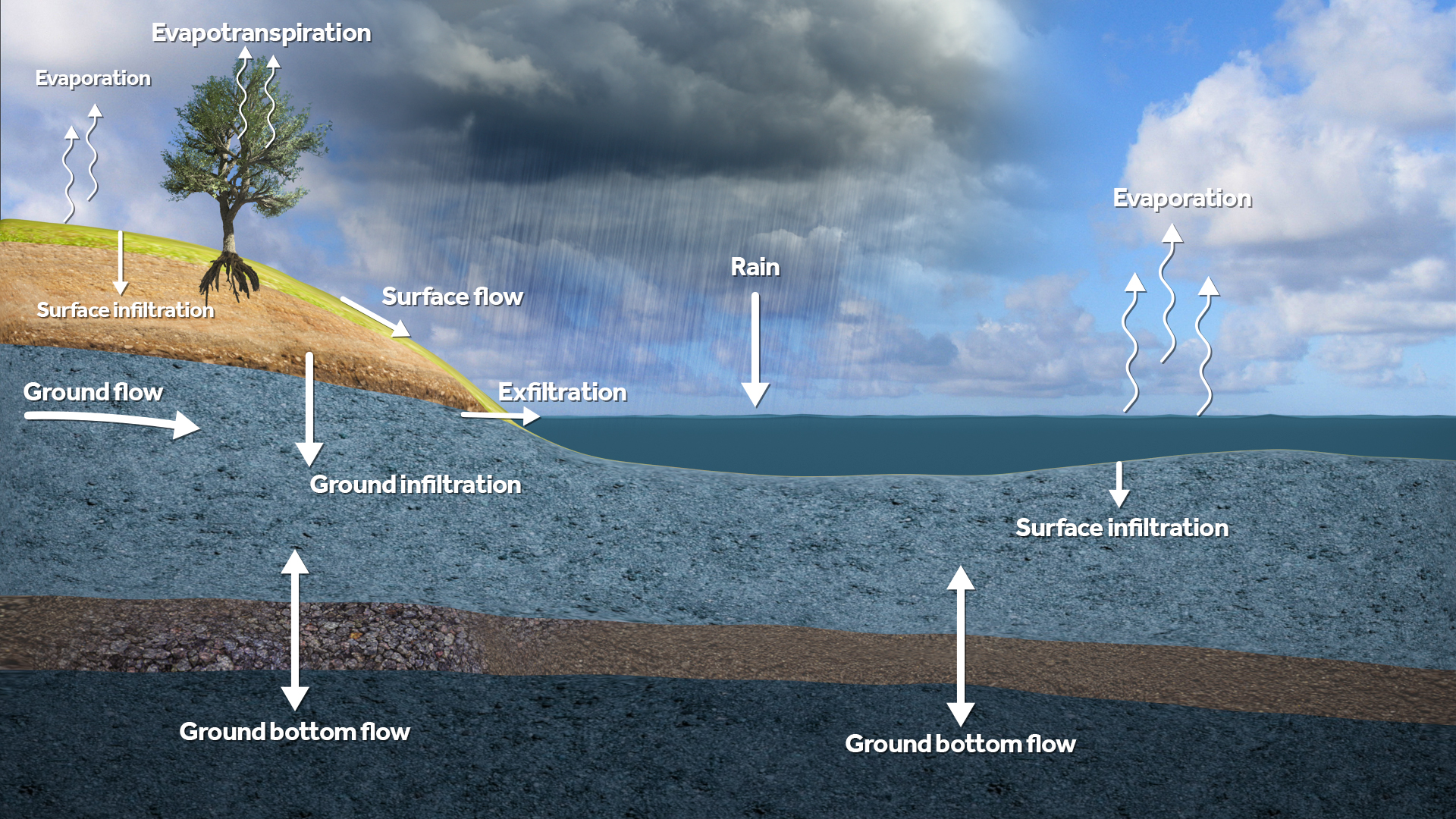
Water Overlay ground model cheatsheet
Jump to navigation
Jump to search
Core principles
Tygron consists of a 2D grid model with a time component. An aquifer and a aquitard can be modelled. The following geohydrological processes can be simulated:
- Infiltration,
- Flow through the unsaturated zone in vertical direction;
- Flow in the saturated zone in horizontal direction;
- Groundwater from the saturated zone can seep away or be replenished through a aquitard layer.
Infiltration Terrain Type: Attributes
Formula used: Surface infiltration formula (Water Overlay)
| Parameter | Attribuut in Tygron | Symbol | Unit |
|---|---|---|---|
| Infiltration speed of the building | GROUND_INFILTRATION_MD | Ibuilding | m/d |
| Infiltration speed of the terrain | GROUND_INFILTRATION_MD | Iterrain | m/d |
| Infiltration speed of the ground | GROUND_INFILTRATION_MD | Iground | m/d |
| Effective infiltration speed. | GROUND_INFILTRATION_MD | Isurface | m/d |
Unsaturated zone Terrain Type: Attributes
| Parameter | Unit | Description |
|---|---|---|
| UNSATURATED_FRACTION | fraction | Initial value saturation E.g. 0.5 means pores are 50% filled with water. |
| WATER_STORAGE_PERCENTAGE | m³/m³ | Effective porosity. Determines water storage capacity. |
| GROUND_INFILTRATION_MD | m/day | Maximum infiltration speed in this type of terrain. |
Saturated zone Terrain Type: Attributes
| Parameter | Unit | Description |
|---|---|---|
| HYDRAULIC_CONDUCTIVITY | m/day | Horizontal conductivity. |
| HYDRAULIC_CONDUCTIVITY_WITH_THICKNESS_MD | m²/day | Horizontal conductivity corrected for layer thickness. |
Simulation modes Water Overlay Wizard
| Mode | Description |
|---|---|
| None | No groundwater processes are simulated. Surface is impermeable. |
| Infiltration only | Only infiltration into the unsaturated zone is simulated. Storage is defined by MAX_INFILTRATION_M. |
| Complete | Complete simulation of infiltration, flow, and evaporation. |
Output Overlays Water Overlay Result Types
| Mode | Description |
|---|---|
| GROUND_WATERTABLE | Groundwater level, in meters relative to reference datum. |
| GROUND_WATERTABLE_WITH_SURFACE | Combines GROUND_WATERTABLE with water on the surface when groundwater level is near the surface. |
| GROUND_FLOW | Horizontal flow of groundwater. |
| GROUND_BOTTOM_FLOW | Groundwater flow via the bottom of the saturated zone. |
| GROUND_LAST_STORAGE | Current amount of water in the unsaturated and saturated zones combined. |
| GROUND_MAX_STORAGE | Highest recorded amound of water in the unsaturated and saturated zones combined. |
| GROUND_LAST_UNSATURATED_STORAGE | Amount of water in the unsaturated zone. |
| GROUND_LAST_UNSATURATED_FRACTION | Fraction of total amount of storage available in unsaturated zone which is actually filled with water. |
| EVAPORATED | Total evaporation recorded, including evapotranspiration through vegetation. |
