Water balance (Water Overlay): Difference between revisions
No edit summary |
No edit summary |
||
| Line 1: | Line 1: | ||
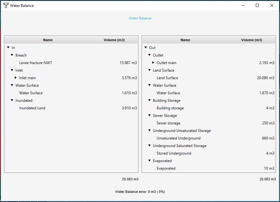
[[File:water_balance.jpg|thumb|250px|A water balance with multiple input and output entries.]] | [[File:water_balance.jpg|thumb|250px|A water balance with multiple input and output entries.]] | ||
| Line 16: | Line 14: | ||
* Inlet | * Inlet | ||
* Rain | * Rain | ||
* Water surface | * [[Water surface (Terrain Attribute)|Water surface]] | ||
* Inundated land | * Inundated land | ||
| style="vertical-align:top"| | | style="vertical-align:top"| | ||
Revision as of 17:36, 20 January 2023
During the simulation, a tally is kept of the total amount of water which the hydrological model is initialized with, how much flows in and out, and how much is left in various layers when the simulation completes. The overview of these tallies is known as the water balance, and can be accessed after the calculation has completed. It will display water categorized into input (where it was initialized and/or how it entered the hydrological system) and output (where in the hydrological system it ended up, or through which path or process it left the hydrological system).
The following entries are displayed:
| Input | Output |
|---|---|
|
|
For completeness, a total for both water input and output is displayed, as well as a check on any eventual water loss in the system. Depending on the size of the project area and the amount of water flowing through various cells, there may be a minor difference between the input and output due to numerical rounding. In these cases the difference should amount to less than a tenth of a millimeter of water per cell in the calculation.


