How to level terrain in Measures: Difference between revisions
Jump to navigation
Jump to search
No edit summary |
No edit summary |
||
| Line 24: | Line 24: | ||
<gallery> | <gallery> | ||
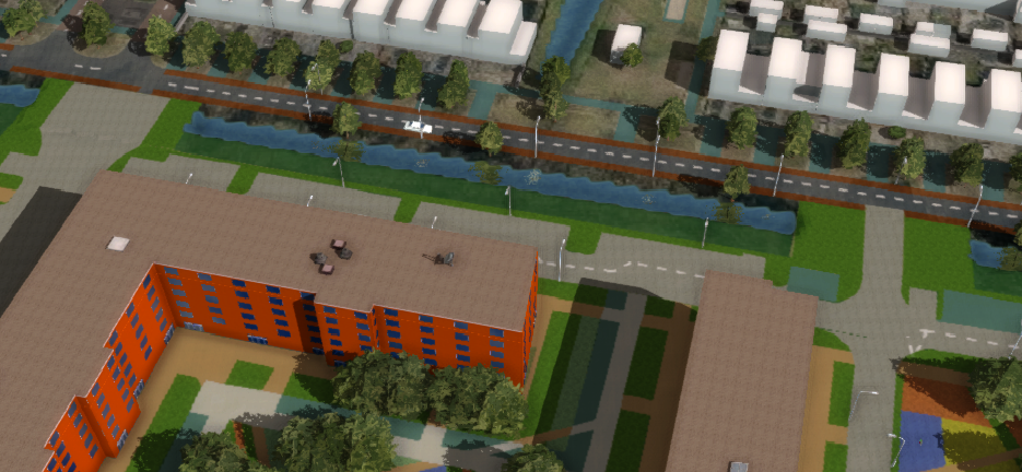
File:measure_level_terrain_original_situation.png|Original [[Demo DXF Import|Measure of City Plan]]with bridge connections situated under water and on sloped terrain. | File:measure_level_terrain_original_situation.png|Original [[Demo DXF Import Project|Measure of City Plan]]with bridge connections situated under water and on sloped terrain. | ||
File:measure_level_terrain_new_situation.png|Effect of using a [[Grid Spatial]]s to adjust [[DTM|terrain height]] and [[Terrain Type|type]]. | File:measure_level_terrain_new_situation.png|Effect of using a [[Grid Spatial]]s to adjust [[DTM|terrain height]] and [[Terrain Type|type]]. | ||
</gallery> | </gallery> | ||
| Line 30: | Line 30: | ||
{{article end| | {{article end| | ||
|howtos=*[[How to remove a waterway from the heightmap]] | |howtos=*[[How to remove a waterway from the heightmap]] | ||
|seealso=*[[Grid Spatial]]*[[Measures]] | |seealso=*[[Grid Spatial]]*[[Measures]]*[[Demo DXF Import Project]] | ||
}} | }} | ||
Revision as of 10:51, 28 May 2025
This How-to contains the steps on how to add a Grid Spatial to a Measure, that will adjust the DTM when the Measure is applied. Additionally, the Terrain Type can be altered. The region where this Grid Spatial is applied can be determined automatically or supplied manually.
How to level terrain in Measures:
- Select Future Design.
- Click on Measures to open the Measures panel.
- Select an existing Measure or add a new Measure by clicking on the Add button.
- With the measure selected, click on the Add Grid button to add a Grid Spatial.
- In the Grid Spatial's Detail Panel, click on the Add button to select a Grid Overlay to apply.
- Select the Grid Overlay that represents the leveled terrain. (See this How-to).
- Uncheck the option Calculate Area from Grids Automatically.
- Click on the Draw Area button to start drawing a manual selection.
- With the Brushes panel opened, draw a selection.
- Click on Apply Selection to finalize the selection
- Optionally select a Terrain Type to override the existing Terrain. (Advisable in case of Water)
-
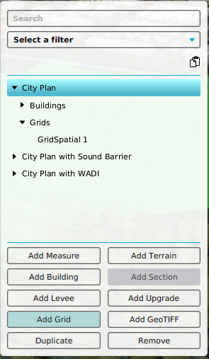 Add a Grid Spatial to a selected Measure
 -
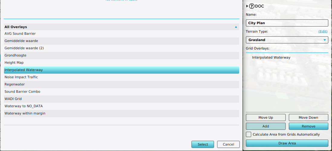 Add a Grid Overlay to a Grid Spatial
 -
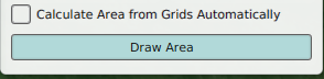 Uncheck the option Calculate Area from Grids Automatically and click on Draw Area
 -
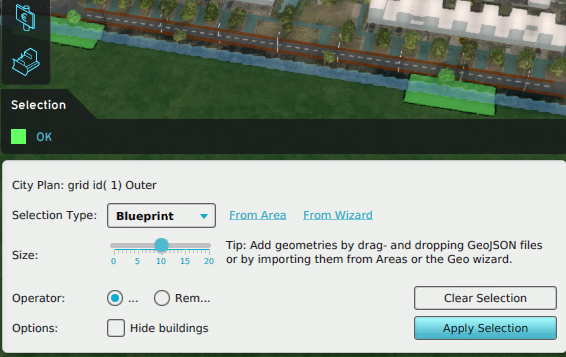 Draw a manual selection for the Grid Spatial
 -
 Adjust the Terrain Type


-
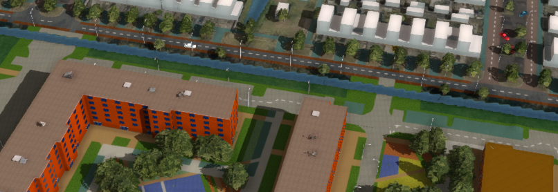 Original Measure of City Planwith bridge connections situated under water and on sloped terrain.
 -