How to remove a waterway from the heightmap
Jump to navigation
Jump to search
This How-to contains the steps on how to create a set of Grid Overlays that calculate a leveled terrain height around waterways. The resulting Grid Overlay can be used to either directly adjust the terrain height of the Current Situation, or applied to the Future Design with a Measure using Grid Spatials
The strategy is as followed:
- Add a Heightmap Overlay
- Add an Average Overlay to create a region around water terrains.
- Add a Combo Overlay to change the region to No Data, and height values otherwise.
- Add an Average Overlay to interpolate the No Data values with surrounding height values.
How to remove a waterway from the heightmap:
- Open a project in the Editor
- Select Current Situation
- In the ribbon bar, hover over Overlays and under Topography, select Digital Terrain Model
- Again, in the ribbon bar, hover over Overlays and under Grid Calculation, select Avg and Interpolation.
- With the Average Overlay selected, rename it to Waterway within Margin
- Under Select Input, set the option to Specific Layer and select the TERRAINS layer type.
- Set the Cell average distance to 10 meters
- Click on the Select button and select the WATER attribute from the list of Terrain attributes.
- Hover over Overlays in the ribbon bar and under Grid Calculation, select Combo Overlay
- With the Combo Overlay selected, name it to Waterway to NO DATA using the Detail Panel
- For Grid A, select the overlay named Waterway within margin
- For Grid B, select the Digital Terrain Model Overlay named Heightmap
- Provide the following formula: IF(GT(A, 0), NO_DATA, B)
- Hover over Overlays in the ribbon bar and under Grid Calculation, select Avg and Interpolation
- Rename the Average Overlay to Interpolated Waterway.
- Under Select Input, set the option to Grid: Input Overlay and select the Overlay Waterway to NO DATA.
- Set the Average distance to around twice as large as the distance of the Waterway within Margin Overlay. In our case we set it to 20 meters.
-
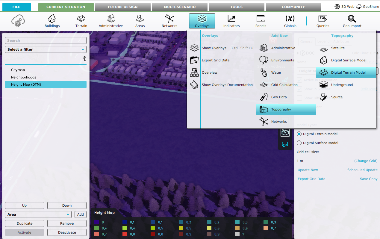 Add a Heightmap Overlay (DTM)
 -
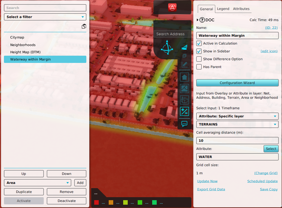 Add and configure an Average Overlay
 -
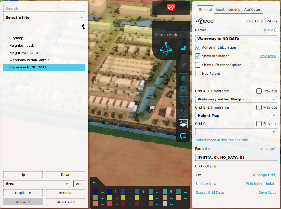 Add and configure a Combo Overlay
 -
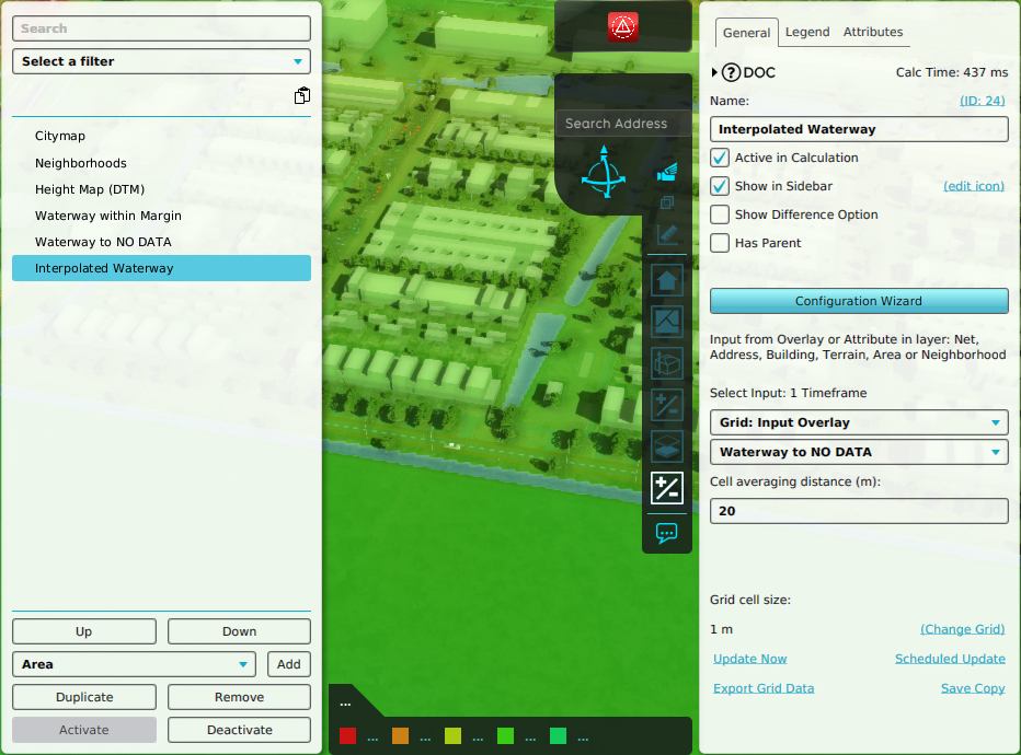 Add and configure an Interpolation Overlay
 -
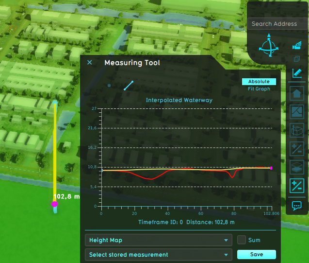 Measurement difference between original Heightmap (red) and Interpolated (yellow)


