Levee Type
In spatial planning Levee refers to a natural or artificial slope or wall to regulate water levels, called levee in US English.
In the Tygron Platform these levees play a special part. As dedicated Buildings they can affect safe zones and floods. By constructing a levee as an independent action or as part of a measure, the safe zone terrain will be expanded, protecting more houses and industry when a flood occurs. This can all be visualized in the Tygron Platform and a dedicated indicator can be set up to have the implementation of levees score on the stakeholder progression.
-
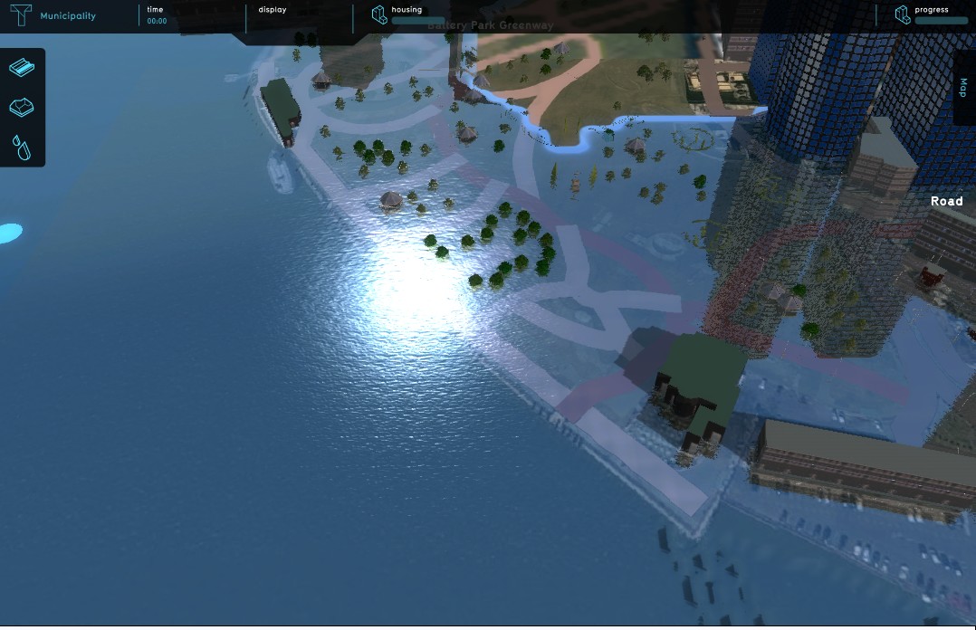 High water in Lower Manhattan, before flood protection
 -
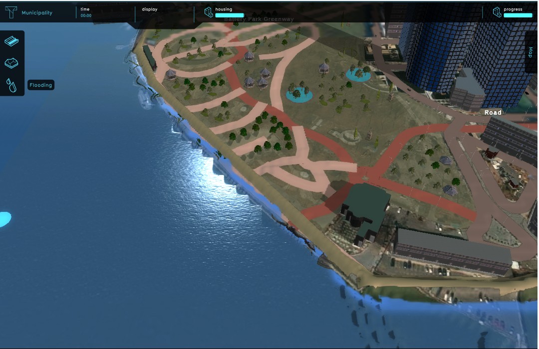 High water in Lower Manhattan, after flood protection
 -
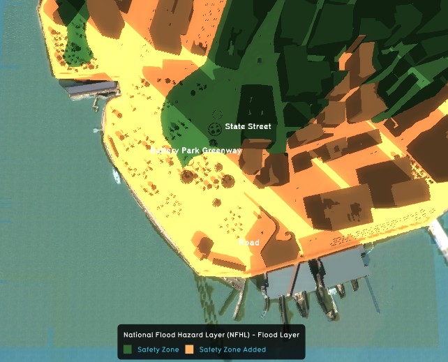 Expanded safe zone in Lower Manhattan, after flood protection
 -
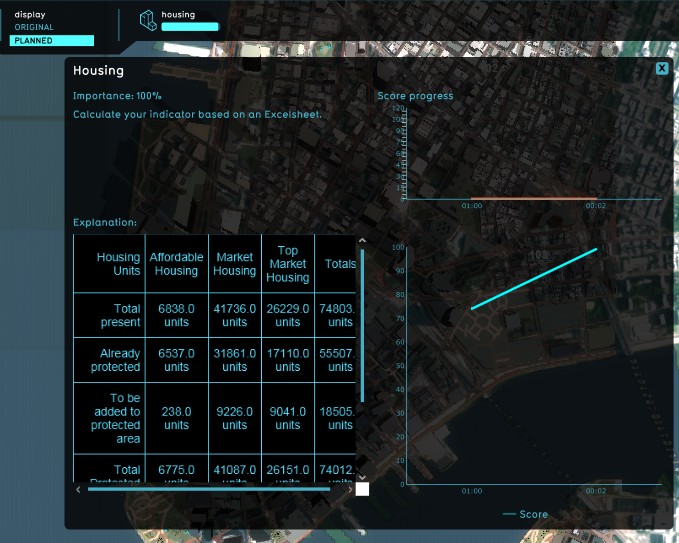 Lower Manhattan Housing units protected (Excel) indicator


Different ways of deploying levees in the Tygron Platform
In the Tygron Platform are two ways present to implement levees in a project; drawn in manually during the session as action, or deployed as part of a measure using LeveeSpatials.
Implementation as action allows for trying out new plans and ideas. This can for instance be convenient when the project is part of an outreach to non-planners, for example residents or business owners, to let them try their own plans and ideas without an engineer pre-planning the flood protection for them. This can give session participants a stronger sentiment of involvement with the project.
On the other hand, deploying the levees as part of a predefined measure enables a project to quickly switch between different pre-planned alignments, in order to visualize the impact of each alignment on the indicators.
Deployed as part of a (predefined) Measure
- Note: it is currently only possible to assign functions to the top and side of a levee when deployed as an Action.
- Select Stakeholders → Measures → Add Spatial Measure
- Open the MeasureSpatials entry
- Select the WATER 1 (default) entry
- On the right panel, select LEVEE as type from the drop down menu on the right panel
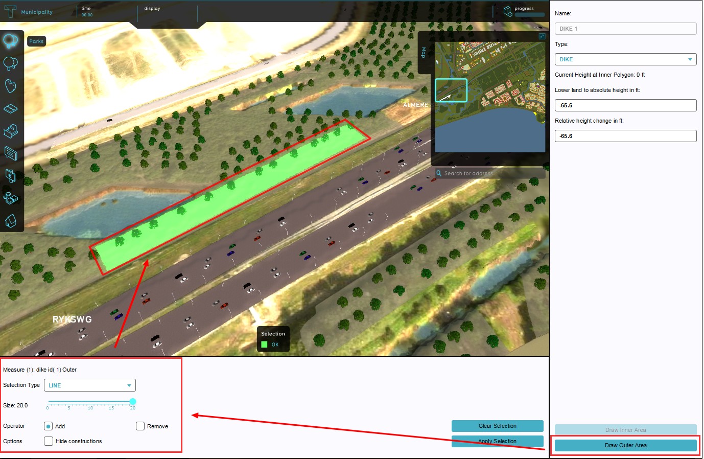
- Set relative and absolute height on the right panel
- Use brush panel to draw Outer Area, and apply
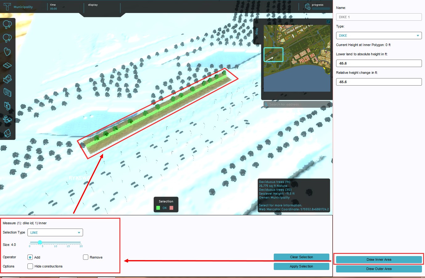
- Use brush panel to draw Inner Area, and apply
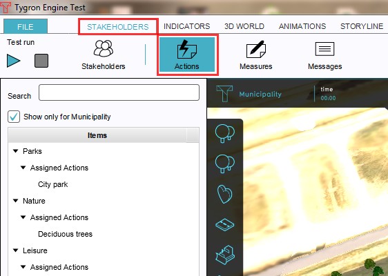
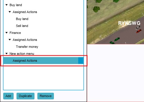
- Select Stakeholders → Actions
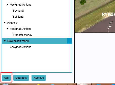
- Add new action (if desired)
- Select Assigned Actions
- Add new Measure to Assigned Actions on the right panel
-
 1. Select Add Spatial Measure
 -
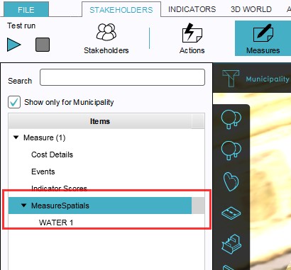 2. Open the MeasureSpatials entry
 -
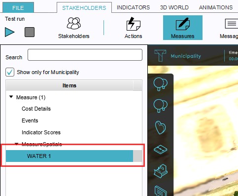 3. Highlight the WATER 1 (default) entry
 -
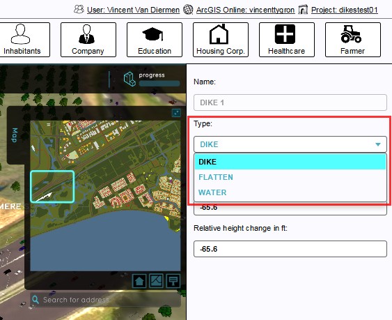 4. Select LEVEE from the drop down menu
 -
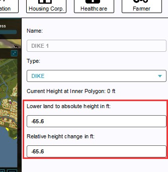 5. Set relative and absolute height
 -
 6. Draw Outer Area
 -
 7. Draw Inner Area
 -
 7. Select Stakeholders → Actions
 -
 8. Add new Action (if desired)
 -
 10. Select Assigned Actions
 -
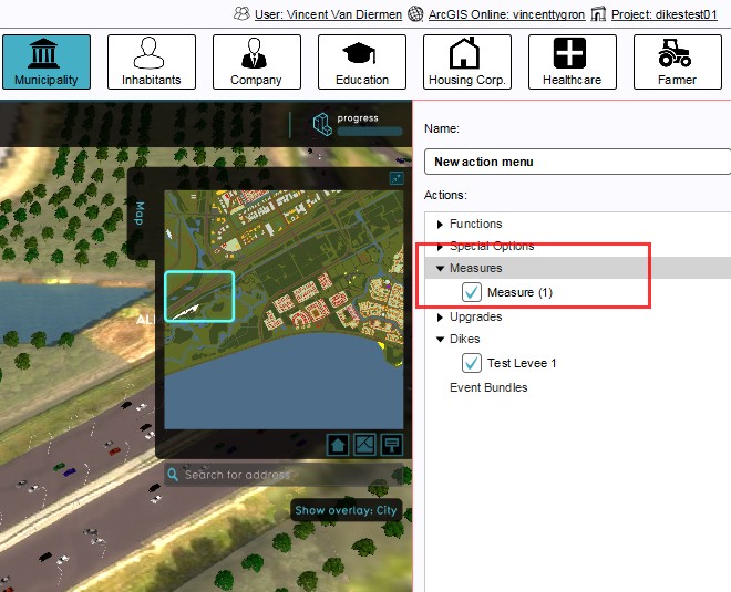 11. Add new Measure to Assigned Actions


