Elevation GeoTIFF: Difference between revisions
Jump to navigation
Jump to search
 Current Situation
No edit summary |
No edit summary |
||
| Line 2: | Line 2: | ||
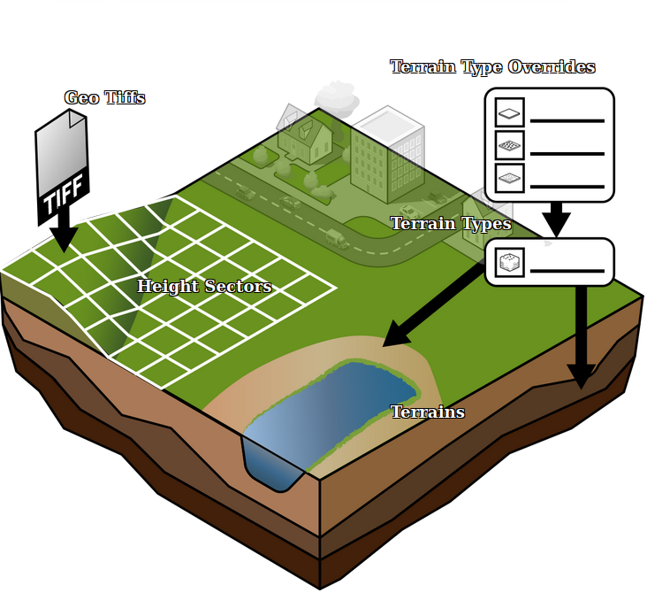
An [[Elevation GeoTIFF]] is a [[GeoTIFF]] that represents a subsection of the DTM, that can be used to update the current DTM in the [[Project]]. | An [[Elevation GeoTIFF]] is a [[GeoTIFF]] that represents a subsection of the DTM, that can be used to update the current DTM in the [[Project]]. | ||
{{article end | |||
|howtos= | |||
* [[How to import a GeoTIFF to change the elevation model]] | * [[How to import a GeoTIFF to change the elevation model]] | ||
* [[How to import a GeoTIFF of waterway depths]] | * [[How to import a GeoTIFF of waterway depths]] | ||
|seealso= | |||
* Digital Terrain Model Overlay | |||
}} | |||
{{Editor_current_situation_nav}} | {{Editor_current_situation_nav}} | ||
Revision as of 13:56, 21 October 2022

An Elevation GeoTIFF is a GeoTIFF that represents a subsection of the DTM, that can be used to update the current DTM in the Project.
How-to's
See also
- Digital Terrain Model Overlay
- Buildings • Terrains • Administrative • Areas • Networks • Overlays • Indicators • Panels • Globals • Queries • Geo Import
- Buildings
- Function • Function Override • Traffic Units
- Terrain
- Height sector • Elevation model • Elevation GeoTIFF • Elevation Grid Overlay • Ground Price • Terrain Type • Terrain Type Override
- Administrative
- Net Cluster • Net Function • Net Line • Net Load • Net Node • Net Setting
- Editor