Watershed Overlay: Difference between revisions
Jump to navigation
Jump to search
Created page with "thumb|420px|right|Example of the Watershed overlay The watershed overlay calculated where surface water will end up based on the DEM or a Wa..." |
No edit summary |
||
| (40 intermediate revisions by 4 users not shown) | |||
| Line 1: | Line 1: | ||
[[File: | [[File:Watershed_Overlay.png|thumb|420px|right|Example of the Watershed overlay]] | ||
The watershed overlay | The watershed overlay calculates where surface rainfall water will end up based on the [[elevation model]] or a [[Water Overlay]]'s [[Surface_avg_direction_result_type_(Water_Overlay)|direction result]]. Users can influence the created [[Watersheds result type (Watershed Overlay)|watersheds]] by providing indicative [[Discharge area (Watershed Overlay)|discharge areas]], which will expand into watersheds. Moreover, a [[Direction prequel (Watershed Overlay)|direction prequel overlay]], such as a [[Rainfall (Overlay)|rainfall overlay's]] [[Surface_avg_direction_result_type_(Water_Overlay)|surface avg direction result]] can be used to calculate more realistic watersheds. | ||
__NOTOC__ | |||
== | ==Usage== | ||
The watershed overlay results can be used to: | |||
* Debug a water system; are the [[Water_level_area_(Water_Overlay)|water areas]] used to initialize my [[Water Overlay|water overlay]] correct or do they need adjustments? | |||
* Determine which waterways are the most important waterways in my water system, based on the size of the calculated discharge areas. | |||
* Help solve disputes with land owners: does rainfall on the land of a land owner end up in water ways or does it remain on land? | |||
* Using discharge areas as input for water simulation tools outside the {{software}}, by combining the size of the area with the amount of rainfall it receives. | |||
The | ==Considerations== | ||
* | The watershed overlay calculates watershed areas based on: | ||
* | * A heavy rainfall; | ||
* Sewer is not taken into account; | |||
* Large Forests often do not have proper discharge when they are not close to water ways; | |||
* Certain computed watershed areas might not be connected to the original water system used as input, in the form as discharge areas. This in turn can help find flaws in your water system; | |||
* Culverts are important for the connectivity of discharge areas, but often not all culverts are initially know or defined. The [[Water_Connection_Generator|water connection generator]] tool has been added to generate culverts on a large scale based on input parameters; | |||
==Module== | |||
{{Template: | A Watershed Overlay can be configured by opening the Watershed Overlay Wizard. | ||
{{Template:Watershed_Module_buttons}} | |||
== | ==Result types== | ||
The watershed overlay can provide the following result types: | |||
{{result types|suppresscategory=true|allowselflinks=true| | |||
{{:Watersheds result type (Watershed Overlay)}} | |||
{{:Discharge areas result type (Watershed Overlay)}} | |||
{{:Direction result type (Watershed Overlay)}} | |||
{{:Base types result type (Watershed Overlay)}} | |||
}} | |||
== | <ul> | ||
<li style = "display:inline-block">[[File:Watershed_Overlay.png|200xpx]]</li> | |||
<li style = "display:inline-block">[[File:Discharge_areas_result.jpg|200xpx]]</li> | |||
<li style = "display:inline-block">[[File:Direction result type (Watershed Overlay).jpeg|200xpx]]</li> | |||
<li style = "display:inline-block">[[File:Watershed_base_types.jpeg|200xpx]]</li> | |||
</ul> | |||
{{ | ==Demo projects== | ||
* The project Demo Watershed can be explored to see how a Watershed Overlay based on a [[Rainfall (Overlay)|Rainfall Overlay]] can contribute to debugging a watersystem. | |||
{{Article end | |||
|howtos= | |||
* [[FAQ (Watershed Overlay)|FAQ for Watershed Overlay]] | |||
* [[How to add and remove an Overlay]] | |||
* [[How to edit an overlay legend|Edit an overlay legend]] | |||
}} | |||
{{WatershedOverlay result nav}} | |||
{{Overlay nav}} | |||
[[Category:Overlays with result types]] | |||
Latest revision as of 13:41, 2 February 2024

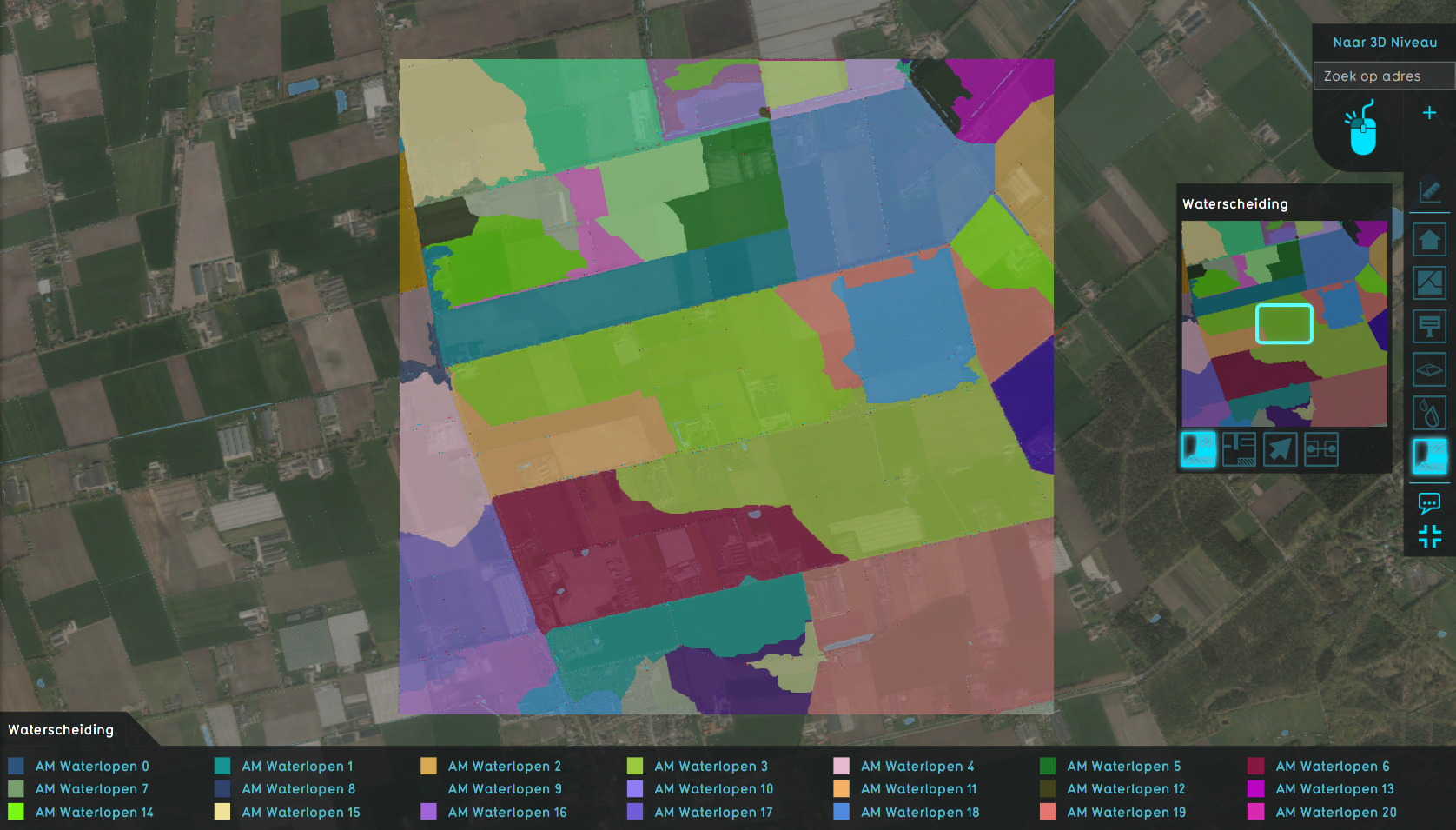
The watershed overlay calculates where surface rainfall water will end up based on the elevation model or a Water Overlay's direction result. Users can influence the created watersheds by providing indicative discharge areas, which will expand into watersheds. Moreover, a direction prequel overlay, such as a rainfall overlay's surface avg direction result can be used to calculate more realistic watersheds.
Usage
The watershed overlay results can be used to:
- Debug a water system; are the water areas used to initialize my water overlay correct or do they need adjustments?
- Determine which waterways are the most important waterways in my water system, based on the size of the calculated discharge areas.
- Help solve disputes with land owners: does rainfall on the land of a land owner end up in water ways or does it remain on land?
- Using discharge areas as input for water simulation tools outside the Tygron Platform, by combining the size of the area with the amount of rainfall it receives.
Considerations
The watershed overlay calculates watershed areas based on:
- A heavy rainfall;
- Sewer is not taken into account;
- Large Forests often do not have proper discharge when they are not close to water ways;
- Certain computed watershed areas might not be connected to the original water system used as input, in the form as discharge areas. This in turn can help find flaws in your water system;
- Culverts are important for the connectivity of discharge areas, but often not all culverts are initially know or defined. The water connection generator tool has been added to generate culverts on a large scale based on input parameters;
Module
A Watershed Overlay can be configured by opening the Watershed Overlay Wizard.
Result types
The watershed overlay can provide the following result types:
| Icon | Result type | Unit | Mode | Description |
|---|---|---|---|---|
| |
WATERSHEDS | Integer | The integer ID of the calculated watershed. NO_DATA if no watershed area was calculated for that particular cell. | |
| |
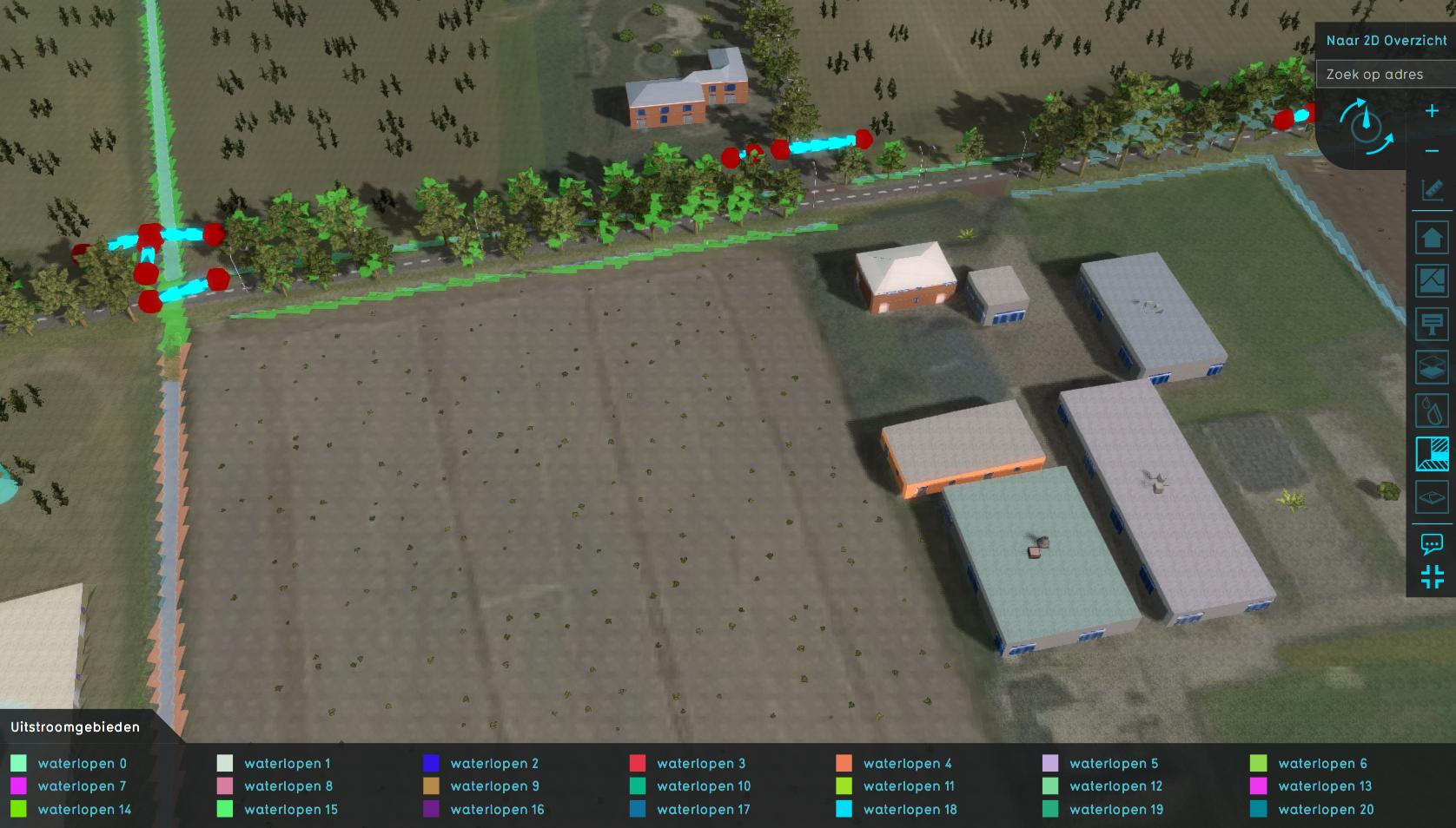
DISCHARGE_AREAS | Integer | The initial Discharge Areas and propagated to water cells by neighbors and culvert-connections. | |
| |
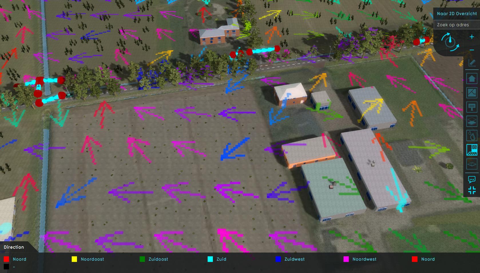
DIRECTION | geo angle (0-360°) | The direction to which rain water would flow. | |
| |
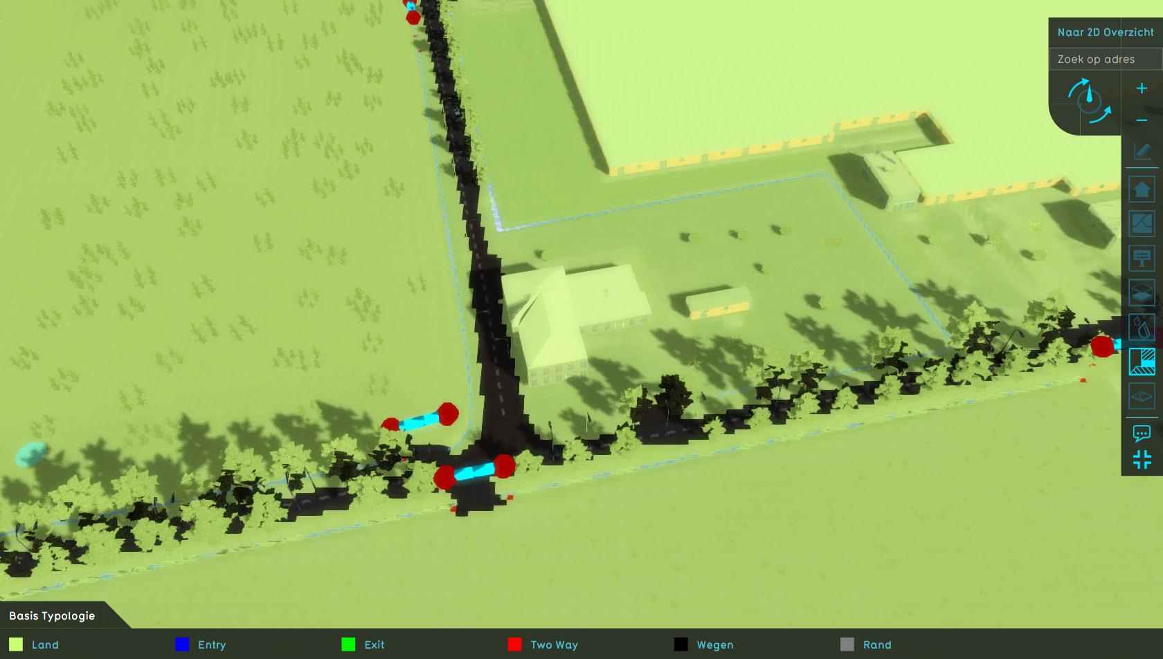
BASE_TYPES | Nominal | Categorization of the individual cells based on how they are processed by the watershed model, displaying which cells are considered to be specific features. |
Demo projects
- The project Demo Watershed can be explored to see how a Watershed Overlay based on a Rainfall Overlay can contribute to debugging a watersystem.


