Inference Overlay
<fullwidth>

</fullwidth>
The AI Inference Overlay is a Grid Overlay which can spatially identify features using one or more Prequel Grids. Features are identified using a Convolution Neural Network. This Neural Network takes a subsection (window) of the input grid and either classifies or detects one or more objects in that window. The window of detection marches over the input grid with a configurable stride.
Foliage Example

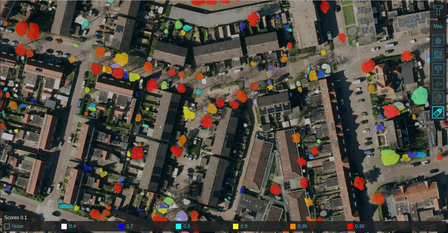
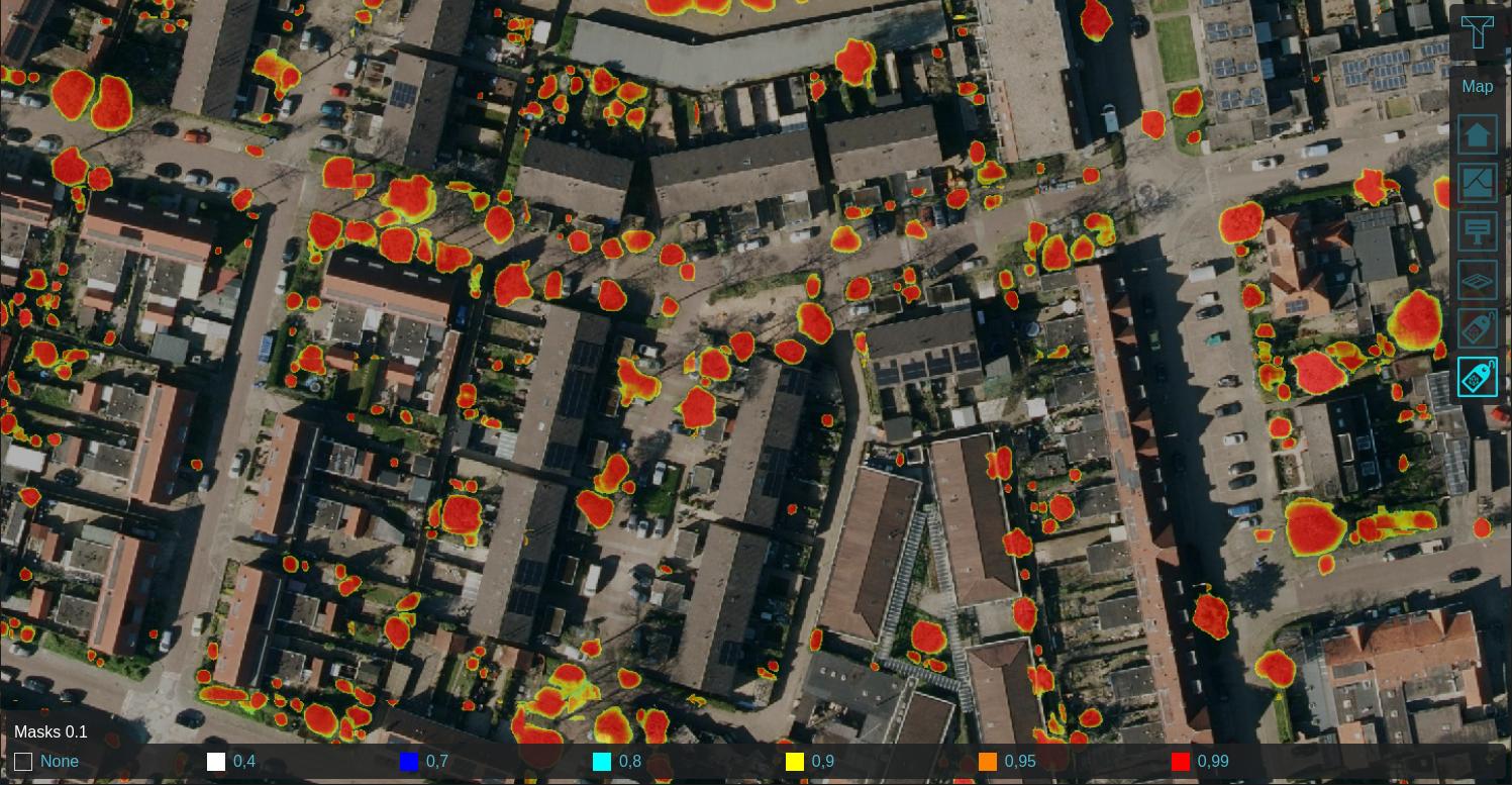
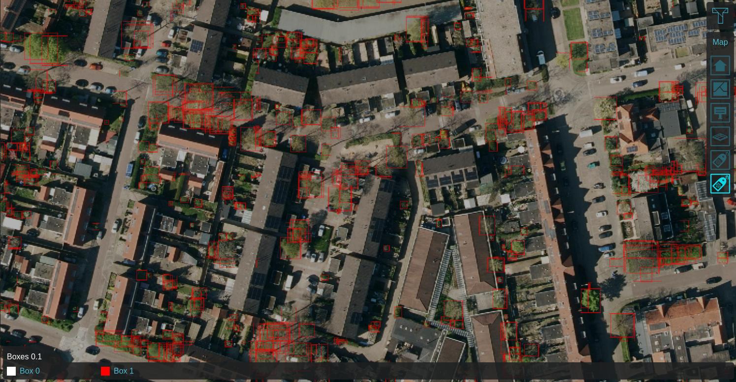
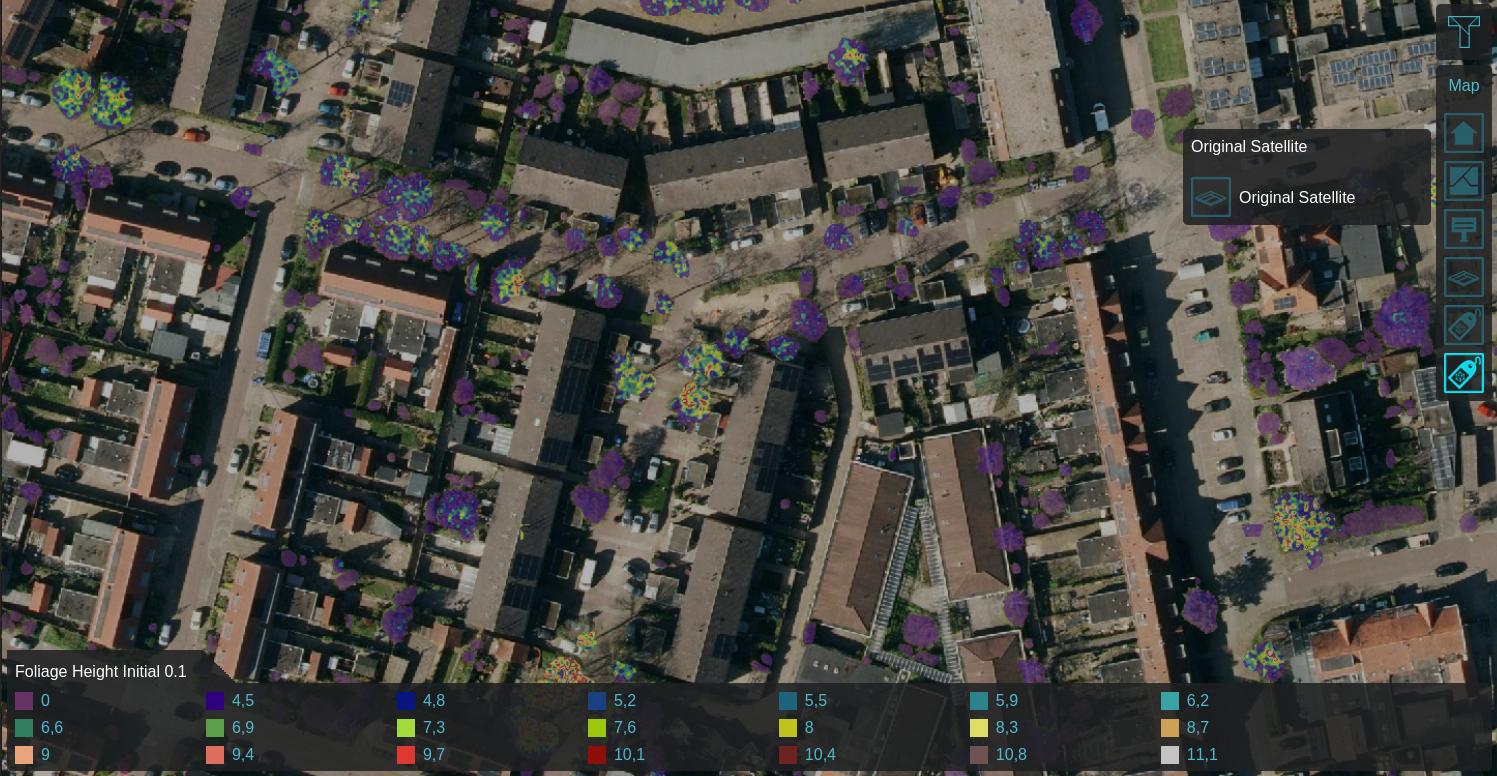
Using a Satellite Overlay of 0.1m detail, foliage features can be identified using an Inference Overlay and enhanced with a Digital Terrain Model Overlay (DTM), a WCS Overlay representing the DSM, Combo Overlay to combine these and an optionally an iterative Max Overlay to enhance the foliage height. For more information, see this how-to.
-
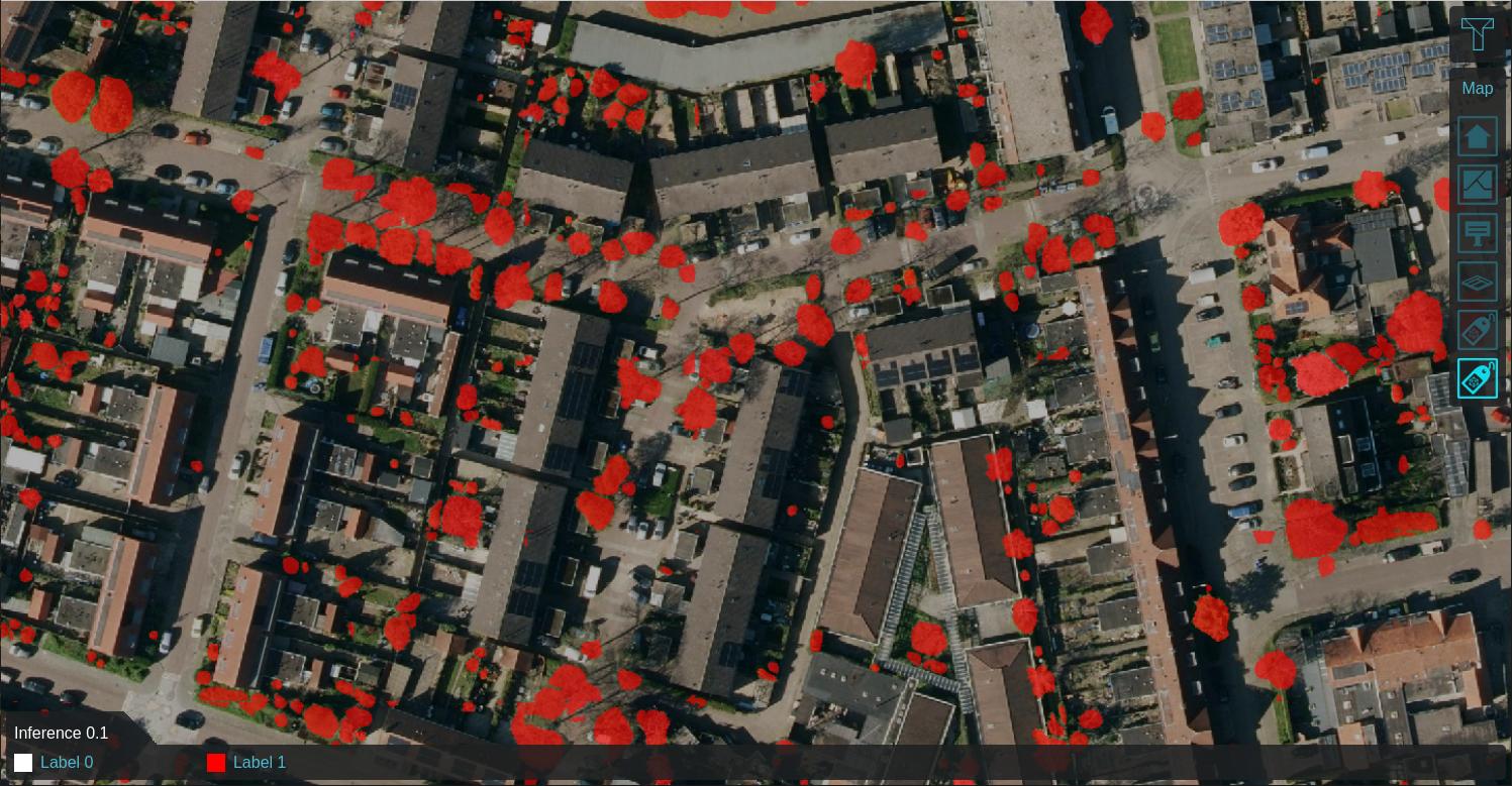 Labeled features on 0.1m satellite image
 -
-
-
-
-
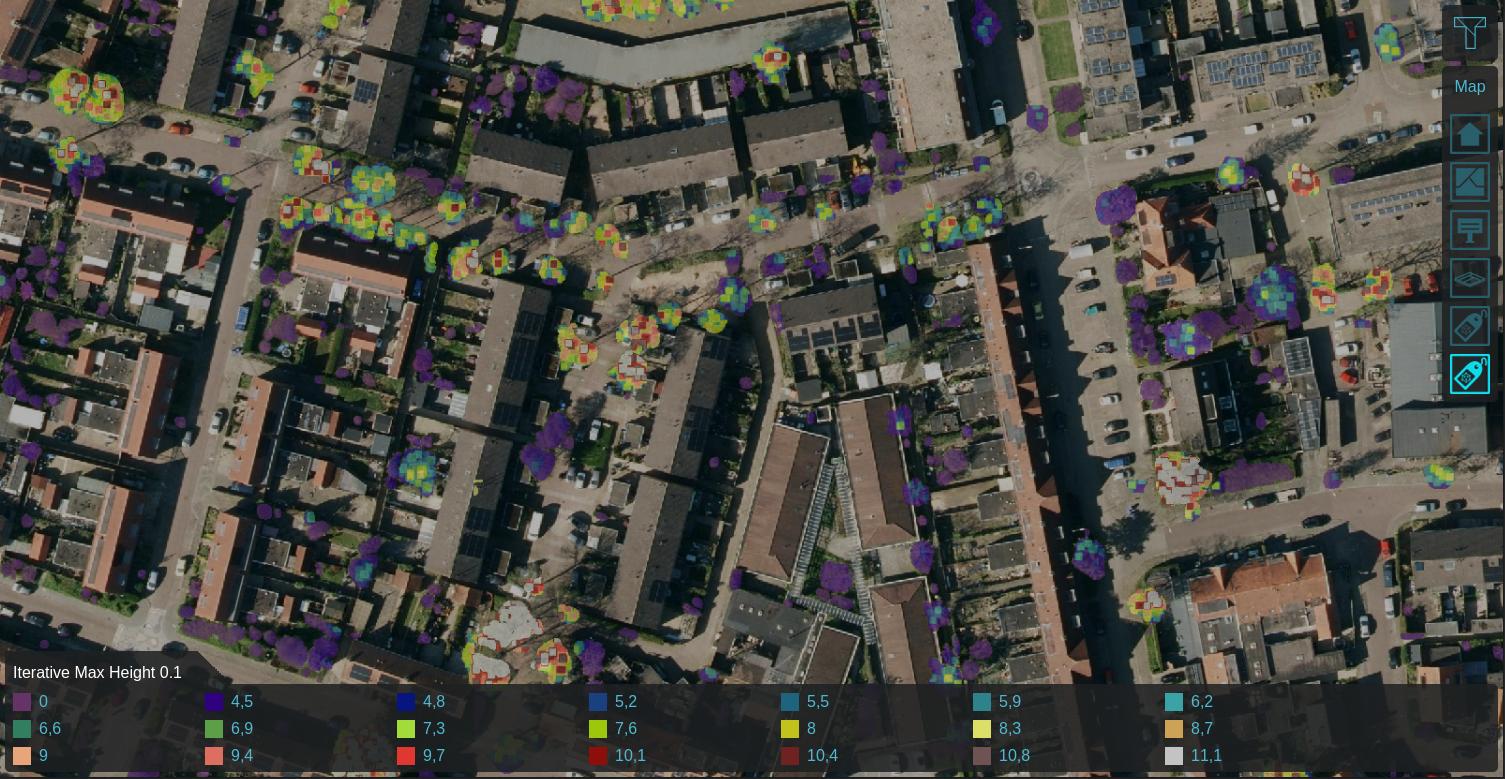 Max neighboring height within 0.25m, iterated 5 times


How-to's
- How to detect foliage using an Inference Overlay
- How to create foliage height areas based on an Inference Overlay
- How to import trees based on an Inference Overlay
- How to detect solar panels using an Inference Overlay
- How to update Buildings's solar panel attribute based on an Inference Overlay
See also


