Measurement: Difference between revisions
Jump to navigation
Jump to search
 Current Situation
No edit summary |
No edit summary |
||
| (14 intermediate revisions by the same user not shown) | |||
| Line 1: | Line 1: | ||
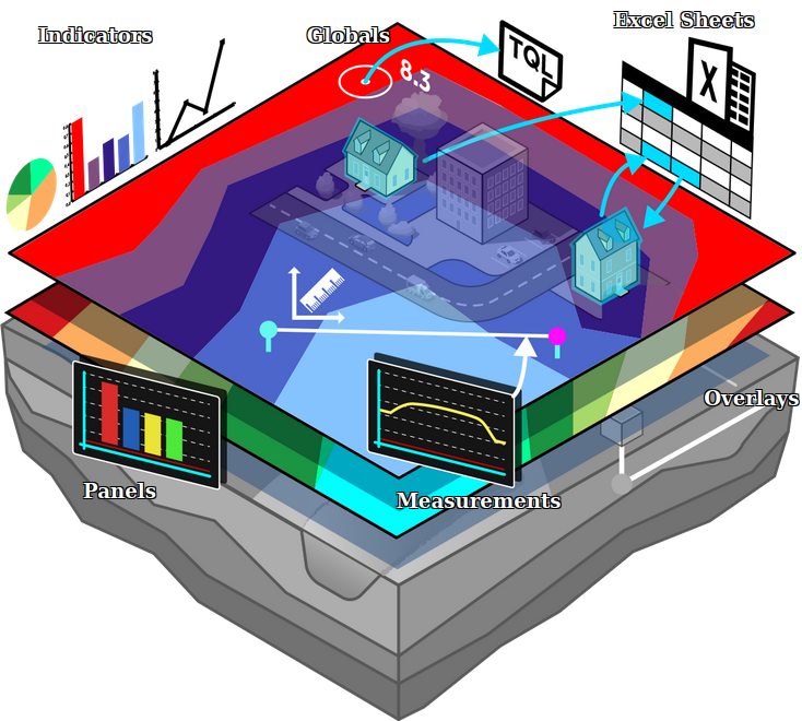
A measurement is the {{software}} is an item which allows users to record and inspect spatial data. Measurements can be positioned in the | [[File:Api_current_situation_calculation.png|thumb|right|400px|[[Measurement]] in comparison to [[Overlay]]s.]] | ||
A measurement is the {{software}} is an item which allows users to record and inspect spatial data. Measurements can be positioned in the [[project area]] using the [[Measurement Tool]] and are applied to a [[grid overlay]] or to an attribute related to a specific grid overlay. | |||
Measurements are accessible by | Measurements are accessible by | ||
| Line 6: | Line 7: | ||
===Types=== | ===Types=== | ||
Currently three types of measurements are supported: | Currently three types of measurements are supported: | ||
* [[Point measurement]] | * [[Point measurement]], to inspect the value of a grid overlay for a specific location. Optionally displays values over time in case the overlay supports timeframes. | ||
* [[Line measurement]] | * [[Line measurement]], to inspect the variation in values of a grid overlay on the line drawn. | ||
* [[Object measurement]] | * [[Object measurement]], to inspect the value of an output attribute of a grid overlay related to that object. Optionally displays values over time in case the overlay supports timeframes. | ||
===Adding a measurement=== | ===Adding a measurement=== | ||
Measurements can be added and | Measurements can be added, inspected, imported and exported using the [[measuring tool]]. It is accessible in the navigation panel, by clicking on the icon above the overlay bar. | ||
<gallery widths=300px> | |||
File:Measuring_tool_location.PNG|The location of the measuring tool in the overlay bar. | |||
File:Point_measurement.PNG|Making a point measurement in a Rainfall overlay's grid. | |||
</gallery> | |||
{{article end | |||
|howtos= | |||
*[[How to make a line measurement]] | |||
*[[How to make a point measurement]] | |||
*[[How to inspect object output attributes of an overlay using the measurement tool]] | |||
*[[How to export an Object output attribute as measurement]] | |||
*[[How to export measurements]] | |||
*[[How to import measurements]] | |||
*[[How to save and load a measurement]] | |||
}} | |||
{{Template:Editor_current_situation_nav}} | |||
[[Category:Items]][[Category:Measurement]] | |||
Latest revision as of 15:09, 30 January 2023

A measurement is the Tygron Platform is an item which allows users to record and inspect spatial data. Measurements can be positioned in the project area using the Measurement Tool and are applied to a grid overlay or to an attribute related to a specific grid overlay.
Measurements are accessible by
Types
Currently three types of measurements are supported:
- Point measurement, to inspect the value of a grid overlay for a specific location. Optionally displays values over time in case the overlay supports timeframes.
- Line measurement, to inspect the variation in values of a grid overlay on the line drawn.
- Object measurement, to inspect the value of an output attribute of a grid overlay related to that object. Optionally displays values over time in case the overlay supports timeframes.
Adding a measurement
Measurements can be added, inspected, imported and exported using the measuring tool. It is accessible in the navigation panel, by clicking on the icon above the overlay bar.

The location of the measuring tool in the overlay bar.
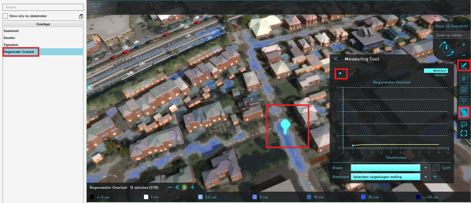
Making a point measurement in a Rainfall overlay's grid.


How-to's
- Buildings • Terrains • Administrative • Areas • Networks • Overlays • Indicators • Panels • Globals • Queries • Geo Import
- Buildings
- Function • Function Override • Traffic Units
- Terrain
- Height sector • Elevation model • Elevation GeoTIFF • Elevation Grid Overlay • Ground Price • Terrain Type • Terrain Type Override
- Administrative
- Net Cluster • Net Function • Net Line • Net Load • Net Node • Net Setting
- Editor