How to export a Grid Overlay as GeoJSON
Jump to navigation
Jump to search
How to export a Grid Overlay as GeoJSON:
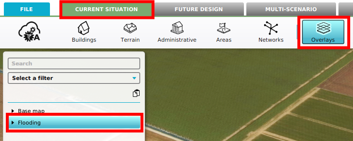
- Select Current Situation in the editor.
- Click on Overlays.
- Select the Grid Overlay that you want to export using the editor.
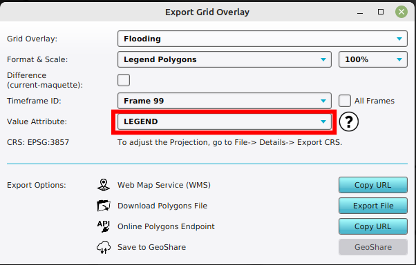
- On the Overlay's Detail Panel, select "Export Grid Data". This opens the Export Grid Overlay panel.
- Verify that the desired overlay is selected.
- Select one of the following formats: Legend Polygons, Legend MultiPolygons, Legend Points (center)
- If applicable, select a timeframe
- Optionally configure the Value Attribute of exported features to contain a different value than their Legend Entry Name.
-
 Select a Grid Overlay.
 -
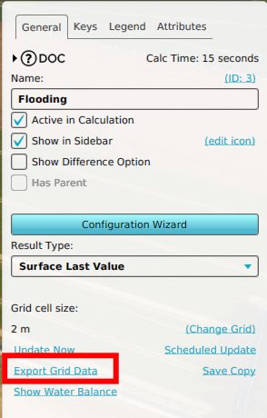 Select "Export Grid Data".
 -
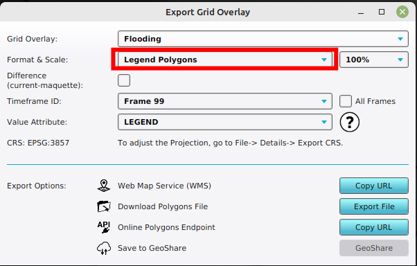 With the desired overlay select, select the Legend Polygons, MultiPolygons or Points (center) format.
 -
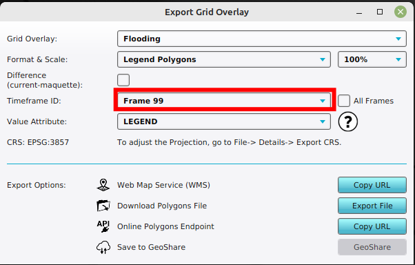 Optionally select a particular timeframe and or difference overlay, if applicable.
 -
 Optionally configure the Value Attribute of exported features to contain a value different from their Legend Entry Name.


Notes
- Based on the legend colors of the Grid Overlay, a vectorisation of the raster data is created and can be exported as a GeoJSON. See also this page for more information on how to change the legend and this video tutorial (in Dutch):
- When exporting Grid Overlays, take note of the grid cell size. The smaller the grid size, the more accurate the exported data is.
- If in a test run the option Difference (current - maquette) is selected, the difference in results between the maquette state and the current state will be exported. If you checked this option outside of the test run, or did not do any Actions yet, the exported dataset will consist no difference.
- For grid overlays which produce multiple timeframes as results, it is possible to export a dataset at a certain timeframe, by selecting the index of the timeframe. It is also possible to export all timeframes at once by checking the All frames box.
How-to's
- How to export a Grid Overlay as GeoTIFF
- How to export a Grid Overlay as ASCII
- How to export a Grid Overlay as png
- How to export a Grid Overlay to the GeoShare