Sight Distance Overlay
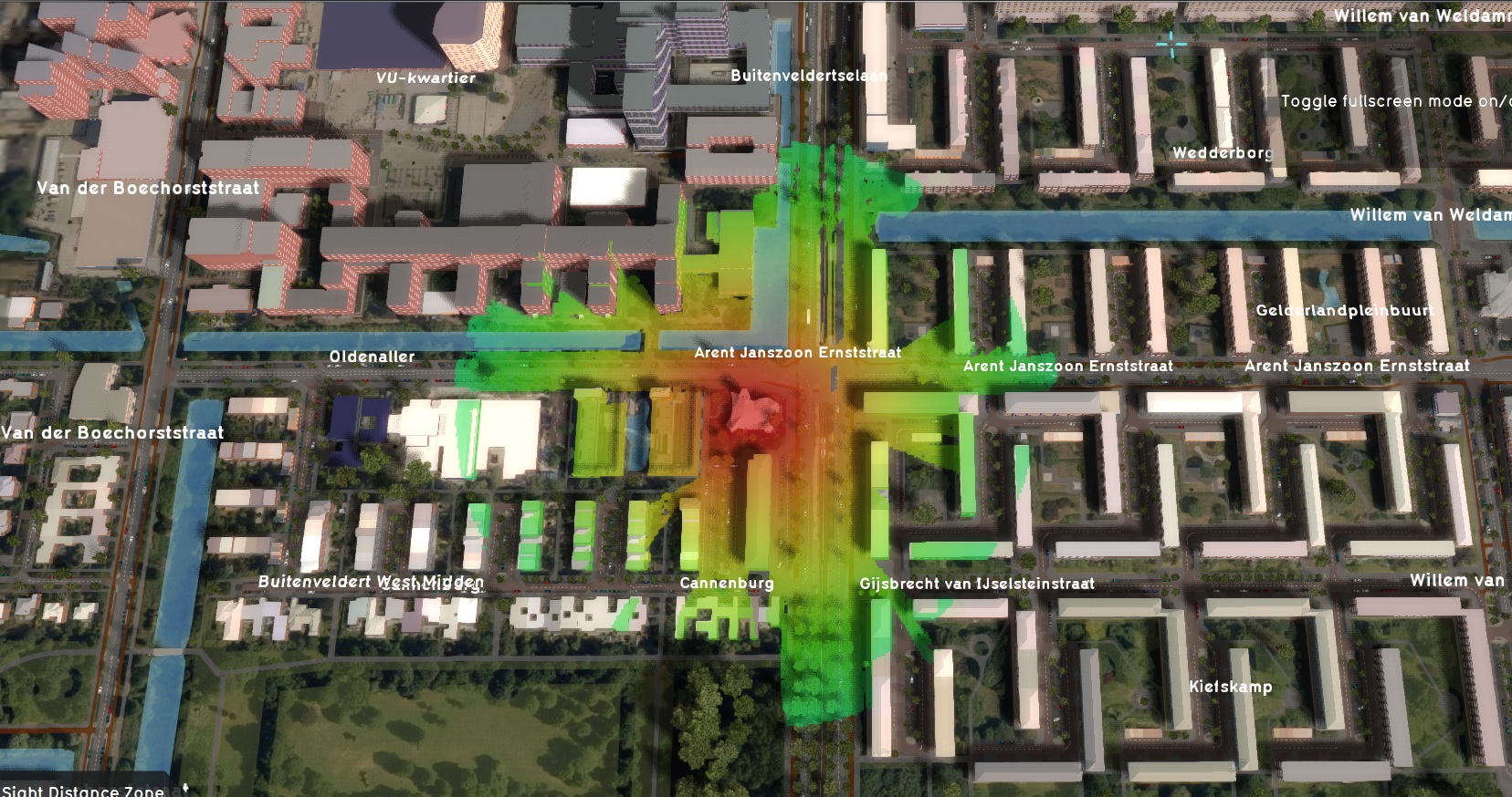
This Distance Sight Overlay is an overlay that combines the Distance Zone as defined by constructions with the direct line of sight for these constructions. The distance zone is always a circle situated around the affected construction(s).
The radius of this circle can be adjusted in the function value table.
The Distance Sight Overlay becomes available for all stakeholders when added to a project.
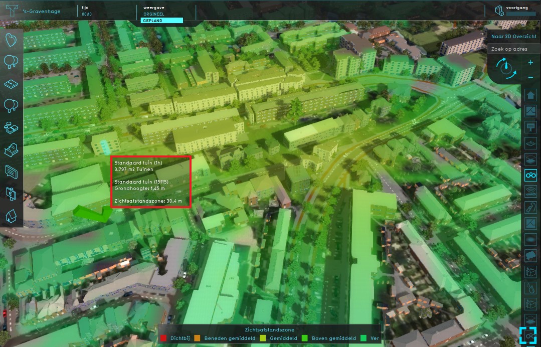
This overlay can be activated by clicking the corresponding icon on the minimap. When activated the Distance Sight Overlay displays 3 colors, red, yellow and green. Different colors mean different distances of the object with the distance zone to other objects in the 3D World.
Legend
- Red: Nearby = - 217
- Yellow: Average distance = 0
- Green: Far away = 127
Additional information displayed in hover panel

When clicking on a specific location on the map, the hover panel gives additional information of the distance from the clicked location to the object which has a distance zone.
How-to's

The Distance Sight Overlay is a Grid Overlay which combines the distance calculation of the Distance Zone Overlay with a line-of-sight calculation. The Overlay calculates whether specific Grid cells have a line of sight to Items which define a distance zone around them, and if so will record the distance to any such Item.
Configuration
The Distance Sight Overlay's calculation model has a number of aspects which can be configured:
- The distances to calculate the lines-of-sight across
- The height from which to compute the lines-of-sight
Keys
A single Overlay Key can be defined. This defines which Attribute the Distance Sight Overlay should look for in data in the Project. When found, the Item on which it is found is considered a source for drawing a line-of-sight from. The value of that Attribute is the maximum distance a line-of-sight may extend from that Item.
Distance zone m (Distance Sight Overlay)
| Icon | Key | Unit | Range | Description | Default value |
|---|
Attributes
The Distance Sight Overlay has one configurable model Attribute which defines a minimum height from which the line-of-sight should be calculated.
Source height m (Distance Sight Overlay)
| Icon | Attribute | Unit | Range | Description | Default value |
|---|
Calculation
The Distance Sight Overlay performs a line-of-sight calculation between any two cells.
For each Grid cell, all other grid cells within a 2000 meter radius are checked whether they are considered a source for a line-of-sight calculation. If so, all cells between the computed cell and the source cell are checked for their computed height. If that height would block the line-of-sight between the source cell and computed cell, the check for that particular calculation ends. If the line-of-sight is uninterrupted for all intermediate cells, the value computed for the computed cell is the distance between the source and the computed cell.
If multiple lines-of-sight are computed for any given cell, and thus multiple resulting distances are computed, the lowest distance is returned.
Cells without a computed line-of-sight to any source have a NO_DATA value.
Results
The results of the Grid Overlay is a grid which shows, for each location, whether there is a line-of-sight to any Item configured to compute a line-of-sight from. And if so, what the minimum distance is to any such Item.
Notes
- Although the terminology implies a computation of whether it's possible to look out from a defined source onto an arbitrary location, the calculations are applicable in reverse as well. Lines-of-sight can also be interpreted as a consideration from which locations a defined source can be seen.
- Features including the Elevation model, and the heights of Constructions, are taken into consideration. However, slanting roofs, and Constructions which are only composed of furniture such as wind turbines and trees, are explicitly not taken into account.
How-to's
See also