Digital Terrain Model Overlay: Difference between revisions
Jump to navigation
Jump to search
m (Godelief@tygron.com moved page Digital Terrain Model (Overlay) to Digital Terrain Model Overlay without leaving a redirect: Syntax web page titles) |
No edit summary |
||
| Line 4: | Line 4: | ||
There exist two Heightmap Overlay types: | There exist two Heightmap Overlay types: | ||
* Digital Terrain Model type: displays the height of the terrain at the selected location on the map. | * Digital Terrain Model type: displays the height of the terrain at the selected location on the map. | ||
* [[Digital Surface Model | * [[Digital Surface Model Overlay|Digital Surface Model]] type: displays the height of the terrain and the height of the building that is located on the selected location on the map. | ||
For more information on how terrain height is obtained in the {{software}}, see [[elevation model]]. | For more information on how terrain height is obtained in the {{software}}, see [[elevation model]]. | ||
[[File:DTM_DSM.png|left|400px]] | [[File:DTM_DSM.png|left|400px]] | ||
Revision as of 09:15, 31 August 2020

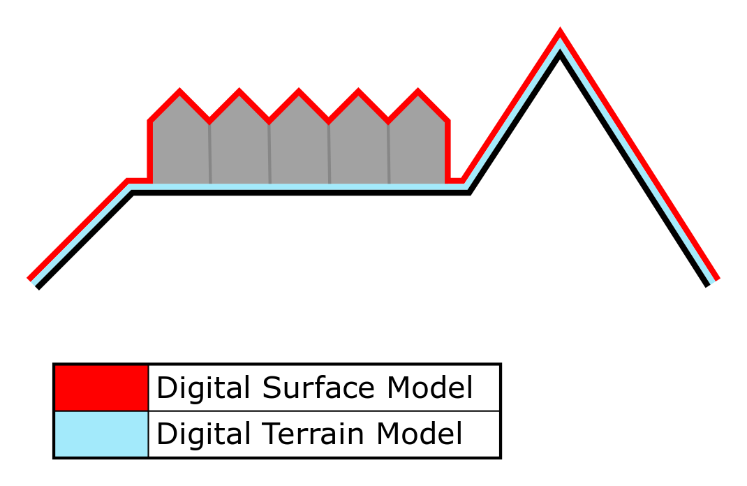
The Digital Terrain Model (DTM) Overlay is a Grid Overlay that displays the elevation model, the height of the terrain. The Overlay is available to all Stakeholders when added to a project.
There exist two Heightmap Overlay types:
- Digital Terrain Model type: displays the height of the terrain at the selected location on the map.
- Digital Surface Model type: displays the height of the terrain and the height of the building that is located on the selected location on the map.
For more information on how terrain height is obtained in the Tygron Platform, see elevation model.

Additional information displayed in hover panel

When clicking on a specific location on the map, the hover panel displays additional information about the height of the terrain at that specific location.
How-to's