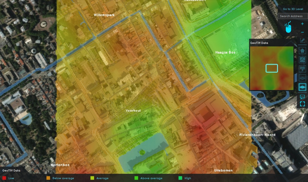
GeoTIFF Overlay

The GeoTIFF Overlay is a Grid overlay which displays the values of a selected GeoTIFF in the project area. It is commonly used to display raster data imported into the Project from outside the Tygron Platform.
Additional information displayed in hover panel
When clicking on a specific location in the map of the GeoTIFF Overlay, the hover panel gives additional information over the actual value in that specific grid cell. That value will be an interpolation, determined by the translation between the source file's resolution and the grid cell size.
GeoTIFF sources
The GeoTIFF Overlay can show GeoTIFFs which are uploaded to the Project as an asset and data of that asset is stored as a GeoTIFF item. Any number of GeoTIFFs can be added to a GeoTIFF Overlay, with each GeoTIFF defining an individual timeframe in the GeoTIFF Overlay.
Color RGB
By default the first band (or channel) in a GeoTIFF is selected resulting in a 32-bit result of for example a height map.
It is however also possible to select a different band via the BAND attribute. This way you can also load in (Aerial[1]) color images. Start by creating 3 GeoTiff Overlays for the R channel (BAND=0), G channel (BAND=1) and B channel (BAND=2), then combine these in a Combo Overlay via the COLOR(R,G,B) formula. The result will show a color image.
| Icon | Attribute | Unit | Range | Description | Default value |
|---|---|---|---|---|---|
| File:Band.png | BAND | number | 0 to 4 | Select a specific band in the GeoTIFF | 0 (first band) |
How-to's
- How to add and remove an Overlay
- How to edit an overlay legend
- How to select a GeoTIFF for a GeoTIFF Overlay
- How to update an existing GeoTIFF
- How to fix a GeoTIFF that has an invalid NO_DATA value
See also
References
- ↑ NL Aerial Imagery ∙ Found at: https://basisdata.nl/hwh-portal/download/index.html ∙ (last visited: 2025-10-28)